
What is absolute location Exact location of place on mathematical grid of the earth divided by two sets of imaginary arcs meridians longitude and parallels latitude longitude meridians ID: 933879
Download Presentation The PPT/PDF document "Review for Unit 1: Geography- Its Nature..." is the property of its rightful owner. Permission is granted to download and print the materials on this web site for personal, non-commercial use only, and to display it on your personal computer provided you do not modify the materials and that you retain all copyright notices contained in the materials. By downloading content from our website, you accept the terms of this agreement.


Slide1
Review for Unit 1: Geography- Its Nature and Perspective
Slide2What is absolute location?
Exact location of place on mathematical grid of the earth divided by two sets of imaginary arcs:
meridians (longitude)
and
parallels (latitude)
longitude (meridians) -
measures distance in 15
o
increments east and west of the
prime meridian
0
o
- Prime Meridian - Greenwich, England
180
o
- International Date Line - Pacific Ocean
latitude
- measures distance north and south of the
equator
(0
o
)
Slide3What is relative location?
Where something is
compared to
other human and physical features on the landscape
Defines how central or isolated a place is
Can change
Example: Samarkand (Uzbekistan)
major Silk Road trade city in 13th C
sea-based trade left it shrinking and isolated
Slide4What are the four features of a map?
Projection
simplification
scale
type
Slide5projection:
representation of the Earth’s surface (three dimensional) on a two-dimensional flat surface.
“all maps lie flat, and all flat maps lie”
S.
hape
A.
rea
D.
istance
D.
irection
Slide6Map Features
P
rojections
Polar (Planar) / Azimuthal
used in airline navigation
Slide7Map Features
P
rojections
Gall -
Peters (1974) - cylindrical - equivalence /
equal area
goal - keeping land masses equal in area
distorts shapes
corrects misconceptions of size of Africa and Latin
America
Slide8Map Features
P
rojections
Mercator
(1569) - cylindrical - conformal
purpose - Atlantic Ocean navigation
parallels and meridians cross at right angles
distorts poles
Slide9Map Features
P
rojections
Robinson (1974) - pseudocylindrical - equivalence / equal area
curves inward to correct polar distortion
goal - make all four errors equally (shape, size, distance, direction)
distortion minimized within 45
o
N and S of equator or E and W of central meridian
good for general use
Slide10Map Features
P
rojections
Goode / Interrupted Homosoline - equivalence / equal-area
land areas shown with minimal distortion; have correct shape and size
Slide11Map Features
S
implification
simplification
omitting, exaggerating, distorting…
depends on map’s use
Slide12Slide13Map Features
S
cale
Scale - Meaning 1
size of the unit studied
(local, regional, global)
synonym:
aggregation
example: eruption of Mount St. Helens in 1980
at first -
local
scale was immediate concern
cloud of volcanic matter traveled to the
regioneventually other areas of the
globe
affected
Slide14Map Features
S
cale
Scale - Meaning 1 - Percentage of College Grads
Slide15Map Features
S
cale
Scale - Meaning 1 - Percentage of College Grads
Slide16Map Features
S
cale
Scale - Meaning 1 - Percentage of College Grads
Slide17Map Features
S
cale
Scale - Meaning 2
Mathematical relationship (ratio) between size of an area on a map and its actual size on the surface of the earth
Slide18Map Features
S
cale
large scale:
small denominator, small area (shows detail)
small scale:
large denominator, large area
Slide19Map Features
S
cale
Scale - Meaning 2
Small-scale
map - shows a region or continent
Even smaller-scale map shows the entire world
Large-scale
map - shows a local area / used for more specific information
Slide20Which scale is largest?
Slide21Map Features
Types
Reference
emphasizes geographic location of features
displays
variety
of information
Slide22Map Features
5. type
Reference
Slide23Map Features
Types
Thematic
highlight a particular feature
- isoline
- cartogram
- choropleth
- proportional symbol (circle)
- dot
Slide24Isoline
Slide25Singles - Male and Female
Slide26Days of Fishing per person
Slide27Origin of items produced for Wal-mart stores
Slide28Obesity
Obesity
Slide29Number of public libraries
Slide30Diarrheal-related deaths
Slide31Average annual rate of population change
Slide32Racial dot map - Los Angeles metropolitan area
Slide33Importance of time zones
Transportation and communications technology made standardization necessary
1883 - Railroads → creation of 4 zones in U.S.
Pacific Standard Time
Mountain Standard Time
Central Standard Time
Eastern Standard Time
(
all one hour apart)
Regions
that adopt the same standard (local) time
Earth geometrically subdivided into 24 sections bordered by meridians (lines of longitude)
Computed
as offset from Greenwich Mean Time
Can stray from meridians to follow country
borders
People’s
Republic of China - one time zone
! (WHY?)
Slide34What’s the difference between remote sensing, GIS, GPS?
GIS -
Computer system that can capture, store, query, analyze, and display geographic
data
GPS -
Precise location (mathematical
location), navigation
primary
purpose, surveillance
Remote Sensing -
Data collected by satellite and aircraft
Slide35What’s the difference between site and situation?
Site -
Physical character of a
place
: Climate
, water sources, topography, soil, vegetation, latitude &
elevation,
h
ave
affected selecting areas for
settlement, cultures can differ on what makes a good
site, humans can modify characteristics of site Situation - Location of place relative to other places, helps find unfamiliar place - compares its location with familiar one - “It’s down past courthouse, on Locust Street, after 3rd traffic light, etc., understands importance - many locations are important because they are accessible to other places
Slide36What are the different regions?
Formal/Uniform - similarities in physical or cultural features
Functional/Nodal - organized around nodes or cores
Perceptual/Vernacular - places people believe to exist a part of their cultural identity
Slide37What are the different types of diffusion?
Expansion Diffusion-
Innovation or idea that develops in a hearth and remains strong there while spreading
outward ex. Islam
Type
1 –
Contagious
Diffusion-
Nearly all adjacent individuals and places are affected
Ex
. disease
Type 2 – Hierarchical Diffusion- Main channel of diffusion in some segment of those that are susceptible to (or adopting) what is being diffused Ex. Any technological innovationType 3 – Stimulus Diffusion - Ideas diffused that are often too vague, different, or impractical for a receiving population but do have an impact Ex. Hamburgers in India (McDonalds) Relocation Diffusion - Involves actual movement of individuals who have already adopted the idea or innovation and who can carry it to a new, perhaps distant, locale, where they proceed to disseminate it
Occurs
most frequently through migration
Migrants develop ethnic neighborhoods to help maintain culture in the midst of unfamiliar one(migrant diffusion)
Slide38Popularity of disco music in N Africa –
migrant
The spread of Islam
- contagious
Introduction of the Maharaja Mac in
India
–
stimulus
Spread of Wal-Mart in the
US
–
hierarchalThe spread of Ebola virus in Western Africa – contagious The migration of Amish from Northern Europe to Pennyslvania and Ohio – relocationThe legacy of Soviet communism in Cuba and Vietnam - migrant
Slide39What is the difference between
possibilism
and environmental determinism?
Possibilism
-
Natural environment merely serves to limit the range of choices available to a
culture, BUT
human cultures frequently push the boundaries of what is “environmentally possible” through advances in
technology
Environmental Determinism
- Human behavior is strongly affected by physical environment, climate is critical factor in how humans behave, “ideal” climate is in the eye of the beholder
Slide40Which one is environmental determinism, which one is
possibilism
?
The highlands environment of western China encouraged the development of a herding culture:
People migrated to the desert southwest in post WWII period in the United States with the help of technological advancement of air conditioning:
Slide41What is the cultural landscape?
Carl Sauer - cultural
landscape - product
of interactions between humans & their environments
Slide42What are the different types of density?
Population density - # of people in a given area of land
90% of people live north of equator
More than 1/2 of all people live on 5% of land and 9/10 on less than 20%
Most people live close to sea level
2/3 of world lives within 300 miles of ocean
Arithmetic density
– Total number of people divided by total land area
Physiological
density - Total
number of people divided by arable
land
Slide43Which map has a lower density?
Slide44What is distance decay and time-space compression?
Depends on time and distance from hearth (time-distance
decay)-
f
arther
from the source & the more time it takes, the less likely innovation adopted (more likely the same trait will develop
differently), Technology
makes this less
important
Space-time compression- describes reduction in time it takes for something to reach another
place,
d
escribes
changes that rapid connections among places and regions have
brought, first transportation and communication, now television and
computers, impact
of globalization
Slide45Distribution and patterns
Distribution - arrangement of locations on earth where people live
Dot maps
Slide46The Land Ordinance of 1785 represents what feature of distribution?
Slide47Which map has a clustered concentration?
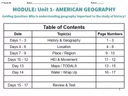
Slide48Unit I. Geography: Its Nature and Perspectives - Basic Vocabulary and Concepts
Basic Concepts
Changing attributes of place (built landscape, sequent
occupance
)
Cultural attributes (cultural landscape)
Density (arithmetic, physiological)
Diffusion (hearth, relocation, expansion, hierarchical, contagious, stimulus)
Direction (absolute, relative)
Dispersion/concentration (dispersed/scattered, clustered/agglomerated)
Distance (absolute, relative)
Distribution
Environmental determinism
Location (absolute, relative, site, situation, place name)
Pattern (linear, centralized, random)
Physical attributes (natural landscape)
Possibilism
Region (formal/uniform, functional/nodal, perceptual/vernacular)
Scale (implied degree of generalization)
Size
Spatial (of or pertaining to space on or near Earth’s surface)
Spatial interaction (accessibility, connectivity, network, distance decay, friction of distance, time-space compression)
Slide49Geographic Tools
Distortion
Geographic Information System (GIS)
Global Positioning System (GPS)
Grid (North and South Poles, latitude, parallel, equator, longitude, meridian, prime meridian, international date line)
Map (Maps are the tool most uniquely identified with geography; the ability to use and interpret maps is an essential geographic skill.)
Map scale (distance on a map relative to distance on Earth)
Map types (thematic, statistical, cartogram, dot,
choropleth
,
isoline
)
Mental map
Model (a simplified abstraction of reality, structured to clarify causal relationships): Geographers use models (e.g., Demographic Transition, Epidemiological Transition, Gravity, Von
Thünen
, Weber, Stages of Growth [
Rostow
], Concentric Circle [Burgess], Sector [Hoyt], Multiple Nuclei, Central Place [
Christaller
], and so on) to explain patterns, make informed decisions, and predict future behaviors.
Projection
Remote sensing
Time zone