
Are you wondering and asking Can we do the site inspection with drone technology If so let us tell you the pivotal role of drone mapping and modeling in construction sites for ensuring a multitude of critical measures ID: 1024006
Download Pdf The PPT/PDF document "Transforming Construction Projects: The ..." is the property of its rightful owner. Permission is granted to download and print the materials on this web site for personal, non-commercial use only, and to display it on your personal computer provided you do not modify the materials and that you retain all copyright notices contained in the materials. By downloading content from our website, you accept the terms of this agreement.


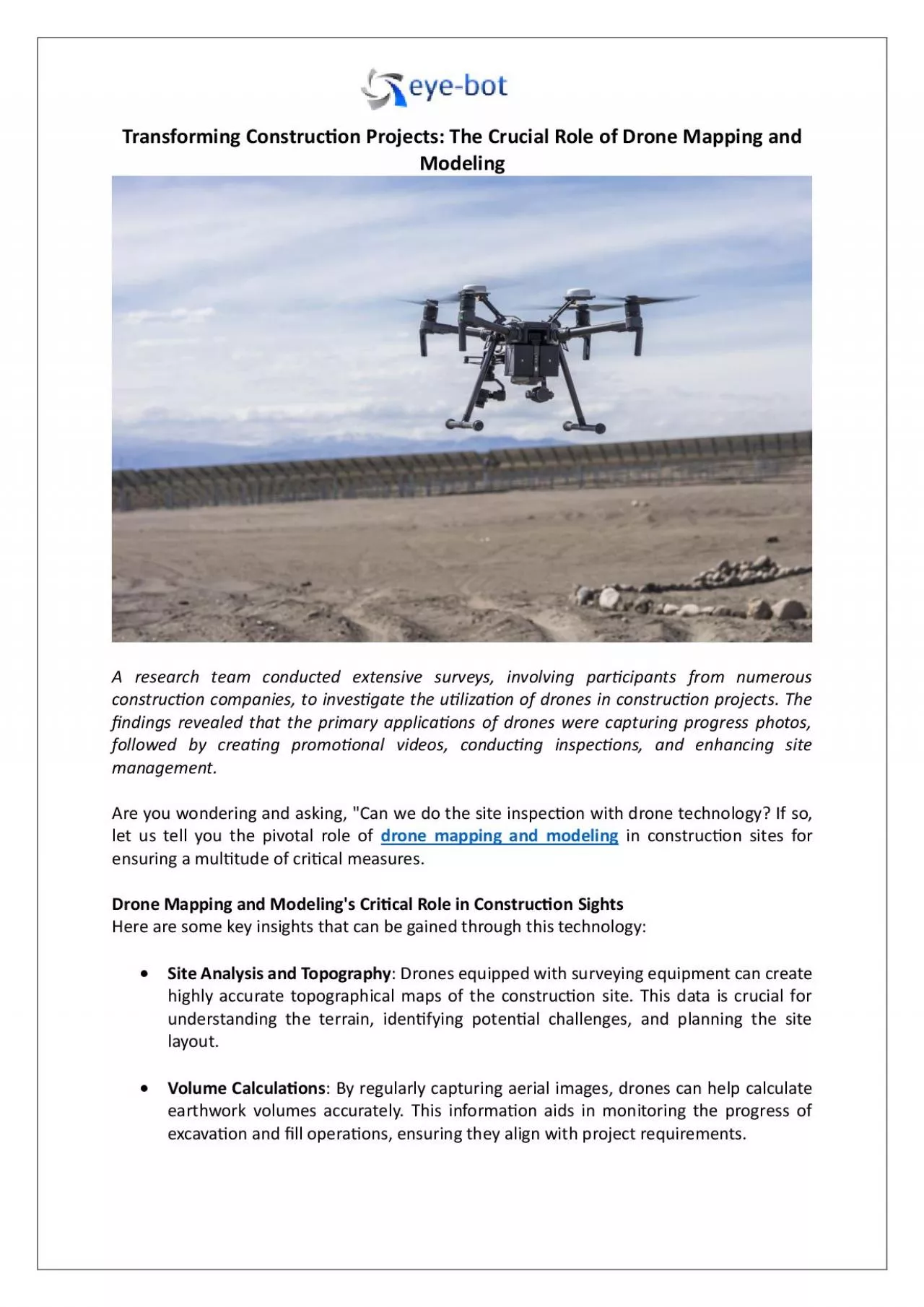
Transforming Construc�on Projects : The Crucial Role of Drone Mapping and Modeling A research team conducted extensive surveys, involving par�cipants from numerous construc�on companies, to inves�gate the u�liza�on of drones in construc�on projects. The �ndings revealed that the primary applica�ons of drones were capturing progress photos, followed by crea�ng promo�onal videos, conduc�ng inspec�ons, and enhancing site management. Are you wondering and asking, " Can we do the site inspec�on with drone technology? If so, let us tell you the pivotal role of drone mapping and modeling in construc�on si tes for ensuring a mul�tude of cri�cal measures. Drone Mapping and Modeling's Cri�cal Role in Construc�on S ight s Here are some key insights that can be gained through this technology: Site Analysis and Topography : Drones equipped with surveying equipment can create highly accurate topographical maps of the construc�on site. This data is crucial for understanding the terrain, iden�fying poten�al challenges, and planning the site layout. Volume Calcula�ons : By regularly capturing aerial images , drones can help calculate earthwork volumes accurately. This informa�on aids in monitoring the progress of excava�on and �ll opera�ons, ensuring they align with project requirements. Progress Monitoring: Drone mapping allows for the crea�on of 2D a nd 3D models that provide a visual representa�on of the construc�on site at di�erent stages. This visual data helps project managers track progress, iden�fy delays, and assess whether work is on schedule. Inventory Management : Drones can be used to tr ack materials and equipment on - site, improving inventory management. By analyzing the data, construc�on teams can prevent shortages, op�mize storage, and reduce waste. Safety Inspec�ons: Drones can give you detailed view s of some areas for safety inspec�ons. They can iden�fy poten�al safety hazards, ensure compliance with safety regula�ons , and minimize risks to workers. Quality Control : High - resolu�on imagery from drones can reveal �ne details of the construc�on, helping to spot defects, devia�ons from design, and areas where quality may need improvement. This aids in maintaining construc�on standards and avoiding rework. Cost Management : By accurately measuring the progress of construc�on, drones assist in tracking co sts and budget compliance. This informa�on allows for more e�ec�ve �nancial management and cost projec�ons. As - Built Documenta�on : Drones can create high - precision as - built documenta�on, which is vital for facility management and future maintenance. This data ensures that the �nal project aligns with the original design and construc�on plans. Technologies Used By Data V isualiza�on and M anagement C ompanies Two of the most vital technologies in this realm are photogrammetry and LiDAR data collec�o n. Photogrammetry : It involves the collec�on of 3D data through photographs taken from various angles. Advanced so�ware then processes these images to reconstruct the spa�al rela�onships of objects and create detailed 3D models. This method is cost - e� ec�ve and versa�le, making it ideal for capturing intricate surface details, such as buildings, landscapes, and cultural heritage sites. LiDAR (Light Detec�on and Ranging) : LiDAR technology uses laser pulses to measure distances and generate precise 3D representa�ons of the environment. It is par�cularly useful for scanning large areas quickly and capturing �ne - grained details with accuracy. Wrap Up Ready to elevate your project with 3D drone visualiza�on or want to try 3D laser scanning services for a more detailed view? If the answer is yes, look no further than Eye - bot. Their experts use all the advanced technologies in the industry and provide a comprehensive range of services, from architectural laser scanning to con�ned space inspec�ons , all under one roof. Connect with their seasoned professionals today.