
Convective Systems book sources Markowski and Richardson 2009 chapter 10 Houze 1993 Cloud Dynamics chapter 9 MCS comet modules MCSs squall lines and bow echoes unnarrated ID: 410046
Download Presentation The PPT/PDF document "Mesoscale" is the property of its rightful owner. Permission is granted to download and print the materials on this web site for personal, non-commercial use only, and to display it on your personal computer provided you do not modify the materials and that you retain all copyright notices contained in the materials. By downloading content from our website, you accept the terms of this agreement.


Slide1
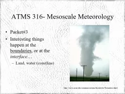
Mesoscale Convective Systems
book sources
:
Markowski
and Richardson (2009), chapter
10
Houze 1993:
Cloud Dynamics
, chapter
9
MCS comet modules:
MCSs: squall lines and bow echoes
(
unnarrated
, 1999)
Severe convection II: MCSs
(narrated
, 2002
)
Tropical MCSs
(
unnarrated
, 2013)Slide2
Overview
Introduction to MCSs
Squall lines
definitiontypessynoptic settingimportance of shearconceptual model of SL with stratiform regionpressure perturbationsorigin of rear inflow jetBow echoesTropical squall linesMesoscale Convective Complexes
300 kmSlide3
IntroductionSlide4
Definition
Mesoscale convective systems (MCSs) refer to all organized convective systems larger than ~50 km (long axis)
Some classic convective system types include:
squall linesbow echoesline echo wave patterns
mesoscale convective
complexes (MCCs) are large MCSs (Maddox 1980)
definition is based on IR imagery:
<241 K cloud shield at least 100,000 km
2
<221 K cloud shield at least 50,000 km2Eccentricity >0.7Must last at least 6 hrsSlide5
Where and when
MCSs occur worldwide
mainly in the warm season
MCC global distribution:
Laing and Fritsch (1993)
TRMM dataSlide6
Compare this to the distribution of hail and tornadoes …
Conclusion: in mid-latitudes the distribution is similar.
MCSs and MCCs are surprisingly common in the tropics. Slide7
US tornado tracksSlide8
MCS examples
warm ocean MCS
Dryline Squall line in TexasSlide9
MCC examples
30 April 2004, 1:32 UTCSlide10
MCS morphology
linear
symmetric
asymmetricamorphousSlide11
MCS morphology
linear
TS
LSPS
Fig. 9.11, adapted from Parker and Johnson (2000)
TS
P
SSlide12
Upscale growth of convection towards a squall line is accelerated when the deep layer (surface to cloud top) mean shear is close to aligned to the boundary along which cells first initiate.
MCS morphologySlide13
MCS morphology
squall
lines
can be continuous or cellularSlide14
Synoptic patterns
Favorable conditions conducive to severe MCSs and MCCs often occur with identifiable synoptic patterns
Synoptic forcing may be quite weak.
Temperature (C, dashed) and dewpoint (C, solid)Slide15
Squall LinesSlide16
Squall line definition
A squall line is any line of convective cells.
100-1000 km long
no strict size definitionUsually trailed by stratiform precip (TS)
Squall line animation 1
Squall line animation 2 (mov file)Slide17
Initial organization
Squall lines may either be
triggered as a line along some boundary (e.g. dryline)
or organize into a line from an amorphous cluster of cells
Thus the majority of cases developed from pre-existing convergence lines
pre-existing
convergence line
pre-existing
convergence lineSlide18
Life cycle
Little is known about the initial and dissipating stages.
Mature structure is well known. It can be
steady-state (long-lived MCS)or a brief transition
(Leary and Houze 1979)Slide19
Environmental factors
Both CIN and CAPE impact MCS structure and evolution
low-level
shear
deep
shearSlide20
Importance of shear
For a given CAPE, the strength and longevity of an MCS increases with increasing depth and strength of the
low-level shear
S0-3(between 0-3 km AGL) For midlatitude environments, |S0-3| : weak |S0-3| <10 m/s
moderate |S0-3| 10-18 m/sstrong |S0-3| >18 m/sA balance is needed between baroclinically generated hor. vorticity and ambient low-level hor. vorticity (RKW theory)
Rotunno, R., J. B. Klemp, and M. L. Weisman, 1988: A Theory for Strong, Long-Lived Squall Lines. J. Atmos. Sci., 45, 463–485.
To continue initiating convection, the cold pool needs to lift air above the LFC. The higher the LFC (drier air), the deeper the layer in which the RKW condition needs to be assessed
deeper ambient shear
deeper cold poolSlide21
Which
low-level shear
matters?
It is the component of low-level vertical wind shear perpendicular
to the line that is most critical for controlling squall line structure & evolutionNote that the initial line orientation is often due to convergence lines (fine lines) independent of LL shear Slide22
Impact of shear on longevity
Short-lived squall lines tend to form under
weak
LL shearLong-lived squall lines have at least 10 m/s of line-normal wind shear in the lowest 3 kmSevere squall lines have more CAPE and/or shear than non-severe onesSlide23
Classic evolution with weak shear
The characteristic squall line life cycle is to evolve from a narrow
band of intense
convective cells to a broader, weaker system over time Slide24
Classic evolution with
stronger
shear
Stronger shear environments produce stronger long-lived lines composed of strong leading
line convective cells and even bow echoes.Slide25
Later evolution in moderate-to-strong shear
Several
bow echoes
may form
Asymmetry (if present) explained by the Coriolis force Slide26
Cold pool motion and shear
Squall lines often have their ‘own’, intrinsic propagation speed, which may be different from the deep-layer mean wind
This speed tends to be controlled by the speed of the system cold pool
New cells are constantly triggered along its leading edgeSpeed is close to cold pool density current speed
In mid-latitudes an "average" gust front speed is ~15 m/s.
Longevity of a squall line depends on its ability to “keep up” with the gust front LL shear Du needs
to match gust front
speed c.Slide27
RKW theory:ambient shear and MCS longevitySlide28
low-level wind shear & updraft slope
note vertical aspect ratio
height is exaggerated by ~5Slide29
wind shear & updraft slope
height
height
B
uoyancy tilting (by shear) produces a larger downward BPPGA, and thus a weaker net upward acceleration Slide30
RKW’s optimal state implies that LL shear
D
u = c
or
Du = c for an erect updraft
Density current plowing into westerly shear (RKW’s optimal state)
The integration of
along the control volume gives:
The vertical vorticity flux,
integrated along the top of the control box,
cancels only under RKW’s optimal state
J
udiciously
choose control volume such that u=0 at z=d . Then
SSlide31
LL shear Du vs. c, and
storm evolution
S
quall lines may move thru the optimal state over time.
c tends to increase as cold pool deepens / strengthensSlide32
The RKW theory for squall line maintenance is not without controversy …
Fig. 9.20: the cold pool strength usually exceeds the low level (0-3 km) shear. Slide33
deep shear may matter as well
coldSlide34
Squall line motion
squall lines sometimes re-orient normal to the low-level shearSlide35
Conceptual model of the mature stage of a symmetric squall line
(textbook Fig 9.7, adapted from Houze et al. 1989)Slide36
Conceptual model of the mature stage of a symmetric squall line
(textbook Fig 9.7, adapted from Houze et al. 1989)
Fig. 9.8Slide37
Conceptual model of the mature stage of a symmetric squall line
LL
conv
U
L div
Fig. 9.3model output(Rotunno et al. 1988)Slide38
LL shear
deep shear
deep shear
H
L
updraftSlide39Slide40
Trailing stratiform region
sustained by a mesoscale updraft above the freezing level
this updraft probably is buoyancy-driven.
buoyancy is due to latent heating (condensation/freezing) Slide41
Surface pressure fields
+3 mb
-3 mb
interpret mesohigh and wake low hydrostatically
weaker shear
stronger shearSlide42
Vertical cross section of reflectivity and pressure perturbations
mature stage pressure perturbations
low under convective towers, near LFC, dominates
due to buoyancy sourceSlide43
Observed pressure perturbations
low near LFC
due to buoyancy source (base of CAPE layer
)hydrostatic high below plus stagnation point high ahead of gust front
S
E
W
LeMone and Tarleton 1986,
Jtech
LeMone et al 1987,
Mon Wea RevSlide44
Numerical simulation of a mature squall line (Fovell and Ogura 1988)
Reflectivity
Storm-relative airflow
qeSlide45
Numerical simulation of a mature squall line
(Fovell and Ogura 1988)
L
H
S
Pressure perturbations
Total
Buoyancy source
Dynamic source
numerical simulation of a density current
(Droegemeier and Wilhelmson 1987)
p’
wind
w
S
wSlide46
The Rear-Inflow Jet (RIJ)
down-gradient
subsident, evaporatively-cooled
may join gust front feeder flowSlide47
Buoyancy distribution, the trailing stratiform region, and the rear-inflow jet
The convective line is positively buoyant from the LFC to the LNB
This B+ spreads into the TSR
Decreasing B+ towards the rear implies a decreasing B-induced low below the B+This implies a horizontal PGF towards the convective lineThis drives the rear inflow jet (RIJ) Slide48
The RIJ is stronger in more unstable environments
More CAPE implies more B in convective line
stronger B-induced low at its base
stronger PGF
stronger RIJ
possible straight-line wind damage & bow-echo formation
Updraft should be more erect!!
Fig. 9.22Slide49
Bow EchoesSlide50
Bow echo definition
Bow echoes are relatively small (20-120 km long), bow-shaped systems of convective cells noted for producing long swaths of damaging surface winds.
bow echoesSlide51
Bow echo environments
deep shear:
Bow echo and supercell
shallow shear:
bow echo only
red line: downburst windsSlide52
evolution of a bow echo
S
towards a balance between ambient,
RIJ
, and cold pool
vorticitiesSlide53
Bow echo evolutionSlide54
Reasons for bow echoes intensity
Rear-inflow jet connects to gust front feeder flowSlide55
Bow echoes and supercells
Bow echoes represent mesoscale organization, supercells are individual storms.
Both require strong shear.
Supercells within squall lines tend to become bow echoes, but cells at the ends of lines can remain super-cellular for long periods of time.Slide56
mature bow echo: RIJ
Fig. 9.25 Slide57
mature bow echo: hook echo
Fig. 9.26
Fig. 9.26: simulated vortex lines around the RIJ
RIJ
3 km DD winds
(NOAA + NRL P-3)
BAMEX – Bow Echo and MCV experimentSlide58
Rear-inflow notch
The reflectivity notch, if sustained or growing, is an indication of a strong RIJ and possible damaging straight-line surface winds.Slide59
The MARC signature
MARC: Mid-altitude radial convergence
(applied to the radial that is normal to the squall line)
rear-inflow
notchSlide60
MARC
characteristics:
MARCs are locally enhanced convergent areas (velocity differentials), embedded within a larger region of convergence extending from 60 to 120 km in length
width: 2-6 kmheight: mid-levels (~5 km AGL)
depth: 3-9 km
magnitude: ~25-30 m/sSlide61
Derechoes: definition
If the cumulative impact of the severe wind from one or more bow echoes covers a wide enough and long enough path, the event is referred to as a
derecho
. To be classified as a derecho, a single convective system must produce wind damage or gusts greater than 26 m/s within a
concentrated area with a major axis length of at least 400 km.
The severe wind reports must exhibit a chronological progression and there must be at least 3 reports of F1 damage and/or
convective wind gusts of 33 m/s (65 kts)
or greater
separated by at least 64 km
. Additionally, no more than 3 hours can elapse between successive wind damage or gust events.Slide62
Derechoes cont’d
A
progressive derecho
is a single bow-shaped system that typically propagates north of and parallel to a weak stationary boundary Serial derechos are most commonly a series of bow-echoes along a squall line (usually located within the warm sector of a cyclone) Slide63
MCCsSlide64
MCC Definition
A mesoscale convective
complex
is defined via IR satellite imagery (Maddox 1980).<241 K (-32°C) cloud shield at least 100,000 km2<221 K (-52°C) cloud shield at least 50,000 km2
Eccentricity >0.7Must last at least 6 hrsSlide65
Mesoscale convective vortices form
in some
MCSsSlide66
MCCs may form mid-to-UL cyclonic vortices
These vortices may be large relative to L
R
(
Rossby
radius of deformation
)
Mechanism the same as that for tropical
cyclogenesis
Can be explained in terms of PV creation due to latent heating
7 July 1982
11:30 UTC
7 July 1982
16:30 UTC
source: Fritsch et al 1994Slide67
Squall line
bows out, stratiform region increases in
size.
Mesoscale Cyclonic Vortex (MCV) may develop (due to f)
Odten
long-lived squall lines in moderate-to-strong shear eventually become asymmetric, with an MCVSlide68
MCV creation due to diabatic PV generation
define IPV
consider
diabatic heating and cooling profiles in sustained deep convectioninfer isentrope distortions and PV anomaliesSlide69
MCV creation due to diabatic PV generation
define IPV
consider
diabatic heating and cooling profiles in sustained mesoscale deep convectioninfer isentrope
distortions and PV anomalies
source: Fritsch et al 1994
SW
NESlide70
Tropical squall linesSlide71
Tropical squall lines
Overall, squall lines in the tropics are structurally
similar
to midlatitude squall lines. Notable differences include:develop in lower shear, lower LFC, less-CAPE environmentstaller convective cellssystem cold pools are generally weaker
less of a tendency toward asymmetric evolution ANDmost tropical squall lines move from east to west Slide72
Tropical Squall Lines
example
:
Arizona monsoonSlide73
Typical evolution of tropical squall lines
Examine divergence, B and p
B
at three stages:Convective stageIntermediary stageStratiform stage
Houze’s book
con divSlide74
Summary
MCS structure and evolution depend on the characteristics of the
environmental buoyancy and shear
, as well as the details of the initial forcing mechanism. The strength and the degree of organization of most MCSs increases with increasing low-level vertical wind
shear values.MCS evolution and motion is heavily controlled by the cold pool.
MCS longevity depends on the interaction between cold pool (c) and low-level vertical wind shear (D
u).
Deeper shear may be important as well.
The
Coriolis effect significantly impacts long-lived MCSs (> 4 hrs). Slide75
References
Fritsch, J. M., Murphy, J. D., Kain, J. S.. 1994:
Warm Core Vortex Amplification over Land.
J. Atmos. Sci., 51, 1780–1807.Hilgendorf, E.R. and R.H. Johnson, 1998: A study of the evolution of mesoscale convective systems using WSR-88D data. Wea. Forecasting, 13, 437-452.Houze, R.A., 1977: Structure and Dynamics of a Tropical Squall-Line System. Mon. Wea. Rev., 105, 1540-1567.Johns, R.H., 1993: Meteorological conditions associated with bow echo development in convective storms. Wea. Forecasting, 8, 294-299.Johnson, R.H., and P.J. Hamilton, 1988: The relationship of surface pressure features to the precipitation and airflow structure of an intense midlatitude squall line. Mon. Wea. Rev., 116, 1444-1472.
Maddox, R. A., 1983: Large-Scale Meteorological Conditions Associated with Midlatitude, Mesoscale Convective Complexes. Mon. Wea. Rev., 111, 1475-1493. Przybylinski, R.W., 1995: The bow echo: Observations, numerical simulations, and severe weather detection methods. Wea. Forecasting, 10, 203-218.