
6Fisheries wwwfisheriesorg vol 26 no 8Ted Sommer Bill Harrell Matt Nobriga Randall BrownPeter MoyleWim KimmererLarry Schemel Ted Sommer is anenvironmental specialistIV at the CaliforniaDepartmen ID: 867646
Download Pdf The PPT/PDF document "The adverse environmental effects of con..." is the property of its rightful owner. Permission is granted to download and print the materials on this web site for personal, non-commercial use only, and to display it on your personal computer provided you do not modify the materials and that you retain all copyright notices contained in the materials. By downloading content from our website, you accept the terms of this agreement.


1 6 The adverse environmental effects of c
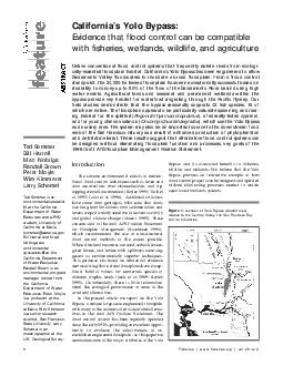
6 The adverse environmental effects of conventional flood control techniques such as levee anddam construction, river channelization, and rip-rapping are well-documented (Bayley 1991; Toth etal. 1993; Galat et al. 1998). Additional criticismshave come from geologists, who note that damsface long-term limitations from sedimentation andlevees are particularly sensitive to tectonic activityand global climate change (Mount 1995). Theseconcerns led to the draft AFS Position Statementfor Floodplain Management (Rasmussen 1996),which recommended the use of non-structuralflood control methods to the extent possible.When structural measures are used, setback levees,gated levees, and levees with spillways were suggested as environmentally superior techniques.This guidance was based on substantial evidencedemonstrating that natural floodplains have exceptional habitat values for numerous species atdifferent trophic levels (Junk et al. 1989; Bayley1991). Unfortunately, there is little informationabout the ecological performance of some of thestructural alternatives.In the present article we report on the YoloBypass, a unique large-scale engineered floodplainwith many of the features cited as desirable alternatives in the draft AFS Position Statement. Theflood control system has been regularly operatedsince the early 1930s, providing an excellent oppor-tunity to evaluate the effectiveness of anestablished engineered floodplain. In this paper wesummarize some of the major attributes of the YoloBypass and its associated benefits to fisheries,wildlife, and wetlands. We believe that the YoloBypass provides an instructive example of howflood control projects can be designed and operatedwithout eliminating processes needed to sustainaquatic and wetlands systems. Fisheries | www.fisheries.org | vol 26 no 8 Ted Sommer Bill Harrell Matt Nobriga Randall BrownPeter MoyleWim KimmererLarry Schemel Ted Sommer is anenvironmental specialistIV at the CaliforniaDepartment of WaterResources and a PhDstudent, University ofCalifornia at Davis,Bill Harrell and MattNobriga arespecialists III at theCalifornia Departmentof Water Resources.Randall Brown is anenvironmental programmanager retired fromthe CaliforniaDepartment of WaterResources. Peter Moyleis a professor at theUniversity of Californiaat Davis. Wim Kimmereris a senior researchscientist, San FranciscoState University. LarrySchemel is anoceanographer at theU.S. Geological Survey. California’s Yolo Bypass: Evidence that flood control can be compatiblewith fisheries, wetlands, wildlife, and agriculture Unlike conventional flood control systems that frequently isolate rivers from ecologically-essential floodplain habitat, California’s Yolo Bypass has been engineered to allowSacramento Valley floodwaters to inundate a broad floodplain. From a flood controlstandpoint, the 24,000 ha leveed floodplain has been exceptionally successful based onits ability to convey up to 80% of the flow of the Sacramento River basin during highwater events. Agricultural lands and seasonal and permanent wetlands within thebypass provide key habitat for waterfowl migrating through the Pacific Flyway. Ourfield studies demonstrate that the bypass seasonally supports 42 fish species, 15 ofwhich are native. The floodplain appears to be particularly valuable spawning and rearing habitat for the splittail (Pogonichthys macrolepidotus), a federally-listed cyprinid,and for young chinook salmon (Oncorhynchus tshawytscha), which use the Yolo Bypassas a nursery area. The system may also be an important source to the downstream foodweb of the San Francisco Estuary as a result of enhanced production of phytoplanktonand detrital material. These results suggest that alternative flood control systems canbe designed without eliminating floodplain function and processes, key goals of the1996 Draft AFS Floodplain Management Position Statement. Figure 1.Location of Yolo Bypass (shaded area)relative to the Central Valley, t
2 he San Francisco Bayand its tributaries.
he San Francisco Bayand its tributaries. August 2001 | www.fisheries.org | Fisheries The historical Sacramento Valley floodplainabove Sacramento, California occupied much ofthe valley floor (Figure 1), when periodic floodsfilled a large part of the alluvial valley. One of the most dramatic of these eventsoccurred in 1862, when the valley was essentiallyconverted into an inland sea. This legendary eventhelped fuel a 50-year debate on the best flood control approach to protect the valley’srapidly-growing communities (Kelley 1989). Initialrecommendations in 1905 for high river leveeswere based on a relatively short hydrologic record.Coincidentally, the release of the flood engineeringreport was followed immediately by the extremeflood of 1907 in which an estimated 120,000 ha ofthe valley were inundated by Sacramento Riverflows of about 17,000 m3. An additional largeflood in 1909 convinced flood managers that otheralternatives were needed. The solution had its rootsin an 1860s proposal by newspaper editor WillGreen to construct a broad bypass system thatwould more closely mimic the Sacramento River’snatural floodplain functions. Based in part onGreen’s concept, the U.S. Army Corps of Engineerseventually developed a network of weirs andbypasses, which became the Sacramento FloodControl Project. Central features of the planincluded the development of two engineered floodplains, the Yolo and Sutter bypasses, to safelyconvey floodwaters around Sacramento and othervalley communities. Much of the system was inplace by the early 1930s, although there were several additions over the next several decades,including the development of upstream reservoirs. Hydrolog Inundation of the Yolo Bypass (Figure 1) is oneof the most dramatic seasonal events inCalifornia’s Sacramento Valley. The Yolo Bypasspresently floods in more than half of water years,creating a large expanse of shallow water habitat(Photograph 1). This has a major physical effect on the SanFrancisco Estuary and its two component regions:1) the Sacramento-San Joaquin Delta, a networkof channels bordered by the cities of Sacramento,Stockton, and a point 20 km downstream of RioVista; and 2) the chain of downstream bays including Suisun, San Pablo, and San Francisco bays. AtYolo Bypass flows greater than about 2,100 m3the partially leveed 24,000 ha floodplain is fullyinundated; this level of inundation approximatelydoubles the wetted area of the delta and is equivalent to about one-third the area of San Franciscoand San Pablo bays. Besides Yolo Bypass, the onlyother delta region with substantial connectivity toportions of the historical floodplain is CosumnesRiver, a small undammed watershed. The floodplain has historically been inundated as early asOctober and as late as June, with a typical peakperiod of inundation during January–March(Figure 2). The hydrology of the system is complex, withinundation possible from several different sources(Figure 1). The primary input to the Yolo Bypass isthrough Fremont Weir in the north, which conveysfloodwaters from the Sacramento and Featherrivers. The typical sequence of inundation is as follows. Flow pulses in the Sacramento River are firstdiverted into Sutter Bypass, a 7,300 ha agriculturalfloodplain with many similarities to Yolo Bypass.The Sacramento River immediately upstream of Photograph 1.Seasonally flooded shallow water habitat in the Yolo Bypass, a 24,000 ha engineered floodplain ofthe San Francisco Bay-Delta Estuary. Fisheries | www.fisheries.org | vol 26 no 8 Fremont Weir has a relatively low channel capacity (800 m3), so Sutter Bypass flooding is ofteninitiated in modest flow pulses. When the com-bined flow of Sutter Bypass and Sacramento andFeather rivers raises stage at Fremont Weir to alevel of 9.2 m (NGVD datum QUERY:SPELLOUT), water subsequently enters Yolo Bypass. Therelative distribution of flow from different tributaries affects the timing that this stage threshold isreached;
3 however, Yolo Bypass flooding typicallyo
however, Yolo Bypass flooding typicallyoccurs when total flow from the Sutter Bypass andtwo rivers surpasses 1,600 m3. Floodwaterthrough Fremont Weir initially flows through the“Toe Drain,” a perennial riparian channel on theeastern edge of the bypass before spilling onto thefloodplain when discharge in this small channelexceeds 100 m3. The floodplain is consideredinundated when the stage of the Toe Drain atLisbon Weir exceeds 2.5 m (NGVD datum). In�major storm events (e.g. 5,000 m3), additional water enters from the east via SacramentoWeir, adding flow from the American andSacramento rivers. Flow also enters the Yolo Bypass from severalsmall west side streams: Knight’s Landing RidgeCut, Cache Creek, Willow Slough Bypass, andPutah Creek. These tributaries can substantiallyaugment the Sacramento basin floodwaters orcause localized floodplain inundation beforeFremont Weir spills. Interestingly, the diverseinputs from the Sacramento Basin and west sidestreams create distinct water masses that are visibleacross much of the length of the 64-km long bypass(Photograph 2). Examination of archived aerial photographsindicate that water mass banding is a regularphenomenon, occurring during both low flowand extreme high flow events. Presumably this Figure 2.Yolo Bypass hydrograph relative to agricultural and environmental activity in the floodplain by month (x-axis). The mean (solid line) andstandard error (dashed line) of total daily Yolo Bypass flow is shown for October 1967–September 1996, the period when all major dams werecompleted in the Sacramento Valley. For agricultural and environmental uses of the floodplain, the primary (solid bars) and marginal (dashed bars)periods are shown. During dry periods (e.g. flows 3 ), resident fishes are confined to the perennial waters which occupy less than 5percent of the total floodplain area. Photograph 2.Natural color aerial photographs of a portion of the Yolo Bypass. Thecolor bands are formed by flow from tributaries, which remain hydrologically separatedthroughout its 64 km length. August 2001 | www.fisheries.org | Fisheries occurs because the size of the turbulent eddiesthat would mix these water masses is limited bythe shallow depth. The mean depth of the floodplain does not exceed 3 m, except in the mostextreme flood events. After floodwaters recede, the basin emptiesthrough the Toe Drain. The floodplain is relatively well-drained as a result of land-grading foragriculture; there are no major topographic features to impede the drainage of flood flows to thelower Sacramento-San Joaquin Delta. Duringdrier months the tidally-influenced Toe Drainchannel is the primary source of perennial waterin the Yolo Bypass, feeding a complex network ofcanals and ditches. From a flood control standpoint, the YoloBypass has saved valley communities numeroustimes. The maximum design flow for theSacramento River channel below the Sacramentometropolitan area is 3,100 m3. By contrast, theadjacent Yolo Bypass floodplain is engineered toconvey approximately 14,000 m3. To illustratethis point, in 1999 flow in the Sacramento Riverwas maintained below 3,000 m3during highflow events by diverting up to 1,350 m3flow to the Yolo Bypass floodplain (Figure 3a). Asan indication of the frequency that the Yolo Bypasshas been needed, total Sacramento River basin flowexceeded the design capacity of the river belowSacramento in 58% of years during 1956–1998(Figure 4). During these wetter years, the designflow was exceeded an average of 23 days. Thedesign capacity of the Yolo Bypass has not yet beenexceeded, despite major floods such as 1997, estimated to be a 70-year recurrence interval event. Agriculture and Wetlands Land use in the Yolo Bypass is dominated by seasonal agriculture, but approximately one third ofthe area is a mosaic of more “natural” habitat typeson the floodplain including wetlands, riparian,upland, and pond areas. By contrast, the adjacentSacram
4 ento River has little habitat diversity.
ento River has little habitat diversity. Likemost other delta channels, the Sacramento River isbounded by steep levees covered with riprap or thincorridors of riparian vegetation (Photograph 3).�The deep (typically 5 m mean depth) channel hasminimal shallow water habitat, essentially no submerged vegetation and only minor strips ofemergent vegetation. The primary agricultural crops in Yolo Bypass aresugar beets, rice, wild rice, safflower, tomatoes, corn,and other grains. Farming activity is concentrated inlate spring and summer, when flooding is uncommon(Figure 2). The state government has flood easements during all months, which can delay springplanting in the event of unusual late season storms.Crop yield data are not available specifically for theYolo Bypass, but yields are generally lower than othernearby regions as a result of high clay content in thesoils of the eastern half of the floodplain and byoccasional late-season flooding. Nonetheless, theYolo Bypass remains a key crop production area forYolo County, where agriculture is the major source ofrevenue (Robert Crowder, California Farm Bureau,pers. comm.). The current wholesale market value of Figure 3 (a-e).Results of floodplain and river sampling for1999 adapted from Sommer et al (2001). a. Mean dailyflow (m 3 ) in Yolo Bypass (solid line) and SacramentoRiver (dashed line). b. Mean daily water temperature ( at Yolo Bypass (solid line) and Sacramento River (dashedline); c. Mean daily chinook salmon fork length for YoloBypass (solid symbols) and Sacramento River (opensymbols) beach seine stations. For presentation purposes,only the daily mean fork lengths are shown; d. Weeklydensity of zooplankton in Yolo Bypass (solid symbols) andSacramento River (open symbols); e. Density of dipteransin weekly drift samples in Yolo Bypass (solid symbols) andSacramento River (open symbols). agricultural crops from Yolo County is approximately$300 million each year.The floodplain also has large areas of wetlands,many of which are managed for waterfowl. The bestexample is the Yolo Basin Wetlands, a 1,250 ha project(Figure 1), reported to be one of the largest wetlandsrestoration projects in the western United States. Landfor the project was purchased in 1991 and wetlandswere constructed through the cooperative efforts of theU.S. Army Corp of Engineers, California Departmentof Fish and Game, Yolo Basin Foundation, U.S. Fishand Wildlife Service, California Department of WaterResources, California Wildlife Conservation Board,and Ducks Unlimited. The project was officially dedicated in 1997 by President Clinton. Habitat types inthe Yolo Basin Wetlands include seasonal wetlands(940 ha), uplands (196 ha), perennial wetlands (75ha) and riparian forest (11 ha). The Yolo Bypass occupies a critical part of thePacific Flyway, a migration route traveled by vastnumbers of waterfowl. Examples of species that usethe newly-created Yolo Basin Wetlands wildlifearea include mallards, northern pintails, Americanwigeon, green-winged teal, northern shovelers,ruddy ducks, snow geese, Ross’s geese, and Canadageese (Table 1). Wildlife managers seasonally flood the area inOctober and maintain ponds for migratory water-fowl through January (Figure 2). The region alsosupports numerous species of shorebirds (e.g., sandpipers, curlews, and avocets), raptors (e.g.,northern harriers, red-tailed hawks, and kestrels),songbirds (e.g., orioles, towhees, and bluebirds),and mammals (e.g., raccoons, skunks, and greyfoxes). Yolo Bypass appears to be especially impor-tant to the Swainson’s hawk, a state-listed Fisheries | www.fisheries.org | vol 26 no 8 Photograph 3.A typicalreach of the SacramentoRiver showing heavychannelization andminimal shallow waterhabitat. Figure 4.Total daily Sacramento Basin flow (m 3 ) during 1956–1998. The horizontal line at 3,100 m 3 August 2001 | www.fisheries.org | Fisheries threatened species which uses the floodplain as for-aging habitat. In recent
5 years, up to 70 individualshave been obs
years, up to 70 individualshave been observed foraging on the floodplain atthe same time during dry periods. (Dave Feliz,Calif. Department of Fish and Game, pers. comm.). Since 1997 we have conducted fish sampling inthe Yolo Bypass, with emphasis on juvenile chinook salmon (Oncorhynchus tschawytsch)and othernative species. Our major research questions haveincluded: 1) what fish species use floodplain habitat; 2) what functions does floodplain habitatprovide for fish; 3) is habitat quality better onfloodplain than river channels; 4) is invertebratespecies composition and biomass different on floodplain habitat than river channels; and 5) what isthe effect of the floodplain on the downstream SaFrancisco estuary? The area presents formidablsampling challenges due to its large size and hydrologic variability, requiring diverse methods toaddress different biological questions. Our samplingprogram has included: egg and larval tows (1998-2001), screw trap, drift and zooplankton nets(1998–2001), beach seine (1997–2001), and purseseine (1998). Comparative data were also collectedby U.S. Fish and Wildlife Service in theSacramento River using beach seine and trawlingmethods (Sommer et al. 2001). Our results show that the Yolo Bypass providesvaluable aquatic habitat to 42 fish species, 15 ofwhich are native (Table 2). Many of these species are year-round residentsin perennial waters in the floodplain. The bypassseasonally supports several state and federally-listedspecies: delta smelt (Hypomesus transpacificussplittail, steelhead trout (Oncorhyncus mykiss), andspring-run and winter-run chinook salmon. Populargame fish are also present including white sturgeonAcipenser transmontanus), striped bass (), largemouth bass (Micropterus salmoidesand white crappie (Pomoxis annularis). Like otherparts of the Sacramento-SanJoaquin Delta, there are moreexotic than native fish speciesin the Yolo Bypass. Exoticspecies are one of the majorenvironmental problems in thedelta, where they frequentlydominate the fish fauna on ayear-round basis (Bennett andMoyle 1996). We hypothesizethat floodplain may providespecial benefits to native fishbecause of the seasonal hydrology of the floodplain. Asillustrated in Figure 2, themajority of the floodplain habitat is seasonally dewatered and therefore cannot bedominated by exotic fish except in perennialwaters. In other words, the Yolo Bypass is largely a“clean slate” at the beginning of each winter.Moreover, the typical winter and spring spawningand rearing period for native delta fishes (Moyle2001) coincides with the timing of the flood pulse.By contrast, most of the introduced species shownin Table 2 spawn in late spring or summer, whenthe floodplain is drained. The hypothesis that thetiming of the flood cycle may provide a competitiveadvantage to native fish (or at least helps to maintain coexistence with introduced species) isdifficult to test because the floodplain-river systemis too large and variable for adequate hypothesistesting. However, we can at least demonstrate thatfloodplain habitat itself has direct benefits to nativefish. To illustrate the importance of the Yolo Bypassto fish we discuss observations on two nativespecies, splittail and juvenile chinook salmon. Splittail, a large native cyprinid (Photograph 4),is perhaps the most floodplain-dependent species inthe Sacramento-San Joaquin Delta. In 1999 thespecies was listed as threatened under the federalEndangered Species Act as a result of concernsabout reduced abundance and distribution (USFWS1999). The legal status of splittail is currently beingreviewed as part of court proceedings; however, thespecies remains a major focus of water managementand restoration activities in the Delta. Splittailreside in the San Francisco Estuary, but seasonallymigrate upstream through the Sacramento-SanJoaquin Delta and its tributaries to spawn (Sommeret al. 1997). The Yolo bypass represents key habitatfor the species and year-class
6 strength is stronglycorrelated with the
strength is stronglycorrelated with the duration of floodplain inundation. Sommer et al. (1997) found that adults moveonto the floodplain in winter and early spring to for-age and spawn on flooded vegetation. Splittail rearon the floodplain and emigrate to the river channelsand estuary as floodwaters recede. These results areconsistent with more “natural” floodplains such asthe Cosumnes River, a nearby undammed watershedthat was recently identified as a major spawning and Table 1.Counts of several major bird groups from 12 monthly surveys at Yolo Basin Wildlife Area during1998 and 1999. The total number of individuals is shown for each year with the total number of species (inparentheses). Note that the observations represent the results of one survey day each month and thereforedo not represent annual population estimates. Source: Dave Feliz, California Department of Fish and Game,unpublished data. Bird Group1998 Total1999 TotalDominant Species (top three)Diving ducks 4,63Ruddy, canvasback, scaup Puddle ducks 44,49Wigeon, mallard, shoveler Geese and swans 13Canada goose, white-front goose, snow goose Raptors 22Northern harrier, red-tailed hawk, Swainson’s hawk Shorebirds 3,48Western sandpiper, dowitcher spp., dunlin Wading birds 45Black-necked stilt, American avocet rearing area for splittail (Moyle, unpublished data).Sommer et al. (1997) concluded that the decline innumbers of splittail during the 1987–1992 droughtwas likely due to the lack of access to floodplainspawning habitat, although the relatively long life�span of the fish (frequently 5 years) allows it tosurvive periods without access to this habitat.Results from 1998–2000 also indicate that anothernative minnow, Sacramento blackfish () uses the bypass for spawning andrearing (T. Sommer, unpublished data). Juvenile chinook salmon represent another goodexample of the value of the Yolo Bypass for nativefish. Most young chinook salmon emigrate from theSacramento River and its tributaries during winterand spring and enter the Sacramento-San JoaquinDelta (Fisher 1994). In low flow periods, theSacramento River and similar delta channels are theonly migratory paths, but during flood pulses theYolo Bypass floodplain provides an alternativemigration corridor.The results of Sommeret al. (2001) suggestthat inundation of theYolo Bypass may provide better rearingconditions than theadjacent SacramentoRiver. Chinook salmonrearing has been well-documented in riverchannels and estuaries(Kjelson et al. 1982;Healey 1991; Levingset al. 1995) and in off-channel habitats insmall Pacific Northwestrivers and streams(Swayles et al. 1986Swales and Levings 1988; Richards et al. 1992).However, our studies of the Yolo Bypass described inpart below present the first solid evidence that weare aware of demonstrating that seasonal floodplainsin large, low elevation rivers represent major areasfor rearing. Like splittail, initial results from theCosumnes River suggest that more “natural” floodplains also provide good habitat for young salmon(Moyle, unpublished data).We have collected juvenile salmon in all inundated regions of the floodplain and in all habitattypes including agriculture, riparian, and wild vegetation. However, salmon are most abundant in areaswith velocity refuges such as trees, shoals, and thedownstream portions of levees. This observation isnot surprising given the preference of chinooksalmon fry for low velocity areas (Everest andChapman 1972). The Yolo Bypass has substantiallymore of this habitat than the Sacramento River,which has little habitat complexity as a result ofchannelization and riprapping. As one indicator ofthe amount of low velocity habitat, we examinedthe amount of “edge” habitat in March 1998 aerialphotographs (Photograph 1). For this analysis, wecalculated the measured shoreline length for adjacent reaches of the Yolo Bypass and SacramentoRiver that each had a total linear distance of 55,500m. T
7 he Yolo Bypass shoreline estimate was pr
he Yolo Bypass shoreline estimate was primar-ily based on the levee margins of the floodplain, butalso included perimeters of internal islands andinundated riparian patches. Yolo Bypass had a totalof 320,500 m of shoreline (5.8 m shoreline/m lineardistance) compared to the Sacramento River, whichhad 95,200 m of shoreline (1.7 m shoreline/m lineardistance). In other words, the Yolo Bypass had overthree times as much shoreline habitat than theSacramento River. However, edge habitat is a grossunderestimate of the total amount of low velocityrearing habitat because it does not include the broadshoals that cover most of the western bypass. We arepresently working on a physical model to estimatethis additional shallow inundated area.As evidence of better habitat quality for juvenile salmon in Yolo Bypass compared to the river,Sommer et al. (2001) found that mean salmon sizeincreased significantly faster in the seasonally-inundated Yolo Bypass floodplain than in theSacramento River, suggesting better growth rates.Their results for 1999 are shown in Figure 3c; however, we have observed the same trend each winterduring 1997–2000. There are several habitat char-acteristics that could account for faster growth ofyoung salmon. First, Yolo Bypass was significantlywarmer than adjacent Sacramento River channels(Figure 3b) as result of the shallower depth andgreater surface area of the floodplain. Higher watertemperatures up to a point can enhance salmongrowth, provided that there is sufficient energy tooffset increased metabolic requirements (Brett1995). Salmon diet analyses showed that the twomajor prey items for river and floodplain salmon aredipterans and zooplankton (Sommer et al. 2001).In 1999, there was little difference in zooplanktonabundance between the Yolo Bypass andSacramento River (Figure 3d) during the mainperiod of flooding; however, dipterans were up toan order of magnitude more abundant in the floodplain drift net samples than the river due to highdensities of chironomids (Figure 3e). Hence, foodresources are substantially better in Yolo Bypass.Sommer et al. (2001) found that these differencesled to significantly higher feeding success of youngsalmon on the floodplain than in the adjacentSacramento River. Differences in water velocitybetween the river and floodplain could also potentially influence bioenergetics. For example, duringthe primary period of inundation in 1999(February–March), we estimate that mean channelvelocity in Yolo Bypass was approximately 0.1–0.3, compared to Sacramento River thatexceeded 1.0 m/sec. The lower velocity Yolo Fisheries | www.fisheries.org | vol 26 no 8 Photograph 4.Sacramento splittail (), a federally-listed minnow which usesthe Yolo Bypass as key spawning, rearing, and foraging August 2001 | www.fisheries.org | Fisheries Bypass habitat is closer to the velocity preferencesof young salmon (Everest and Chapman 1972) andmay result in lower energy expenditure. The benefits of floodplain habitat are consistent with PacificNorthwest studies by Swales et al. (1986) andSwales et al. (1989 QUERY: NOT IN REFERENCES), who found that coho salmon grew fasterin off-channel ponds than main river channels. Although our results suggest that several measures of habitat quality may be better for youngsalmon in the Yolo Bypass, floodplain habitat car-ries risks from avian predation and stranding whenwater levels drop. Some predation occurs as a resultof wading birds such as egrets and herons; howeverwe believe that these birds are unlikely to have amajor population effect as the densities of wadingbirds are typically low (e.g., Table 1) relative to thethousands of hectares of available fish rearing habitat. The relative importance of stranding mortalityis difficult to evaluate because the number ofsalmon emigrating from the Sacramento River andits tributaries is unknown, despite substantial monitoring efforts by several agencies. The floodplain isexceptionally well-drained
8 because of grading foragriculture, which
because of grading foragriculture, which likely helps promote successfulemigration of young salmon. Moreover, water stagedecreases are relatively gradual; for example, themaximum stage decreases in 1998 were 1 cm/hr(Figure 4), well below levels that have been foundto result in high stranding rates in experimental sys-tems (Bradford 1997). Sommer et al. (2001examined the survival issue by doing paired releasesof juvenile coded-wire-tagged salmon in YoloBypass and Sacramento River to obtain comparative data. They found that the Yolo Bypass releasegroups had somewhat higher survival indices thanSacramento River fish in both 1998 and 1999, butthe sample size (n=2 paired releases) was too low todemonstrate statistical significance. Importance of the Yolo Bypass tothe San Francisco Estuary High flow years are known to enhance populations of a variety of fish and invertebrates of theSan Francisco Estuary (Jassby et al. 1995).However, the exact mechanisms for these relationships remain largely unknown. Possible reasons forthe positive effects of higher flow on fish includeincreased habitat availability, food supply and lar-val transport and reduced predation or competition(Bennett and Moyle 1996). Floodplain inundationis one of the unique characteristics of above nor-mal flow years and may be responsible for some ofthe positive effects. The previously-described fishstudies demonstrate that floodplain is importanthabitat for many fish. However, we also have evidence that floodplain inundation may also affectorganisms downstream in the brackish portion ofthe estuary. Studies by Schemel et al. (1996) indi NATIVE SPECIES white sturgeon Acipenser transmontanus Sacramento sucker Catostomus occidentalis prickly sculpin Cottus asper threespine stickleback Gasterosteus aculeatus delta smelt (FT,ST) Hypomesus transpacificus tule perch Hysterocarpus traski river lamprey Lampetra ayresi Pacific lamprey Lampetra tridentata Lavinia exilicauda Pacific staghorn sculpin Leptocottus armatus steelhead trout (FT) Oncorhyncus mykiss chinook salmon Oncorhynchus tschawytscha fall-rusprint-run (ST)-run (FE,SE) Sacramento blackfish Orthodon microlepidotus splittail (FT) Pogonichthys macrolepidotus Sacramento pikeminnow Ptychocheilus grandis INTRODUCED SPECIES yellowfin goby Acanthogobius flavimanus American shad Alosa sapidissima white catfish Ameiurus catus black bullhead Ameiurus melas brown bullhead Ameiurus nebulosus goldfish Carassius auratus common carp Cyprinus carpio red shiner Cyprinella lutrensis threadfin shad Dorosoma petenense western mosquitofish Gambusia affinis wakasag Hypomesus nipponensis channel catfish Ictalurus punctatus green sunfish Lepomis cyanellus warmout Lepomis gulosus bluegill Lepomis macrochirus redear sunfish Lepomis microlophus inland silverside Menidia beryllina smallmouth bass Micropterus dolomieu spotted bass Micropterus punctulatus largemouth bass Micropterus salmoides striped bass Morone saxatilis golden shiner Notemigonus crysoleucas bigscale logperch Percina macrolepida fathead minnow Pimephales promelas white crappie Pomoxis annularis black crappie Pomoxis nigromaculatus shimofuri goby Tridentiger bifasciatus Table 2.Yolo Bypass fish species documented during1997–2001. Federally-listed species are identified asthreatened (FT) or endangered (FE) and state-listedspecies are identified as threatened (ST) or endangered(SE). Species names are listed in alphabetical order. cate that the Yolo Bypass is the major pathway forsediment into the estuary in wet years. They alsofound that the floodplain is the dominant source oforganic carbon in wet years, when estuarine production of aquatic organisms is enhanced (Jassby etal. 1995). Although much of the carbon from river-floodplain sources may not be bioavailable (Jassbyet al. 1996), floodplain organic carbon still remainsa potentially major contribution to the estuary. Asevidence, our results demonstrate t
9 hat the YoloBypass can be a modest expor
hat the YoloBypass can be a modest exporter of phytoplankton,a high quality source of organic carbon for the foodweb. In 1998 chlorophyll a(an indicator of phytoplankton biomass) trends downstream of the YoloBypass closely followed the floodplain hydrograph,with a peak as floodwaters receded (Figure 5), presumably caused by shallower water, increasedresidence time, and warmer temperature in thefloodplain. As noted by Sommer et al. (2001),enhanced primary productivity is unlikely to be aresult of agricultural fertilizer use in the bypassbecause nutrients are rarely limiting to phytoplankton in the San Francisco estuary. Modeling studiesby Jassby and Cloern (2000) also confirm that YoloBypass is an important local source of phytoplankton. Post-flood blooms of phytoplankton have beenreported for tropical (Schmidt 1973; Garcia deEmiliani 1997) and temperate locations (Heiler etal. 1995; Hein et al. 1999).Higher floodplain production of phytoplanktonmay be relatively brief in Yolo Bypass; however, itstill probably represents an important carbon subsidy to the downstream estuarine food web.Phytoplankton are responsible for most of the primary production in the estuary (Jassby et al. 1996),but there has been a major long-term decline inbiomass (Lehman 1992). Reasons for reduced phytoplankton biomass include the effects grazing byintroduced bivalves (Alpine and Cloern 1992),water exports and outflow (Jassby et al. 1995), andclimate change (Lehman 2000). To illustrate themagnitude of this decline, Alpine and Cloern(1992) found that mean annual chlorophyll a�centrations decreased from 10 min 1980 toless than 1 mby 1990 in Suisun Bay, a majorrearing area for estuarine fish and invertebrates. The degree to which the floodplain contributesinvertebrate biomass to the estuary remains to bedetermined. As noted previously, sampling to dateshows that Yolo Bypass zooplankton biomass is nothigher than the adjacent Sacramento River duringfloodplain inundation (Figure 3d). The drift inver-tebrate results (Figure 3e) suggest that invertebrateproduction within the floodplain is substantial;however, we have not determined how much of thisbiomass is used by downstream consumers. Summary Yolo Bypass was originally constructed based onengineering considerations. At the turn of the century, a passive floodplain system was the mostreasonable approach given the extreme seasonaland annual variability in California hydrology. Itseconomic effectiveness versus conventional leveesand dams has not yet been evaluated, but the factthat the system has not failed after many decades ofoperation suggests a high degree of success.Moreover, the Yolo Bypass appears to provide substantial benefits to aquatic, terrestrial, and wetlandspecies, while still being compatible with agriculture. Although the system is an engineered basinrather than a natural floodplain, it shares some ecological characteristics with the natural largeriver-floodplain systems described by Junk et al.(1989). Like natural floodplains, habitat diversity Fisheries | www.fisheries.org | vol 26 no 8 Figure 5.Chlorophyll a ; solid line) trendsas measured using afluorometer (TurnerDesigns) at Rio Vista andYolo Bypass floodplainstage (m, NGVD datum;solid line) versus dateduring January–June1998. Rio Vista is locatedat the confluence of theSacramento River anthe outflow from theYolo Bypass in the Yolo Bypass is much higher than adjacent river channels.Yolo Bypass has a mosaic of habitats including wetlands, ponds,riparian corridors, and upland areas, whereas the adjacentSacramento River is a relatively homogenous channel borderedby steep levees covered with riprap or some vegetation. Junk etal. (1989) note that natural floodplain production from lowertrophic levels is a major input to channels, which is consistentwith Yolo Bypass drift insects and phytoplankton exports todownstream areas. Finally, our data on splittail and salmongrowth support the observations of Junk et al. (19
10 89) that morenatural river-floodplain sy that morenatural river-floodplain sy")
89) that morenatural river-floodplain systems can result in higher fish production on the floodplain than in the river channels. On the whole, we believe that the Yolo Bypass example dis-cussed here provides strong support for the use of a carefullydesigned and engineered floodplain as an alternative to conventional flood control techniques. This is not to say, however, thatthe Yolo Bypass is optimally designed. Examples of possibleimprovements to the Yolo Bypass include the construction ofmore wetlands for wildlife, fixing fish passage and stranding problems at the floodplain weirs, and increasing the frequency offloodplain inundation in drier years. These and other actions arebeing considered as part of the CALFED (2000) program, anambitious state, federal, and local effort to resolve long-standingproblems in the San Francisco Estuary and its tributaries. Weacknowledge that the Yolo Bypass model is not wholly applicableto many areas. For example, the Missouri River shows bimodalflood pulses in March–April and June (Galat et al. 1998), making crop production before July less feasible in that region’sfloodplain. While large areas of Missouri River floodplain are alsomanaged to promote fall and spring use by migratory waterfowl,overwintering is not a primary habitat function as in the YoloBypass. As a consequence, regional analyses are needed to deter-mine the compatibility of different land uses in potentialengineered floodplain projects. August 2001 | www.fisheries.org | Fisheries Alpine, A. E.,and J. E. Cloern.Trophic interactions and direct physicaleffects control phytoplankton biomassand production in an estuary. Limnologyand Oceanography 37(5):946-955.Bayley, P. B.1991. The flood pulseadvantage and the restoration of river-floodplain systems. Regulated RiversBennett, W. A.,and P. B. Moyle.Where have all the fishes gone?Interactive factors producing fishdeclines in the Sacramento-San JoaquinEstuary. Pages 519542 iJ. T.Hollibaugh, ed. San Francisco Bay: theecosystem. Pacific Division of theAmerican Association for theAdvancement of Science, San Francisco,Bradford, M. J.1997. An experimentalstudy of stranding of juvenile salmonidson gravel bars and in sidechannels duringrapid flow decreases. Regulated RiversBrett, J. R.1995. Energetics. Pages 3-68 iC. Groot, L. Margolis, and W. C. Clarke,eds. Physiological ecology of Pacificsalmon. UBC Press, University of BritishColumbia (QUERY: CITY?).2000. Programmatic record ofdecision. August 28, 2000. CALFED,Sacramento. Available atEverest, F. H.,and D. W. ChapmanHabitat selection and spatial interactionby juvenile chinook salmon andsteelhead trout in two Idaho streams.Journal of the Fisheries Research Boardof Canada 29(1):91-100.Fisher, F. W.1994. Past and present status ofCentral Valley chinook salmon.Conservation Biology 8:870-873.Galat, D. L.,and 16 other authors. 1998.Flooding to restore connectivity ofregulated, large-river wetlands.Bioscience 48(9):721-734.Garcia de Emiliani, M.O.1997. Effects ofwater level fluctuations onphytoplankton in a river-floodplain lakesystem (Parana River, Argentina).Hydrobiologia 357: 1-15.Healey, M. C.1991. Life history of chinooksalmon. Pages 311-394 iC. Groot andL. Margolis, eds. Pacific salmon lifehistories. UBC Press, University ofBritish Columbia (QUERY: CITY?).Heiler, G, T. Hein, F. Schiemer,and GBornette. 1995. Hydrologicalconnectivity and flood pulses as thecentral aspects for the integrity of river-floodplain systems. Regulated Rivers:11(3/4): 351-362.Hein, T. G. Heiler, D. Pennetzdorfer, P.Reidler, M. Schagerl,and F. Schiemer.1999. The Danube restoration project:functional aspects and planktonicproductivity in the floodplain system.Regulated Rivers: 15: 259-270.Jassby, A. D.,and J. E. Cloern.Organic matter sources andrehabilitation of the Sacramento-SanJoaquin Delta (California, USA).Aquatic Conservation: Marine andFreshwater Ecosystems 10(5):323-352.Jassby, A. D., W. J. Kimmerer, S. G.Monismith, C. Armor, J. E.
11 Cloern, T.M. Powell, L. R. Schubel,and
Cloern, T.M. Powell, L. R. Schubel,and T. J.1995. Isohaline position as ahabitat indicator for estuarinepopulations. Ecological ApplicationsJassby, A. D., J. R. Koseff,and S. G.Monismith. 1996. Processes underlyingphytoplankton variability in SanFrancisco Bay. Pages 325-350 iJ. T.Hollibaugh, ed. San Francisco Bay: theecosystem. Pacific Division of theAmerican Association for theAdvancement of Science, San Francisco,Junk, W. J., P.B. Bayley,and R. E. Sparks.1989. The flood pulse concept in river-floodplain systems. Special Publication ofthe Canadian Journal of Fisheries andAquatic Sciences 106:110-127.Kelley, R. L.1989. Battling the inland sea:floods, public policy, and the SacramentoValley, 1985-1986. University ofCalifornia Press, California (QUERY:CITY?). Kjelson, M. A., P. F. Raquel,and F. W.Fisher. 1982. Life history of fall-runjuvenile chinook salmon,in the Sacramento-San Studies described in this article were funded byCALFED Category III program and the InteragencyEcological Program (IEP). In addition to the authors’agencies, we gratefully acknowledge assistance from otherIEP organizations, particularly U.S. Fish and WildlifeService and California Department of Fish and Game. Joaquin estuary, California. Pages 393-411 iV.S. Kennedy, ed. Estuarinecomparisons. Academic Press, New York.Lehman, P. W.1992. Environmental factorsassociated with long-term changes inchlorophyll concentration in theSacramento-San Joaquin Delta andSuisun Bay, California. Estuaries 15(3):Lehman, P. W.2000. The influence ofclimate on phytoplankton communitybiomass in San Francisco Bay Estuary.Limnology and OceanographyLevings, C.D., D.E. Boyle,and T.RWhitehouse. 1995. Distribution andfeeding of Pacific salmon in freshwatertidal creeks of the lower Fraser River,British Columbia. Fisheries Managementand Ecology 2:299-308.Mount, J. F.1995. California’s rivers andstreams: the conflict between fluvialprocess and land use. University ofCalifornia Press, Berkeley.Moyle, P. B.2001. Inland fishes ofCalifornia. University of California Press,Berkeley. In press.Rasmussen, J. L.1996. Draft AmericanFisheries Society position statement:floodplain management. Fisheries10. Richards, C., P.J. Cernera, M.P. Ramey,and D.W. Reiser.1992. Development ofoff-channel habitats for use by juvenilechinook salmon. North AmericanJournal of Fisheries Management 12:721-Schemel, L. E., S. W. Hagar,and DChilders. 1996. The supply and carboncontent of suspended sediment from theSacramento River to San Francisco Bay.Pages 237260 iJ.T. Hollibaugh, ed. SanFrancisco Bay: the ecosystem. PacificDivision of the American Association forthe Advancement of Science, SanFrancisco, CA.Schmidt, G.W.1973. Primary production ofphytoplankton in three types ofAmazonian waters. Amazonia 4: 139-Sommer, T., R. Baxter,and B. Herbold.1997. The resilience of splittail in theSacramento-San Joaquin Estuary.Transactions of the American FisheriesSociety 126:961-976.Sommer, T. R., M. L. Nobriga, W. C.Harrell, W. Batham,and W. J.2001. Floodplain rearing ofjuvenile chinook salmon: evidence ofenchanced growth and survival.Canadian Journal of Fisheries andAquatic Sciences 58(2):325333. Swayles, S., R.B. Lauzier,and C.DLevings. 1986. Winter habitatpreferences of juvenile salmonids in twointerior rivers in British Columbia.Canadian Journal of Zoology 64: 1506-Swales, S.,and C.D. Levings1988. Role ofoff-channel ponds in the life cycle ofcoho slamon (Oncorhynchus kisutch) andother juvenile salmonids in theColdwater River, British Columbia.Canadian Journal of Fisheries andAquatic Sciences 46: 232-242.Toth, L. A., Obeyssekera, J. T. B., W. A.and M. K. Loftin.1993. Flowregulation and restoration of Florida’sKissimmee River. Regulated RiversUSFWS (U.S. Fish and Wildlife Service).1999. Final rule. Endangered andthreatened wildlife and plants:determination of threatened status forthe Sacramento splittail. Federal Register64(25):5963-5981. February 8, 1999. Fisheries | www.fisheries.org | vol 2