
CUNY CREST INSTITUTE 2010 Growth of the BCC Geospatial Center of the CUNY CREST Institute throughout the years In 2001 a proposal led by the City College of New York was submitted to the NOAACREST program for funding Bronx Community College was one of the partners on the proposal which was ID: 912356
Download Presentation The PPT/PDF document "EVOLUTION OF THE BCC GEOSPATIAL CENTER O..." is the property of its rightful owner. Permission is granted to download and print the materials on this web site for personal, non-commercial use only, and to display it on your personal computer provided you do not modify the materials and that you retain all copyright notices contained in the materials. By downloading content from our website, you accept the terms of this agreement.


Slide1
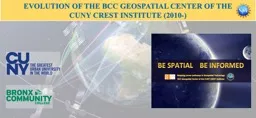
EVOLUTION OF THE BCC GEOSPATIAL CENTER OF THE
CUNY CREST INSTITUTE (2010-)
Slide2Growth of the BCC Geospatial Center of the CUNY CREST Institute throughout the years
In 2001, a proposal led by the City College of New York was submitted to the NOAA-CREST program for funding. Bronx Community College was one of the partners on the proposal, which was funded by NOAA.
In 2010, Dr. Sunil Bhaskaran spearheaded efforts in the development of geospatial technology at BCC leading to the formation of the first ever CUNY Geospatial Center. Seminars, workshops and demonstrations to build campus wide awareness were followed by submitting and receiving series many grants from federal and private agencies including major grants from the Environmental Systems Research Institute, Federal Highway Administration and US Department of Transportation (FHWA-USDOT), and the National Science Foundation’s Advanced Technological Education (NSF-ATE).
Slide3Geospatial technologies
are critical to managing the earth and its limited resources. They are required for:
preparing environmental impact assessment (EIA) models for mining companies,
modeling emergency services,
integrating social behavior,
mapping demographic characteristics and
planning and redeveloping urban landscapes and a whole range of applications that have a spatial component.
Geospatial technologies are therefore used by many industries, educational institutions to either map spatial patterns, or to determine spatial relationships between multi-faceted variables. They may also be used for observing and monitoring natural processes or mapping environmental pollutants.
What is Geospatial Technology?
Slide4Mentoring Undergraduates in focused STEM & Geospatial Research?
Mapping Shadows from High-Res satellite Data
https://link.springer.com/content/pdf/10.1007%2Fs12518-013-0118-4.pdf
Rule-based classification of high-resolution imagery over urban areas in New York City
https://www.tandfonline.com/doi/abs/10.1080/10106049.2012.726278
Slide5Grants Awarded to the BCC Geospatial Center of the CUNY CREST Institute (2011-)
(2017) Training BCC students and faculty in 3D Geographic Information System Data Analysis and Modeling.
($16,000).
(2017) Teaching Early Childhood Students about Geospatial Faculty Mentor: Sunil Bhaskaran.
($2,500)
(2017) CUNY WIDE GIS research repository.
($15,000)
(2017-2020) ‘Pathways to Geospatial Technology and Careers’ National Science Foundation-Advanced
Technological Education.
($899,840.00).
(2016) Mapping Air Quality in New York City using Geospatial Technology. Student Tech Fee.
[$7,000]
(2016) Interning to Careers in Geospatial Technology, Job Linkages Grant - BCC-OAA.
[$9,564.00]
(2015) NASA Space Grant faculty mentor release time.
[$6,000]
(2015) ‘Mapping Global Urbanization Patterns’. Digital Globe Foundation
[$120,000]
(2015) BCC Environmental Technology Program NYCDEP Internship Program.
[$13.500]
(2015) BCC STEM Majors participation in the 2015 Black Engineer of the year award (BEYA), Conference, Washington, DC (Grant from NOAA-CREST Institute. [$5,500](2015) Student Technology Fee Grant, BCC-CUNY. [$5,000](2013-2015) Workforce Development Initiative Grant – CUNY, [$38,000](2013) Grant from Federal Highway Administration (FHWA) to host Summer Transport Institute at BCC. (Grant from Federal Government), [$15,000](2013) Faculty Travel Grant, BCC-CUNY. [$500](2013) Environmental System Research Institute (ESRI) & PCI Geomatics Natural Resources imagery grant award. (Grant from the Industry). [$100,000] (2011-2013) Exelis curriculum development software grant award, (Grant from the Industry). [$20,000](2012/2013) GeoEye Foundation Award, GeoEye, Colorado, USA, GeoEye Foundation Imagery Grant Award. Mapping land cover and land Megacities. (Grant from the Industry) [$15,000](2010/2011) GeoEye Foundation Award, GeoEye, Colorado, USA Grant award from GeoEye Foundation, Colorado, USA. (Grant from the Industry). [$15,000](2011) BCC Foundation Faculty Scholarship Support Grants. [$500](2011) BCC Global Initiative - Faculty Presidential Grant Awards. [$4,000]
Slide6The BCC Geospatial Center of the CUNY CREST Institute (BGCCCI) is a unit under the Office of Academic Affairs and Student Success. The Bronx Community College Geospatial Center of the CUNY CREST Institute (BGCCCI) is collaboration between Bronx Community College of The City University of New York and CUNY Remote Sensing Earth System (CREST) Institute. The center was created after a Memorandum of Understanding (MoU) was signed between Bronx Community College (Senior Vice President and Provost Dr. Claudia Schrader) and Director of CUNY-CREST Institute Dr. Reza Khanbilvardi on the 3rd October, 2014.
Memorandum of understanding with the CUNY CREST Institute (City College of New York). Official launch of the BCC Geospatial Center
Slide7We are served by a strong industry advisory board. They guide us in designing courses and programs, internships, and collaborative projects.
https://drive.google.com/file/d/0B-ZEsSyEpH6wVGYzMVNCeHRJdjg/view
Slide8The program director, Dr
. Sunil Bhaskaran has published two books that have been published through Kendall Hunt and have been very useful in the learning process of prospect geospatial students.
Introduction to Remote Sensing: Introduction to Remote Sensing. (2015). A lab manual for STEM and Non-STEM students.
Introduction to Geographic Information System: Introduction to Geographic Information System. (2015). A lab manual for STEM and Non-STEM students.
We wrote textbooks and hands-on learning materials using a place-based and inquiry-based approach for students
Slide9Two new courses a) Introduction to Geographic Information Systems (GIS 11) and b) Introduction to Remote Sensing (GIS 12) were designed by the Director of BGCCCI and submitted for approval to the college wide curriculum committee. These courses will be located in the Pathways bucket (Scientific World – E) and will be writing intensive. The courses were approved by the college wide curriculum committee, senate, university and pathways steering committee and offered to the students in fall 2015.
New pathways GIS 11 & 12 courses designed at the center transfers to any CUNY colleges. (from Fall 2015- we have enrolled 265 students in the courses)
Slide10A GIS summit was hosted by the Office of Research (Interim Vice Provost for Research Dr. Mark Hauber, Professors Glen Johnson, Andrew Moroko and Sunil Bhaskaran). The event attracted the cream of GIS faculty and students across CUNY and was a roaring success. It facilitated an open discussion about different GIS approaches and enabled participants to network and brainstorm collaborations. The event was held at the CUNY LAW school’s Dave Field auditorium.
The inaugural CUNY Geographic Information System Summit – 3/3/2017
We co-hosted the first CUNY-wide GIS Summit with the Office of Research CUNY central!
Slide11The Smarter Cities convention at the famous Gould Memorial Hall was attended by key institutes, centers, and students from NYC
The BCC Geospatial Center of the CUNY CREST Institute has had several national research collaborations with the department of Math and Computer Science, University of Missouri and University of Nebraska Lincoln.
The BCC Geospatial Center of the CUNY CREST Institute has
also conducted international research collaborations and been actively involved in projects with the City of Townsville, Australia. The projects centered on Smarter Cities and applications of geospatial technology for mapping smarter cities initiatives.
We collaborate with universities, institutions and others in cutting-edge research
https://atecentral.net/msites/bhaskaran/bgcccicol
Slide12The program is designed to heighten awareness about geospatial technology and its application to STEM, increase and diversify the number of young adults interested and academically prepare them to enter into the field. It is a partnership between Bronx Community College, and York College who will work in collaboration with the industry, and federal agencies to train participants in geospatial technology.
We are recognized as a national center of excellence now!
A major grant was awarded by the National Science Foundations’ – Advanced Technological Education Program (NSF-ATE) 2017-2020 - $900,000
https://www.nsf.gov/awardsearch/showAward?AWD_ID=1700644
Slide13The BGCCCI offered Fall Geospatial Workshops for Middle and High Schools.
The BGCCCI will also be offering Summer Geospatial Workshops for Middle and High Schools and Undergraduate Students; Summer Workshop Internship Programs for High Schools and Undergraduate Students and Professional Development Workshop for Educators from Middle and High Schools and Colleges
We enthuse, train, mentor, and guide the next generation of Americans by delivering all year-round geospatial workshops, internships and training educators
We are building the country’s human capital of skilled technicians by engaging school and college students with the industry
Slide14Dr. Sunil Bhaskaran |
Professor & Director - BCC Geospatial Center of the CUNY CREST Institute Office of Academic Affairs and Student SuccessBCC-CUNY &
Principal Investigator:
NSF Grant Award - Pathways to Geospatial Technology and Careers
Doctoral Faculty: PhD program in E.E.S.,
Tel:
718.289.5233/5566/5100 (ext:7233)
Fax:
718.289.6448/6075Email: Sunil.Bhaskaran@bcc.cuny.edu
or
Sunil_director.bgccci@bcc.cuny.edu
Geospatial Center
http://www.bcc.cuny.edu/geospatial/Graduate Center
http://www.gc.cuny.edu/home
Geospatial Center Facebook
@
bccgeospatialTwitter @BGCCCIGeoCUNY's STEMIf you are interested in enrolling for the GIS courses or collaborating in research or being trained in geospatial technologies or interested in teaching, please contact us:Current courses being offeredIntroduction to Remote SensingIntroduction to Geographic Information Systems
Slide15Read our newsletters and learn about our biggest accomplishments
https://atecentral.net/msites/bhaskaran/newsletters
Slide16What our students and faculty think about geospatial technology and careers
https://drive.google.com/file/d/0B-ZEsSyEpH6wc3JibG9nTXEwWXM/view?usp=sharing
https://drive.google.com/file/d/0B-ZEsSyEpH6wMFhIUXkxdkIzRm8/view?usp=sharing
https://drive.google.com/file/d/0B-ZEsSyEpH6wRXdFbkU1aDhacXM/view?usp=sharing
https://drive.google.com/file/d/0B-ZEsSyEpH6wNkRaY0lJQUZ0Ym8/view?usp=sharing