
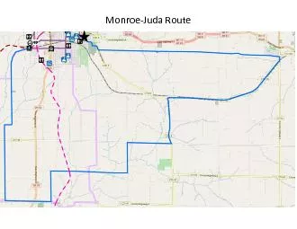
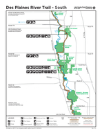
Monroe Monroe Juda Route Starting Point Recreational Park Route runs clockwise from that point Source Gmap Pedometer Distance 28 Miles Minimum Elevation 823 ft Maximum Elevation ID: 851783
Download Pdf The PPT/PDF document "Juda Route" is the property of its rightful owner. Permission is granted to download and print the materials on this web site for personal, non-commercial use only, and to display it on your personal computer provided you do not modify the materials and that you retain all copyright notices contained in the materials. By downloading content from our website, you accept the terms of this agreement.


1 Monroe - Juda Route Monroe - Jud
Monroe - Juda Route Monroe - Juda Route = Starting Point: Recreational Park . Route runs clockwise from that point . Source: Gmap - Pedometer Distance: 28 Miles Minimum Elevation: 823 ft. Maximum Elevation: 1, 099 ft.
2 Total Elevation Gain : 1, 427 ft.
Total Elevation Gain : 1, 427 ft. Destinations along Route: SLICE - State Line Ice & Community Expo Victorian Gardens Bed and Breakfast Cheese Country Trail Head Smokey Row District Recreation Park St. Victor School