
Datums and Map Projections DArcangelis 11909 Every map user and maker should have a basic understanding of projections no matter how much computers seem to have automated the process Hmmm ID: 408735
Download Presentation The PPT/PDF document "Coordinate Systems," is the property of its rightful owner. Permission is granted to download and print the materials on this web site for personal, non-commercial use only, and to display it on your personal computer provided you do not modify the materials and that you retain all copyright notices contained in the materials. By downloading content from our website, you accept the terms of this agreement.


Slide1
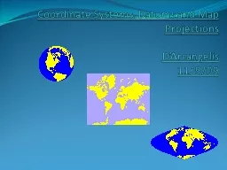
Coordinate Systems, Datums and Map ProjectionsD’Arcangelis11/9/09Slide2
Every map user and maker should have a basic understanding of projections, no matter how much computers seem to have automated the process.Hmmm…Slide3
Why is this important?Creating spatial data (collecting GPS data)Import into GIS and overlay with other layersAcquiring spatial data from other sourcesDisplay your GPS data using mapsSlide4
Coordinate SystemsThere are 2 types of coordinate systems:Geographic Coordinate Systems Projected Coordinate SystemsSlide5
Geographic Coordinate SystemA reference system using latitude and longitude to define the location of points on the surface of a sphere or spheroiddecimal degrees (DD) -92.5degrees/minutes/seconds (DMS) 92° 30’ 00” WSlide6
Geographic Coordinate System
- Earth is not a sphere- Poles are flattened- Bulges at equator
Earth is a spheroid……or ellipsoid Slide7
Geographic Coordinate SystemSpheroid approximates the shape of the earth Model of the earthEssentially when surveyors get together and all agree to be wrong
Also called an “ellipsoid”Slide8
Geographic Coordinate SystemA datum defines the position of the spheroid relative to the center of the earthOrigin and orientation of latitude and longitude lines are determined by the datum
Hundreds of datums customized for different parts of the worldSlide9
Common Datums used in U.S.North American Datum 1927 (NAD27)Uses the Clarke 1866 spheroidReference point is located at Meades Ranch, Kansas Based on ground survey inrmation in the 1800’s
North American Datum 1983 (NAD83)
Uses GRS80 (Geodetic Reference System) spheroidEllipsoid model from geocentric perspectiveBased on ground surveys and satellite information
WGS 1984 Most recently developed datum/ framework for measurements worldwide
Earth centered, or geocentric, perspectiveThis is the datum used by all GPS satellitesNearly identical to NAD83…therefore NAD83
is compatible
with data collected in GPS using WGS84!Slide10
Transforming between datumsSeveral methods available for transforming between NAD27 and NAD83Standard and most accurate is NADCONAvailable in ArcView 8.x (ArcToolbox)Many GPS devices transform using less accurate transformations
If you your GIS data is in NAD27, you should considering collecting in NAD83/WGS84 and transform your coordinates using ArcToolboxSee “Appendix A” in TEC7132 course book on how to perform datum transformation using ArcToolboxSlide11
Geographic Coordinate SystemUniversal Coordinate System (lat/long)Lat/long is good for locating positions on surface of a globe
Lat/long is not efficient for measuring distances and areas!
Latitude and longitude are not uniform units of measureOne degree of longitude at equator = 111.321 km (Clarke 1866 spheroid)One degree of longitude at 60
° latitude = 55.802 km (Clarke 1866 spheroid)Slide12
Projected Coordinate SystemsA map projection is the systematic transformation of locations on the earth (latitude/longitude) to planar coordinates The basis for this transformation is the geographic coordinate system (which references a datum)
Map projections are designed for specific purposesSlide13
This process of flattening the earth will cause distortions in one or more of the following spatial properties:ShapeConformal map projections preserve shapeAreaEqual area map projections preserve area
Distance/ScaleEquidistant map projections preserve distanceDirection/AngleAzimuthal map projections preserve true directionSlide14
Sinusoidal ProjectionSlide15
Mercator ProjectionSlide16
Universal Transverse Mercator (UTM)Developed by militaryGrid systemEarth divided into 60 zonesGreat for small areasminimal map distortion
distortion greater at edge of zonesMost common map projection used by NWRsSlide17
Zone 1
International Date
Line - 180
Equator
Zone 18
o
Universal Transverse Mercator- GridSlide18
State Plane Coordinate SystemTo support high-accuracy applications, all US states have adopted their own specialized coordinate systems: State Plane Coordinates. For example, Texas has five zones based on the Lambert Conformal Conic projection
, while Hawaii has five zones based on Transverse Mercator projection.
http://www.pipeline.com/~rking/spc.htmSlide19Slide20
When GPS points don’t align with GIS Data There are huge errors…data points do not overlay Features could be displayed in wrong state or hemisphere!
Most likely a projection issue if:Slide21
When GPS points don’t align with GIS Data GPS data overlays with GIS data, but off by several hundred feetDifferences between NAD27 and NAD83 can be as much as 500 feetThis creates problems when doing analysis
Possibly a datum issue if:Slide22
ConclusionAll maps are centered on a point or planeDifferent projections cause maps to display spatial data differentlyCareful thought toward map projection must be made in order to display data correctly