
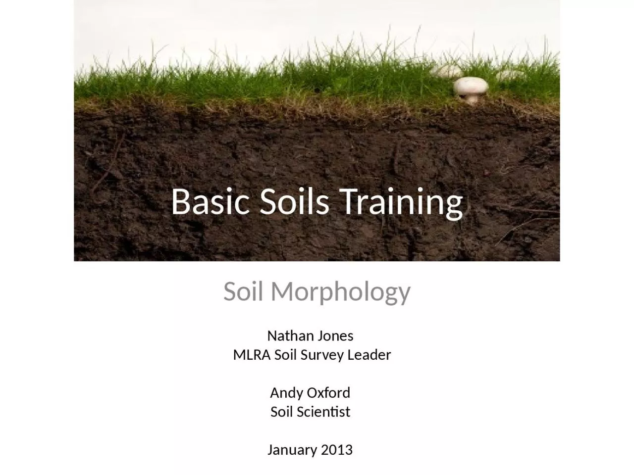
Nathan Jones MLRA Soil Survey Leader Andy Oxford Soil Scientist January 2013 Objectives Soil Horizons Soil Color Soil Texture Soil Structure Soil Rupture Resistance Soil Roots and Pores Soil Restrictive Layers ID: 1025168
Download Presentation The PPT/PDF document "Basic Soils Training Soil Morphology" is the property of its rightful owner. Permission is granted to download and print the materials on this web site for personal, non-commercial use only, and to display it on your personal computer provided you do not modify the materials and that you retain all copyright notices contained in the materials. By downloading content from our website, you accept the terms of this agreement.

1. Basic Soils TrainingSoil MorphologyNathan Jones MLRA Soil Survey LeaderAndy OxfordSoil ScientistJanuary 2013
2. ObjectivesSoil HorizonsSoil ColorSoil TextureSoil StructureSoil Rupture ResistanceSoil Roots and PoresSoil Restrictive LayersSoil BoundariesSoil pH
3. SOIL MORPHOLOGY - a definitionCharacteristics and properties of the soil observable in the field within the various soil horizonsThe description of the kind and arrangement of soil horizons
4. Soil HorizonsHetland SoilCBkBtAp
5. Soil Horizons “Horizon”: A layer of soil or soil material approximately parallel to the land surface and differing from adjacent related layers in physical, chemical, and biological properties or characteristics such as color, structure, texture, consistence, or pH “Profile”: sequence of horizons stacked vertically that tells the story of how the soil formed “Series”: name given to profile that has characteristic set of properties and horizons (determined by NRCS)
6. Soil Sampling UnitsHoudek Series
7. Soil Horizon DevelopmentA-Horizon developmentAccumulation of organic matterClumping of individual soil particlesDistinct from parent material and other layersB and C horizon developmentCarbonic and organic acids are carried by water into soil where they dissolve various minerals (transformations)Clay films - thin layers of oriented trans-located claySalts and carbonates are carried by water and precipitate in the soil from upper to lower horizons (translocation)Wetting and drying cracks soils and creates soil structureWeathering of parent material
8. Master HorizonsO = The layer of organic matter on the surface of a mineral soil A = Topsoil. The mineral soil horizon on the surface with organic matter and low clayE = The horizon of maximum leaching. Not in all soils, but if present, is located just below the “A” horizonB = Subsoil. Horizon most often located below A horizon. The zone of maximum clay accumulationC = Weathered rock. Lies below the “A” and/or “B” horizons and has NOT been acted upon by the soil forming processesR = The hard, consolidated rock beneath the soil
9. O: litter, forest floor; Oi common, ½-1" thick; Oa,Oe usually very thin or absent A: topmost mineral soil; 2-12" typical; use “p” if abrupt boundary (tillage mark) E: often absent due to erosion; may be light-colored, usually same texture as A; not blocky Transition: usually only one– BE or EB; B often first, since more distinct B: usually clayey, blocky, Fe coloration; 6-36" thick; may be subdivided (B1,B2); use t, w, or h–only one type per profile Transition: usually BC (B more distinct) C: weathered parent material; lower clay, massive/rock structure; if clear rock-like structure and appreciable rock fragments, use r (“Cr”) R: hard rock (cannot be dug); describe type if possible
10. Houdek soil series (SD State Soil)BtCBkA
11. Soil Horizon DesignationsTonka SoilAEBC
12. Barnes SoilABBkC
13. Soil PropertiesPhysical: particle size/arrangement; porosityChemical: effect on plant growthBiological: determine long-term behavior (“sustainability”)
14. Physical Soil PropertiesColorTextureStructureConsistencyRoots and PoresRestrictive Layers
15. Soil ColorMcIntosh Soil
16. Soil ColorProbably the most obvious soil featureMunsell system color charts used to standardize colorsHue = the dominant spectral color (related to wavelength of light)Value = measure of degree of lightness or darkness (amount of light reflected)
17. More Soil ColorChroma = measure of purity or strength of spectral colorDominant (matrix) color = the color that occupies the greatest volumeMottling refers to repetitive color changes that cannot be associated to a soil property. Redoximorphic (redox) features are a type of mottling associated with wetness
18. Soil Color: Pigments in SoilsDark brown to black: humus/organic matter gives soil this color; topsoils (A horizon)Reds and yellows: iron oxide, subsoil horizons (B horizons) either red, yellow, oxidized (Fe+3) iron well-oxidized (well-drained)Grey: reduced (Fe+2) iron; water doesn't drain out, poor drainage; Fe is reduced, depletedWhitish or light grey: leached out horizons; other pigments (humus, iron oxides) have been leached away Munsell system: soil colors matched to color chips in book–standardized way to describe soil color
19. Munsell color chart: “10YR 5/3”hue value chroma
20. Soil ColorDark brown to black- ( A horizon) top soils, humus- decomposed organic material. A few percent of humus gives a brownish color and up to 5% the soil becomes black. Waubay Soil
21. Soil ColorReds and Yellows- (B horizons) iron oxide formed during weathering, Fe+3 is well oxidized (well-drained)Alabama State Soil
22. Soil ColorGrey colors are caused by reduced Iron (Fe+2 )Water has excluded oxygen from diffusion into soilOther pigments are leached out from horizons (humus, iron oxides) Tonka Soil
23. Redoximorphic FeaturesRedoximorphic (oxidation/reduction) FeaturesIndication that soil is saturated for some time during the yearRedox depletions (reduction) low chromaFe and Mn have been stripped from soilRedox concentrations (oxidation) high chroma Accumulation of Fe and Mn oxides
24. Soil Morphology Exercise 1Color soil samples with a Munsell color book
25. Soil Texture
26. Soil TextureDefinition (USDA ) - the weight proportion of the soil separates less than 2.0 mm in size (sand, silt, and clay). Or, more commonly, the relative proportions of sand, silt, and claySand = 2.0 to 0.05mmSilt = 0.05 to 0.002mmClay = < 0.002mmSand, silt, and clay in various proportions make up 12 textural classes
27.
28. USDA Textural Triangle
29. Example:35 % sand55 % silt10 % clayTexture is ‘silt loam’Sand 0.05 - 2.0 mm Silt 0.002 to .05 mmClay < .002 mmUSDA Textural Triangle ExampleTextural ClassThe percentage of sand sized particles+ % of silt sized particles+ % of clay sized particles
30. Coarse FragmentsMineral particles larger than 2.0 mm = rock fragments (gravels, stones, or boulders)Modifiers = 0 - 15%, 15 - 35%, 35 - 60%, 60-90%, > 90%
31. Gravels: 2.0 to 75 mm Cobbles: 76 to 250 mm Coarse Fragments
32. Coarse FragmentsStoney: 250 to 600mmBoulders: 600mm+
33. TEXTURAL CLASSES BY “FEEL” METHOD
34. Soil Morphology Exercise 2Texture by “feel” method
35. Soil Structure
36. The aggregation of primary particles into secondary units surrounded by planes of weakness.Porosity 30 to 60 % of ped volumeGranularBlockyPlatyPrismaticColumnarMassivewetting and dryingfreezing and thawingroot actionanimal activityorganic matterkind of clayInitial materialPed facePoresSoil Structure - a definition
37. Soil Structure - ShapesGranular - peds are approximately spherical or polyhedral and are bounded by curved or irregular faces (A horizons)Platy - the peds are flat and “platelike”; they are usually oriented horizontally (E horizons)Blocky - somewhat “blocklike”; bounded by flat or slightly rounded surfaces; nearly equidimensional (Upper B horizons)Prismatic - peds are longer than they are wide (Lower B horizons)Massive – no structural units; material is a coherent mass (C horizons)Single grain – no structural units; entirely noncoherent; example is loose sand (C horizons)
38. Soil Structure - ShapesGranular - peds are approximately spherical or polyhedral and are bounded by curved or irregular faces (A horizons) Platy - the peds are flat and “platelike”; They are usually oriented horizontally (E horizons)
39. Soil Structure - ShapesBlocky - Somewhat “block like”. Bounded by flat or slightly rounded surfaces; Nearly equidimensional (Upper B horizons)Prismatic - Peds are longer than they are wide (Lower B horizons)Angular Blocky Subangular blocky
40. Soil Structure - ShapesColumnar – Similar to prismatic; vertically elongated units with rounded tops; found in natric horizons
41. Soil StructureAffects:Pore spaceLiquid and gas movementPermeabilityStructure is strongly correlated to many properties, particularly soil hydrology
42. Soil Morphology Exercise 3Observe structure types using the structure kits
43. Soil Rupture Resistance
44. Soil Rupture Resistance - a definitionThe resistance of soil to deformation or rupture; or the degree of cohesion (tendency of similar surfaces to cling to one another) or adhesion (tendency of dissimilar surfaces to cling to one another) of the soil mass
45. Soil Rupture Resistance - Moist Soilloosevery friablefriablefirmvery firmextremely firm
46. Soil Rupture Resistance Loose: You have trouble picking out a single ped and the structure falls apart before you handle it.*Extremely Firm: The ped can’t be crushed with your fingers (you need a hammer!).Firm: The ped breaks when you apply a good amount of pressure and dents your fingers before it breaks.Friable: The ped breaks with a small amount of pressure.* Soils with “single grained” structure always have loose consistence.Very FriableVery Firm
47. Soil Morphology Exercise 4Practice determining moist rupture resistance class
48. Soil Roots and Pores
49. Soil Roots and PoresDescribe the quantity, size, and location of roots and poresProvides a visual representation of soil healthAffected by soil structureImpacted by soil restrictive layers and management and use
50. Soil Roots and Pores
51. Soil Restrictive LayersSoil materialShale bedrock
52. Soil and Root Restrictive LayersBedrockNatric horizonsSand and gravelClay panWaterCompaction
53. Soil Restrictive LayersInfluences:Rooting depthWater infiltrationSalt accumulationLand use and management
54. Soil Boundaries
55. Soil Boundaries - a definitionA surface or transitional layer between two adjoining horizons or layers Most boundaries are zones of transition rather than sharp lines of division
56. Soil Boundaries - DistinctnessAbrupt = less than 1 inch thickClear = 1 to 2.5 inches thickGradual = 2.5 to 5 inches thickDiffuse = greater than 5 inches thick
57. Soil Boundaries - TopographySmooth = the boundary is a plane with few or no irregularitiesWavy = there are undulations in which depressions are wider than they are deepIrregular = pockets that are deeper than they are wideBroken = One or both of the horizons separated by the boundary are discontinuous and the boundary is interrupted
58. Soil Boundaries
59. Soil Chemical PropertiesAcidity/alkalinity: “pH”Affects many other soil chemical propertiesLarge effect on nutrient availability (solubility)Optimum range (most plants): 5.5-6.5
60. Soil pH
61. Soil pH – definitionA numeric designation of the acidity or alkalinity in soilsA measure of the H+ ion activity in soilsOn a scale of 0 to 14
62. Soil pH - classesVery strongly acid: 4.5 to 5.0 Strongly Acid: 5.1 to 5.5Moderately Acid: 5.6 to 6.0Slightly Acid: 6.1 to 6.5Neutral: 6.6 to 7.3Slightly Alkaline: 7.4 to 7.8Moderately Alkaline: 7.9 to 8.4
63. Soil pH pH influences nutrient availability, rate of biological and chemical processes, the amount and types of plants and microorganisms present, and the corrosion potential of concrete or steel structures in the soilYou can alter the soil pH by incorporating compounds in to the soil. The most common is to add lime (calcium carbonate, CaCO3 ) to increase the pH
64. Soil pH-nutrient availability
65. Questions??
66. CreditsPictures and Content from PowerPoint Presentations Created by:William Miller and David Radcliffe, Crop and Soil Sciences, University of GeorgiaUniversity of Florida Soil LabAlabama A&M UniversityUSDA Natural Resources Conservation Service Alaska Soil Survey ProgramEarl D. Lockridge, USDA NRCS National Soil Survey Center
67. CreditsOther pictures and content provided by:USDA Handbook No. 18, Soil Survey Manual by the Soil Survey Division StaffField Book for Describing and Sampling Soils Version 2.0 by USDA NRCS National Soil Survey CenterUSDA NRCS Keys to Soil Taxonomy 10th EditionVerdegaalbrothers.comStthomas.eduSoilquality.orgNoonturfcare.comViette.comEhow.comGardeningstepbystep.comMccc.msu.eduDeeproot.comSwac.umn.eduScifaithkansas.netAllianceforwaterefficiency.orgEcoclublive.blogspot.comSd.nrcs.usda.govWater-research.net