
147The USDA is an equal opportunity provider and employer148Mark Twain National Forest401 Fairgrounds Road Rolla MO 65401wwwfsusdagovmtnfIn 1968 Congress established the National Wild and Scenic Rive ID: 880119
Download Pdf The PPT/PDF document "x0000x0000Eleven Point Scenic RiverTrave..." is the property of its rightful owner. Permission is granted to download and print the materials on this web site for personal, non-commercial use only, and to display it on your personal computer provided you do not modify the materials and that you retain all copyright notices contained in the materials. By downloading content from our website, you accept the terms of this agreement.


1 ��Eleven Point Scenic Rive
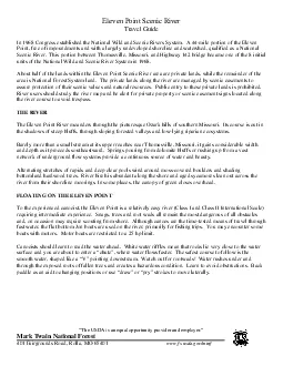
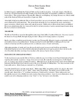
��Eleven Point Scenic RiverTravel Guide “The USDA is an equal opportunity provider and employer.”Mark Twain National Forest401 Fairgrounds Road, Rolla, MO 65401www.fs.usda.gov/mtnf In 1968 Congress established the National Wild and Scenic Rivers System. A 44mile portion of the Eleven Point, free of impoundments and with a largely undeveloped shoreline and watershed, qualified as a National Scenic River. This portion between Thomasville, Missouri, and Highway 142 bridge became one of the 8 initial units of the National Wild and Scenic River System in 1968. ��Eleven Point Scenic River Travel GuidePage “The USDA is an equal opportunity provider and employer.”Mark Twain National Forest401 Fairgrounds Road, Rolla, MO 65401www.fs.usda.gov/mtnf FISHINGSmallmouth bass, rock bass, walleye and trout are eagerly sought by anglers on the Eleven Point. All fishing is subject to State of Missouri regulations. Nonresidents may purchase a 3day or annual license. A trout permis also required if you are in possession of trout. Gigging is popular, but not permitted within the Wild Trout management area. To prevent illegal fishing practices and possible citations, review and study the latest fish and game regulations published by the Missouri Department of Conservation.CAMPINGCamping along the river is a unique experience. Seven (7) float camps are available along the river for camping. These areas are only accessible by boat and provide a latrine and fire ring. These camping areas are located higher above the river and providemore protection in the event of a sudden water level rise. Dispersed camping is permitted along the river on gravel bars and sand bars. However please be cautious, storms upstream can cause a rapid raise in the water level while
2 you are sleeping. Be sure to check weat
you are sleeping. Be sure to check weather forecasts prior to leaving on your trip. Please remove all evidence of camping and all trash. A Forest Service campground is located at Greer Crossing along Highway 19. Private campgrounds can be found in Alton, Greer and Riverton. No camping is allowed on private land adjacent to the river.OPURIVER TRIPThe most popular day trip is from Greer to Whitten. For an overnight trip most people travel from Greer to RivertonThomasvilleCane Bluff Access Mi.6 hoursGood solitude. Usually can be floated March through June.ThomasvilleGreer Access 16.6 Mi.8 hoursGood solitude. Usually can be floated March through June.Cane Bluff Access to GreerAccess 8 Mi. 4 to 6 hoursPicturesque settings Canyon walls, eagles can beseen year roundGreer AccessTurner MillSouthMi.3 to 4 hoursMost used put in location on the Eleven Point River, passes through Mary Decker Shoals. Greer AccessWhitten Access 11.4 Mi.4 to 6 hoursGreer to Whitten access is the most popular 1 day float trips.Greer AccessRiverton 19.0 Mi.8 to 10 hoursExcellent twoday float. Can be done in one long day. Experience going through Halls Bay Chute.Turner Mill South to Whitten 6 miles 3 hoursWhitten to Riverton 7miles 3 to 4 hoursRivertonHwy 142 Access 8.1Mi.Nice leisurelyfloat. ��Eleven Point Scenic River Travel GuidePage “The USDA is an equal opportunity provider and employer.”Mark Twain National Forest401 Fairgrounds Road, Rolla, MO 65401www.fs.usda.gov/mtnf The Upper RiverSection see Map on Page 90.0 Mi.State Highway 99 Access at Thomasville is the uppermost point from which the Eleven Point can be floated. (July through October is generally the low flow period and canoeing may not be possible). Thomasville was a trading post for exchanging goods with the Indians, became a
3 settlement in 1809, and served as Orego
settlement in 1809, and served as Oregon County seat from 18450.5 Mi.Middle Fork of the Eleven Point River enters and increases the river flow.1.5 Mi. Mill Creek and Barren Fork enters from the south bringing still more water.3.0 Mi. Posey Spring enters the river from the left via a wooded glen. The spring emerges from the base of a bluff on private landa few feet from the river.3.8 Mi. Round Hollow enters from the left and the river turns abruptly south, skirting around bluffs to the east and south. At this point, there are remnant upright supports and several cross members of an old low water bridge. A portage may be necessary.5.9 Mi. Blowing Spring enters the river from the left.6.2 Mi. Roaring Spring, to the right on private land, makes enough noise that a topographic map is scarcely needed for guidance. The water pours from a horizontal crack in the face of the bluff, plunging 15 yards to the river in a tumbling cascade. 6.7 Mi. Graham Springs branch enters from the right. The Spring itself is about 0.3 miles up Graham Hollow on private land. Mi. Cane Bluff Access and Picnic Area is the first public access point down river from Thomasville. The towering 250 foot Cane Bluff is directly across the river from the access area. Upstream 100 feet, a rock slide occurred in 1991, knocking down trees and scaring the bluff to the river’s edge.11.7 Mi. Spring Creek enters from the left.12.0 Mi. Minich Spring flows in from the right bank. Some of the water from McCormack Lake travels beneath the Eleven Point to resurge in Minich Spring.. Long Hollow area to the right. A popular primitive area, it has a sandy beach and a nice swimming hole. Long Hollow is not a river access, but a primitive gravel road will get you close enough for a short walk to the river.1
4 4.3 Mi. The Boom Hole. During the Ozar
4.3 Mi. The Boom Hole. During the Ozark lumber rush between 1890 and 1910, virgin pine logs cut from the surrounding hilltops were chuted off the top of the bluff. The logs plunged into the river with a tremendous ��Eleven Point Scenic River Travel GuidePage “The USDA is an equal opportunity provider and employer.”Mark Twain National Forest401 Fairgrounds Road, Rolla, MO 65401www.fs.usda.gov/mtnf boom! They were floated to the log dam that once existed at Mary Decker Shoal, about 6 miles downstream. Also a primitive access.14.8 Mi. McCormack Hollow enters from the left. About one mile up McCormack Hollow is McCormack Lake. A foot trail from McCormack Lake to Greer Crossing follows along the left bank of the river, first on the uff tops and then in the flats along the river.16.0 Mi. Greer Spring Branch inlet on the right. Boats are prohibited within the spring branch. About one mile up the spring branch is Greer Spring, second largest spring in Missouri. Greer Spring once powered Greer Mill, (named after Samuel Greer). Greer Spring can be seen by walking a one mile long trail. The trailhead is on the west side of Missouri Highway 19, one mile south of the river bridge. The mill is on land reserved for the use by previousland owners and is not open to the public.The Wild Trout Management area, with special regulations in effect, begins here and goes 51/2 miles downstream to the Turner Mill Accesses.16.4 Mi. Missouri State Highway 19 Bridge, site of the old Bellows Ford. At one time a sorghum mill operated close to the ford and farmers crossed the river to go to Greer Mill.16.6 Mi. Greer Crossing is the Highway 19 River Access. On the left is the access point, a picnic area, campground and hiking trails.17.0 Mi. The River forks here. The lef
5 t fork is known as the Stair Step Hole&#
t fork is known as the Stair Step Hole” named after the historic concrete steps on the steep left bank. The right fork is known as the “Motor Chute” named because its deep water allows motor boats to pass through. Mi. Located on the left is Graveyard Hollow.19.4 Mi. Little Hurricane Creek enters from the right.19.6 Mi. On the right bank in the flat below Little Hurricane Creek is the location where Simpsons Mill, one of the first along the Eleven Point, wasbuilt before the Civil War. The mill ground grain and sawed timber for early settlers, and was used by the Confederate Army as a recruiting station.20.1 Mi. Mary Decker Shoal, a chute type rapids with many large boulders scattered over the stream bed.rock dam once existed at this point during the lumber boom. Logs floated down the river from Boom Hole were taken from the river, loaded onto rail cars and hauled to the Ozark Land and Timber Company mill at Winona.20.4 Mi. Hurricane Creek enters from the left. Hydrological studies show that some of the water from the Hurricane Creek flows underground to Big Spring in Carter County 17 miles to the east. The river butts up against a 300 foot high bluff and turns sharply to the right. ��Eleven Point Scenic River Travel GuidePage “The USDA is an equal opportunity provider and employer.”Mark Twain National Forest401 Fairgrounds Road, Rolla, MO 65401www.fs.usda.gov/mtnf 21.5 Mi. Turner Mill Access on the left or north is a day use picnic area with a boat launch. It was the site of a community that contained a general store, post office, school, Turner’s Mill, several houses and a population of almost 50. The mill operated from 1850’s to the early 20century. Turner Mill South on the right is a major landing/launch area.22.3 Mi.
6 Stinking Pond Float Camp on the left n
Stinking Pond Float Camp on the left near a 20foot bluff.24.2 Mi. McDowell Primitive Access to the left. Just past this access the river makes asharp bend around a narrow bluff line, forming a horseshoe bend, giving the area its name. This entrenched river meande4r kept getting deeper as the 0zark uplifted and the valleys eroded deeper.25.5 Mi. Horseshoe Bend Float Camp on the left.The Lower River Section see Map on Page 10 and 1126.3 Mi. Barn Hollow Float Camp is on the leftBliss Spring inlet enters on the left. The spring is about ¼ mile from the river. A loop of Whites Creek Trail passes near the river at this location.Whitten Access.Whites Creek Float Camp located to the left near the mouth of White’s Creek. Whites Creek Cave is a 20 minute hike up the ridge to the right. This cave, like all others, needs your help in preventing litter and protecting formats from damage.NOTEWHITE’S CREEK CAVE IS CLOSED TO PROTECT ENDANGERED BATS.30.9 Mi. Greenbriar Float Camp is located on the left.32.0 Mi. Conner Chute, just downstream from where Conner Spring Branch enters the river, contains a stretch of enjoyable fast water.33.0 Mi. Turtle Island Spring enters from the right.33.3 Mi. On the left, Boze Mill Float Camp is just upstream from Boze Mill.33.5 Mi. Boze Mill Spring enters from the left adding an average of nearly 15 million gallons of water to the river each day. A variety of aquatic plants in the spring branch add several shadesof green to the water. The mill dam, remains of an old water turbine and the turbine housing are all that remain of the mill that probably operated early in the 1850’s. The river valley begins to widen here.34.0 Mi. Halls Bay. River divides here. The right channel is best when the water level is above normal. It provides
7 a fast run over a ledge. The left chann
a fast run over a ledge. The left channel is a tricky, shallow “S” curve with swift water. ��Eleven Point Scenic River Travel GuidePage “The USDA is an equal opportunity provider and employer.”Mark Twain National Forest401 Fairgrounds Road, Rolla, MO 65401www.fs.usda.gov/mtnf 35.6 Mi. Riverton Access on the left, just above Highway 160 bridge is a major landing/launch area. Below the Hwy. 160 bridge is Riverton East Day Use Area. Picnicking and swimming are popular here. This area also has facilities accessible to persons with disabilities. 38.4 Mi. Piney Creek enters from the left.39.9 Mi. Hurricane Creek enters from the left.43.0 Mi. Frederick Creek enters from the right. This creek forms the west side of the Narrows, a narrow ridge of land that separates it from the Eleven Point River.43.3 Mi. Morgan Spring Float Camp on the right, just past the spring branch inlet from Morgan Spring. Old Thompson Mill Spring was the original name for this beautiful spring back in the days when a small grist mill by that name stood nearby. Only the dam and sluice still remain. Foot paths lead from the float camp to Morgan, Sullivan, Jones and Blue Springs.44.0 Mi. The Spring Branch from Sullivan, Jones, and Blue Springs enters the river from the right. These springs are nestled against the steep bluff of the Narrows. An overlook at the top of the bluff can be reached by foot trail. At the overlook, the ridge between the Eleven Point and Frederick Creek is about 30 feet wide.44.3 Mi. The NarrowsAccess is on the left just above Highway 142 bridge. This access is the last on the southern end of the Eleven Point National Scenic River Area. The Scenic River Area ends at the bridge, but the river continues south into Arkansas. Myrtle Access, managed
8 by the State of Missouri, is located app
by the State of Missouri, is located approximately 4.0 miles downstream near the state line.49.3 Mi. Welcome to the State of Arkansas OUTFITTERSCanoe outfitters or guies are required to have a permit to operate on the Eleven Point National Scenic River. They can provide canoes, life jackets, and shuttle service for people or private canoes. River outfitters authorized to operate on the Eleven Point National Scenic River are: Huffstedlers Canoe Rental Route 1, Box 1280Alton, Missouri 65606Located on Hwy. 160 Riverton, MO Phone: (417) 778 Eleven Point River Canoe Rental Route 2 Box 2522Alton, MO 65606Located at the junction of Hwy 19 and 160 Hwy Alton, MO Phone: (417) 778 Down River Canoe and Tube Rental Box Myrtle, MO 65 Richards Canoe Rental Route 2, Box 2426Alton, Missouri 65606Located on Hwy. 19 near Greer, MOPhone: (417) 778 ��Eleven Point Scenic River Travel GuidePage “The USDA is an equal opportunity provider and employer.”Mark Twain National Forest401 Fairgrounds Road, Rolla, MO 65401www.fs.usda.gov/mtnf SAFETY FIRSTOne life preserver for each person is required and should be worn.Beware of flash flooding. The river rises rapidly during and just following heavy rain storms.Stay off the river during flood stage, especially when it is swollen out of its banks.Don’t tie induffle bags, dogs, and food supplies; allow them to float free. A full load tiein will make it nearly impossible to salvage the canoe if it sinks.Observe all boating safety regulations, especially when using power boats. Do not overload the canoe; leave at least six inches between the water and gunwale, or top edge of the canoe sides. Load the canoe so that the center of gravity is just back from the midway point out of the canoe. Keep gear low in the canoe.S
9 tore all valuables (billfolds, watches,
tore all valuables (billfolds, watches, cameras, etc.) in watertight containers. Make sure these are tied into the boat.If a chute looks a little hazardous to you, step out and walk the boat through. The chutes at Mary Decker and Halls Bay approach a Class III on the international difficulty scale.Spring and river water are not safe to drink. Many springs are fed from long distances away and do not provide good filtering of the water and may have many types of contaminants. Boiling may kill bacteria, but does not remove dissolvedcontaminates. It is recommended that people carry drinking water.Never paddle alone. A companion makes floating enjoyable and greatly reduces the danger of accidents. Bring a fully equipped first aid kit and know how to use it. Poisonous snakes and stinging insects are residents. Poison ivy is common along the banks.Cold water can be a great hazard, causing loss of body heat faster than it can be produced. A condition known as hypothermia develops. The hazard doubles if water is below 50 degrees Fahrenheit. Know the symptoms, and how to administer appropriate first aid.Avoid overexposure to the sun. Use protective lotions or creams from the start. Have a hat, clothes or a towel handy for protection.WANT TO KNOW MORE?Interested in knowing more about the National Forest? Write to the following:Forest SupervisorEleven Point District RangerMark Twain National ForestMark Twain National Forest401 Fairgrounds Road#4 Confederate Ridge RoadRolla, MO 65401Doniphan, MO 6393Phone: (573) 3644621 (voice)Phone: (573) 9962153 (voice)(573) 3646844 (FAX) ��Eleven Point Scenic River Travel GuidePage “The USDA is an equal opportunity provider and employer.”Mark Twain National Forest401 Fairgrounds Road, Rolla, MO 65401www.fs.usda.gov/mtnf
10 REGULATIONS AND USE HINTSTo maitain the
REGULATIONS AND USE HINTSTo maitain the river’s scenic quality, please remember the following:Select existing campsites. Latrines are provided at developed float camps.Remember, it is unlawful to cut or strip green trees or shrubs.Leave your river and campsite clean for those who follow; pack out unburnable trash. Use notrace camping, cleaning up so no one knows you were there.Use cord instead of nails at campsites.Build small fires only at existing fireplaces or fireproof locations. When leaving, make sure your fire is dead out.Be considerate of other river users. Canoes and boats should move to the side of the river opposite where people are fishing when possible.Wash dishes and dispose of dishwater and cooking grease away from the river.Park your vehicle in designated areas to avoid blocking traffic at the launch/retrieval points.Learn hunting and fishing seasons and respect all outdoor enthusiasts. Wildlife may be taken only under Missouri Department of Conservation hunting and fishing regulations and only when you hold an appropriate license.Discharging of firearms must be limited to areas away from developed float camps or other sites where people could be injured. Snakes, frogs, birds and other wildlife are part of the river ecology and should not be used for target practice. Respect private property rights . Being upon private lands under scenic easement is a violation of State Trespass Laws and Secretary of Agriculture’s Regulations. Outboard motors are limited to a maximum of 25 hp.Glass bottles and glass Food containers are prohibited on the river and within the river zone. Glass containers and bottles may be used in GreerPicnic Area and Campground and at Riverton Picnic Area (West) only.The U. S. Department of Agriculture (USDA) prohibits discrimination i
11 n all its programs and activities on the
n all its programs and activities on the basis of race, color, national origin, gender, religion, age, disability, political beliefs, sexual orientation, and, marital or family status. (Not all prohibited bases apply to all programs). Persons with disabilities who require alternative means for communication of program information (Braille, large print, audiotape, etc.) should contact USDA’s TARGET Center at 2022600 (voice and TDD).To file a complaint of discrimination, write USDA, Director, Office of Civil Rights, Room 326W, Whitten Building, 14and Independence Avenue, SW, Washington, DC 202509410 or call (202) 7205964 (voice or TDD). USDA is an equal opportunity (202) 7205964 (voice or TDD). USDA is an equal opportunity provider and employer.” ��Eleven Point Scenic River Travel GuidePage “The USDA is an equal opportunity provider and employer.”Mark Twain National Forest401 Fairgrounds Road, Rolla, MO 65401www.fs.usda.gov/mtnf Eleven Point Scenic River Upper SectionMap(Broken into two sections)Map 1: Western Half*of the Upper Section of the Eleven Point Scenic RiverMap 2: Eastern Half of the Upper Section of the Eleven Point Scenic River ��Eleven Point Scenic River Travel GuidePage “The USDA is an equal opportunity provider and employer.”Mark Twain National Forest401 Fairgrounds Road, Rolla, MO 65401www.fs.usda.gov/mtnf Eleven Point Scenic River LowerSectionMap(Broken into two sections)Map 3: Top Half of the Lower Section of the Eleven Point Scenic River ��Eleven Point Scenic River Travel GuidePage “The USDA is an equal opportunity provider and employer.”Mark Twain National Forest401 Fairgrounds Road, Rolla, MO 65401www.fs.usda.gov/mtnf Map 4: Bottom Half of the Lower Section of the Eleven Point Sce