
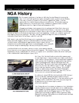
On 21 June 1956 President Eisenhower ordered the commencement of secret highflying U2 aircraft reconnaissance flights over the Soviet Union to observe and detect Moscow146s actions and potential cap ID: 875201
Download Pdf The PPT/PDF document "The US geospatial intelligence effort be..." is the property of its rightful owner. Permission is granted to download and print the materials on this web site for personal, non-commercial use only, and to display it on your personal computer provided you do not modify the materials and that you retain all copyright notices contained in the materials. By downloading content from our website, you accept the terms of this agreement.


1 The US geospatial intelligence effort be
The US geospatial intelligence effort began in 1803 when President Thomas Jefferson sent the Army’s Lewis and Clark expedition to explore and map the recently acquired Louisiana Territory. As the Army, assisted by its contract civilian scientists, supported the country’s westward expansion, the Navy similarly began reaching out across the oceans. This maritime expansion, coupled with the Navy's desire not to have to rely on Brit On 21 June 1956, President Eisenhower ordered the commencement of secret, high-flying U-2 aircraft reconnaissance flights over the Soviet Union to observe and detect Moscow’s actions and potential capabilities. At the same time, the US embarked on a program to develop satellites capable of photographing the earth and return 1961 CORONA IMAGE OF CUBA U-2 RECONNAISSANCE AIRCRAFTNGA History After Vietnam, the need for economy, maximum use of new technologies, and reduced hum For more information:NGA General Help DeskMail Stop L-523200 South Second StreetSt. Louis, Mo. 63118-3399Toll Free: 1-800-455-0899Commercial:(314)260-5032Fax:(314)260-5024OR http://www.nga.milBy the mid-1990’s, imagery was the basis for both imagery intelligence and map-based imagery products, the Intelligence Community considered centralizing management of both functions. In 1996, the US Congress, the CIA, and the Department of Defense agreed to combine the efforts of the country’s mapping and imagery analysis efforts, creating the National Imagery and Mapping Agency (NIMA). Formed from several defense and intelligence agencies, NIMA merges imagery, maps, charts, and environmental data to produce what has been coined “geospatial intelligence”. Using state-of-the-art software and hardware, NIMA can create animated renditions of imagery and geospatial data, allowing users to visualize inaccessible terrain. This capability can aid in multiple applications, such as resolving international disputes; for example, between 1995 and 1998, NIMA products helped resolve longstanding border differences between Pe
2 ru andEcuador as well as between Israel
ru andEcuador as well as between Israel and South Lebanon. NIMA products also supported the Dayton Peace Accord efforts in the Balkans. In February 2000, the Space Shuttle Endeavour’s Shuttle Radar Topography Mission (SRTM) provided themost detailed measurements of the planet’s elevation ever gathered--data that will prove invaluable in supporting NGA’s geospatial intelligence efforts. NIMA has contributed to homeland defense efforts, helped resolveinternational disputes, aided disaster relief efforts, helped the armed forces overseas, developed safer airways charts, and remapped the world. In the mid-1990’s NIMA produced the Global Positioning System “Safety of Navigation” effort that vastly improved information on airports. NIMA supported peace maintenance operations in the Balkans by providing visual representations and analyses of terrain for international forces monitoring activities in the region. NIMA continues to support maritime operations by providing the “Notice to Mariners,”a unique capability that provides those at sea the most accurate nautical charts available. NIMA also plays a critical role in homeland security. After September 11th, NIMA partnered with the U. S. Geological Survey to survey the WTC site and determine the extent of the destruction. In 2002, NIMA partnered with Federal organizations to provide geospatial assistance to the 2002 Winter Olympics in Utah.NGA’s geospatial intelligence products serve a variety of military, civil, and international needs. NGA is proud of its mission to provide timely, relevant, and accurategeospatial intelligence in support of national security and will continue efforts to achieve our vision to Know the Earth, Show the Way.On Nov. 24, 2003 the President signed the 2004 Defense Authorization Bill, a provision of which authorized NIMA to change its name to the National Geospatial-Intelligence Agency (NGA). Our new name is the latest step in a transformation process underway since our inception on Oct. 1, 1996.NGA Histor