
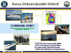
1 COMMAND BRIEFThis Brief is Approved for Public Release distribution is unlimitedCEANOGRAPHICFFICE CAPT Ron Piret Commanding OfficerCAPT Ivo Prikasky Executive OfficerMr Mark Jarrett Technical ID: 854395
Download Pdf The PPT/PDF document "United States Fleet Forces" is the property of its rightful owner. Permission is granted to download and print the materials on this web site for personal, non-commercial use only, and to display it on your personal computer provided you do not modify the materials and that you retain all copyright notices contained in the materials. By downloading content from our website, you accept the terms of this agreement.


1 1 United States Fleet Forces COMMAND BRI
1 United States Fleet Forces COMMAND BRIEFThis Brief is Approved for Public Release; distribution is unlimited.CEANOGRAPHICFFICE CAPT Ron Piret, Commanding OfficerCAPT Ivo Prikasky, Executive OfficerMr. Mark Jarrett, Technical DirectorAGCM Chad Goff, Senior Enlisted Advisor 2 United States Fleet Forces • 1830 Depot of Charts and Instruments established; later renam
2 ed U.S Hydrographic Office • 1962
ed U.S Hydrographic Office • 1962 Renamed U.S. Naval Oceanographic Office • 1977 Relocated from Washington, D.C. to Stennis Space Center, Miss. • 1987 Operational Oceanography Center established • 1991 Supercomputer became operational • 1994 T - AGS 60 Class military survey ships became operational • 2000 Inaugural Underwater Unmanne
3 d Systems operations. • 2004 Bega
d Systems operations. • 2004 Began daily runs of world's only 3 - D Operational Global Ocean Model • 2005 Restructured as Oceanographic Reach - Back Center to support Naval Operations • 2008 Began Maritime Homeland Defense surveys of U.S. Military installations • 2011 Daniel H. Williams Oceanographic Information Technology Center Dedicat
4 ed Naval Oceanographic OfficeHistory and
ed Naval Oceanographic OfficeHistory and Milestones 3 United States Fleet Forces MissionTo optimize sea power by applying relevant oceanographic knowledge in support of U.S. National Security 4 United States Fleet Forces VisionWe will assure the Navy’s oceanographic knowledge superiority and reduce risk by providing the forecast battlespace through:Smart Collection(
5 Focused on ASW, MIW, NSW & EXW needs)ResRes")
Focused on ASW, MIW, NSW & EXW needs)Responsive Delivery(Decreased turnaround time)Focused Analysis(Direct Support) 5 United States Fleet Forces Naval Oceanography KNOWLEDGECENTRIC WARFIGHTING FOCUSED FNMOCNAVOUSNOWarfightingSafetyShapingPDCTeamworkTechnical ExcellenceClear CommunicationsManage RiskMeasure ResultsContinuous Improvement Naval Oceanography Operations Comma
6 nd Naval Special Warfare ISR Navigation
nd Naval Special Warfare ISR Navigation Precise Time and Astrometry Fleet Operations Maritime Operations Aviation Operations Mine Warfare AntiSubmarine Warfare 6 United States Fleet Forces Fleet Aligned Fleet Numerical Meteorology Oceanography Center(FNMOC)Monterey, CA Naval Oceanography Operations Command(NOOC)Stennis Space Center, MS Commander, Naval Meteorology and Oc
7 eanography Command(CNMOCStennis Space Ce
eanography Command(CNMOCStennis Space Center, MS Chief of Naval Operations(CNO)Washington, DC Commander, Fleet Forces Command(USFF)Norfolk, VA Naval Oceanographic Office(NAVOCEANO)Stennis Space Center, MS Fleet Survey Team (FST)SSC, MS *Naval Information Dominance Forces, Type CommanderNAVIFORSuffolk, VA Man, Train, EquipReadinessOps Fleet Weather Center(FWC)Norfolk, VA
8 Fleet Weather Center(FWC)San Diego, CA NSan Diego, CA
N")
Fleet Weather Center(FWC)San Diego, CA Naval Meteorology and Oceanography Professional Development Center (NMOPDC)Gulfport, MS U.S. Naval Observatory(USNO)Washington, DC 7 United States Fleet Forces NAVOCEANO Organization NP6MineWarfare NP2Littoral &Riverine NP3Oceanographic Department OceanProjects NP5Acoustics NP4HydrographicDepartment COMMANDING OFFICER Technical Dire
9 ctor 0TT 0TO 0TE 0TPC 0TPE 0TP Productio
ctor 0TT 0TO 0TE 0TPC 0TPE 0TP Production 0TPL Senior Enlisted Leader Command Services Operations Resources & Budget Engineering Plans, Programs,& Requirements 01N 01T Executive Officer Command Services Contracts 8 United States Fleet Forces NAVOCEANOOver 800 Civilian, Contractor and Military personnelTotal Workforce: Over 800 Scientific Technical Profe
10 ssionalClerical Other 39%8%4
ssionalClerical Other 39%8%4%14% Highly Skilled Operational Oceanography WorkforceFleet Survey TeamOver 50 Military and Civilian personnel NAVOCEANO Personnel Education % Total NAVO Workforce Ph.D.5%M.A./M.S.23%B.A./B.S.43%Associate Degree11%Other18% 9 United States Fleet Forces Core Competencies SPECOPS NSW NECC ISR ASW MIW Fleet OPS CSG ESG USM
11 C HYDROGRAPHY BATHYMETRY GEOPHYSICS ACOU
C HYDROGRAPHY BATHYMETRY GEOPHYSICS ACOUSTICS PHYSICAL OCEANOGRAPHY GEOSPATIAL INTELLIGENCE 10 United States Fleet Forces Military Survey Ships (TAGS) w/HSLFleet Survey Team (FST)Airborne Coastal Survey ProgramUnderwater Autonomous Vehicles (UUV) / Sea GlidersProfiling FloatsDrifting BuoysNaval Platforms (TTS)Satellites Maury Oceanographic LibraryHigh Performance Compu
12 ting (DSRC)National and International DaNational and International Da")
ting (DSRC)National and International Data Exchange AgreementsData WarehouseCollection and Processing Assets 11 United States Fleet Forces Year Launched 12 United States Fleet Forces Approved for Public Release Naval Oceanographic Office 13 United States Fleet Forces Ocean Gliders WeightHull Dia.Length1.5 mSpeed 31 cm/sMax Depth200/1000 mEndurance6
13 monthsRangeEnergyoxyhalide LBSGlider Sp
monthsRangeEnergyoxyhalide LBSGlider Specifications: 14 United States Fleet Forces Longer endurance aircraftHigher resolution sensors10,000 Hz Pulse Rate (hydro / topo)0.4 Hz / 25 MP Digital camera (~20 cm pixel)CASI1500 Hyperspectral Imager1500 pixels1050 nm wavelength288 possible bandsIHO Order 1 Surveys capableShot spacing:0.7 X 0.7 meter topo / shallow hydro2.0
14 X 2.0 meter deep hydro400 m op altitude
X 2.0 meter deep hydro400 m op altitude (hydro)1200 m op altitude (topo) Shorter laser pulse length and receiver response for increased accuracy, especially in shallow (2m) water.Large fieldofview afforded by prism, and more sensitive receivers, increase signalnoise ratio.Improved depth detection in shallow turbid water. 400 m Airborne Coastal Surveys ProgramCoastal Zon
15 e Mapping and Imaging Lidar (CZMIL) 17 U
17
U")
e Mapping and Imaging Lidar (CZMIL) 17 United States Fleet Forces Specialized Products D Fly Thru Field Chart Bottom Sediment Chart V DatasetsSpecial Analyzed Image Littoral (SAIL) NCOM 1/30 DE䱆吳D†1⼀1100 18 United States Fleet Forces Theater Security CooperationEcuadorVietnamMontenegro Philippines CongoGabon 19 United States Fleet Forces Proactive HA/DR (Shapin
16 g) Indonesia Tsunami ReliefDiviDiviAir,
Indonesia Tsunami ReliefDiviDiviAir,")
g) Indonesia Tsunami ReliefDiviDiviAir, Netherlands Antilles Adam AirOperation Unified Response (Haiti) 20 United States Fleet Forces Unclassified Web: https://nepoc.oceanography.navy.mil/portal/web/navo To initiate a new product request if an existing product is not available on the web page, choosethe link under IMPORTANT LINKS AND DOWNLADS labeled NAVOCEANOREQUEST F
17 OR SERVICE For 24/7 Customer Service, Pr
OR SERVICE For 24/7 Customer Service, Product Information, Availability, or Status:Classified Web: http://nepoc.oceanography.navy.smil.mil/portal/web/navo To initiate a new product request if an existing product is not available on the web page, choosethe link under PRODUCT SUPPORT labeled REQUEST FOR PRODUCTS Customer Support Office (CSO)To speak to a Customer Service R
18 epresentative:COMM: (228) 6885176DSN: 6885176DSN:")
epresentative:COMM: (228) 6885176DSN: 8285176Mail: Unclassified: cso.navo.fct@navy.mil Classified: cso@ocean.navo.navy.smil.mil If checking on Product Status, please have your RFS number available. 21 United States Fleet Forces Rapidly deployable teams4 to 6 personnel, 9 m RHIB or flyaway urvey it for boat of opportunityRapid Littoral Surveys Beache
19 s and Rivers Rapid Littoral Survey Vesse
s and Rivers Rapid Littoral Survey Vessels (RLSV), w/bolt on sensor package for nearshore assessments. Deployable to Amphibious Squadrons (PHIBRONs)International Cooperative SurveysHost country participation, boats of opportunityTheater Security Cooperation Global partnership building through Maritime Safety, Security, and TrainingHumanitarian Assist / Disaster R
20 eliefPosthurricane surveys Katrina, Rita
eliefPosthurricane surveys Katrina, Rita, Gustav, IkePostearthquake surveys Indonesia, Haiti, Chilehours to departure upon taskingA specialized team of military and civilian experts providing hydrographic and oceanographic knowledge of the littoral environment to support safety navigation Tailored Products and delivery in the field Fleet Survey Team (FST) 22 United Stat