
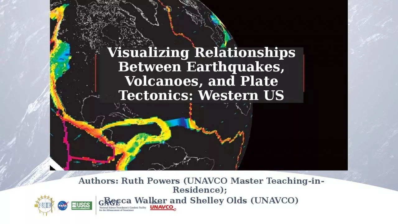
Western US Authors Ruth Powers UNAVCO Master TeachinginResidence Becca Walker and Shelley Olds UNAVCO Activity Outcomes Learners should be able to Describe how the locations of earthquakes volcanoes and velocity vectors from GPS stations in the Western United States inform us ab ID: 1002132
Download Presentation The PPT/PDF document "Visualizing Relationships Between Earth..." is the property of its rightful owner. Permission is granted to download and print the materials on this web site for personal, non-commercial use only, and to display it on your personal computer provided you do not modify the materials and that you retain all copyright notices contained in the materials. By downloading content from our website, you accept the terms of this agreement.


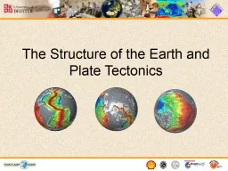
1. Visualizing Relationships Between Earthquakes, Volcanoes, and Plate Tectonics: Western USAuthors: Ruth Powers (UNAVCO Master Teaching-in-Residence); Becca Walker and Shelley Olds (UNAVCO)
2. Activity OutcomesLearners should be able to…Describe how the locations of earthquakes, volcanoes, and velocity vectors from GPS stations in the Western United States inform us about plate boundary zonesDescribe and draw a velocity vectorAnalyze regional plate motion and crustal deformation based on velocity vector mapsDescribe the difference between a plate boundary and plate boundary zoneDescribe potential societal impacts of active seismic and volcanic regions2
3. Part 1: Prepare your map for study using the UNAVCO GPS Velocity ViewerGoogle search for: UNAVCO GPS Velocity Viewer
4. Remove all of the vectors& Reposition the mapUncheck the box labeled: Display vectorsVery important!!!Click on Draw Map to apply changes
5. Part 2: Study, Record, & Discussearthquake and volcano data
6. Study, Record, & DiscussWork with a partnerAdd your feature (either Earthquakes or Volcanoes) Study your map Answer the questionsHow are the data distributed? How would describe the spatial pattern(s) of the data? Are they located near the edges of the continent, mid-continent, in the ocean?At what depth(s) do the earthquakes occur? What other data would be useful?
7. Compare the Earthquake and Volcano DataDiscussion:What geographic features (mountains, plains, valleys, etc) are found where there are only:Earthquakes? Volcanoes? In which regions do you find earthquakes and volcanoes near each other? What’s there?Summarize the relationships you discovered. D. What explanation can you provide for the observed relationships?
8. Part 3: How is Alaska moving over time? Analyzing GPS data GPS station positions change as tectonic plates move.How will the ground under GPS Station A move relative to GPS Station B?GPS stations are not to scaleGPS Station BGPS Station A
9. How will the ground under GPS Station A move relative to GPS Station B?GPS Station A is moving toward GPS Station B.GPS stations are not to scaleGPS Station AGPS Station B
10. Anatomy of a High-precision Permanent GPS StationGPS MonumentMonument legs attach the GPS antenna to the ground.GPS antenna inside of domeIf the ground moves, the GPS station moves.Additional station equipmentSolar panel for powerEquipment enclosureGPS receiverPower/batteriesCommunications/ radio/ modemData storage/ memory
11. 11About Velocity VectorsLength of the vector arrow = how fast the plate is moving (magnitude). Direction of the vector arrow = the direction that the plate is moving at that GPS stationTail of vector = location of GPS stationNotice the different lengths of the vectors. Where is the ground moving most quickly?
12. Add Velocity VectorsCheck the box next to Display vectorsTip: Select Show one in ten for the Western US.Choose one in one hundred before zooming out to continent level.Click on Draw Map to apply changesKeep the GNSS Data source on N. America.
13. Study & Sketch the VectorsSketch some of the directions & lengths of the vectors. Add different data types (earthquakes, volcanoes, plate boundaries) What do you notice about the length of the vectors (the velocities) from the coast to inland? What patterns do you see?How do the directions of the GPS vectors change?What patterns do you see in different regions?How do the ground motions compare to the locations of earthquakes and volcanoes?
14. Examples: Earthquakes & Ground Motion
15. Examples: Volcanoes and Ground Motion
16. Types of Plate Boundaries 16ContinentalConvergent
17. Societal Impacts & Plate Boundary Zones17
18. Societal impacts & Seismic Hazards
19. Wrap UpWhat we did:Studied the patterns of earthquakes and volcanoes and made hypotheses about the relationshipsCompared ground motion in different regions of AlaskaDetermined plate boundary zones using multiple lines of evidence: Ground motions from GPS dataEarthquake locationsVolcano locationsDiscussed societal impacts
20. Continue to explore the world!
21. Thank you!education@unavco.org
22. One more thing: Reference Frames & GNSS Data Sources The surface of the Earth is not stationary. It moves. … Every location on the Earth is moving. How do we compare the motion of one location to another?Scientists have chosen reference locations, often the interior region of tectonic plates and state (scientifically), “This region is not moving!”. Every point on Earth thus moves relative to that stationary point/region.For the North American Reference Frame (NAM14), we measure the motion of the adjacent tectonic plates, including the edges of the North American plate, compared to that reference region (eg Kansas/ midwest)
23. Ex: Two reference frames:North American vs IGS14/No Net RotationN. America, NAM14, UNAVCON. America, IGS14/NNR, UNAVCO
24. How GPS WorksFour satellite signals are needed to locate the receiver in 3-dimensional space.The fourth satellite is also used for time accuracy. Position can be calculated within to a millimeter.Ground control stations around the world
25. Anatomy of a GPS AntennaAntennaAmplifierChoke ringDomeAntenna MountCableSupports