
Glaciers Earthquakes Rivers GEOL 131Running Water GEOL 131Running Water GEOL 131Running Water Precipitation and snowmelt can Infiltrate absorbed into ground becomes part of groundwater ID: 696600
Download Presentation The PPT/PDF document "Review Running Water Volcanoes" is the property of its rightful owner. Permission is granted to download and print the materials on this web site for personal, non-commercial use only, and to display it on your personal computer provided you do not modify the materials and that you retain all copyright notices contained in the materials. By downloading content from our website, you accept the terms of this agreement.


Slide1
Review
Running Water
Volcanoes
Glaciers
EarthquakesSlide2
RiversSlide3
GEOL 131:Running WaterSlide4
GEOL 131:Running WaterSlide5
GEOL 131:Running Water
Precipitation and snowmelt can:
Infiltrate
absorbed into ground
becomes part of groundwater
Run off (flow over surface)
How water gets into rivers?
Where does it go?Slide6
Streamflow Characteristics
GEOL 131:Running Water
Flow velocity: speed of water movement
Channel steepness (gradient
):
Elevation change per unit
distance
Channel roughness:
Water can be slowed by
a
rough
channel
Channel size and
shape:
Wide, shallow channel slower than narrower, deeper one with same cross-sectional
area
Discharge:
Volume of water moving through
channel
Discharge = width x depth x
velocitySlide7
Erosion, Transport, Deposition
GEOL 131:Running Water
Erosion:
Quarrying: removal of blocks from riverbed
Abrasion: scraping of channel sides by particles in flowing water
Transport:
Suspended load, bedload, dissolved load
Capacity: max
sediment load river
can carry
d
epends on velocity
Competence: max
grain size
river can carry
Depends on discharge
Deposition
When velocity slows, sorted sediment depositsSlide8
Stream Channel Types
GEOL 131:Running Water
Bedrock
Cut into rock, steep-sided, V-shaped
Alluvial
Cut into sediment or soil
Two types:
Meandering: fine-medium grained sediment,
consistent discharge
Braided: coarse sediment, highly variable
dischargeSlide9
Deltas and alluvial fans
GEOL 131:Running Water
Deltas:
At river mouths
Fine-grained sediment deposited
when river enters standing water
Alluvial fans
Base of steep mountainsSlide10
Floods
GEOL 131:Running Water
Regional: usually seasonal
Flash: Little warning, short duration
Ice-jam: breakup of river ice
Dam failuresSlide11
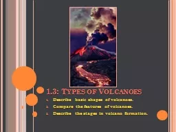
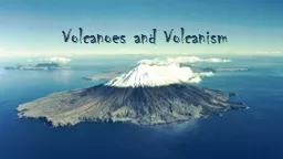
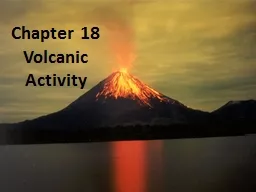
VolcanoesSlide12
Eruptive Style
Why do volcanoes have different eruptive styles?
Dissolved gases (volatiles)
Viscosity: resistance to flow
TemperatureHotter = less viscous (runnier)Silica contentMore silica = more viscous (thicker)Explosive eruptions
fed by high-silica, low-temp
magmas
with high
viscosity
Effusive eruptions
Fed by low-silica, high-temp
magma
with
low viscosity
GEOL131: VolcanoesSlide13
Eruptive Materials
Lava
Aa and pahoehoe
Pyroclasts
Ash, lapili, cinders, blocks, bombsGasesWater vapor, carbon dioxide, others
GEOL131: VolcanoesSlide14
Three Types of Volcanoes
Figure 4.14
GEOL131: VolcanoesSlide15
Calderas
Pits caused by magma chamber collapse
Three types
Hawaiian-type: collapse of top of shield volcano caused by subterranean drainage from central magma chamber
Crater Lake-type: collapse of the summit of a large composite volcano flowing an explosive eruptionYellowstone-type: collapse of large area, caused by discharge of huge volumes of silica-rich pumice and ash along ring fractures
GEOL131: VolcanoesSlide16
Other Volcanic Landforms
Basalt plateaus
Volcanic necks
Lava domes
GEOL131: VolcanoesSlide17
Plate Tectonics & Igneous Activity
Most volcanism occurs along tectonic plate boundaries
Divergent boundaries: decompression melting
Subduction zones: hydration melting
Ring of Fire: chain of active volcanoes around the Pacific OceanIntraplateNot near plate boundaries
GEOL131: VolcanoesSlide18
GlaciersSlide19
What is a Glacier?
Mass of land-based ice
In motion downslope
Develop in high-latitude polar regions
Four typesAlpine (or valley)Continental (or ice sheet)Ice capOutlet
GEOL131: GlaciersSlide20
Formation and movement
Snow recrystallizes into
firn
Ice crystals with texture of sand
Fuse to form glacial iceMovementPlastic flowMost movement occurs this wayFlow in the solid state under highpressureBasal slidingSmall amount of movementEntire ice mass slides along base
GEOL131: GlaciersSlide21
Movement
Glacier budget
Balance between accumulation and loss of ice
GEOL131: GlaciersSlide22
Glacial Erosion
Depends on several factors:
Rate of glacial movement
Ice thickness
The shape, abundance, and hardness of the rock fragment contained in the ice at the base of the glacierErodibility of surface beneath glacierMechanismsPlucking: loosens and lifts blocks of rock and incorporates them into the iceAbrasion:
ice and the rocks incorporated within slide over the bedrock, smoothing and polishing the surface below
GEOL131: GlaciersSlide23
Glaciated Mountain Valleys
GEOL131: GlaciersSlide24
Types of Glacial Sediment
GEOL131: Glaciers
Drift
General term for any sediment deposited by a glacier
Till
Deposited directly from melting ice
Unsorted
Stratified drift
Deposited by meltwater rivers
Well-sortedSlide25
Depositional features
GEOL131: GlaciersSlide26
Effects of ice age glaciers
GEOL131: Glaciers
Crustal subsidence and rebound
Change in sea level
Changes in rivers and valleys
Proglacial lakes
Pluvial lakesSlide27
Possible Causes of Ice Ages
GEOL131: Glaciers
Plate tectonic movement
Continents can move poleward
Variations in Earth
’
s orbit
Precession, obliquity, eccentricity
Others
Changes in atmospheric composition
Changes in Earth
’
s reflectivity
Cooling of ocean currentsSlide28
EarthquakesSlide29
What is an Earthquake?
Earth vibration
Usually caused by movement on a fault
Strain energy is stored up along fault over time
Seismic energy propagates through planet’s interior in all directions
GEOL131: EarthquakesSlide30
Seismology
Study of earthquake waves
Seismograph: measures seismic wave magnitudes
Seismic waves
Body: travel through Earth’s interiorP (primary): push-pull motion; travel fastest; solids, liquids, and gasesS (secondary): movement at right angle to direction of motion; slower; solids only Surface: travel in rock layers below surface
GEOL131: EarthquakesSlide31
Epicenter Triangulation
GEOL131: Earthquakes
S-P interval
: delay between P- and S-wave arrivals
S-P = 5 min.
S-P = 7 min.
S-P = 11 min.Slide32
Epicenter Triangulation
GEOL131: Earthquakes
If S-P = 5 mins, distance to epicenter is 3500 km
Repeat for other two stations
Travel-time curveSlide33
Epicenter Triangulation
GEOL131: Earthquakes
Plot distances from travel time curve on globe as circles
Point where circles intersect is epicenter
EpicenterSlide34
Size of Earthquakes
Intensity: degree of shaking at given locale based on damage and human perception
Magnitude: estimate of total energy released
32-fold increase in energy for each increase of 1 on magnitude scale
Richter vs MomentRichter: seismogram onlyMoment: seismogram, total movement on fault, depth of movement, rock strength
GEOL131: EarthquakesSlide35
Richter Magnitude Scale
GEOL131: EarthquakesSlide36
Earthquake Damage
GEOL131: Earthquakes
Destruction from seismic vibrations
Direct damage
Shaking of structures
Amplification of seismic waves
Liquefaction
Indirect damage
Landslides: ground shaking causes loose sediments on slope to slump
Tsunami: failure in subduction zone displaces water, which spreads out radially in all directionsSlide37
Exam 2 Reminders
Thursday,
March 22
at 1:40 pm
3 x 5 inch notecardHandwrittenBoth sides okBring calculator – phones not allowed!Lab for Section 2 to follow!