
from GPS Trajectories Radu Mariescu Istodor 1 7 1 201 9 GPS Trajectory START END Google map Latitude 622351 Longitude 294123 Timestamp 10102018 ID: 815144
Download The PPT/PDF document "Inferring Road Networks" is the property of its rightful owner. Permission is granted to download and print the materials on this web site for personal, non-commercial use only, and to display it on your personal computer provided you do not modify the materials and that you retain all copyright notices contained in the materials. By downloading content from our website, you accept the terms of this agreement.


Slide1
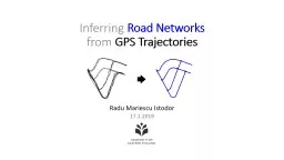
Inferring Road Networks from GPS Trajectories
Radu Mariescu Istodor17.1.2019
Slide2GPS Trajectory
START
END
Google map
Latitude : 62.2351
Longitude : 29.4123
Timestamp : 10.10.2018
:
19:05
Slide3L
änsikatu
GPS
Trajectories
Road Network
Intersections
Geometry
Slide4Satellite Images
Chicago
Joensuu GPS Trajectories
MOPSI
Slide5Proposed MethodMariescu-Istodor, Radu, and Pasi Fränti. "
Cellnet: Inferring road networks from gps trajectories."
ACM Transactions on Spatial Algorithms and Systems (TSAS) 4, no. 3 (2018).
Detecting
Intersections
CreatingRoad segmentsStep 1Step 2In the next slides I will:Teach the backgroundShow how we did it*Give you a challenge
*most important steps only
Slide6Detecting IntersectionsNO
Fathi
,
Alireza
, and John
Krumm
.
"
Detecting
road
intersections
from
GPS
traces
."
Geographic Information Science
(2010).Descriptor
Slide7Detecting IntersectionsYES
Fathi
,
Alireza
, and John
Krumm
.
"
Detecting
road
intersections
from
GPS
traces
."
Geographic
Information Science, pp. 56-69 (2010).
Slide8Detecting Intersections
Karagiorgou
, Sophia, and Dieter
Pfoser
. "On vehicle tracking data-based road network generation." Advances in Geographic Information
Systems (2012).Turning patterns
Slide9Detecting Intersections
YES
Mariescu-Istodor,
Radu, and Pasi Fränti.
"
Cellnet
:
Inferring
road
networks
from
gps
trajectories." ACM TSAS (2018).PROPOSEDSplits8025
Slide10Detecting Intersections
YES
Mariescu-Istodor,
Radu, and Pasi Fränti.
"
Cellnet
:
Inferring
road
networks
from
gps trajectories." ACM TSAS (2018).PROPOSEDStill works…Fränti, Pasi, and Juha Kivijärvi. "Randomised local search algorithm for
the clustering problem."Pattern Analysis & Applications (2000).Random Swap
Slide11WB indexRate-distortion methodSilhouette Coefficient (SC
)Davies-Bouldin index (DBI)Bayesian Information Criterion (BIC)Minimum description length
(MDL)
Sum of squared errors vs. Validity Indices
8025
No. Clusters
SSE
5
10
15
20
Validity
Index
Rousseeuw
, Peter J., and L. Kaufman.
"Finding groups in data."(1990)Silhouette CoefficientS2 (synthetic) datasetcs.uef.fi/sipu/datasets
Slide12Creating Road segments
Slide13Creating Road segments
Davies, Jonathan J., Alastair R. Beresford, and Andy Hopper.
"Scalable, distributed, real-time map generation."
Pervasive
Computing
(
2006).
Skeleton
Threshold
Visual
Slide14Creating Road segments
Cao, Lili, and John
Krumm
.
"From GPS traces to a routable road map."
Advances
in geographic information
systems
(2009).
Merging
Slide15Creating Road segments
Edelkamp
, Stefan, and Stefan
Schrödl
.
"Route planning and map inference with global positioning traces."
Computer Science in
Perspective
(2003).
Clustering
Slide16Creating Road segments
DTW
averaging
Mariescu-Istodor,
Radu, and Pasi Fränti.
"
Cellnet
:
Inferring
road
networks
from
gps
trajectories
."
ACM
TSAS (2018).PROPOSED
Hautamäki
, Ville, Pekka Nykänen, and Pasi Fränti. "Time-series clustering by approximate prototypes." ICPR pp. 1-4. (2008).
Slide17Accepted connections
length
(
α
)
≃
length
(
α
)
Slide18Accepted connections
length
(
α
)
≃
length
(
α
)
sim
(
α
,
α
)
= 0
sim
(
α
,
α) = 96%Mariescu-Istodor, Radu, and Pasi Fränti. "Grid-based method for GPS route analysis for retrieval." ACM TSAS (2017).
Slide19Evaluation
Visual
Clustering
Merging
CellNet
Chicago
Joensuu
42
%
46
%
10
%28 %19 %38 %87 %58 %P = .97R = .27P = .56R = .38P = .17R = .94
P = .07R = .70P = .24R = .87P = .13R = .33P = .92R = .83P = .68R = .49
Slide20Radu Mariescu
-
Istodor
radum@cs.uef.fi
Challenge:Average GPS segmentshttp://cs.uef.fi/sipu/segments Other useful links:http://cs.uef.fi/mopsi/routes/network http://cs.uef.fi/mopsi/routes/dataset
Thank You .
Slide21Slide22Choosing the test locations
Slide23Choosing the test locations
Mean shifting
Slide24Slide25Too many detections!
Slide26Slide27Non-intersections
Roundabout
Slide28Slide29Silhouette Coefficient:
Slide30Slide31Cohesion: measures how closely related are objects in a clusterSeparation: measure how distinct or well-separated a cluster is from other clusters
cohesion
separation
Silhouette coefficient
[
Kaufman&Rousseeuw
, 1990]
Slide32Cohesion a(x): average distance of
x to all other vectors in the same cluster.Separation b(x): average distance of x to the vectors in other clusters. Find the minimum among the clusters.
silhouette s(x):
s
(x) = [-1, +1]: -1=bad, 0=indifferent, 1=goodSilhouette coefficient (SC):
Silhouette coefficient
Slide33separation
x
a
(
x
): average distance in the cluster
cohesion
x
b
(x): average distances to others clusters, find minimal
Silhouette coefficient
Slide34Slide35Detecting Intersections
NO
- no
i
ntersection case -