
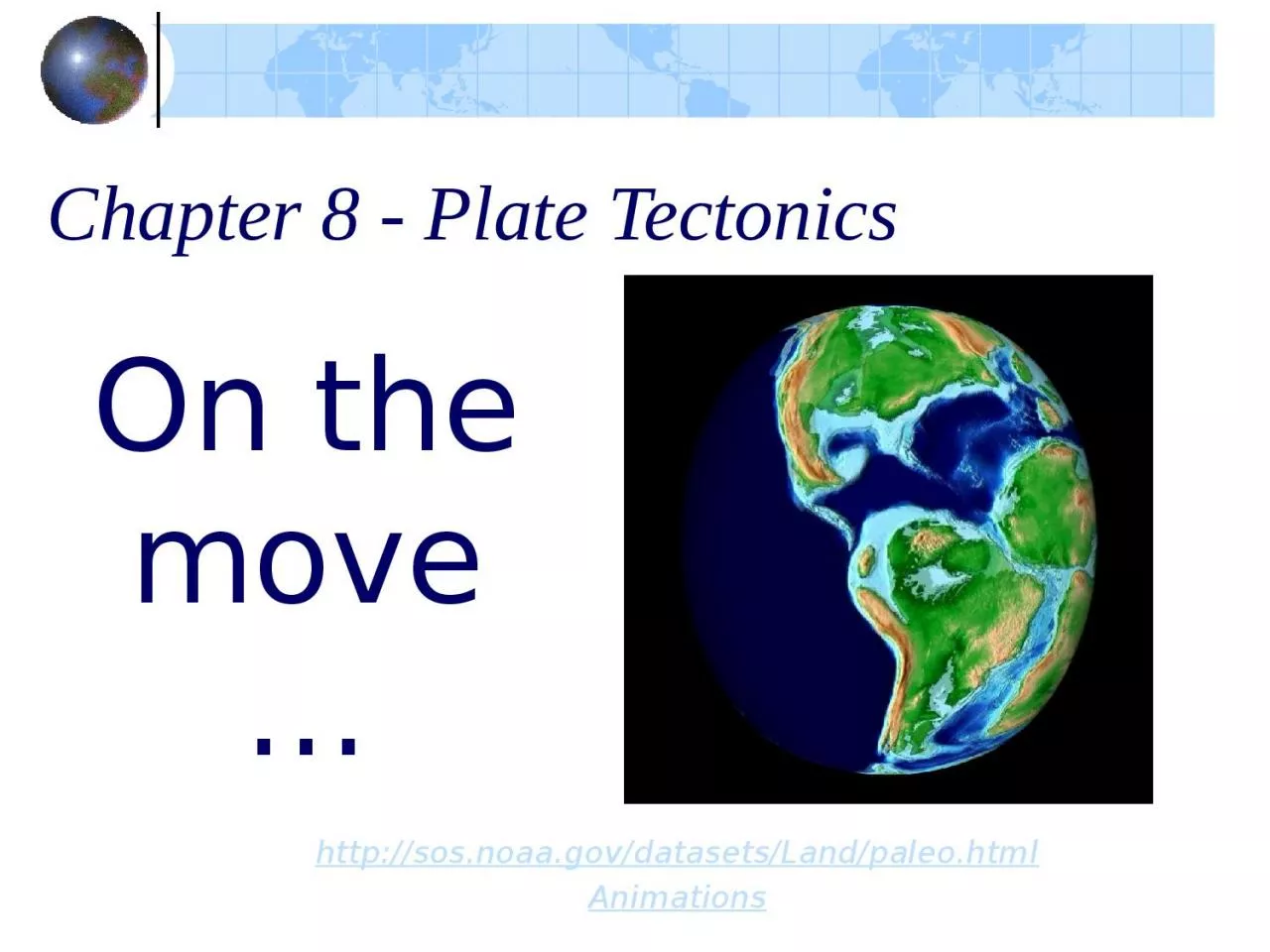
httpsosnoaagovdatasetsLandpaleohtml Animations On the move Plate Tectonics the rocky history of an idea Ever notice that the shore lines of South America and Africa seem to fit together ID: 1022697
Download Presentation The PPT/PDF document "Chapter 8 - Plate Tectonics" is the property of its rightful owner. Permission is granted to download and print the materials on this web site for personal, non-commercial use only, and to display it on your personal computer provided you do not modify the materials and that you retain all copyright notices contained in the materials. By downloading content from our website, you accept the terms of this agreement.

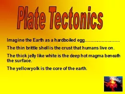
1. Chapter 8 - Plate Tectonics http://sos.noaa.gov/datasets/Land/paleo.htmlAnimations On the move…
2. Plate Tectonics: the rocky history of an ideaEver notice that the shore lines of South America and Africa seem to fit together?
3. Antonio Snider-Pellegrini's Illustration of the closed and opened Atlantic Ocean (1858).
4. Continental Drift: a theoryIn 1912, Alfred Wegener proposed the idea of “continental drift.”The continents were once part of a single land mass and they drifted to their present locations.
5. Continental DriftWegener named the supercontinent Pangea (meaning “all lands” in Greek)The vast ocean that surrounded Pangea was named Panthalassa.
6. Evidence used to support the Continental Drift TheoryThe continents shapes matchThe plants & animals (fossils) matchThe rocks matchThe ice matchesThe climates don’t match
7. The shorelines of the continents appear to fit together like a jigsaw puzzle.
8. The plant & animal fossils matchFossils of the same kind were found on several different continents.Ex: Mesosaurus & Glossopteris
9. The rock matchesRocks of the same age, same types and structure are found on widely separated continents
10. The rock matchesWhen the continents are reassembled, the mountain chains form a continuous belt.Ex: The Appalachian and Caledonian mountain ranges align.
11. The ice matches
12. The ice matches
13. The ice matchesGlacial striations on rocks show that glaciers moved across continentsScratches from a glacier.
14. Climate Change The discovery of fossils of tropical plants in the form of coal deposits in Antarctica. This frozen land must have been situated closer to the equator in the past, in a warmer climate where, swampy vegetation could grow.
15. Climate ChangeGlacial till & striations found in deserts.Moraine and till
16. St. Mary Lake, Glacier National Park.
17. New Zealand's Franz Joseph glacierBridal Veil Falls in Yosemite National Park flowing from a hanging valley
18. Yeager Rock, a 400 ton erratic sitting on top of glacial till on the Waterville Plateau, Washington.
19. Pretend you are a skeptical scientist. Would Wegener’s evidence be enough to convince you that the continents are moving? What could you argue against this theory?What is Wegener missing?Although plenty of evidence supports Wegener’s Continental Drift theory, it was not accepted by the scientific world at the time.
20. The mystery…How does it work? What causes the motion?Do continents just plow through the ocean?These questions weren’t answered until decades later after Wegener’s death.
21. …solvedBeginning in the 1950’s new evidence emerged to support the old theory and helped develop a new one… Plate Tectonics
22. Imagine an Earth without water
23. Plate Tectonics…in general:The Earth’s solid surface is broken up into pieces called plates that “float” on top of the gooey part of the mantle.
24.
25. Plate Tectonics: a beginning To understand the relatively new idea of Plate Tectonics, we have to review the layers of the Earth.
26. Crust – 2 typesOcean crustThin, dark in colorMore denseMostly made of BasaltContinental crustThick, light in colorLess denseAll rock types
27. Inside Earth:
28. Tectonic Plates are made from the Earth’s broken lithosphere.The lithosphere consists of the crust and the upper solid part of the mantle.
29. The lower pliable part of the mantle is the asthenosphere.The lithospheric plates move over the slow flowing asthenosphere.
30.
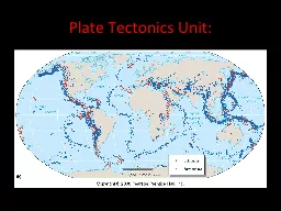
31. New Evidence used to develop Plate Tectonics Ocean floor mapping led to the discovery of…Seafloor spreadingMagnetic ReversalsLocations of Earthquakes and Volcanoes
32. Ocean Floor Map
33. Mid-Ocean RidgesMid-Ocean Ridges are chains of volcanic mountains on the ocean floor with a deep central valley called a rift zone.Mid-ocean ridges are the sights of Seafloor Spreading.
34. Seafloor Spreadingoccurs where oceanic plates are moving apart. Magma rises through the rift and spreads out at the surface building new sea floor.
35. As magma cools & hardens it pushes ocean floor away from the ridge forming new ocean crust.Old rock is destroyed in a trench.
36. Age of rocks increase away from the rift zonehttp://www.wwnorton.com/college/geo/egeo/animations/ch2.htm
37. More evidence…Magnetic reversals recorded in rocks along the mid-ocean ridges support Seafloor Spreading and Plate Tectonics.The direction of the Earth’s magnetic field are preserved in the new rock formed at the ridges.The poles switch and are seen in a pattern of bands paralleling mid-ocean ridges.http://www.wwnorton.com/college/geo/egeo/animations/ch2.htm
38.
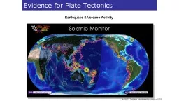
39. Earthquakes mark plate boundaries
40.
41. Locations of Earthquakes & VolcanoesDo not occur randomly.Actually mark the locations of plate boundaries.Occur when plates are pushing towards, pulling away, or sliding past each other.
42. Remember…convection is the motion of boiling water
43. What drives the plates?Mantle Convection
44. Plate Boundaries…are where two plates meet3 types of motionsDivergentConvergentTransform Faulthttp://www.wwnorton.com/college/geo/egeo/animations/ch2.htm
45. Divergent BoundariesPlates are moving apart and new crust is created. Land or Ocean crust splits.A rift valley over land forms when continental crust splits. A mid-ocean ridge forms when ocean crust splits.
46. Divergent – Continent splits
47. Divergent – Rift ValleyExample: East African Rift Zone
48. Divergent BoundariesEx: Mid-Atlantic Ridge & Eastern Pacific Rise
49. Divergent Boundaries
50. Convergent BoundariesPlates are moving towards each other.Ocean ContinentOcean OceanContinent Continent
51. Ocean ContinentSubduction occurs when one plate dives under another forming a trench.Ocean crust is being carried down into the mantle, where it begins to melt. The magma rises to form volcanoes along the edge of the continent.
52. O CEx: Andes in South AmericaCotopaxi is considered one of the world's highest active volcanoes and is at 5897m in Ecuador.
53. Ocean ContinentEx: Cascades in Oregon & WashingtonMount Rainier over Tacoma, Washington, USA.Plumes of steam, gas, and ash often occurred at Mount St. Helens in the early 1980s. On clear days they could be seen from Portland, Oregon, 50 miles (81 kilometers) to the south. The plume photographed here rose nearly 3,000 feet (1,000 meters) above the volcano's rim. The view is from Harrys Ridge, five miles (8 kilometers) north of the mountain.
54.
55. Ocean OceanThe deep sea trench is the site of a subduction zone. The subducted ocean crust melts and rises to the surface forming an island arc (volcanic islands).
56. Ocean trenches – Volcanic mtns. / islands
57. Ocean OceanEx: JapanEx: Mariana TrenchChallenger Deep - the deepest surveyed point in the oceans, with a depth of about 11,000 meters (about 36,000 feet). If you cut Mount Everest off at sea level and put it on the ocean bottom in the Challenger Deep, there would still be over a mile of water over the top of it.
58. Ocean OceanEx: Aleutian IslandsChain of volcanic islands off the coast of Alaska
59. Continent ContinentContinental crust collides with and slides over other continental crust, forming high mountain ranges.
60. C CThe continuous collision of India and Asia, which began about 45 million years ago, produced the Himalayas.
61. Continent ContinentHimalayas - Mt. Everest View from space station
62. Transform FaultOcean or Continental crust slide past each other.Forms an offset crack in the ocean or land.
63. Transform FaultEx: The San Andreas Fault in California.
64. Transform FaultEx: The San Andreas Fault in California.
65. Transform FaultEx: Found at right angles to the mid-ocean ridges.
66. World Relief Map
67. TypeMotionFeaturesExamplesDivergentOceanLandConvergentO-CO-OC-CTransformFault
68. The main features of Plate Tectonics are:The Earth's surface is covered by a series of lithospheric plates. The ocean floors are continually moving, spreading from the center, sinking at the edges, and being regenerated. Convection currents beneath the plates move the plates in different directions. Visualizations