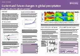

Precipitation Tropical rainfall intensification Daily precipitation was sorted by intensity Bin boundaries were calculated and monthly anomalies in frequency in each bin computed Linear regression with SST was applied to estimate precipitation response to warming Fig 2 ID: 810464
Download The PPT/PDF document "Water Vapour (%)" is the property of its rightful owner. Permission is granted to download and print the materials on this web site for personal, non-commercial use only, and to display it on your personal computer provided you do not modify the materials and that you retain all copyright notices contained in the materials. By downloading content from our website, you accept the terms of this agreement.
Slide1
Water Vapour (%)
Precipitation (%)
Tropical rainfall intensification Daily precipitation was sorted by intensity. Bin boundaries were calculated and monthly anomalies in frequency in each bin computed. Linear regression with SST was applied to estimate precipitation response to warming (Fig. 2)The most intense 1% of daily events explains 66% of the variability in the SSM/I monthly precipitation anomalies over the tropical oceanThe observed intensification of rainfall lies at the upper bounds of the model responses (vertical lines)The range in model responses of the most intense tropical rainfall to warming is considerable
Figure 3. June-August anomaly in precipitation (top) and column integrated water vapour (bottom) over north Atlantic (30-60N, 10-70W).
ReferencesAllan, R. P., B. J. Soden, V. O. John, W. Ingram and P. Good (2010) Current changes in tropical precipitation, Environ. Res. Lett., 5, doi:10.1088/1748-9326/5/2/025205Allan, R. P. and I. I. Zveryaev (2010), Variability in the summer season hydrological cycle over the Atlantic-Europe region 1979-2007, Int. J. Climatol., in press. Zelinka, M. D., and D. L. Hartmann (2010), Why is longwave cloud feedback positive?, J. Geophys. Res., 115, D16117, doi:10.1029/2010JD013817.
Rainfall responses: key constraints
Contact information1 - Department of Meteorology, University of Reading, Whiteknights, RG6 6AL Email: r.p.allan@reading.ac.uk Web: www.reading.ac.uk/~sgs02rpa 2 - RSMAS, University of Miami ; 3 - Met Office, Exeter ; 4 - P. P. Shirshov Institute, Moscow
Changes within dynamical regimesMonthly precipitation is computed for percentile bins of vertical motion and temperature for models (Fig. 4a) and GPCP data.Models overestimate precipitation over the warm, descending bins when compared to GPCP data (Fig. 4b)Model precipitation responses over the 21st century (Fig. 4c): increases in cold bins and warm, ascending bins (tropical wet regions)less precipitation for warm, convectively suppressed tropical regions Wet/dry precipitation responses (Fig. 1) are counteracted by reduced magnitudes of ascent and descent (Fig. 4d), linked to a weakened tropical circulation (Zelinka and Hartmann, 2010)
Current and future changes in global precipitation
Introduction
Changes in the atmospheric component of the global water cycle, including precipitation and its extremes, are of primary concern in planning and adapting to climate change. Climate models are our only tools for projecting future changes in climate. Here we assess future climate model projections in the context of current changes in precipitation using blended satellite observations. The wet get wetter Reanalysis vertical motion fields are used to define “wet” ascending and “dry” descending branches of the tropical circulation for use with satellite precipitation products. Mean precipitation is calculated separately for each region (Fig. 1; Allan et al. 2010) for models and GPCP/reanalysesThere are positive precipitation trends in the wet regions and negative trends in the dry regionsObserved trends appear stronger than model trends but are sensitive to the reanalysis vertical motion used
Figure 1. Changes in 2-year mean tropical precipitation anomaly , P (%), calculated separately for (a) ascending and (b) descending branches of the tropical circulation for CMIP3 models and GPCP blended observations. The ascent and decent regions are defined by NCEP or ERA Interim reanalyses
Global precipitation rises due to enhanced radiative coolingIntense rainfall in the wet regions of the tropics is constrained by enhanced moisture convergence determined by the Clausius Clapeyron equation (surface moisture increases at ~7%/K)Enhanced moisture divergence in the dry subtropics explains a component of the projected drying in these regionsInterplay between energetics and thermodynamics, involving increased static stability, imply weakening of the atmospheric circulation in the tropics (Zelinka and Hartmann, 2010)
Figure 4
. Precipitation binned in percentiles of vertical motion (0-5% bin is strongest ascent) and temperature (95-100% bin is warmest) for the HadGEM1 model (top) and an ensemble of 10 CMIP3 models (bottom). (a) Mean precipitation and % area enclosed in each contour, (b) model – GPCP precipitation and model
change
in (c) precipitation (scaled by temperature change) and (d) vertical motion for 2080-99 minus 1980-99
(a) P (mm/day); % area (b) Model–GPCP P (%) (c) 2080-99 – 1980-99 P (%/K); (d)
ω
Vertical motion (ω) percentiles ascent descent
Figure 2
.
Linear fit between
frequency of tropical ocean precipitation in high percentile bins of intensity (P
%) and sea surface temperature (SST) for satellite observations (SSM/I), AMIP3 models and Clausius Clapeyron scaling (dP/dT=0.07P). See Allan et al. (2010) for further details.
Trends were recalculated using the precipitation fields to define the wet and dry regions (30% wettest and 70% driest grid boxes):
Regional changes in north Atlantic
Regional changes in precipitation are dominated by dynamics
Trends in the north Atlantic region in summer are apparent with increases in column integrated water vapour yet an apparent decline in precipitation for SSM/I microwave data and ERA Interim (Fig. 3)
Models forced with observed SSTs simulate increases in moisture with warming (3.7 %/K), similar to ERA interim but lower than SSM/I & HadCRUH observations (>5 %/K)Models do not capture an observed negative relationship between precipitation and surface temperature
Models