
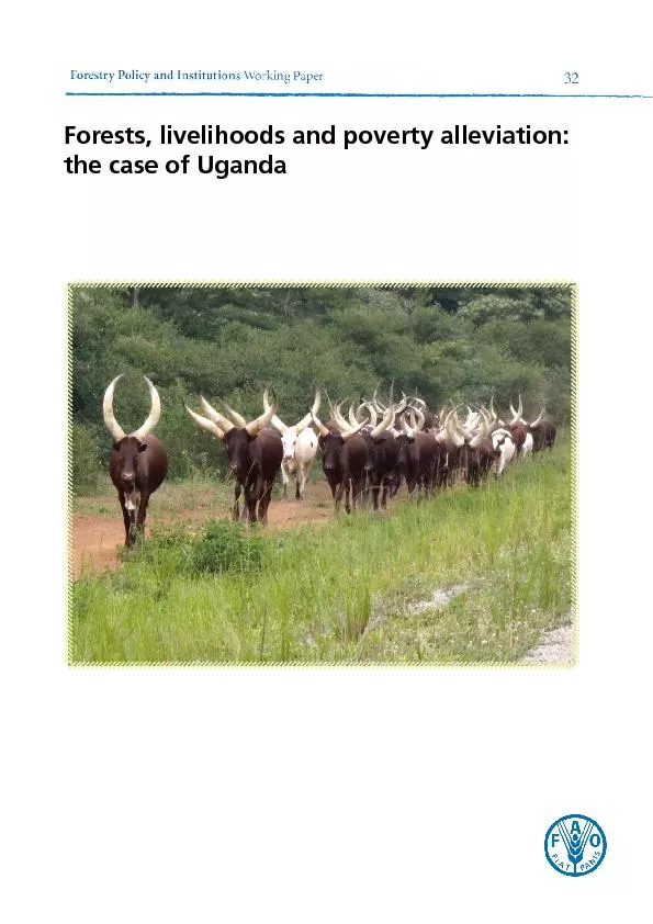
72 otal rural income high forest150high poverty category orthern version Lamwotype Total Total official Northern pc income Forests livelihoods and poverty alleviation the case of Uganda ID: 467105
Download Pdf The PPT/PDF document "Forests, livelihoods and poverty allevia..." is the property of its rightful owner. Permission is granted to download and print the materials on this web site for personal, non-commercial use only, and to display it on your personal computer provided you do not modify the materials and that you retain all copyright notices contained in the materials. By downloading content from our website, you accept the terms of this agreement.


Forests, livelihoods and poverty alleviation: 72 otal rural income high forest–high poverty category (orthern version), -Lamwo-type Total Total official Northern p.c. income Forests, livelihoods and poverty alleviation: the case of Uganda 71 otal rural income Western Region Forests Total Total official High–high p.c. income US$487 High–low p.c. income otal rural income high forest–high poverty category, Masindi-type Total Total official Central p.c. income US$594 Northern p.c income Western p.c. income otal rural income high forest–low poverty category, Kibaale-type Total Total official Central p.c. income Eastern p.c. income Western p.c. income otal rural income low forest–high poverty category, Kumi-type Total Total official Central p.c. income Northern p.c income Eastern p.c. income 70 TABLE otal rural income Central Region Forests Total Total official High–high p.c. income US$594 High–low p.c. income US$594 Low–high p.c. income orthern Region Forests Total Total official High–high p.c. income US$246 Low–high p.c. income US$246 High–high striped p.c. income astern Region Forests Total Total official High–low p.c. income US$423 Low–high p.c. income US$423 otal rural income Western Region Forests Total Total official High–high p.c. income US$487 High–low p.c. income 69 otal rural area income, by Humboldt University forests and poverty category, 2010 Western Region – rural onlyKabaroleNtorokoKisoroKisoroIsingiro2010 value of districts marked in deep yellow computed using Northern Region growth rate for 2002 of 42 percent (UBOS, 2010a: 97–98, Table 2 68 otal rural area income, by Humboldt University forests and poverty category, 2010 orthern Region – rural onlyMorotoYumbe2010 value of districts marked in deep yellow computed using Northern Region growth rate for 2002 of 42 percent (UBOS, 2010a: 97–98, Table 2 67 otal rural area income, by Humboldt University forests and poverty category, 2010 astern Region – rural onlyKaliroSerereSorotiTororoSironko2010 value of districts marked in deep yellow computed using Eastern Region growth rate for 2002 of 35 percent (UBOS, 2010a: 97–98, Table 2 66 otal rural area income, by Humboldt University forests and poverty category, 2010 LuweeroLyantondeWakiso2010 value of districts marked in deep yellow computed using Central Region growth rate for 2002 of 26 percent (UBOS, 2010a: 97–98, Table 2 65 TADETAILEDCALCULATIONTable 1: Urban–rural population split, by district and Humboldt University forests and poverty category.Table 2: Total rural area income, by district, Humboldt forests and poverty category and Tables 3 to 10: Total rural income for each region and each Humboldt forests and poverty category. Districts of Uganda: populations in 2010, Humboldt University forests and poverty categories Western RegionKabaroleNtorokoKisoroKisoroIsingiro2010 value of new districts marked in deep yellow computed using Western Region growth rate for 2002 of 32 percent (UBOS, 2010a: 20, Table 2HH = high forest–high poverty HL = high forest–low poverty LH = low forest–high poverty LL = low forest–low poverty 64 Müller, D., Epprecht, M. & Sunderlin, W.D. trees? Targeting of poverty reduction and forest conservation in Vietnam. Working Paper No. 34. Bogor, Indonesia, Center for International Forestry Research (CIFOR). www.cifor.org/publications/pdf_files/wpapers/wp-34.pdf 2002. Food security. Policy planning and implementation. Key Sheet No. 8. London, Overseas Development Institute (ODI). www.odi.org.uk/sites/odi.org.uk/files/odi-Sasaki, N. & Putz, F.E.International Center. http://sites.tufts.edu/feinstein/2006/movement-on-the-marginsSunderlin, W.D., Dewi, S., Puntodewo, A., Müller, D., Angelsen, A. & Epprecht, M.Why forests are important for global poverty alleviation: a spatial explanation. , 13(2): article 24. www.ecologyandsociety.org/vol13/iss2/art24/.2006. Uganda National Household Survey 2002/2003. Version 1.0 of the dataset (November 2006), provided by UBOS. Kampala. www.ubos.org2007. The 2002 Uganda Population and Housing Census. Version 2.0 of the dataset (May 2007), provided by UBOS. Kampala. www.ubos.org/nada/index.php. Kampala. www.ubos.org/onlinefiles/uploads/ubos/www.ubos.org/unhs0910/unhs200910.pdf. Kampala and Nairobi, Uganda Bureau of Statistics (UBOS) and International Livestock Research Institute (ILRI). www.ubos.org/onlinefiles/uploads/UNDP.. Kampala. http://hdr.undp.org/en/reports/nationalreports/africa/uganda/www.unpei.org/pdf/uganda-enhancing-forest-contribution-prosperity-final.pdfVedeld, P., Angelsen, A., Sjaastad, E. & Kobugabe-Berg, G.Counting on the environment. . Environmental Economics Series Paper No. 98. Washington, DC, Environment Department. www.rmportal.net/training/poverty-reduction-seminar/seminar-reading-list-1/countingontheenvironmentforestincomesandtheruralpoor.pdf 63 Angelson, A. & Wunder, S. . Occasional Paper No. 40. Bogor, Indonesia, Center for International Forestry Research (CIFOR). www.cifor.org/publications/pdf_files/occpapers/op-40.pdfAnselin, L. 1995. Local indicators of spatial association: LISA. Geographical Analysis, 27(2): 93–115. www.dces.wisc.edu/documents/articles/curtis/cesoc977/anselin1995.pdfForestry, poverty and aid. Occasional Paper No. 33. Bogor, Indonesia, Center for International Forestry Research (CIFOR). www.cifor.org/publications/ Working Paper No. 19. Bogor, Indonesia, Center for International Forestry Research (CIFOR). www.cifor.org/publications/pdf_files/wpapers/wp-19.pdfFAO.in the West African humid forest zoneNote No. 6. Rome. www.fao.org/docrep/t9450e/t9450e00.htmFAO.Falconer and J.E.M. Arnold. Community Forestry Note No. 1. Rome. www.fao.org/FAO.. FAO Foresty Paper No. 140. Rome. Foster, J., Greer, J. & Thorbecke, E. 1984. A class of decomposable poverty measures. National Development Authority. www.npa.ug/docs/ndp2.pdf Hansen, M.C., DeFries, R.S., Townshend, J.R.G., Sohlberg, R., Dimiceli, C. & Carroll, M.2002. Towards an operational MODIS continuous field of percent tree cover algorithm: examples using AVHRR and MODIS data. ftp://glcf.umiacs.umd.edu/www/pmaterials/presentations/operationalmodistreecover.Hansen, M.C., DeFries, R.S., Townshend, J.R.G., Carroll, M., Dimiceli, C. & Sohlberg, the MODIS vegetation continuous fields algorithm. Earth Interactions, 7: 1–15. http://Heirhues, F., Atsain, A., Nyangito, H., Padilla, M., Ghersi, G. & Le Vallee, J.-C. Discussion Paper No. 38. Washington, DC, International Food Policy Research Institute (IFPRI). www.ifpri.org/sites/default/files/pubs/2020/dp/dp38/2020dp38.pdf 62 As the section on post-conflict reconstruction in chapter 6 makes clear, forests have helped forests to livelihoods; national-level as well as local data are needed to achieve this objective. However, the methodology described in the report was designed to make the best use of The report therefore does not recommend that FAO’s FRA use the methodology described, of forests’ contribution to the livelihoods of local people – to provide FRA with affordable The design of instruments for gathering forest data will require World Bank support and FAO collaboration. The World Bank advises developing countries that are interested in improving offices in three or four countries can then work with FAO and the World Bank to initiate and 61 ATHWAYSPOVERTYAbove all, the data collected for this study show how firmly forests underpin local livelihoods, a somewhat larger percentage of the needs of the poor), and for people living near markets as well as people living in remoter areas, whose reliance on forest is somewhat higher. Earlier discussions of forests’ role in poverty alleviation tended to look for direct income-generating activities, such as forest products to sell, which would lift people out of poverty. However, these efforts have tended to fail, except where timber sales are possible or where it is economic to grow trees to sell for poles. (The NFA Web site is currently encouraging the planting of pine and eucalypt plantations for telegraph poles by people with cash to invest A few of the world’s forest areas produce high-value In Uganda, forest-based cash is raised mainly from the sale of fuelwood and charcoal (36 do not intervene) and school fees, which help to enhance shorter- and longer-term resilience However a far greater proportion of forest income goes to support the household through income, while direct consumption accounts for 72 percent (Table 10).vulnerability. www.nfa.org.ug/ 60 REPORTVALUATIONintensive readjustment and post-conflict reconstruction (Table 15), and that this figure will decline to US$3.1 billion once reconstruction is complete (Table 18). These figures are high by the standards of Bush et al. (2004) and UNDP/NEMA/UNEP Poverty Environment Initiative This report has frequently noted that the values of forest products consumed at home are completely unrecorded, even though they are huge and outweigh the value of marketed forest from forest sales (Table 17). The cash figure (US$1.1 billion) is about 6 percent of GDP.As the consumption value of forests is not currently counted when calculating GDP, US$2.9 billion is missing from the GDP figure of US$17.01 billion. However, the consumption either, so it would be incorrect to add only forest consumption. Uganda’s forests clearly play a major role in the lives of rural people (87 percent of all forest’s overall contribution to the Ugandan economy is probably closer to 15 percent than 6 percent, and may be even higher.Better recognition of the value of forest could lead to changes in some of the poor land-use while this report has shown that instead forests are of significant value to Uganda’s economy. Guardian Weekly 59 VALUATIONSof forests to the national economy in Uganda still presents both conceptual and methodological Many forest products are important to the livelihoods of the rural poor, but are not well 6.1 percent of Uganda’s GDP. (2004) noted that forest’s contribution to global GDP is estimated at 6 percent (excluding forest environmental services). However, they estimated from their own field in estimating the livelihood value of Uganda’s forests at only 3.5 percent of GDP – A Forest Department estimate quoted in Bush et al. at the time of their survey in 2004 calculated that about 70 percent of Uganda’s wood consumption was in the informal sector; this quantity was not factored into Falkenberg and Sepp’s 6.1 percent figure. As no attempt forests to the national economy is likely to be very much higher than 6.1 percent, although million rather than US$506 million. However, if ¬– as seems likely ¬¬– this figure excludes value of Uganda’s forests to US$300 million or 5–6 percent of GDP. 58 In Table 18, under “stable” conditions in Uganda, on average, rural people generate: When this pattern is applied to the two “unstable” regions (using the same per capita income figures), reliance on forest drops considerably, with overall forest income falling to about US$3.1 billion (Table 18). This drop of US$870 million in products gathered from forests in Northern and Eastern regions is likely to occur when post-conflict reconstruction has been completed. Forests help in the transition from war to peace in three vital ways: With agriculture, they support households’ slow rebuilding of livestock assets, ¬which When life returns to normal in the two unstable regions, forest dependence will drop to the levels 57 Combining field data, Humboldt University’s categories and national-level data In 2009/2010, Uganda’s health budget was US$319 million, or US$10.4 per member of the Data collected by this report suggest that every year, every rural Ugandan can collect at least promoting food security. Forest food accounts for 19 percent of forest income (Table 17) and 8 percent of all the food consumed and sold, including that from agricultural production (Tables 15 and 17). Forest food’s nutritional quality is probably even more important than its quantity (FAO, 1990; 1991). It is now well recognized in the agriculture and food policy sectors that Post-conflict reconstructionproducts to rural people in Uganda. At present, as shown in Table 15, two of the study regions – Central and Western – are relatively stable while Eastern and Northern regions are still recovering from civil war and conflict. Table 18 shows what the total value of forest products would be if all four regions were as stable as Central and Western. able 18: Hypothetical total rural income once stability has been established in all four regions Per Total Recorded Unrecorded from forest Total income Agriculture and tradeForest All forest Central Region (actual)246 423 Western Region (actual) 423 7 330 612 17 The author of this article also points out that an excessive proportion of the notional US$10.4 per person is spent on central administration rather than the delivery of health services. 56 ATNATIONALThe total value of forests to rural people in Uganda comes to about US$4.01 billion. Of this, 28 percent comes through sales of forest products such as fuelwood, building materials, forest foods, fibre, medicines and timber, with a total annual value of US$1.137 billion; 72 percent – US$2.882 billion – is contributed by the forest products that are used and consumed at home. otal annual value of forest products to rural people Forest product category of forest products Forest foodsFibre (for ropes, baskets, At the household level, the forest provides US$730 a year, which for an average household of five members is US$146 for every man, woman and child. This household forest income is made up of US$290 from fuel, US$180 from building materials, US$135 from forest foods, US$60 from fibre, US$35 from herbal medicines and US$30 from timber.Forests’ direct value to Uganda’s rural people is best seen through comparisons. Forest products often substitute for goods that the Ugandan government cannot afford to provide itself. Uganda’s energy budget for 2011/2012 was expected to reach US$514 million.Ninety-seven percent of houses in Uganda are constructed from forest products or wood-fired bricks – 46 percent are made of mud and poles, and 52 percent of wood-fired bricks; 42 percent have thatched roofs; and only 3 percent are made of concrete or other “modern” materials (UBOS, 2010b). Building materials from the forest are worth more that US$1 billion a year. Forest fibres (for making rope, string, ties for poles and thatch, mats, baskets, etc.) are used to complete and furnish the home, and also provide households with farming and foraging equipment. Their annual value is US$325 million. www.casepolicy.org/p208. 55 Combining field data, Humboldt University’s categories and national-level data Main income sources for the rural population, by region (Annex 1, Agriculture Forest income Percentageorthern Percentageastern PercentageWestern PercentagePercentage Main income sources for the rural population, by forests and poverty category Forests Agriculture Forest income PercentagePercentagePercentageHH northern war-affected PercentagePercentageHH = high forest–high povertyHL = high forest–low povertyLH = low forest–high poverty 54 Using the differentiations in rural percentages shown in Table 14 regional per capita income District (79 percent); US$246 in Northern District (46 percent); and US$497 in Western OTAL BPOVERTYCATEGORYAnnex 1, Table 2 shows the total rural population for each region, grouped by forests and are set out in full in Annex 1, Tables 3 to 10, and summarized in Tables 15 and 16.The regional figures in Table 15 show how in the “stable” Uganda pattern represented by Central and Western regions, the rural livelihood portfolio is made up of agriculture, with back into normality, agriculture contributes a similar proportion of the portfolio, but forests build up, and the still very weak employment/trading sector. Forests are also important in the In Table 16, analysis by forests and poverty category shows similar patterns for the high forest–high poverty and high forest–low poverty parts of the country, where forests contribute highly valued in low forest–high poverty areas, which have been much affected by insecurity. home consumption of forest products, which is included in this study. 53 Combining field data, Humboldt University’s categories and national-level data Proportions of urban and rural population, by region, 2006 Within regionEasternNorthernWesternpoverty categories (see Annex 1, Table 1 for results).CAPITATable 14 uses figures from the most recent year for which data are available (2005/2006) showing Uganda’s average national household expenditure and how urban and rural averages vary by region. The fifth column shows that Central Region’s rural household expenditure is 111 percent of the national average; Eastern Region’s is 79 percent; Northern Region’s is 46 percent; and Western Region’s is 91 percent. Household consumption expenditure, 2005/2006 asternorthernWesternAccording to the International Monetary Fund (IMF), Uganda’s average per capita income in 52 dependence based on the detailed data collected. This analysis was based on the maps of poverty country, where war and insecurity had kept the population confined to IDP camps outside the Final classification by forests and poverty relationship In Map 6, districts with similar forests and poverty relationships to Masindi’s are shown in red; 51 Uganda has 110 districts, grouped into four regions (Map 5): Northern (yellow), Western Uganda’s 110 districtsThe preliminary Humboldt analysis (chapter 3) offered a way of classifying Uganda’s districts Masindi (52 on Map 5): high forest–high poverty in Western Region;Kibaale (37 on Map 5): high forest–low poverty in Western Region; 49 Cash and non-cash forest income, by village location and household wealth category Villages near to urban centresVillages further from urban centresWealthierPoorerWealthierPoorerWealthierPoorerWealthierPoorerrading Centrerading CentreCash and non-cash forest income, by village location and gender (numbers of mentions) Villages near to urban centresVillages further from urban centresWomenWomenWomenWomenrading Centrerading Centre 48 Wealthier and poorer villagersTable 11 shows that although the forest dependence of all villagers is conditioned by their percent of forest products used and consumed at home, at 34 percent each. In remoter villages, Table 12 (line number 6) shows that men sell higher percentages of forest products than women are also more heavily involved than women in gathering products for home consumption, Main resultsTables 11 and 12 show that location makes a difference to how forests are used, and by whom: accessible villages sell a higher proportion of what they gather (Table 11). produce sales than do wealthier villagers, while there is no difference between the two villagers (Table 11).(Table 12). both types of village (Table 12), but the situation varies among villages. This is an unusual 47 Relative importance of categories of forest product for cash and non-cash income Forest product categorycompared with cash Twice as importantForest foodsTwice as importantFibre (for ropes, baskets, etcMore than 3 times as Timberotal number of times products Cash and non-cash percentagesRelative importance of categories of forest product for cash and non-cash income This section and Tables 11 and 12 examine the factors that shape cash and non-cash forest use.The bottom lines of Tables 11 and 12 show the overall balances of cash and non-cash uses of market. Both types use similar proportions of forest products but, unsurprisingly, the villages In villages near to urban centres (line number 6 in the tables) villagers sell 32 percent of the resources they take from the forest, and use 68 percent of them for home consumption. In 46 Important forest products for home use/consumption, aggregated (numbers of mentions) Forest productCharcoalWithiesFibre for weaving, rope sisal, reeds, etcForest foods Forest fruits, Protein – Protein – other MushroomsCoffee 45 Table 10 shows the cash and non-cash importance of forest products weighted by the number proportionally, with 3 221 set as 100 percent.higher than its cash value. Households use products that they gather in the forest to construct Important forest products for cash income, aggregated (numbers of mentions) Forest productCharcoalWithiesFibre for rope making Forest foods Forest fruits, Protein – Protein – other MushroomsCoffee 44 Livelihood sources in all four districts MPORTANTpresented in Tables 8 to 10.C, D and E and various amino-acids), cooking oils such as shea butter, and treats and The least important category is timber.The same products, in the same order, are of major importance for domestic use and consumption, 43 SUMMARYRVINATURALfrom toolkit exercises involving four focus groups (with wealthier men, wealthier women, Masindi and Kibaale pie charts are remarkably similar. Both areas lie in the better forested west of Uganda, but Masindi is classed as forest–high poverty, while Kibaale is classed as high below the poverty line. However, although Kumi’s forest cover is low-density scattered is being resettled as people return after the insurgency. After fuelwood, the highest sales of forest products are almost all building materials: poles, brick clay, fibre, and reeds and grass for are high, with about 80 percent below the Uganda poverty line, and population density is low. probably resemble the balance of land uses already seen in Masindi and Kibaale, as population 42 Gender differences in cash and consumption reliance on forests in PadwatCash income from forests in Padwat on-cash income from forests in Padwat Fuelwood is an important sale item for both men and women, although women sell far smaller medicinal herbs, while women sell a little shea butter and honey.Women are the main collectors of fuelwood for home use. They also collect shea butter, 41 Collection of field data on contexts, poverty and forest uses in the districts Cash income from forests in Palabek rading Centre on-cash income from forests in Palabek rading Centre For home consumption, as well as fuelwood and charcoal, bushmeat, honey, shea butter and medicinal herbs are important items collected by both men and women. Building materials are 40 but only 16 percent among poorer villagers. Tool 2 results show that both agricultural lands Comparisons of wealthier and poorer villagers in Palabek rading Centre and Padwat Gender differences in cash and consumption reliance on forests rading Centre forest foods are as sale items. The most important products sold by men are honey, followed by shea butter, bushmeat and medicinal herbs. The most important products sold by women are shea butter, followed by honey. 39 Collection of field data on contexts, poverty and forest uses in the districtsLivelihood dependence on forest and other income sourcesHumboldt University’s maps show that Lamwo has 10 to 19 percent forest cover and 70 to 80 percent incidence of poverty. Differences in market access between the two villagesPalabek Ogili Trading Centre is adjacent to an urban centre. Villagers derive 50 percent of is further away from an urban centre. Villagers obtain 50 percent of their incomes are needed to bring it back into cultivation after a long period of insecurity. Farmland is distant from the village (up to six hours away), which limits the amount of time/labour available for cultivation itself. Poverty levels are very high, and the long periods spent in IDP camps have made it difficult for people to invest, acquire assets and move out of poverty. Timber felling is regulated, but extensive felling occurs without permission, as people returning supplies are still ample. Unfortunately, the sample drawn for the toolkit exercises contained Wealth differences in the two villagesIn Palabek Ogil Trading Centre, wealthier villagers generate 27 percent of their livelihood 38 Each family has from 3 to 10 acres (1.2 to 4 ha) in Palabek, but only about 2 acres (0.8 ha) in Padwat. Ideally, plots are used for two years and rested for three. Land is fertile because it was not used during the insurgency period, but the area under cultivation is rapidly expanding as the population increases and cultivation with ploughs and oxen becomes more common. In Palabek, farming areas may be between half an hour and four hours away. In Padwat, they are more distant, taking from two to six hours to reach. Since 2000, markets for agricultural crops have sprung up, offering incentives for the production of surpluses, and trade with neighbouring villages. Crop extension and improved seeds are available, but the seeds are expensive and sometimes of inadequate quantity.Since 2000, a major restocking exercise has been ongoing to replace the animals that were rustled or killed for food during the insurgency period. Land disputes may arise as agriculture and livestock compete for land, and areas for grazing become increasingly scarce. There are few livestock extension services. NAADS has promoted fish farms over the last decade, and prices for fish are high. However, fish farms are sometimes badly located, causing damage to dams or stream banks. Both public (trucks and buses) and private (motor cycles, bicycles and cars) transport are common. Road quality is good in Palabek, but less so in remoter Padwat, although feeder Palabek has eight primary schools and a secondary school. Padwat has fewer schools, but is still expected to implement the government’s policy of universal primary and secondary education. The pupil-to-teacher ratio has been problematic in primary schools since universal primary education was introduced, and inhabitants of both villages complained about this. Padwat has some private primary schools, which charge very high fees. governmental organizations and the government. Lamwo has undergone major changes and upheaval over the last three decades, as has much of northern Uganda. Forest has been instrumental in supporting the population through this long period of insecurity, supplying essentials such as fuelwood and building materials for the residents of IDP camps, as well as fruit to supplement and diversify their diets As often happens during wars, while forest was much depleted in densely settled areas containing IDP camps, it was left to grow undisturbed in areas that were temporarily emptied of their human populations. Not only was this absence of human inhabitants beneficial to forest The emptying of IDP camps over the last decade has changed the picture, resulting in much deforestation as rural people resettle the land. This situation will stabilize as the landscape evolves and the movements of people cease, but currently conflicts arise as agriculture, livestock and planted trees vie with each other for space. Many farm plots are several hours away from villages, which hinders the evolution of more sustainable farming systems. The agricultural frontier is still expanding at the expense of forest and bush, and traditional governance structures and local government are unlikely to be able to control this expansion until the 37 Collection of field data on contexts, poverty and forest uses in the districtsAfzelia . The decentralized administrative structures that regulate access to resources were known as Resistance Councils from 1986, and Local Councils from 1995. Drivers of deforestation and forest degradationThere was ample forest from the 1960s until the 1980s, and men and women had free access to gather the products they needed. From the 1980s onwards forest started to decline around Palabek as a result of charcoal making and timber felling. In remoter Padwat, forest cover was maintained because the rural population had all been moved to IDP camps. Throughout the 1990s, forest cover disappeared from the areas close to IDP camps, because camp residents had to rely entirely on the forest for poles to build houses and for fuel for cooking. After 2000, IDPs slowly began resettling outside the camps, and the forest picture changed again. Deforestation spread outwards from the areas around camps as families cleared forest for agriculture, house During the insurgency period, rules controlling the gathering of forest products were not applied, while insecurity limited forest access to some extent. In the 1980–2000 period, women in Palabek gathered essential thatching grass and fuelwood, despite the dangers, while in Padwat men and women used only the forest closest to IDP camps. In spite of this dangerous background, trade in basic forest products was maintained throughout the insurgency period, with sales of fuelwood, thatching grass, charcoal and fruits such as mangoes. Prices rose steeply over the decades, and continue to rise as products become more difficult to find. Today, access to forest near Palabek can be obtained only with local authority permission, while in Padwat the forest is open for the collection of NWFPs, but permission must be sought for timber felling. Local people in both villages reported that bush fires became more common in the 1970s, limiting their access to forest. In the early years, these fires may have been part of the tactics of insurgents, but they still occur and both villages listed them as their top forest problem. More recently, fires seem to be the result of careless bush clearing – the second most mentioned problem was indiscriminate forest clearance. In Palabek, excessive exploitation of the forest for timber and other forest products was highlighted; people in Padwat complained of oppressive forest laws and excessive restrictions on access to forest resources, while their crops are raided ReforestationBefore the insurgency period, there was some forestry extension and tree planting in Palabek, but not in Padwat. All such activity was put on hold throughout the 20-year insurgency. Since 2000, village-level forestry extension services have been established in both villages, under the National Agricultural Advisory Services (NAADS) programme. Species offered include fruit , teak, acacia and eucalyptus, but problems with domestic animals have not been resolved and tree survival rates are low. In both villages, wealthier men and women mentioned the limited forestry extension available for tree planting and the lack of good-quality seedlings. 36 ) DOf the two villages selected in Lamwo (a low forest–high poverty area), Palabek Trading Centre is close to a market, and Padwat is several kilometres away from the nearest market. This section presents data collated from tools 2, 3 and 6. Areaini coefficient Favourable climate with bi-modal rainfall peaking in March to May and September to December The western part of the district bordering the Rift Valley is generally drier Temperatures range from 15 and 30° CVegetation: Savannah woodland characterized by woody cover and grass layersAdministrative structure and governanceThe people of Lamwo have lived through terrifying times over the last 25 years. The main victims of the Lord’s Resistance Army (LRA), which has operated since 1987, have been the Acholi people of northern Uganda in Kitgum, Gulu and Pader districts. In 2003, the United Nations regarded the humanitarian crisis in northern Uganda as among the worst in the world, and the International Criminal Court, based in the Hague, announced arrest warrants for Joseph Kony and other senior LRA leaders in 2005. In the late 1980s, more than 1 million Acholi people were moved to IDP camps, which they settled villages in Kitgum District spent years coping with armed attacks, insecurity, loss of agrarian livelihood systems, limited food aid, and inadequate health and sanitation conditions. As hostilities between the armed forces of the Government of Uganda and the rebel LRA came to an end (with the LRA moving first to the Congo and then to the Central African Republic), the government started to exert pressure on IDPs to return home, and most were very willing to leave the crowded conditions in the camps. Many IDPs chose to return to their homes in stages, initially moving in and out of the camps daily or seasonally, because it was very risky to abandon the safety of the camps altogether (Stites, Mazurana and Carlson, 2006). Forests have been nominally owned by the community since the 1960s, under the leadership of chiefs and clan heads. The Palabek Local Forest Reserve is also communially owned. : wwworg/scrip/docs&databases/; Kitgum overnment Web site wwwug; UBOS and ILRI, 2003/2004); UBOS, 2010s; UNDP, 2007 35 Collection of field data on contexts, poverty and forest uses in the districtsFor home use, the products are similar: fuelwood, thatching grass and building materials for Gender differences in cash and consumption reliance on forests in KachaboiCash income from forests in Kachaboi on-cash income from forests in Kachaboi Cash income from forests in Kachaboi is based almost entirely on fuelwood, charcoal and building materials, including clay for firing bricks. Women also sell sisal for rope/handicrafts. Given the important contribution to livelihood incomes that forests make in these villages (Figure 19), it is interesting to observe the very narrow range of products used. The pattern of forest products gathered for non-cash use is almost the same, although the order 34 Gender differences in cash and consumption reliance on forests rading Centre Cash income from forests in rading Centre on-cash income from forests in rading Centre Fuelwood, charcoal and grass for thatching are the main products sold by women, followed by brick clay and small quantities of forest foods such as mushrooms and wild fruit. Men sell mainly brick clay, fuelwood and building materials. Medicinal herbs are of only minor interest for either cash or home consumption, and forest foods are generally less important than in some higher-rainfall parts of Uganda, such as Masindi and Kibaale. 33 Collection of field data on contexts, poverty and forest uses in the districtson sales of agricultural crops, which account for 37 percent of all income, compared with 30 Wealth differences in the two villagesIn Ongino Trading Centre, wealthier villages generate 28 percent of their total annual income from forests, while poorer villagers generate a very high 44 percent. Wealthier villagers have invested in cattle, which provide 12 percent of their income. It is not clear why there were a few cattle, although they generate a smaller proportion of their income from cattle than do Ongino’s poorer villagers. categories. Wealthier villagers derive 30 percent of their income from forest (against Ongino’s Comparisons of wealthier and poorer villagers in rading Centre and Kachaboi 32 Livelihood dependence on forest and other income sourcesAccording to the Humboldt University analysis, Kumi District has low forest cover (of 10 percent or less of the total area) and a medium-to-high incidence of poverty at 50 to 60 percent. Differences in market access between the two villagesOngino Trading Centreis near an urban centre. Villagers generate 49 percent of their incomes from cash sources and 51 percent from non-cash sources. The forest makes a major contribution to livelihoods, accounting for 36 percent of all income – 13 percent from cash sales and 23 percent from products collected and consumed at home. pressure. The poorest households now have to farm the same plot every year, with no spare birds, wild fruits (including Balanites and tamarind), mushrooms and honey. There is also a wide range of important non-food products. During and after the insurgency, cattle were raided and cattle ownership declined to almost zero. The forest provided incomes from many people. Nearby forests can be reached in half an hour. is further from a market. Villagers generate 50 percent of their incomes from cash is still sufficient land to leave plots fallow for a year. The cultivated area is expanding as people 31 Collection of field data on contexts, poverty and forest uses in the districtsIn remoter Kachaboi, land was widely available for all purposes until the 1980s, when population increases (mainly from immigration) changed the situation. Today, farm plots are smaller and more fragmented, but it is still possible to rotate plots and leave them fallow for a year between plantings. The agricultural area continues to expand as bush is cleared. Until about 1992, despite occasional severe famines, soils were good, particularly when the land was rested during the insurgency period. Starting in the second half of the 1990s, land has been more and more intensively used, as oxen, tractors and good-quality agricultural extension become available and market opportunities improve. Small stock have been owned for the last 40 years, but cattle disappeared rapidly during periods of insurgency or raiding and are only slowly being replaced. In recent years, pigs have become more common, as they are not stolen and do not require pasture, which is increasingly being converted to farmland. Good veterinary services have become available over the last 20 years, and all livestock are easy to sell. Fish can be caught near Ongino and there is Both public (lorries and buses) and private (motor-cycles and cars) transport are now common, although public transport costs are extremely high. Roads that were once well-surfaced are becoming degraded, and community road maintenance has decreased. The School fees became very high in the 1990s and girls began to be withdrawn from school. Compulsory universal primary education – offered free to all children – was introduced at the end of the 1990s, and enrolment increased. However pupil-to-teacher ratios are very high. Ongino Trading Centre offers free clinic services for HIV/AIDS and other diseases, but drugs are periodically lacking. Sanitation has also improved. In Kachaboi, drugs can be bought Ongino Trading Centre has benefited greatly from its market and adequate roads. Opportunities for marketing are more limited in Kachaboi, and the main forest products sold are fuelwood and charcoal. In both villages unregulated timber and fuelwood cutting and forest product sales are the main forest problems. Bush burning and clearance for agriculture are a major threat, especially in Kachaboi where the agricultural frontier is still expanding. Excessive grazing of forest by livestock is rated a serious problem in Ongino. Both villages reported droughts as the chief challenge to agriculture, together with reduced soil fertility resulting from far more intensive use of land as population density increases. Crop diseases are on the rise, especially in intensely cultivated Ongino. Kachaboi inhabitants Overall, Kumi District seems to have moved on from the intensely unsettled period of the past 30 years. However, with the return of peace, both the farming system and the forest are under severe pressure. Efforts are being made to plant trees to replace the disappearing forest, especially in urbanized Ongino, but there are insufficient tree seedlings to satisfy the demand. Around Kachaboi, tree and bush clearing to create more farmland continues to be a major activity. Traditional governance structures and local government are unlikely to be able to 30 Drivers of deforestation and forest degradationUntil the 1980s, the landscape around both villages was savannah woodland with large individual trees set in extensive shrub. Trees were valued for shade, as boundary markers and way markers, and meetings and ceremonies were held under them. The main species . Wild mangoes were also found. There was and other trees. In the 1970s, a few people in Ongino began to make charcoal to sell to Nubian and Somali immigrants. Thorny shrubs were cut to sell to make livestock kraals as protection from predators. Charcoal production increased in the 1980s, and trees were also cut for brick firing, house building and, in due course, fuelwood and construction materials for IDPs. To some extent this increased off-take was mitigated by the slaughter and non-replacement of cattle during the insurgency period. During the 1990s, sales of forest products for fuelwood, charcoal and brick making increased as a way of making a living in the absence of livestock to sell. In the last decade, with returning peace, households have been restocking, clearing land for farming and continuing to generate cash from sales of forest products. The pressures on forest near both villages have become extreme. Access to government-managed local forest reserves has been strictly limited and all forest products have to be purchased from either local government or private tree owners. The selling of forest products in Ongino began in the Idi Amin period and slumped for a while after the Nubians and Somalis left. In the 1990s, the Teso started to buy fuelwood and charcoal, and gradually forest products became marketable throughout the area. Since 2000, every conceivable forest product has been sold, including white ants, birds and a wide range of construction materials, from reeds and poles to hard-core and murram. Small wild animals such as squirrels and hedgehogs are caught, and the forest provides honey, mushrooms and important fruits and vegetables. Intra-household conflict has erupted over who can sell forest products and keep the proceeds. Local forest reserves are all government-owned. In remoter Kachaboi, forest product sales seem to be limited to fuelwood and charcoal, although forest fruits and vegetables, honey, mushrooms and wild animals can also be found.ReforestationIn Kachaboi, some woodland restoration has been attempted, in addition to the planting of trees on individual farms and homesteads. The village-level LC I Committee has organized extension assistance. In Ongino, there is little interest in afforestation, although farmers are interested in planting citrus, mango, other fruit tree seedlings and timber and pole species, such ). Land is owned customarily through clans and their constituent households, except in the case of land originally donated by clans for creation of the Ongino Trading Centre, or land now owned by schools or other institutions. In Ongino, residents estimated that in 1980, about two-thirds of available land was allocated to crops, and a third was kept for livestock. Today, permanent houses cover so much of the land that only 40 percent is available for crops and almost nothing for grazing. Plots have to be cultivated every year and there is no space for agricultural expansion. Some farmers have to rent plots from the trading centre. 29 Collection of field data on contexts, poverty and forest uses in the districtsOf the two villages selected in Kumi (a low forest–high poverty area), Ongino Trading Centre is close to a market, and Kachaboi is several kilometres away from the nearest market. This section provides the results of using tools 2, 3 and 6. Areaini coefficient Two seasons averaging 216 mm each Moderate climate with temperatures Vegetation: Savannah species and some dry and moist bushlands Woodlands, dry thickets and swampsAdministrative structure and governanceKumi District has faced a series of catastrophic events over the last 40 years. During Idi Amin’s rule from 1971 to 1979, Nubians and Somalis took over Ongino Trading Centre; they were replaced by the Iteso (related to the Karamojong) when Obote deposed Idi Amin. Power structures changed again in 1985, when Obote was overthrown by Yoweri Museveni. From 1986 to the early 1990s, northern rebels loyal to Obote fought Museveni’s National Resistance Army through various insurgent organizations, provoking a major government offensive in Kumi district in 1990. Internally displaced persons (IDPs) from adjacent districts such as Seroti lived in Kumi District until about 2005. Until the 1980s, forest was communally owned and looked after, with the exception of planted trees on farmland. The ownership of individual planted trees in Ongino passed first to Nubians and Somalis and then back to the Iteso. In remoter Kachaboi, fewer outsiders arrived, and trees were communally and individually owned with more continuity. Institutions such as schools and government offices also owned trees. In the 1990s, by-laws were passed to conserve the environment and penalties were introduced for illicit use. The decentralized administrative structures that regulate access to resources were known as Resistance Councils from 1986, and Local Councils (LCs) from 1995. In Ongino, clan and individual ownership of forest and farmland have been asserted more and more strongly, with some cases being taken to court. The LC III level of administration has taken over the management of trees in Ongino’s central trading area. People in Kachaboi complained of overnment Web site http://wwwUBOS, 2010s; UNDP, 2007 13 Local councils are administered through various levels. LC I is the village level, LC III the sub-district level and LC V the district level. 28 on-cash income from forests in Kiryanga Among the most striking contrasts in Figures 13 and 14 are the far wider spread of products gathered for home use and consumption than for sale, and the far broader involvement of women in gathering products for home use than for sale. The timber and poles sold by women probably come from Kiryanga’s private forests. Women play a significant role in the gathering of fuelwood, a wide range of forest foods (including fish), medicinal plants and building materials. Men are heavily involved in the gathering of fuelwood, timber and fibre for baskets. They collect (and sell) more medicinal 27 Collection of field data on contexts, poverty and forest uses in the districtson-cash income from forests in Paachwa Figure 11 shows an unusually wide range of products sold by men (15 as opposed to the usual six or so), and the unusually narrow range sold by women (only charcoal). Men are also heavily involved in the collection of items for home use and consumption (Figure 12), although – as is usually the case – they sell a wider range of products than they collect for home use. Women on the other hand collect the normal wide range of products – fuelwood, forest foods, medicinal herbs and building and handicraft materials – but do not sell them. Gender differences in cash and consumption reliance on forests in Kiryanga Cash income from forests in Kiryanga 26 Comparisons of wealthier and poorer villagers in Paachwa and Kiryanga Gender differences in cash and consumption reliance on forests in Paachwa Cash income from forests in Paachwa 25 Collection of field data on contexts, poverty and forest uses in the districtsLand is very scarce: farm areas are only a third to 1 acre (0.1 to 0.4 ha). There are very few private forest owners and most remaining forest is government forest reserve under fairly strict control, which individuals can enter only illegally at their own risk. is about 9 km from Paachwa market, and registers a smaller proportion of income from cash sources (42 percent) than from non-cash sources (58 percent (Figure 9). The forest contributes an average of 24 percent of total livelihood income – 3 percent from cash sales and an important 21 percent from products collected and consumed at home. There is still sufficient land for agriculture, with many households having access to 8 to 9 acres (3.2 to 3.6 ha), some of which can be left fallow while about 2 acres (0.8 ha) is cultivated. Government forest reserves and private forests are sufficiently abundant (although they are somewhat degraded) for forest products to generate almost a quarter of all income. Government forest may be used for gathering all products except timber. Agricultural lands are nearby, forests for timber and NWFPs are about 2 km away, and forests for hunting are 7 km away.Both villages have similar reliance on livestock, which accounts for about 13 to 14 percent of total income. Kiryanga has slightly higher reliance on off-farm activity (wage labour or small business), at 6 percent, than Paachwa does, at 4 percent (tools 1, 2, 3 and 4). Figure 11 shows that men sell a far wider range of forest products than normal, while women sell only one – charcoal. Wealth differences in the two villagesFigure 10 presents livelihood analysis results from Tool 4. In Paachwa, the poor are slightly more dependent on forests than their wealthier counterparts (with 21 percent compared with 18 percent), derive slightly less of their incomes from cattle (12 percent compared with 14 percent), and sell a smaller proportion of their agricultural produce (31 percent compared with 37 percent). The main difference seems to be that the poor make up income shortfalls with wage labour to a greater extent than the wealthy do (6 percent compared In Kiriyanga, the differences between poor and wealthy villagers are more extreme. Forest dependence is considerably higher for poorer than wealthier villagers (30 percent of total annual livelihood income compared with 18 percent). Poorer villagers derive lower proportions of their income from cattle (9 percent compared with 17 percent) and from crop sales (19 percent compared with 31 percent). Income from forest – which is predominantly non-cash income – therefore partially substitutes for lack of income from other sources. Consumption rather than sale of agricultural produce is also higher among poorer villagers. Wage labour is 24 Almost 100 percent of children attend primary schools in both villages. Kiryanga also has a secondary school and private schools. By the decade 2001–2010, Kiryanga had a well-equipped health clinic and several private clinics, while Paachwa inhabitants still had to travel 7 miles (11.2 km) to reach the Forests in the vicinity of these two villages have become depleted over the years but are still yielding plentiful supplies of the products most desired by local people, and still contain enough wild animals for these animals to be regarded as a threat, albeit one that has diminished over the decades. It is unclear what proportion of the products gathered come from forest reserves and what proportion from private forests, but many products can be collected from private forests on request, while they have to be gathered illegally from State forest reserves “at the gatherer’s own risk”.Inhabitants of both villages view crop pests and diseases as their second most important agricultural problem, after the depredations of forest animals eating farm produce while it grows. Farmers would like better access to improved seeds and extension help. Low yields from dried-out, overworked lands, and a rapidly developing land shortage characterize Paachwa in particular.Livelihood dependence on forest and other income sourcesAccording to Humboldt University’s analysis, Kibaale has good forest cover (with at least 20 percent of land cover) and a relatively low poverty incidence of about 30 to 40 percent. This profile is typical of large parts of southern Uganda. Differences in market access between the two villagesPaachwa has a weekly market. As Figure 9 shows, villagers generate 51 percent of their incomes from cash sources (agriculture and livestock sales, employment and sales of forest products) and 49 percent from non-cash sources. The forest contributes 19 percent of total livelihood income – 3 percent from cash sales and 16 percent from products collected and consumed at home. 23 Collection of field data on contexts, poverty and forest uses in the districtsthe owner’s permission. Women’s access to forests was mainly to gather fuelwood, palm leaves 1960s, although lions, leopards and snakes made the forest dangerous until recently. Paachwa in intensity and prices since then. Forest animals, such as baboons and wild pigs, are still a ReforestationNFA has established tree nurseries in Paachwa. Although there was no mention of similar initiatives in Kiryanga, local people plant fruit trees such as citrus, guava, jackfruit and pawpaw, and ). The World Wide Fund for Nature (WWF) and NFA are undertaking Land was originally allocated by village leaders, until land purchases started in the 1980s. Farms in Kiryanga are about 2 to 4 acres (0.8 to 1.6 ha); those in Paachwa are tiny – a third of an acre to an acre (0.1 to 0.4 ha). Some people are landless and rent from others. In both areas, soils started to lose their fertility in the 1990s; in Paachwa this was mainly because of the introduction of cash crops such as coffee, cotton and tobacco. Soils in both villages are now depleted and fertilizer is required. Extension has been available for cash crops from the government and British American Tobacco for the last 30 years, and has recently expanded to support the improvement of local crops. The market for products such as alcohol, groundnuts Men, women and children own their own small stock in both villages (goats, sheep, rabbits, turkeys, chickens, pigs). Cattle numbers are increasing because of high market prices for meat. There is a very good market for all forms of livestock, resulting in a high risk of livestock theft. Grazing land is becoming scarce in Kiriyanga and is completely unavailable in densely settled Paachwa, where fodder has to be purchased. Originally fishing was not part of the local economy, and no-one had fishing equipment. Net and basket-trap technology was brought into the area about 15 years ago, and fish such as tilapia, cat fish and mud fish are now caught for sale and home consumption. People from outside the area also come to fish, so supplies are dwindling. Both private transport (bicycles, motorbikes) and buses were first available in the 1970s, and there are now high numbers of them. Maintenance of access roads to the main road is poor 22 Of the two villages selected in Kibaale (a high forest–low poverty area), Paachwa contains a market, while Kiriyanga is several kilometres away from the nearest market. This section provides the results from tools 2, 3 and 6. Areaini coefficient Favourable climate with bi-modal rainfall peaking in March to May and September to December The western part of the district bordering the Rift Valley is generally drier Temperatures range from 15 and 30° CVegetation: Modified equatorial, wooded savannah mosaic and savannah grassland Wooded savannah mosaic forms a transitional zone from modified equatorial vegetation to open savannah grassland Open grassland and thicket promote livestock farmingAdministrative structure and governanceThe Kasato Central Forest Reserve near Kiryanga is owned by the government and managed through NFA. In both villages, forest is divided between government-owned central forest reserves, which now come under NFA, and privately owned local forests (There was little contact with forestry officials until the 1990s, when forest reserves began to be more actively protected and extensionists began conservation training with local people. Both villages listed oppressive forest laws, limited access to forest resources and overactive forest guards as major forest problems. In Paachwa, villagers are also troubled by rebels and thieves who hide in the forest and steal crops and animals. Drivers of deforestation and forest degradationIn the 1960s and 1970s, forest was intact and rich in biodiversity; forest began to disappear earlier in Kiryanga than in Paachwa. As settlements and the harvesting of forest products continued to expand, forests around both villages were first degraded and then converted for agriculture. risk” until recently). Access to private forests to gather most products could be obtained with : wwworg/scrp/docs&databases/; Kibaale overnment Web site wwwug; UBOS and ILRI, 2003/2004; UBOS, 2010a; UNDP, 2007 12 Bibanja are private forests on such long-term leases that they are regarded as owned by those who hold the leases. In some land-short areas, the original landowners are demanding the return of their forests, and are forcibly evicting leaseholders. The term bibanja is sometimes used to refer to the landowners themselves. 21 Collection of field data on contexts, poverty and forest uses in the districtshome use, building materials and fibre, while men focus on forest fruits for sale, and bushmeat for sale and consumption. Gender differences in cash and consumption reliance on forests in Kilanyi Cash income from forests in Kilanyi on-cash income from forests in Kilanyi Figures 7 and 8 show the results for Kilanyi, some of which are similar to those for Kyangamwoyo. In Kilani too, men focus more on gathering forest fruits for sale and consumption, and are far less interested than women in medicinal herbs for sale or home use, or in building materials such as poles, rattan and grass. In both villages, women are more involved in fuelwood sales Women are interested in a wider spread of forest products than men are, particularly in Kilanyi 20 Gender differences in cash and consumption reliance on forests in KyangamwoyoFigures 5 and 6 show the cash and consumption values generated by forest products, and how these vary by gender. For sales, the top three items for men are forest fruits, charcoal and fuelwood, and the top three for women are fuelwood, medicinal herbs, and poles and grass for thatch. For home consumption, fuelwood, bushmeat and poles are the most important for men, while for women the top three products are fuelwood and poles, with forest fruits, medicinal Cash income from forests in Kyangamwoyo on-cash income from forests in Kyangamwoyo Although fuelwood is very important for both sales and consumption and for both sexes, the gender division of labour makes women prioritize the collection of medicinal herbs for sale and 19 Collection of field data on contexts, poverty and forest uses in the districts4 ha). The poor cannot leave their land fallow, but farmers with more resources do, using their plots for three to four years and then leaving them fallow for two. There is tremendous pressure to convert previously private forest to farmland because many people are coming into the area, and commercial agriculture is an option through sugar cane outgrower schemes. Land Some Kilanyi villagers plant woodlots, and there are small natural forests, but the large forest (Budongo) is too far away (4 km) to be used, even illegally. People living in villages closer to the park gather NWFPs, but it is not worth the journey for most inhabitants of Kilanyi. Both villages rely on cattle for part of their income: cattle contribute 17 percent of income in Kyangamwoyo and 11 percent in Kilanyi. With fewer cattle, Kilanyi inhabitants rely more heavily on sales of agricultural produce to make up the income they need. Cattle are increasingly owned by women. As grazing land has become scarcer over the last 20 years, its ownership has Wealth differences in the two villagesThe results for Kyangamwoyo show that wealthier villagers derive far more than twice as much benefit from cattle than poorer villagers do; poorer villagers rely more on the forest for generating cash from sales of forest products and for consumption, and on off-farm In poorer Kilanyi, the two wealth categories rely on income from cattle to almost the same extent. In this village, it is the wealthier villagers who derive more cash benefit from forests, probably because these forests are privately owned. The poor sell a slightly higher proportion of their crops than wealthier villagers do, and are far more likely to seek off-farm employment. cash purposes. Comparisons of wealthier and poorer villagers in Kyangamwoyo and Kilanyi 18 Livelihood dependence on forest and other income sources According to Humboldt University’s analysis, Masindi District has high forest cover (40 percent or more) and high (50 to 60 percent) incidence of poverty. This profile is relatively uncommon in Uganda (marked in red on Map 4). Differences in market access between the two villages is located conveniently on a road that leads to Masindi, the district capital, and villagers can sell their main cash crop – tobacco – to passing traders. There is also a small trading centre nearby on the road. By local standards, 30 percent of households are of wealthy or average status, and 70 percent are poor or very poor (Table 3). Villagers generate an average of 50 percent of their incomes from cash sources, and 50 percent from non-cash sources. The forest contributes an average of 23 percent of all livelihood income, 8 percent from cash sales wealth households may have 0.5 to 5 acres (0.2 to 2 ha); and some of the wealthy have accumulated large areas of land through inheritance and purchase, so they can have anything from 10 acres (4 ha) upwards. Those with sufficient land, farm their plots for three years and then rest them for a year on rotation. All the forest in this area is privately owned or lies within The Uganda Wildlife Authority prevents people from hunting, gathering or collecting honey, and some of the land that previously belonged to individuals has been incorporated into the park. Pigeon is the only game species that can be legally hunted. The park has squeezed people on to very small plots of land. Forests are only half an hour away, but as hunting and gathering is poorer than Kyangamwoyo, with only 24 percent of households ranked as wealthy or average by local standards, and 76 percent ranked as poor or very poor (Table 3). Villagers generate 49 percent of their incomes from cash sources and 51 percent from non-cash sources. The forest contributes 23 percent to livelihood income – the same proportion as in Kyangamwoyo, but the cash component is smaller at 4 percent, and the non-cash component Villagers live in worse conditions than in Kyangamwoyo. The very poorest are landless, the poor are squatters, and average and wealthy households own between 3 and 10 acres (1.2 and 17 Collection of field data on contexts, poverty and forest uses in the districtsReforestationThere have been forest extension services in the area since the 1960s, promoting tree planting, including of eucalyptus and various fruit trees. Services are offered through NFA, the Uganda Wildlife Authority and the District Forestry Service. In Kyangamwoyo, close to the park, forestry extension has been very limited, and few seedlings have been planted. In more deforested Kilanyi, more extensive efforts to rehabilitate forest and replant trees have been made. In both villages, however, there is a high and unmet demand for better-quality and were originally kept mainly for family ceremonies, bride price, etc., until the 1970s, when many cattle were stolen and eaten by Idi Amin’s soldiers during the bush war, and little effort was made to replace them. From the 1990s onwards, rapid commercialization led to growing numbers of animals and scarcities of pasture and water. Today all animals – including cats and dogs – may be sold for meat. have greatly improved over the last 20 years, although recent heavy usage is causing deterioration. Public transport costs have become very high. In both villages, almost 100 percent of children attend primary school. By the 2001–2010 decade, 100 percent of the population of Kyangamwoyo (near the market) had access to clean drinking-water, and 70 percent had decent pit latrines. In the remoter village of Kilanyi, only half of villagers had access to clean water, and only 45 percent Both villages mentioned low and unstable market prices, difficult access to markets, and crop pests and diseases as their main problems. In Kyangamwoyo, villagers also complained of land shortage, lack of capital for agriculture (poor borrowing facilities) and high costs of agricultural inputs. In Kilanyi, farmers listed high costs of inputs, dwindling soil fertility and unpredictable climate variability, which depresses yields, as their main problems. This demonstrates that land shortages and land-use intensification have proceeded further in the village close to the market, as might be expected. Agricultural extension is not easing the transition. The survey findings suggest that Budongo forest is heavily protected, and the effects of this protection on local people are not being addressed. Agricultural intensification – including the intensified raising of livestock for sale and consumption – is occurring without government assistance. Prices are high and the means of raising cash to purchase inputs, such as by selling more crops, are hampered by low food crop prices and poor market access. Farmers have no redress for crop damage caused by wild animals from the park. There is also considerable unsatisfied demand for specialized tree seedlings to plant on farms and around homesteads. Evidence suggests that the most desired tree species are substitutes for the 16 Of the two villages selected in Masindi (a high forest–high poverty area), Kyangamwoyo is very close to Budongo National Park and Kilanyi is 4 to 5 km from the park. The Budongo Forest Reserve is managed by the National Forestry Authority (NFA) on behalf of the central Areaini coefficient Located in a comparatively dry part of Uganda; sufficiently fertile to support a mainly agricultural populationVegetation: Moist medium-altitude forest on hills; dry and humid savannah with elephant grass and permanent swamps in Administrative structure and governanceIn both village areas, management of forest, which was originally owned by the Bunyoro Kingdom, was passed to the central Government when the kingdoms were abolished in 1964. Over time, forest administration has split, and today there are central government forest reserves, local government forest reserves and areas under the Uganda Wildlife Authority, all ultimately under NFA. As in many other parts of Uganda, there are also private forests in In Budongo, restrictions and arrests became more common in the 1980s, and in the 1990s, park staff in both the reserves and private forest applied laws strictly. The collection of forest products is restricted in reserves and the park, and the products’ availability has diminished on In remoter Kilanyi, forest use started to be heavily restricted in the 1980s. Game guards were issued with guns, and more active patrolling and management reduced access for many people. However, resources continued to be depleted throughout the 1990s, and in the last decade large areas of forest have been privatized in an attempt to retain access to some resources. Drivers of deforestation and forest degradationIn the 1960s and 1970s, forest was full of large trees, and animals such as lions, leopards, elephants and buffaloes. Forest degradation began in earnest in the 1980s, with influxes of immigrants and the introduction of pit-sawing, charcoal production and more extensive mechanized farming and ranching. At this time, there was a lot of hunting, using guns left over from the war. The bushmeat trade was important in the 1970s and 1980s, but bushmeat had become scarce and expensive by the 1990s. Guns were withdrawn in the 1990s, and hunting has now been stopped completely. Animal numbers seem to have grown greatly as a result, as the most significant overnment Web site http://www2003/2004; UBOS, 2010a; UNDP, 2007 15 Collection of field data on contexts, poverty and forest uses in the districts VillageWealthyAverageVery poorPadwat VillageThe names of all the village household heads in each village were put on to separate cards, ranked according to wealth – using the criteria set in consultation with local leaders – and sorted into wealth/poverty categories. Participants for the four focus groups were then drawn randomly from within each category. The resulting balance of wealth levels across all eight villages is shown in Table 3. The main interest in Table 3 is in the contrasts between the two villages in each district, which are shown more simply in Figure 2. In each case, as might be expected, poverty Relative wealth and poverty levels, by local criteria, in the eight villages (percentages) The following four sections set out key data for each of the sampled districts, on landscape and population, governance, changes over time – including drivers of deforestation – and the 14 Tool 6 – main forest, agriculture and other problems experienced in the village, and EALTHWealth ranking was conducted using the same categories of criteria for differentiating among wealth levels in all villages, but setting the details of what constituted each wealth level through consultation with village leaders. Table 2 shows an example of wealth ranking. VariableVery poor Average householdsWealthy householdsand area e*1–3 acres3–4 acres5 acresno mattresses and Small radio; poor-cotton mattressesmattresses and beds; Motorcycle and other ther sources mushrooms and brewing local beer; making ropes, mats, pottery, bricks and charcoaldo commercial farming; rental fees; small-scale property rentals scale commercial farming; well-remunerated employment; rental fees; large-scale property rentals from high-quality premisesPoor-quality grass- oors smeared with Plastered brick walls, painted; iron roof tops; three* 1 acre = 0 13 In each of the eight villages selected, a team worked for about three days to apply the six tools of the Poverty-Forests Toolkit: Tool 1 – wealth rankingpoverty. It is used to select a sample of 40 individuals of both genders and from across Tool 2 – forest and agricultural landscape userights, hunting and gathering, timber, and the impact of investors from outside the area, such as logging companies where these are present. Villagers are also asked how long it Tool 3 – timeline and trendseveryone recognizes. These time blocks may simply be decades, or they may be remembered because of presidential periods in office, revolutions, disease outbreaks, etc. productivity; crop extension services; markets, trade and prices for crops; main Tool 4 – sources of cash and non-cash incomemembers give to cash and non-cash income flows over the year. The data are generated Tool 5 – the relative importance of different forest products 12 Fieldwork was conducted in October and November 2010, before campaigning for general elections began. Preliminary analysis of field data took place in December 2010 and January 2011, ready for presentation at the United Nations Forum on Forests (UNFF) ninth session in New York in January and February 2011. 11 levels (pink); and v) an assorted category where clear LISA patterns do not occur (white). Maps 1A, 1B and 2C gave some sense of the forest–poverty relationships in the districts in these areas. With the resources available, the team was able to undertake field surveys in only eight villages – two per district. It was essential to have samples from: The fourth pair of villages was not from a low forest–low poverty district (as this pattern is found mainly in urban and periurban areas) but from one of the northern areas where poverty incidence is high. For each district, the authors commissioned a custom-made map from the National Forestry Authority, at 1: 100 000 scale showing district boundaries, towns, villages, roads and forested areas. These maps made it possible to select two villages that were not far from one another and that used the same or similar forest resources. In each district, one of the selected villages was not far from an urban centre, or was itself a small trading centre, and the other was somewhat further away from such urban opportunities. The final choices are shown in Table 1 and Map 4. Village close to an urban centre/main road Village distant from an urban centre/main roadMasindi (high forest–high poverty)Kibaale (high forest–low poverty)Kumi (low forest–high poverty)Ongino Trading CentrePalabek Ogil Trading Centre 10 Spatial association of closed forest cover and povertyvisualizes the spatial clusters and shows that positive clusters (high–high and low–low) are quite rare. Sub-counties with high closed forest cover are surrounded by sub-counties with high poverty rates only inland of the northern shore of Lake Albert and along the southern border with the Democratic Republic of the Congo. Sub-counties where low forest and low poverty are spatially associated are found in the southern part of the country. Although quite large areas fall into the high forest–low poverty and low forest–high poverty clusters, Uganda has more spatial outliers (shown in white) than most other countries investigated by Sunderlin et al. (2008). Comparison of LISA maps of tree cover (10, 20, 30 and 40 percent) and poverty rate Based on the information shown in Figure 1 and Maps 2 and 3, the authors selected a level of 20 percent cover as the threshold between open and closed forest. This was because open forest is far more common than closed forest in Uganda, and it was felt that a cut-off of 40 percent cover (Map 2E) resulted in too large an area in the open forest category. On the other hand, choosing a forest cover level of only 10 percent (Map 2B) resulted in virtually all the country were set against the available poverty data. The largest number of districts where significant correlations between forest cover and poverty could be observed occurred at the 20 percent Five kinds of relationship between forests and poverty emerge from the Humboldt University maps: i) high forest cover and high poverty levels (red); ii) low forest cover and low poverty levels (dark blue); iii) low forest cover and high poverty levels (turquoise); iv) high forest cover and low poverty 9 ree cover in Uganda at various density levels A – tree cover; B – open for�est ( 10 percent tree cover); C – open for�est ( 20 percent tree cover); D – open forest �( 30 percent tree cover); closed for�est ( 40 percent tree cover); F – LISA cluster map of closed forest 8 ree cover percentages along varying threshold values In Map 2, open forest cover is found across most of the country, with small exceptions in the northeast (2A, 2C and 2D). Closed forest cover shows spatial autocorrelation with a Moran’s I of 0.71. Most closed forests are concentrated in central and western Uganda, particularly along the southern shores of Lake Albert and, to a lesser extent, close to Lake Edward (2E). 2F visualizes the spatial clusters in areas where a sub-county with high closed forest cover is likely to be surrounded by sub-counties with similarly high closed forest cover (dark red). Low closed canopy forests are spatially concentrated in eastern and northern Uganda (dark blue in 2F). 7 According to the Uganda Welfare Map, there were 24.4 million individuals in Uganda in 2002. Of these, 9 million lived below the poverty line, amounting to a countrywide poverty rate of (Map 1C) is relatively evenly spread across the country, with clusters in southern Uganda and along Lake Victoria. Poverty density is highest in eastern and poverty density show a positive correlation with a correlation coefficient of 0.75. alization; all data from Uganda Welfare Map 2002. luster map of poverty incidence; C – population density; D – poverty density.ree coverVCF analysis gives a closed forest canopy cover for Uganda of 18 percent of total land area in 2001 (Map 2C) and an open forest cover of 88 percent (Map 2B). Figure 1 visualizes this sharp decline at varying thresholds. The change is particularly high in the range between 10 and 30 percent tree cover. Few sub-counties are more than 80 percent closed forest. 6 10 to 90 percent in steps of 10 percent. Before tree cover percentages in each sub-county were calculated, water pixels and missing data were excluded, to avoid area bias. For subsequent calculations the researcher used FAO’s definitions of closed and open forest from FRA 2000 (FAO, 2001). Closed forests are forest formations with tree cover of more than 40 percent; open forests are formations with discontinuous tree cover of between 10 and 40 percent. Decisions regarding what constitutes forest and the cut-off between open and closed forest are widely debated in the literature (e.g., Sasaki and Putz, 2009). For current research purposes, and using the open and closed forest categories from FAO (2001), VCF data were used for thresholds of 10, 20, 30 and 40 percent tree cover.NALYSISapproach followed was largely that of Müller, Epprecht and Sunderlin (2006), used by Sunderlin to neighbouring observations. The method results in maps that depict the spatial correlations ESULTS are strong and positively correlated (p = 0.97). Thus, a high poverty rate tends to go hand in hand with a high depth of poverty, and results that apply for the poverty rate also apply for the depth of poverty.In Map 1, poverty is strongly and positively autocorrelated in space (global Moran’s I = 0.79). cluster together, as do areas with low poverty are visualized in Map 1B, which shows that clusters with high poverty incidences are found across most of northern Uganda and in eastern Uganda. Low incidences of poverty concentrate in southern Uganda and central Uganda around Kampala and in the vicinity of Lake Victoria. The spatial weight matrix defines the neighbouring observations considered in calculation of the global Moran’s I and in the production of the maps of the univariate and bivariate LISA indicators. Univariate global Moran’s spatial autocorrelations of poverty and forest at the country level. Moran’s I ranges between -1 and +1. A positive Moran’s I indicates spatial clustering of either high or low values, whereas a Moran’s I near zero implies no spatial autocorrelation, or spatial randomness (Anselin, 1988). Local Moran’s I measures LISA. 5 ALYSISOVERTYThe latest available poverty data for Uganda are from the Uganda Welfare Map 2002, which uses small-area estimations (SAEs) combining census, survey and sectoral data. The Uganda Welfare Map generates poverty estimates at the sub-county level. Uganda poverty data were downloaded from the Geographic Information System (GIS) Web site of the International Livestock Research Institute (ILRI). The SAEs combine data from the Uganda National Household Survey 2002/2003 (UBOS, 2006) and the Uganda Population and Housing Census 2002 (UBOS, 2007). The estimates comprise observations on 938 out of 958 sub-counties in Uganda; 20 sub-counties are missing The Uganda Welfare Map produces poverty measures following Foster, Greer and Thorbecke (the percentage of people below (the average distance of the poor below the (p2) are not available from the Uganda Welfare Map, although the data do include the Gini coefficient at the sub-county level. The Uganda Welfare Map also contains data on total numbers of individuals in sub-counties and The tree cover data used come from MODIS VCF, which contain proportional estimates of the vegetative cover types “tree cover”, “herbaceous ground cover” and “bare ground cover” , 2003). The product is derived at 500-m spatial resolution from all seven bands of the MODIS sensor on the National Aeronautics and Space Administration’s (NASA’s) Terra satellite. In this study, the only tree cover product used is the annual percentage of tree cover The continuous classification scheme of the VCF product depicts areas of heterogeneous land cover better than traditional discrete classification schemes. While traditional classification schemes indicate where certain land cover types are concentrated, the VCF product is more apt at showing how much of a specific land cover, such as forest or grassland, exists anywhere on a land surface (Hansen et al., 2003; 2002). The VCF provides significantly better spatial resolution and temporal match than do the tree cover data for 1992–1993 derived from the Advanced Very High Resolution Radiometer (AVHRR) images used by Sunderlin (2008). The percentage of the area of each sub-county with tree cover above a specified percentage threshold has been calculated. Thresholds vary from www.ubos.org. Gini coefficient show increasing or decreasing inequality. 3 This report outlines one approach to the challenge of generating deeper insights into the relationship between forests and the livelihoods of rural people, while presenting a national-level picture – in this case of Uganda. It combines three types of data. First, a desk analysis of the whole of Uganda was conducted to identify broad forest–poverty relationships. Forest data from Moderate Resolution Imaging Spectroradiometer (MODIS) vegetation continuous fields (VCF) from 2000/2001 was overlaid with Government of Uganda poverty data (Uganda Welfare Map 2002). The methodology for this is described in chapter 3. Using data from the desk analysis, the team selected four districts that represent examples of the different relationships between poverty and forest identified in the desk analysis. In each (within 4 km) and one further from such a centre (at least 10 km away). Such differences in remoteness from urban centres are proving increasingly important in identifying variations in forest dependence. In the second step, a short, intensive field data gathering exercise was conducted in each of the eight villages selected, using the Poverty-Forests Toolkit. This instrument makes it possible to identify differences in the types and levels of forest dependence of wealthier and poorer villagers and of men and women; generate insights on trends in forest cover and the reasons for change; and investigate the forest and natural resource problems perceived by local people. The second and third of these types of data can also be used to improve understanding of governance Third, the data presented in chapters 3, 4 and 5 were combined with the Government of Uganda’s latest district-level population data to assess rural forest dependence countrywide. This dependence was then converted into cash values to calculate the overall value of forests to rural Chapter 7 draws overall conclusions and shows how the work conducted in Uganda can be used as a stepping-stone towards new and affordable methods of collating data for the FAO FRA process, which enhance the ability to calculate forests’ true value. This section is based on work by Daniel Müller of Humboldt University, Berlin.in 2003–2004 and tested by the World Bank/United Nations Development Programme (UNDP) Programme on Forests (PROFOR) in 2005–2006. It was developed further and used by the International Union for Conservation 2 FAO is undertaking an ambitious remote sensing survey to form the basis for a long-term of each degree of latitude and longitude (approximately 100 km apart). The result will be www.fao.org/forestry/fra2010-remotesensing. 1 15 years, partly driven by earlier work on community forestry. There is growing interest in the role of forests in supporting the poor, increasing their resilience, reducing their vulnerability to forests and poverty. Arnold has published widely on this subject (e.g., Byron and Arnold 1997; Arnold 2001; 2002), and Angelson and Wunder contributed an important paper in 2003. Major workshops and conferences on forests and poverty were held by FAO in 2001 in Cortevecchia, Italy; by the European Forest Institute (EFI) in 2002 in Tuusula, Finland; and by FAO, the International Tropical Timber Organization (ITTO) and others in 2006 in Ho Chi Minh City, Viet Nam. In 2004, the World Bank conducted a meta-analysis of 54 primary non-cash incomes (Vedeld et al., 2004). None of these earlier papers looked at the relationship between forests and poverty in spatial terms, but this aspect is now being examined more frequently (e.g., Sunderlin et al., 2008). Most recently, the Center for International Forestry However, these debates have gone on largely among forestry researchers, while policy-little or no light on forests’ contributions to the lives of the poor. It is therefore extremely significant that FAO has considered to promote the collection of data (FRA). FRA’s demand for these data will encourage governments to collect them, resulting that value internationally. The FRA process depends heavily on the good will and voluntary xvi AVHRR Advanced Very High Resolution Radiometer Global Forest Resources Assessment (FAO) International Tropical Timber Organization Lord’s Resistance Army NFA Programme on Forests (UNDP and World Bank) World Wide Fund for Nature xv Uganda’s energy budget in 2011 was expected to rise to US$514 million. The energy from the forest used by rural people is worth almost US$1.6 billion – three times as much.Housing Fifty-one percent of houses in Uganda are made of wood-fired bricks, 46 percent of mud and poles, and only 3 percent of “modern” building materials; 42 percent have thatched roofs (UBOS, 2010b). Most of these materials are taken from the forest, to a value of more than US$1 billion a year. Other vital domestic materials for making rope, string, mats, baskets, etc. come to US$325 million. Uganda spends US$10.4 per head per year on health, focusing this expenditure on HIV/AIDS, tuberculosis and malaria. The Ministry of Health suggests that to treat other diseases, such as respiratory tract infections, malnutrition, child and maternal mortality, it would need to spend an additional US$28 per head. Meanwhile every rural Ugandan collects at least US$27 worth of forest foods a year (forest foods are of particular value in supplying the protein, vitamins and minerals that are lacking in farm-based diets) and another US$7 worth of herbal medicines. The forest is vital for supplementing government health budgets and contributing to food security.The report calculates that forests in Northern and Eastern regions contribute an additional US$870 million dollars per annum over and above into post-war life.The data collected in this report demonstrate how firmly forests underpin livelihoods, everyone. They are not just for hard times, although they have played a key role in Uganda’s post-conflict reconstruction. They support both men and women, both richer and poorer In many parts of Uganda the livelihood needs drawn from forests are far more important contribution to Uganda’s GDP is 6.1 percent, but this figure does not factor in the major role of forest products consumed domestically, which are worth an additional US$2.9 billion. Forests’ actual contribution to the Ugandan economy may be as high as 15 percent of GDP. The implications for FAO’s FRA are profound, especially in poorer countries. for forests’ importance to livelihoods. However, it is not recommended that FRA use the World Bank support and FAO collaboration will be needed for the design of such forest data xiv Share of consumed forest products calculated from fieldwork Corrected Kibaale, Western RegionMasindi, Western RegionKumi, Eastern RegionLamwo (Kitgum), Northern RegionIncome by Region and by sourceData generated by Humboldt University’s analysis were used in conjunction with data Rural populations’ main income sources, by regionAgriculture Forest products PercentageNorthern PercentageEastern PercentageWestern Percentageregions. Forests make up about 35 percent of their incomes – at least 12 percent more than All regions draw about 60 percent of their incomes from agriculture. However, even in Forest income at the national levelThe total value of forests to rural people in Uganda (across the great majority of the country covered in this analysis) comes to more than US$4 billion per year, almost US$146 for each man, woman and child, or about US$730 a year for each household. Of this value, 72 percent is used domestically, and 29 percent is cash derived from sales. For an average household, the value of forest products breaks down into US$290 from fuel, US$180 from building materials, US$135 from forest foods, US$60 from fibre, US$35 from herbal medicines and US$30 from timber.In money terms, the value of forests to Uganda’s rural people – and to the nation itself – is best * Includes non-cash forest income calculated from fieldwork xiii Category of forest products compared Twice as importantForest FoodsTwice as importantFibre (for ropes, baskets etc)TimberPercentage split between cash Ability to collect and use or sell forest products, by remoteness and by gender was defined as remote). We could thus compare more remote and less remote villages across Overall, use is slightly higher in a more accessible village closer to a market, mainly Men sell a higher percentage of forest products than women do, in both less remote and use as well as women in both villages near to markets and villages further away. Rural Western xii In Kumi (low forest–high poverty), poverty levels are about the same as in Masindi, with about 50 to 60 percent of the population below the poverty line. However, although Kumi’s and partly because the area is undergoing reoccupation following the insurgency. Kumi is and population density is low. Forest has greatly regenerated in areas distant from the camps. than in forestry. The picture derived from the two villages in Lamwo is typical of many areas Important types of forest product in the villages Tables were compiled of the most important types of forest product gathered for sale and for cooking oils such as shea butter, and treats and flavourings such as honey herbal medicines; timber.The same range of products, in exactly the same order, is also of major importance for domestic use and consumption. To local people, the non-cash values of forest products are two to four xi possible to divide most of the country into one of four patterns: high forest–high poverty; high forest–low poverty; low forest–high poverty; and low forest–low poverty.Much of the country falls into the high forest–low poverty and low forest–high poverty clusters; only a few areas were found in the high forest–high poverty category, and low poverty–low forest areas were predominantly around the capital, Kampala, and in the southern part of the country. Large areas in the north had faced great difficulties during the years of warfare and the Lord’s Resistance Army, and the population had only recently started to leave the camps for It was decided to conduct fieldwork in one district with a high forest–high poverty pattern, one with a high forest–low poverty pattern, one with a low forest–high poverty pattern, and one in the north where the forest–poverty pattern needed to be explored. The researchers did not sample a low forest–low poverty periurban area because of the limited interest and resources In each of the four districts, two villages were selected – one near to a market/urban centre (less than 4 km away) and one further from such a centre (at least 10 km away). Such spatial relationships are proving increasingly important in identifying variations in forest use and forest dependence. The districts selected were Masindi – high forest–high poverty; Lamwo – high forest–high poverty in a former conflict area; Kibaale – high forest–low poverty; and Kumi – low forest–high poverty.ESULTSIn each of the eight villages, a team worked for four to five days applying the six tools in the Poverty-Forests Toolkit. Working with four focus groups in each village, this process generated the drivers of deforestation and other changes over the past 20 to 30 years, as recalled by The second and third types of data can also be used to improve understanding of governance Differences in the use of natural resources across the four districtsare remarkably similar. Both areas lie in the better forested west of Uganda, but Masindi is classed as an area of high forest and high poverty, while Kibaale is classed as high forest and low poverty. Income sources are as follows: x METHODOLOGY OVERVIEWhis report represents one approach to the problem of generating deeper insight into the relationship between forests and the livelihoods of rural people, while presenting a picture of the situation at the national level – in this case of Uganda. It does so by combining three types of data. , to set out the broad relationships between forests and poverty. Forest data from Moderate Resolution Imaging Spectroradiometer (MODIS) vegetation continuous fields (VCF) in 2000/2001 were overlaid with Government of Uganda poverty data (Uganda Welfare Map 2002). Using the data from the desk analysis, the team selected four districts that represented examples of the different types of poverty–forest relationship identified. Second, a short intensive field data gathering exercise was conducted in each of the eight villages selected, using the Poverty-Forests Toolkit. Third, the results from these earlier steps were combined with the Government of Uganda’s latest district-level population data to generate an assessment of rural forest dependence countrywide. This dependence was then converted into cash values to calculate the value of forests to livelihoods. The report finishes with some overall conclusions, suggests the implications for FAO, and shows how the work conducted in Uganda can be used in the development of affordable data collation methods for the FAO FRA process. DESK ANALYSISThe latest available poverty data for Uganda are from the Uganda Welfare Map 2002, which makes small-area estimations (SAEs) at the sub-county level by combining census, survey and sector data. The SAEs combine the Uganda National Household Survey 2002/2003 (UBOS, ree coverTree cover data is used from the MODerate-resolution Imaging Spectro-radiometer (MODIS) Vegetation Continuous Fields. The VCF provides a significant improvement in terms of spatial resolution and temporal match compared with earlier tree cover data from 1992-1993. For the subsequent calculations the researcher used the FAO definition for closed and open forest from the FRA 2000 (FAO, 2001).In Uganda, open forest is far more common than closed forest (as defined by FAO). When poverty and forest maps were overlaid, the best patterning was found with a threshold of 20 percent forest cover to distinguish between high and low forest cover. At this level, it was This work was commissioned from Daniel Müller of Humboldt University, Berlin. ix SUMMARYyears. There is growing interest in the roles that forests play in supporting the poor, reducing However, these debates have gone on largely among forestry researchers, while policy-makers light on the contributions made by forests to the lives of the poor. It is therefore very significant that FAO is seeking to stimulate the collection of data about local people’s reliance on forests in the context of their national forest monitoring systems , and many developing countries have asked FAO for assistance in these efforts. Including these national level and fuller assessment of that value internationally. strongly linked to other government data collection processes such as living standards surveys, undertake a few country studies to investigate the ways in which forests support local livelihoods, and the overall importance of these forest contributions at the national work with national bureaux of statistics and the World Bank to develop forest-oriented vii At FAO, grateful acknowledgement is made to Fred Kafeero, Mette Loyche-Wilkie, Eva Mueller, Ken MacDicken, Ewald Rametsteiner, Sophie Grouwels and Adam Gerrand.for their contributions to the study: Zainab Birungi, Frank Kizza, Agnes Twebaze, Cornelia Asiimwe, Prisca Kisembo, Robert Esimu, Sarah Akello, Lilian Wanican, Mercy Alungat, vi Figures Tree cover percentages along varying threshold values Relative wealth and poverty levels, by local criteria, in the eight villages The two villages selected in Masindi District Comparisons of wealthier and poorer villagers in Kyangamwoyo and Kilanyi Cash income from forests in Kyangamwoyo Non-cash income from forests in Kyangamwoyo Cash income from forests in Kilanyi21 Non-cash income from forests in Kilanyi21 The two villages selected in Kibaale District10Comparisons of wealthier and poorer villagers in Paachwa and Kiryanga11Cash income from forests in Paachwa12Non-cash income from forests in Paachwa13Cash income from forests in Kiriyanga14Non-cash income from forests in KIriyanga2815The two villages selected in Kumi District16Comparisons of wealthier and poorer villagers in Ongino Trading Centre and Kachaboi3317Cash income from forests in Ongino Trading Centre3418Non-cash income from forests in Ongino Trading Centre3419Cash income from forests in Kachaboi20Non-cash income from forests in Kachaboi21The two villages selected in Lamwo District22Comparisons of wealthier and poorer villagers in Palabek Ogili Trading Centre and Padwat23Cash income from forests in Palabek Ogili Trading Centre24Non-cash income from forests in Palabek Ogili Trading Centre25Cash income from forests in Padwat26Non-cash income from forests in Padwat27Livelihood sources in all four districts28Relative importance of categories of forest product for cash and non-cash income v Tree cover in Uganda at various density levels. Comparison of LISA maps of tree cover (10, 20, 30 and 40 percent) Uganda’s 110 districtsFinal classification by forests and poverty relationshipImportant forest products for cash income, aggregated (numbers of mentions)Important forest products important for home use/consumption, aggregated (numbers of mentions)Relative importance of categories of forest product for cash Cash and non-cash forest income, by village location Cash and non-cash forest income, by village location Proportions of urban and rural population, by region, 2006Household consumption expenditure, 2005/2006Main income sources for the rural population, by region (Annex 1, Tables 3, 4, 5 and 6)Main income sources for the rural population, by forests and poverty category (Annex 1, Tables 7, 8, 9 and 10)Total annual value of forest products to rural peopleHypothetical total rural income once stability has been established in all four regions iv Combining field data, Humboldt University’s categories The rural-urban split in the four regionsRural per capita income in the regionsTotal rural income by region and forests and poverty categoryForest income at the national levelPrevious valuations of forest in UgandaThis report’s valuation of forestReferences1. Background tables: detailed calculation of rural income iii Introduction . . . . . . . . . . . . . . . . . . . . . . . . . . . . . . . . . . . . . . . . . . . . . . . . . . . . .Fieldwork resultsDeveloping a national-level pictureAcronymsIntroduction . . . . . . . . . . . . . . . . . . . . . . . . . . . . . . . . . . . . . . . . . . . . . . . . . . . . . . . . . . . . . . . . . . . . . . . . . . . . . . . . . . . . . . . . . .Tree coverpoverty and forest uses in the districtsTools usedWealth rankingContrasts among the four districts’ use of natural resourcesImportant forest products in the sample villagesCash and non-cash forest income across all field sites The Forestry Policy and InstitutionsWorking Papers report on issues in the work programme of Fao. These working papers do not re�ect any of�cial position of FAO. Please refer to the FAO Web sitewww.fao.org/forestryThe purpose of these papers is to provide early information on ongoing activities and programmes, to The Forest Economics, Policy and Products Division works in the broad areas of strenghthening nationalinstitutional capacities, including research, education and extension; forest policies and governance; supportto national forest programmes; forests, poverty alleviation and food security; participatory forestry andsustainable livelihoods. Fred KafeeroForestry Of�cerForest Economics, Policy and Products DivisionForestry Department, FAOViale Delle terme di Caracalla00153 Rome, ItalyFred.Kafeero@fao.orgWebsite: www.fao.oFAO.2013. Ankole Cattle of Uganda The designations employed and the presentation of material in this information product do not imply the expression af any opinion whatsoever on the part of the Food and Agriculture Organization of the United Nations concerning the legal or development status of any country, territory, city or area or of its authorities, All right reserved. Reproduction and dissemination of material in this information product for educational or other non-commercial purposes are authorized without any prior written permission from the copyright holders provided the source is fully acknowledged. Reproduction of material in this information product for resale or other commercial purpose il prohibited without written permission of the copyright holders. Applications forsuch permission should be addressed to the Chief, Publishing Management Service, Information Division, FAO,Viale delle Terme di Caracalla, 00153 Rome, Italy or by e-mail to copyright@fao.org© FAO 2013 Forests, livelihoods G. Shepherd and C. Kazoora