
Peggy McNeal 1 Heather Petcovic 2 Joel Moore 1 Matt Reeves 2 Matt Gordon 1 amp Oluwarotimi Popoola 2 1 Towson University 2 Western Michigan University This material is based upon work supported by the National Science Foundation under Grants No DUE2043616 PI ID: 1026846
Download Presentation The PPT/PDF document "What Spatial Thinking Skills are Importa..." is the property of its rightful owner. Permission is granted to download and print the materials on this web site for personal, non-commercial use only, and to display it on your personal computer provided you do not modify the materials and that you retain all copyright notices contained in the materials. By downloading content from our website, you accept the terms of this agreement.


1. What Spatial Thinking Skills are Important in Hydrogeology?Peggy McNeal1, Heather Petcovic2, Joel Moore1, Matt Reeves2, Matt Gordon1, & Oluwarotimi Popoola21Towson University, 2Western Michigan University This material is based upon work supported by the National Science Foundation under Grants No. DUE-2043616 (PI McNeal) and DUE-2043620 (PI Petcovic). Any opinions, findings, and conclusions or recommendations expressed in this material are those of the author(s) and do not necessarily reflect the views of the National Science Foundation.
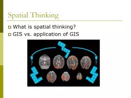
2. https://www.researchgate.net/publication/350123046_Field_evaluation_of_175_groundwater_profiler_and_field_screening_device_for_on-site_contamination_profiling_of_chromiumVI_in_groundwaterHydrogeology is concerned with how water and contaminants move in the subsurfaceStatic geology: rock, sediment, and soilDynamic fluidsSparse dataNo direct physical interaction (can’t see it)Interpretation/visualization/spatial thinking
3. Research Question: What spatial thinking skills are essential to successfully completing a site characterization and contaminant plume task in hydrogeology? Research Design: An expert-novice study with a cross-sectional design including up to 100 novice to expert hydrogeologists measuring predictor and outcome variables to produce a model using linear regression.*Theoretical assumption that spatial thinking skills are discrete cognitive factors that are identifiable and can be measured
4. To do this work we needed:A measure of hydrogeology performance to use as an outcome variablePredictor variablesSelected spatial thinking testsA measure of hydrogeology knowledgeA measure of hydrogeology experienceFirst year of project: instrument development/selection and data collection from 49 participants
5. Sample (N = 49)Professional licensure: 25%HAZWOPER trained: 48%Data collected from:GSAProfessional associations (NGWA)AlumniUniversity of Wisconsin
6. An authentic task typical of those used with undergraduates in hydrogeology coursesInclude components that are spatially challengingAbility to distinguish expert versus novice performanceHydrogeology TaskBegan with an exercise set from Lee, Fetter, & McCray 2003Hydrogeologists on the project team and advisory board expanded and modified the exercise set Pilot tested with students in field and classroom hydrogeology courses during summer and fall of 2021Developed a rubric for scoring each component of the taskThree researchers iteratively tested and refined the rubricA total of 20 items are scored across the task series
7. Hydrogeology TaskWellsTrace of cross section CreeksThis page is for reference only.
8. Draw connection between subsurface features that will affect flowDescribe at least 2 unitsIdentify flow direction.Hydrogeology Task: Cross-section
9. AquifersConfining Layer?Flow directionHydrogeology Task: Cross-section
10. Hydrogeology Task: Cross-section?
11. Hydrogeology Task: Potentiometric SurfaceDraw and label contours for the potentiometric surface across the siteIndicate flow direction with arrows that begin at the stars
12. Hydrogeology Task: Potentiometric Surface
13. Hydrogeology Task: Potentiometric Surface
14. Hydrogeology Task: Three-point problemDraw and label at least 5 contours Indicate direction of groundwater flow
15. Hydrogeology Task: Three-point problem
16. Hydrogeology Task: Three-point problemCurved contoursArrow going wrong direction“Straightened” arrow
17. Hydrogeology Task: Contaminant PlumeDraw and label contours to identify the contaminant plumeIdentify the well closest to the contaminant source
18. Hydrogeology Task: Contaminant PlumeSparse data here9800 µg/L10000 µg/L contour17 µg/L
19. Single highest concentration identified and plume extends to include 17 µg/LThree separate hotspotsExtended high contamination zone; no treatment of 17 µg/LHydrogeology Task: Contaminant Plume?
20. Hydrogeology Task
21. Closure speedFlexibility of closure Mental rotationPerspective takingSpatial scanningVisual memoryVisualization/penetrative abilityVisual searchFrames of referenceSpatial Thinking TestsWe reviewed the spatial thinking literature (McNeal & Petcovic 2020) and selected 9 testable spatial thinking skills potentially used in hydrogeologyWe ran a Qualtrics survey with professional hydrogeologists who helped to identify the “top four” spatial thinking skills that they thought aligned with the taskFeedback from a cognitive scientist on our advisory board provided additional guidance
22. Spatial Thinking Tests: Mental RotationVandenberg & Kuse (1978) XXTimed, 20 item testChoose two blocks on the right that are identical but rotated versions of the block on the left
23. Spatial Thinking Tests: Spatial ScanningEkstrom et al. (1976 ) Timed, 20 item testFind shortest route between two letters that doesn’t pass through a circle and only passes by one square
24. Spatial Thinking Tests: Visualization/Penetrative AbilityOrmand et al. (2014) Timed, 16 item testChoose cross section on right that matches left if sectioned as indicated
25. Spatial Thinking Tests: Frames of ReferencePiaget & Inhelder (1956) Untimed, 6 item testDraw a line to show water surface if bottle were half full
26. Prior work demonstrates that the biggest predictor of performance on domain tasks is domain knowledge (Roebber & Bosart 1996; Hambrick et al. 2012; McNeal et al. 2019).However, a validated hydrogeology concept inventory is not availableWe are working with Arthurs (Arthurs 2019) and LaDue (LaDue et al. 2021) to develop a validated hydrogeology concept inventory.See Friday’s poster session: Timi Popoola*Currently working with a prototype that we call the Hydrogeology Knowledge Test
27. Tentative Correlations Between Variables Hydro KnowledgeHydro ExperiencePenetrative AbilityMental RotationSpatial ScanningWater LevelTask TotalHydro Knowledgea10.556**0.416**.0760.0560.355*0.678**Hydro Experiencea 10.037-0.10-0.0870.0790.470**Penetrative Abilitya 10.453**0.491**0.435**0.589**Mental Rotationb 10.422**0.426**0.233Spatial Scanninga 10.311*0.322*Water Levela 10.555**Task Totala 1* Correlation is significant at the 0.05 level (2 tailed). ** Correlation is significant at the 0.01 level (2 tailed). aN = 49; bN = 48TakeawaysHydrogeology knowledge is highly correlating with experienceHydrogeology knowledge is the strongest predictor of task performanceSpatial thinking test scores are correlating with each otherMental rotation is the only spatial thinking skill that is not predicting task performance
28. VariableΔRaBbΔFcdfdStep 1: Hydrogeology Knowledge 0.4490.565*40.079*1,46Step 2: Spatial Score Total Adjusted R2 N = 49; * = p <0.001aVariance in the outcome; bbeta; cF-ratio; ddegrees of freedom Tentative Model Summary*Penetrative ability, spatial scanning, and frames of reference collapsed into a “single spatial” score to prevent issues with multicollinearity
29. VariableΔRaBbΔFcdfdStep 1: Hydrogeology Knowledge 0.4490.565*40.079*1,46Step 2: Spatial Score 0.1450.405*36.184*1,47Total Adjusted R2 0.594 N = 49; * = p <0.001aVariance in the outcome; bbeta; cF-ratio; ddegrees of freedom Tentative Model SummaryHydrogeology knowledge may account for 45% of the variance.Spatial thinking skills may account for an additional 14.5% of the variance.Preliminary data suggests:
30. Future workContinued data collection and analysis will allow us to look more critically at each spatial thinking skill, along with how well they individually predict or moderate performance.Analysis of think-aloud data will augment our work and help with interpretation of quantitative analysis.In Phase 2 of the project will be working with students in field camp and classroom settings to more fully understand how students use (or aren’t using) the spatial thinking skills that we identify as significant predictors.
31. Thank you!Questions?We want your feedback! Visit our project website here