
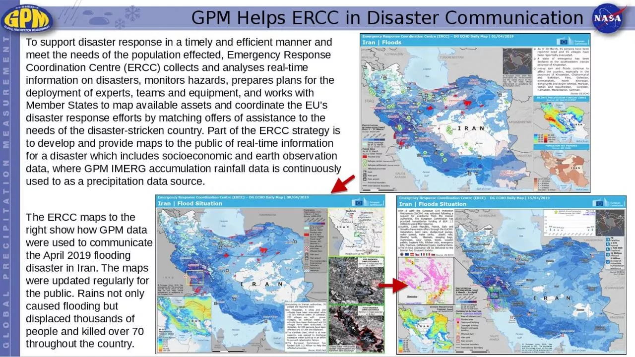
To support disaster response in a timely and efficient manner and meet the needs of the population effected Emergency Response Coordination Centre ERCC collects and analyses realtime information on disasters monitors hazards prepares plans for the deployment of experts teams and equipme ID: 1020952
Download Presentation The PPT/PDF document "GPM Helps ERCC in Disaster Communication" is the property of its rightful owner. Permission is granted to download and print the materials on this web site for personal, non-commercial use only, and to display it on your personal computer provided you do not modify the materials and that you retain all copyright notices contained in the materials. By downloading content from our website, you accept the terms of this agreement.


1. GPM Helps ERCC in Disaster CommunicationTo support disaster response in a timely and efficient manner and meet the needs of the population effected, Emergency Response Coordination Centre (ERCC) collects and analyses real-time information on disasters, monitors hazards, prepares plans for the deployment of experts, teams and equipment, and works with Member States to map available assets and coordinate the EU's disaster response efforts by matching offers of assistance to the needs of the disaster-stricken country. Part of the ERCC strategy is to develop and provide maps to the public of real-time information for a disaster which includes socioeconomic and earth observation data, where GPM IMERG accumulation rainfall data is continuously used to as a precipitation data source. The ERCC maps to the right show how GPM data were used to communicate the April 2019 flooding disaster in Iran. The maps were updated regularly for the public. Rains not only caused flooding but displaced thousands of people and killed over 70 throughout the country.