
th Century Technology History I thought this was science The History of Oceanography is very closely tied with the worlds overall history Understanding why people explored the ocean from a historical perspective helps you understand where the science of oceanography came from ID: 551428
Download Presentation The PPT/PDF document "History of Oceanography and 20" is the property of its rightful owner. Permission is granted to download and print the materials on this web site for personal, non-commercial use only, and to display it on your personal computer provided you do not modify the materials and that you retain all copyright notices contained in the materials. By downloading content from our website, you accept the terms of this agreement.


Slide1
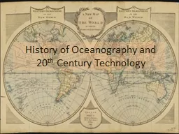
History of Oceanography and 20
th Century TechnologySlide2
History?!?!
I thought this was science!
The History of Oceanography is very closely tied with the world’s overall history.
Understanding why people explored the ocean from a historical perspective helps you understand where the science of oceanography came from.Slide3
Dividing Up the History
There are four main divisions in the History of Oceanography:
1. Ancient Uses and the Middle Ages
(5000 B.C. to 1400 A.D.)
2. European Voyages of Discovery (1400 A.D. to 1700 A.D.) 3. Birth and Growth of Marine Science (1700 A.D. to 1900 A.D.)
4. 20
th
Century Technologies
(1900 A.D. to Present)Slide4
Ancient Uses
Why would early civilizations want to explore the ocean?
To obtain food
To discover new lands
To trade
The earliest recorded sea voyage was in 3200 B.C. by the Egyptians.Slide5
Ancient Polynesians
The Polynesians were the first
long-distance
sailors who traveled beyond the sight of land.
The Polynesians settled numerous islands in the S. Pacific, making it as far as Hawaii and South America!
They used instruments called
“stick charts”
to navigate.Slide6
Ancient Greece
What didn’t the Greeks do?
- Learned to use the sun, constellations, and the north star to navigate the open ocean. They also
knew
the Earth was a sphere!
Star Charts helped them locate constellations for seafaring.Slide7
Ancient Greece
The Greeks also furthered modern map making, making sea voyages easier for later explorers.
First map showing Earth as a sphere on a flat surface.Slide8
Eratosthenes
Eratosthenes (264-194 B.C.) is credited for two important contributions to oceanography:
1. He calculated the Earth’s circumference.
2. He invented the first latitude/longitude system.
(800 A.D. to 1400 A.D.). Slide9
Chinese Explorations
The Chinese were active explorers during the Middle Ages (800 A.D. to 1400 A.D.). They advanced technology for seafaring greatly.
1.
Magnetic Compass
:
invented about 1000 A.D. and widely used by 1125 A.D. The Europeans use of the compass was not widespread until almost the 1400s!Slide10
Chinese Explorations
2. Ship Technology:
Chinese ships had a central rudder and water-tight compartments, both of which are still used in modern ships. In addition, Chinese ships were much larger than their European counterparts.
During this time, Europe was in the Dark Ages, where further advancement was suppressed and little ocean exploration occurred. Only the Vikings set out to conquer new lands.Slide11
The European Middle Ages (800 A.D. – 1400)
Also known as the Dark Ages because during this time further advancements in the knowledge of geography and science were suppressed in Europe.Little ocean exploration by Europeans was made, only trade continued.
Viking Explorations and Discoveries
The Vikings were the only people with significant exploration taking place in Europe during the Dark Ages:
They established trade routes throughout Britain, Ireland, Southern Europe, North Africa, and Central Asia.In the 9th century there was a global warming that freed the North Atlantic of ice allowing the Vikings to explore westward discovering Iceland, Greenland, and North America.Slide12
European Voyages of Discovery
(1400 to 1700)
The well known European explorers did not appear in history until the 1400s. This time period corresponds to the
Renaissance
.
The first major contribution to Oceanography was the route around the southern tip of Africa, the Cape of Good Hope, to reach India and other parts of Asia. This provided an alternate route to the East from the Mediterranean Sea.
This was accomplished by the Portuguese in the late 1400s. Slide13
Exploration of the New World
Christopher Columbus took the first of his four voyages to find a route to Asia in 1492. He believed he’d found Asia when he landed on a Caribbean island.
http://www.mariner.org/educationalad/ageofex/columbus_1st.php#Slide14
European Voyages of Discovery
(1400 to 1700)
In
1519, Ferdinand Magellan
(Portuguese) led the first expedition to circumnavigate the world. His expedition began with 5 ships and 260 men. One ship and 18 men returned successfully in 1522…Magellan was not one of them. He was killed in the Philippines
in 1521.Slide15
European Voyages of Discovery
(1400 to 1700)
In
1577, Sir Francis Drake (English)
led the second expedition to circumnavigate the world. He returned to England in 1580.
He left England for the New World with the purpose of raiding Spanish ships and settlements for treasure.
Drake returned to England in
1580
where he was knighted for his exploits as well as for bringing back treasure and spices worth a fortune.
…and yes, this is same “Francis Drake” who inspired the video game “Uncharted”.Slide16
Birth and Growth of Modern Science
(1700 to 1900ish)
Prior to this time, sailors could accurately determine latitude using the position of the Sun above the horizon. However, longitude was much more difficult as accurate time keeping was necessary.Slide17
What is longitude?
Longitude is based on the rotation of the Earth. Earth rotates at 15° per hour. Therefore, at the Equator, it takes exactly one hour to travel 15° of longitude.
Longitude was based on time. Prior to the 1700s, there was no way to keep accurate time at sea. Slide18
Birth and Growth of Modern Science
(1700 to 1900ish)
In 1735,
John Harrison
invented the
chronometer.
The marine chronometer is a clock and keeps accurate time at sea. Therefore, if one could keep track of the time, they could determine their longitude!
The chronometer would be used by many explorers to come to create accurate maps of unknown places.Slide19
Birth and Growth of Modern Science (1700 to 1900)
From 1768 to 1779,
Captain James Cook
mapped much of the lands in the Pacific Ocean. These included Australia, New Zealand, Hawaii, west coast of N. America, and more. These voyages are recognized as the
first sea expeditions devoted to methodical, scientific oceanography.
Cook’s Voyages:
1
st
Voyage
2
nd
Voyage
3
rd
VoyageSlide20
Matthew Maury,
Father of Physical Oceanography
Between 1842 and 1855, Maury published many books on sea navigation. He was born near Richmond and was in the U.S. Navy (but served the Confederacy during the Civil War.)
- In 1855, his most famous book
The Physical Geography of the Sea was published and is considered to be the first modern oceanography textbook.
Maury’s monument on Monument AvenueSlide21
Charles Darwin and the H.M.S.
Beagle
Charles Darwin was aboard the H.M.S.
Beagle
for a 5-year voyage, making observations and taking notes on various places and life. He went on to write
The Origin of the Species based on his journey.Slide22
Charles Darwin and the H.M.S.
Beagle
Most importantly to Oceanography, he theorized about the formations of atolls.Slide23
The H.M.S.
Challenger
The
Challenger
expedition is recognized as the first devoted entirely to marine science.
Took soundings more than 4000 meters (8200 meters in the Marianas Trench)
Took marine life samples in mid-water and from the bottom
Identified 715 new genera and 4717 new speciesSlide24
The H.M.S.
ChallengerSlide25
20
th Century Technology
(1900 to Present)
The Industrial Revolution spearheaded the growth and expansion of modern science.
- New ships built of iron - Steam engines
- Submarines
- Improvements on Research EquipmentSlide26
Meteor
– 1925 to 1927
A German ship,
Meteor
crossed the Atlantic Ocean 14 times, mapping the seafloor using echo-sounding technology. Also took data on ocean circulation, plankton growth, and nutrient dispersal.Slide27
Atlantis
– 1931 to 1964
An American ship,
Atlantis
is the first ship built purely for marine science. It was operated by the Wood’s Hole Oceanographic Institute.
It added to Meteor’s work and confirmed the existence of the Mid-Atlantic Ridge.Slide28
HMS
Challenger II – 1951
Challenger II
purpose was to measure the depths of the Atlantic, Pacific and Indian Oceans using SONAR.
It discovered the deepest known part of the ocean, named the “Challenger Deep” in the Marianas Trench. Its depth is 10,838 meters (35,558 feet).Slide29
Modern Ocean Exploration
Today, Oceanographers use numerous tools to study the ocean. These include, but are not limited to:
- Remotely Operated Vehicles (ROVs)
- Autonomous Underwater Vehicles (AUVs)
- Manned Submersibles
- SCUBA
- SONAR
- GPS
- Satellites
- Floats/Drifters/BuoysSlide30
Submersibles
A submersible is an underwater vehicle that can either be manned or unmanned and include submarines. These vehicles are well constructed to withstand high pressures at great depths.
Alvin
is known for discovering the
Titanic
wreckage. It is still used to explore the ocean deep ocean floor.
Director James Cameron
(Titanic
) emerges from his own submersible (March, 2012)
.Slide31
Unmanned Submersibles
Submersibles can also be unmanned, meaning they are robots. There are two types: Remotely Operated Vehicles (ROVs) and Autonomous Underwater Vehicles (AUVs).
ROVs –
Tethered to a boat on the surface and are equipped with arms for moving items as well as sample collection. They are equipped with lights and a video camera for recording. ROVs are highly maneuverable.
AUVs –
Are true robots, operated by a person on a ship. They are remote-controlled. They can be equipped with lots of instruments to measure the seafloor and water column.Slide32
Self-Contained Underwater Breathing Apparatus (SCUBA)
First introduced in 1943 by Jacques Cousteau,
SCUBA
allowed for a person to go underwater without being tethered to a breathing tube.
Slide33
So
und Navigation A
nd
R
ange (
SONAR)
During World War II, the US Navy developed SONAR to track German U-Boats. SONAR uses sound propagation to navigate or detect objects or other vessels. It provided scientists a fast way to map the ocean floor.
Slide34
SONAR
– How does it work?
Sound waves are sent from a ship on the surface and the time it takes for them to return to the ship is recorded. The time is plugged into simple formula to calculate the depth.
D = ½ t*s
D = depth in meters
t = time
s
= speed of sound in seawater
= 1500 m/sSlide35
Types of SONAR
Side-scan SONAR
identifies the object or feature of the seafloor. This type is performed from a tow vehicle deployed underwater and can provide 3-D images of objects.
Multi-beam SONAR
uses a swath of sound beams rather than just a single straight line. Multi-beam measures the depth of an object.Slide36
Satellites
Satellites can be used to collect data on ocean temperatures and its influence on global climate change. In addition, satellites can measure the height of the ocean surface and use it to interpret the seafloor.
The ocean’s surface is
not
flat! It varies with the underlying topography.
Satellites cannot “see” through water.Slide37
Slide38
Global Positioning Systems (GPS)
GPS is a network of computers and satellites that can be used for location. This enables oceanographers to provide coordinates for data collection more easily.
However, it is not always reliable…
Slide39
Floats/Drifters/Buoys
Drifters are instruments used to track ocean
currents. They can be either at the surface
the water or at a given depth. The drifters
send signals to satellites of their location
and time. Slide40
Floats/Drifters/Buoys
Drifters can also be used to collect data on changes in ocean temperatures, salinity, etc. in order to make predictions on future events.
ARGO floats collect temperature and salinity data at various determined depths. They are a series of floats throughout the world’s oceans. Slide41
ARGO floats in May 2011