
Figure 3 The Multiple Ring Buffer Tool in ArcToolbox The Multiple Ring Buffer tool is an Analysis Tool in the Proximity Toolset The main difference between this and the Buffer Wizard sing tool al ID: 453685
Download Pdf The PPT/PDF document "Figure 2: The Buffer Wizard is set to b..." is the property of its rightful owner. Permission is granted to download and print the materials on this web site for personal, non-commercial use only, and to display it on your personal computer provided you do not modify the materials and that you retain all copyright notices contained in the materials. By downloading content from our website, you accept the terms of this agreement.


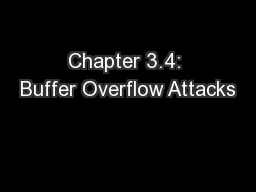
Figure 2: The Buffer Wizard is set to buffer the Ocean layer with twelve rings one kilometer apart. In the 8.x Buffer Wizard, select the layer you want to buffer. To create the coastal polygon of a lake. Select As multiple buffer rings and set a suitable number of rings the units for the buffer distances. The more the intervals are not too large. In the next dialog box, it does not really matter for dissolving barriers. Select Only outexample. Save the buffers in a new feature layer. Buffers can also be created using the ArcGIS 9.0 geoprocessing Multiple Ring Buffer Figure 3. The Multiple Ring Buffer Tool in ArcToolbox. The Multiple Ring Buffer tool is an Analysis Tool in the Proximity Toolset. The main difference between this and the Buffer Wizard sing tool also allows you to make rings of from the coast. If you want all your rings to be the same size, it is easier to use the Buffer Wizard instead because the width of each ring does not need to be input. Symbolizing the Buffers ing one of the two methods described above, Figure 4. The Layer Properties dialog box wherRight click the name of the buffer layer in under the Symbology tab, select Quantities and then Graduated colors. Set the color for the buffer class farthest from land to the blue that will be used for the water outside the coastal area, and set the color for the class nearest to land to white (Figure 5). e buffer farthest from land it should be set to the same color used to show the rest of the water. Select the first and last classes together color patch in the display and choose Ramp Cowhite color ramp to all of the vector bu the closest source cell that is, the nearest shornput source data is a is performed. Conceptually, the Euclidean algorithm works like this: for each cell, the distance is calculated to each source cell by calculating the hypotenuse with the x-max and y-max as the other two legs of the trance to a source is determined, and if it is less than the specified maximum distance, the value is assigned to the cell location on the e Euclidean distance function in Spatial The Euclidean Distance function can be accessed either through the Spatial Analyst geoprocessing framework of ArcToolbox. Note that the Spatial Analyst methodology will work for 8.1+ and the geoprocessing method works with 9.0+. We first describe the Spatial Analyst method. First make sure the Spatial Analyst extension and make sure Spatial Analyst is checked) aclick Tools, click Customize, then under In the Spatial Analyst dropdown menu, click Dilated from this is a polygon layer of the land area. Then grid, you can symbolize it using the Layer ed to symbolize the raster in ArcMap: creating a custom algorithmic color ramp and stretching the raster values to fit the custom color ramp. Figure 9. The Layer Properties dialog box whercoastal vignette created To create a custom color ramp, use the Style Manager (click the Tools menu, point to Styles, then click Style Manager.) On thin which you want to store the custom color ramp and then click on Color Ramps. On the right side click Algorithmic Color Ramp. Set the first color to white and the second color to the OK and type a name for the new color ramp you created. To apply the color ramp to your raster grid, under the Symbology tab of the Layer Minimum/Maximum option so that you have values in the Euclidean distance grid. The minimum is usually zero for the pixels near the shoreline; the maximum determines where the gradation of color stops so that the highest pixel values have the same color blue. By working with the histogram, you can change the application of the collows you to make some of the same manipulations as with the buffer tOne of the advantages of using the raster Euclidean distance metvignettes is this flexibility in symbolization of method. With this option, the clcolor ramp. As with the buffer method, there are also a few limitations to this approach. Pixels along the shoreline will become apparent if the raster is too coarse for the map scale (that is, the rger file sizes result from using raster layers; although the . SID or some other compressed format image, drawing performance and output will not improve significantly. This paper describes two methods for creavector method involves the creation of multiple buffers symbolized with colors graded from white near the shoreline to the blue used for the deeper ocean. This method has the advantage of being flexible in terms of the number and size of buffer classes. Vector buffers allow you to set the symbology of each of the bands, but once the buffers have the second method, raster analysis is used to create a smoothed continuous surface that represents the distance from the shoreline. This method allominimum and maximum values (i.e., stretch the data to fit the chosen symbolizatisymbology options (e.g., specifying a classified renderer and its associed to create and symbolize the vignettes, both methods can yield almost identical results. References Environmental Systems Research Institute (ESRI). 2004. ArcGIS Desktop Help, Loggia.com 2003. A Momentary http://www.loggia.com/vignette/subarchterms.html Robinson, A.H., J.L. Morrison, P.C. Muehrcke, A.J. Kimerling, and S.C. Guptill. 1995. Tufte, E.R. 1990. Envisioning Information. Part 5: Publication Symbolpstds/acrodocs/qmaps/5psym202.pdf Environmental Systems Research Institute, Inc, Email: dbarnes@esri.com Representing where land and water meet can be done using a number of methods, some of which are called coastal vignettes. Coastal vignettes symbolize the water from the symbolized graphic mark) that gradually an undefined edge (Loggia.com 2003). Various methods exist to achieve this effect. On historic mato shore highlight the water areas along coastlines. On more recent maps, gradation of color is often used, ranging from white along areas (USGS 2002). Because lighter values are associated with less of something, this approach leads the map reader to the impression that coastal areas are shallower than shore may be associated with the white In this paper, we demonstrate how to create coastal vignettes to symbolize the water using two different methods for creating a gradation in color Buffers and Euclidean Distance. One method uses multiple buffer rings either of the same size or of gradually ances, for example, using narrower buffers near land and widening them towards open water. The other method uses a raster surface that represents distance from shoreline. For each method we show you how to use both the tools from ArcGIS 8.x and the tools that are cessing framework of