

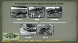
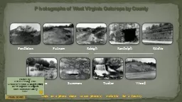
Use esc button to end show Photographs of West Virginia Outcrops by County Photo Credits Photos by Peter Lessing PhD Senior Research Geologist retired West Virginia Geological and Economic Survey ID: 599898
Download Presentation The PPT/PDF document "Click on a photo above to see photo(s) a..." is the property of its rightful owner. Permission is granted to download and print the materials on this web site for personal, non-commercial use only, and to display it on your personal computer provided you do not modify the materials and that you retain all copyright notices contained in the materials. By downloading content from our website, you accept the terms of this agreement.


Slide1
Click on a photo above to see photo(s) available for a County.Use “esc” button to end show.
Photographs of West Virginia Outcrops by County
Photo Credits
Photos by:
Peter Lessing, Ph.D.
Senior Research Geologist (retired)
West Virginia Geological
and Economic Survey
1997Slide2
County: BerkeleyQuadrangle:
Inwood
Location Info: Just east of Route 11, one mile SE of
Inwood.
Rock Formation(s): Ordovician New Market Limestone overlain by Ordovician Chambersburg Limestone.
Strike/Dip (in degrees):
N 25 E, dip about 45 SE.Comments: Overview from upper bench showing lower benches and standing water; dip is to the left. Contact of Chambersburg/New Market on wall of far quarry, about half way up. Chambersburg is dark limestone at top and New Market is light gray below. Mining is for the New Market.
Limestone Quarry
County List
NextSlide3
County: BerkeleyQuadrangle:
Glengary
Location Info: Along Back Creek, 0.6 miles SE of
Glengary.
Rock Formation(s): Devonian Mahantango
FormationStrike/Dip (in degrees
): N 30 E, 25 SEComments:
Fossils are brachiopods, all about ¼ to ½ inch in diameter.Fossils
County List
PreviousSlide4
County: BrookeQuadrangle:
Bethany
Location Info: On Route 67, 2.5 miles W of Bethany and 3.5 miles E of Wellsburg
Rock Formation(s): None
Strike/Dip (in degrees):
NoneComments: Gravel deposit on left and steep, cut-bank on right, next to Route 67. Stream is flowing W (away from viewer), and named Buffalo Creek.
Meander Bend
County ListSlide5
County: CabellQuadrangle:
Athalia
Location Info: On Route 22, 2.5 miles S of Mason/Cabell line
Rock Formation(s): Pennsylvania Monongahela Group
Strike/Dip (in degrees)
: HorizontalComments:
Height of slide is about 100 feet. Composed mostly of soil and trees with a few blocks of rock. This is a very recent slide, perhaps less than a month old.Landslide
County ListSlide6
County: GilmerQuadrangle:
Glenville
Location Info: On Cedar Creek in Cedar Creek State Park, 3.5 miles S of Glenville
Rock Formation(s): Pennsylvanian Conemaugh
GroupStrike/Dip
(in degrees): Horizontal
Comments: Cut bank is on the right and deposition is occurring at the left bank. No bedrock is visible here, but can be seen across the road.
Meander Bend
County ListSlide7
County: HancockQuadrangle:
East Liverpool South
Location Info: One mile W of Newell on Route 2
Rock Formation(s): Quaternary Alluvium
Strike/Dip (in degrees):
NoneComments: Sand and gravel deposit composed of
quartzites, gneisses, sandstone, conglomerates, etc. Some gravel reaches 6 inches in diameter and all are very rounded. Source of clast is most likely Canada.
Quaternary Alluvial Gravel
County ListSlide8
County: HardyQuadrangle:
Baker
Location Info: At limestone quarry, 0.3 miles east of intersection of Routes 55 and 29.
Rock Formation(s): Silurian Tonoloway
FormationStrike/Dip
(in degrees): N 40 E, 55 NW
Comments: Hammer (about 1 foot long) is parallel to dip and rock is dipping towards viewer.
Mud Cracks
County List
NextSlide9
County: HardyQuadrangle:
Baker
Location Info: On Route 29, 0.7 miles north of intersection with Route 55.
Rock Formation(s): Devonian Brallier
FormationStrike/Dip
(in degrees): Nearly vertical dip; strike N 30 E
Comments: Folded layers near top. Hammer in lower center is about one foot long.
Folded Rocks
County List
PreviousSlide10
County: JeffersonQuadrangle:
Charles Town
Location Info: Vicinity of Charles Town.
Rock Formation(s): Cambrian Conococheage
FormationStrike/Dip
(in degrees): Nearly horizontal, on axis of anticline.
Comments: These Cambrian stromatolites are elongated parallel to elongation.
Additional Photo (click on photo to left): Perpendicular to bedding showing Stomatolites in cross section and layers of algal mats. Exact location must remain unnamed because site must not be destroyed.
Stomatolites
County ListSlide11
County: LoganQuadrangle:
Amherstdale
Location Info:
One mile north of Amherstdale
Rock Formation(s): Pennsylvanian Kanawha Formation (upper part of formation)
Strike/Dip (in degrees):
HorizontalComments: Fossil leaves are
Eusphenopteris obtusalopa.Fossil Leaves
County List