
Ted Blank IOTA Conference Carson City NV September 2017 80 km Center Line You have chosen a chord calculated the distance perhaps even visited the site or checked it out on Google Street View ID: 639834
Download Presentation The PPT/PDF document "Using a Portable GPS To Determine Distan..." is the property of its rightful owner. Permission is granted to download and print the materials on this web site for personal, non-commercial use only, and to display it on your personal computer provided you do not modify the materials and that you retain all copyright notices contained in the materials. By downloading content from our website, you accept the terms of this agreement.


Slide1
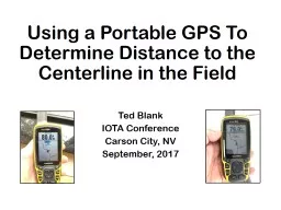
Using a Portable GPS To Determine Distance to the Centerline in the Field
Ted BlankIOTA ConferenceCarson City, NVSeptember, 2017Slide2
80 km
Center Line
You have chosen a chord,
calculated the distance,
perhaps even visited the site
or checked it out on Google
Street View.Slide3
X
X
80 km
However, upon getting
close to your site, you find out
that the road you chose is
closed due to flood damage!Slide4
?
X
X
There’s another road that
crosses your chord, but
how will you know when
you are the proper distance
from the center line?Slide5
You will need a portable GPS unit which can display “Off-Course Distance”
Garmin GPSMap 64Garmin eTrex 10, 20, 30Garmin “Montana”Garmin “Oregon”Slide6
Use Occult 4’s option to export the path of the centerline in “GPX” format.Slide7Slide8Slide9
Track FileSlide10
Open .TRX file in
WordpadFive “track segments”First segment is center lineKeep this segment.(Trim to <250 points)Delete the other foursegments, which represent
the 1-sigma and 2-sigmalines
Edit the “Track File”Slide11
Be careful not to delete these last two lines
Save fileSlide12
Convert the Track File to a “Route File” using website:
www.gpsies.com/convert.do- Register (free)- Select “Convert” from GPS Track to GPS RouteSlide13Slide14
Download and install free Garmin “Basecamp” softwareSlide15
Import your “route” file into Basecamp, and plug in your portable deviceSlide16
Device
Route FileSlide17
Select and use the “Route”
you have just downloaded tothe handheld device.Set up the device to display the“Off Course” distance on the map.
You will now know your perpendicular distance to the center line at all times.