
KB Kataebati GSD Geoscience Division Texture I nformation IKONOS GeoEye WorldView2 1 st Step Palm Resource Mapping with VHR Satellite Images Using World View2 resolution 50cm ID: 461012
Download Presentation The PPT/PDF document "Accuracy of Counting Coconut Palms with ..." is the property of its rightful owner. Permission is granted to download and print the materials on this web site for personal, non-commercial use only, and to display it on your personal computer provided you do not modify the materials and that you retain all copyright notices contained in the materials. By downloading content from our website, you accept the terms of this agreement.


Slide1
Accuracy of Counting Coconut Palms with VHR Image Data
KB. KataebatiGSD – Geoscience DivisionSlide2Texture Information
IKONOS
GeoEye
WorldView-2
Slide31
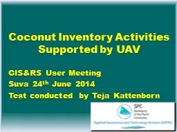
st Step - Palm Resource Mapping with VHR Satellite Images Using World View-2 resolution 50cmSeparation of coconut palm from other vegetation
Density stratificationSelection of PlotsDigitisingCounting of palms per hectare
Remote Sensing Application
Field WorkSlide4Density Classes
Scattered coconut: 25 - 50 palms/hectareSemi Dense: 50 – 150 palms/hectareDense Coconut >
150 palms/hectareSlide5DigitisingSlide6Counting Palms in Plots
Placing a dot on top of every visible palmDigital overlay with grid and
counting in MapInfo (GIS software) dots per grid cellTransfer to AccessSlide7
The number of palms is counted through a semi automatic process connecting MapInfo GIS software with Access Database software
Transfer
MapInfo (GIS)
Access Database
Slide8Establishment and Identify Plot in the Field using GPS
GPS - Base Station
Communicating with Satellite
GPS- Rover (recording)
Plot lineSlide9Examples of Overlaying GPS Plot over the Image Plot
Established from
Satellite Image
Identified by GPSSlide10Mismatch of Plot Outlay
GPS accuracy of 80 cm does not apply for way pointsSolution → new image interpretation for field plotsSlide11Comparison Between Image interpretation and in Reality Slide12Result
Images VS Reality100 plots investigatedDense coconut, 70 plots 10.6% underestimatedSemi dense coconut 14 plots 4.4% underestimatedScattered coconut plots 16 plots correct image interpretation Slide13
Dense Coconut PalmSlide14
ConclusionFactor 10.6% and 4.4% is incorporated in code to calculate palms per hectare
Accuracy will be improved with additional investigationsSlide15
Thanks