
Taking the bite out of map reading The World of Geography Our World Geography is the study of Earths Physical Properties An important tool used to study geography is a Map A Globe is helpful and informative too ID: 768891
Download Presentation The PPT/PDF document "Taking the bite out of" is the property of its rightful owner. Permission is granted to download and print the materials on this web site for personal, non-commercial use only, and to display it on your personal computer provided you do not modify the materials and that you retain all copyright notices contained in the materials. By downloading content from our website, you accept the terms of this agreement.


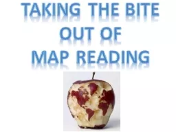
Taking the bite out of map reading
The World of Geography! Our World
Geography is the study of Earth’s Physical Properties
An important tool used to study geography is a Map!
A Globe is helpful and informative too
What are the Similarities and Differences Between Maps and Globes? Let’s brainstorm this together!
Map and Globe Similarities and Differences Similarities Differences
Globe Map
A map and a globe are very much different. While a map gives a two dimensional presentation of certain regions in the world, a globe gives a three dimensional presentation of the entire world. A map is easy to use and portable, whereas a globe is not. The regions can be easily identified in a map than in a globe. A map presents the physical features of a particular region of the earth on a plane surface. Maps come with various symbols and signs related to the geographical and physical features. A globe can be called as a duplicate earth. It is round in shape and shows accurate areas, distances, directions and relative shape and size. Globe A map and a globe are very much different. While a map gives a two dimensional presentation of certain regions in the world, a globe gives a three dimensional presentation of the entire world. A map is easy to use and portable, whereas a globe is not. The regions can be easily identified in a map than in a globe. A map presents the physical features of a particular region of the earth on a plane surface. Maps come with various symbols and signs related to the geographical and physical features. A globe can be called as a duplicate earth. It is round in shape and shows accurate areas, distances, directions and relative shape and size. A globe is a 3 dimensional, accurate presentation of the entire world. It shows accurate areas, distances, and relative shape and size. However, a globe is not portable and cannot show the specific information that a map can show
Maps A map is not as accurate as a globe . A map looks d istorted w ith its view of the Earth’s features. Greenland is almost as big as South America on a flat map. What are Earth’s features? For instance, areas near both poles are much larger on a map than in reality.
However a map shows more detail than a globe which we’ll go into more detail soon. For school work, the Robinson Projection is the best map to use for Social Studies, which looks like this... Maps There are different ways to make a map. So, some maps show less distortion than others.
Just as we use a vocabulary to communicate to each other Map reading has its own vocabulary which we will use this year
Scale Bar and Map Key The Equator Compass Rose Cardinal Directions Prime Meridian Longitude Latitude Map reading is a life skill, with a vocabulary all its own!
Cardinal Directions are North , East, South and West.
Cardinal Directions are shown on a map as a compass rose .
Let’s practice using our Cardinal Directions San Francisco is what direction from Philadelphia? True/false the Great Lakes are found in southwest United States? San Francisco is what direction from Alaska? What state is the furthest north? New Jersey is what direction from Pennsylvania? Houston is what direction from Philadelphia? What state is the furthest south? What state is the furthest east? What state is the furthest west?
The scale bar helps reading the map. It shows distance between any two places. Scale sizes change based on the map.
The map key (or legend) helps identify features on a map. Popular map keys show elevation, terrain population, religions, and more.
Latitude and Longitude are measured by degrees DEGREES To help locate places on a map, we use lines of latitude and longitude
Latitude is shown on a map as a horizontal line.
Lines of Latitude are parallel lines . They go around, but never touch or intersect each other.
Lines of Latitude measure distance in North to South direction
The Equator is a line of latitude which is the midway point between the northern and southern hemispheres
Longitude is a vertical line seen on a globe or map. The long lines goestop to bottom.
Lines of Longitude measure distance in East to West direction
Meridian is a line oflongitude
Prime Meridian is zero degrees longitude, the first line of longitude
Latitude and Longitude work together on a map or globe to find exact locations .
It may look like this
Or it may look like this
Or it may look like this
1. Place 1 on the Equator. Place 1A North of the Equator. Place 1B South of the Equator.2. The degree of Longitude which goes through the center of North America ______, South America ____.3. The degree of Latitude which goes through the center of North America ______, South America ____.4. Place an X on the map where 20 North Latitude and 20 East Longitude meet (intersect). 5. Place an O where 40 South Latitude and 40 West Longitude meet (intersect). Class Drill:
See Ya !