
Drainage Basin This is the area of land drained by a river system a river and its tributaries The drainage basin system is said to be open as both inputs and outputs of energy and material occur ID: 131056
Download Presentation The PPT/PDF document "What is the River Discharge and What Fac..." is the property of its rightful owner. Permission is granted to download and print the materials on this web site for personal, non-commercial use only, and to display it on your personal computer provided you do not modify the materials and that you retain all copyright notices contained in the materials. By downloading content from our website, you accept the terms of this agreement.


Slide1
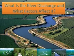
What is the River Discharge and What Factors Affect it?Slide2
Drainage Basin
This is the area of land drained by a river system (a river and its tributaries).Slide3
The drainage basin system is said to be open as both inputs and outputs of energy and material occur.
All rivers receive a water from it. The boundaries of the basin are known as the watershed and will usually be marked by areas of higher land. Drainage basins have many different characteristics that influence how quickly or slowly the main river within them responds to a period of intense rainfall, these are outlined in more detail in the section relating to
storm hydrographs. Slide4Slide5
River
DischargeThe discharge of a river is the volume of water which flows through it in a given time. It is usually measured in cubic meters per second
.Slide6
Calculation:
Cross-sectional area of channel (m2)
X Velocity of the river / water (m/s)
*This gives discharge as the volume (m3/s) or cumecs
.Slide7
How is river discharge affected by physical factors?
Impermeable Rock (e.g. granite) – Water is unable to infiltrate through, resulting in more surface runoff, increasing volume of the channel and its speed.Permeable Rock – More infiltration, resulting in less surface runoff and less volume in the river
Size of drainage basin – Small
Water will enter the river quicker and fasterRelief of drainage basin – If the slope of the basin is more steep, water in the river is likely to move down faster, increasing its speed
Percipitation – heavy rain can cause saturation in the soil and hence cause more water to reach the river (runoff). This also means that the speed of the river increases.
Vegetation – allows more infiltration and interception, causing less surface-runoff and slowing down the speed of the riverSlide8
How is river discharge affected by human factors?
Impermeable man-made surfaces – Concrete and tarmac can cause rivers in urban drainage basins to have a higher discharge due to higher amounts of surface runoff. Speed is also increased due to drainage systems and ground.
Destruction of vegetation (deforestation) – Less infiltration + interception causes more surface run off and increases speed of the water.River Management – Presence of dams allow river flow to be controlled, which may cause more discharge (before the dam) , or less (below the dam). Slide9
Hydrographs
Graphs which shows how the river discharge in a drainage basin responds to a period of rain.Slide10
Base flow – the normal day to day discharge of a river
The rising limb – the rapid increase of discharge resulting from a rainfall
.
Peak flow – when the river reaches the maximum capacity that it can hold.
The recession limb – when the discharge starts to decrease and river levels fall.
Basin lag time – the time difference between the peak of the rain event to the peak flow. Slide11
What factors affect the shape of flood hydrographs?
Drainage basin
- Type of rock (impermeable or permeable) – Impermeable rock will not allow water to seep in, thus causing larger amounts of surface runoff and a shorter lag time. - The gradient of the drainage basin – Steep gradients will cause greater overland flow and a shorter lag time.
- Size of drainage basin – larger basins will take longer to reach the river, hence a longer lag time
- Present conditions of the drainage basin – soil either saturated, very dry or even frozen Slide12
Type and amount of Precipitation
- Rapid rain – soil will saturate at a very rapid rate, excess water quickly transfers by surface runoff thus causing a short lag timeSlide13
Land Use and Human Impact
- Impermeable man-made surfaces – e.g. concrete and tarmac roads, shorter lag times- Vegetation area –infiltrates more and intercepts water, a longer lag time, reducing discharge- Area of deforestation – short lag time, increases dischargeSlide14
Time/season of the year
- Summer – evapotranspiration rates are higher, reducing surface run off, longer lag time - Temperatures Slide15
Water Use
- Dams and reservoirs near area – slow down the rate of discharge, a much longer lag time, and may also cause a reduced amount of discharge Slide16Slide17Slide18
How do flood hydrographs change as river discharge changes? Slide19
When it starts to precipitate, the level of discharge starts fairly low at base flow level (1).
As the rain starts to get heavy, the soil may be saturated, thus there is an increase in surface run off. This causes water to start flowing into the river channel, causing the level of discharge to increase, making the line go up positively.
A very steep rising limb (2) would indicate a fast increasing discharge rate meaning water flowing into the river channel is a faster rate, and thus a heavier rainfall. (3) When the amount of water in the river is at its maximum level (peak discharge), the curve will reach its highest point on the graph.
As river discharge starts to decrease (4), the curve will start to slop gradually (gradient is normally less steep compared to the lag time).