
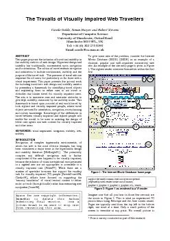
Graphic Documentation Systems in Mural painting Conservation GraDoc in November 1999 Published proceedings of this seminar became a widely accepted document addressing purposes requirements and m ID: 840145
Download Pdf The PPT/PDF document "Graphic documentation a cool presentatio..." is the property of its rightful owner. Permission is granted to download and print the materials on this web site for personal, non-commercial use only, and to display it on your personal computer provided you do not modify the materials and that you retain all copyright notices contained in the materials. By downloading content from our website, you accept the terms of this agreement.


1 Graphic documentation: a cool presentati
Graphic documentation: a cool presentation tool or a helpful assistant? Case study Nako, North India. Tatjana BAYEROVÁ and Maria GRUBER University of Applied Arts Vienna, Institute for Conservation and Restoration Salzgries 14, 1020 Vienna, Austria tanja.bayerova@uni-ak.ac.at ; maria.gruber@uni-ak.ac.at Keywords: mapping, graphic documentation, cultural heritage, Nako Abstract: The development of new technologies during the past ten years affected also the field of cultural heritage preservation where the digital mapping and graphic documentation hold an important position. This article focuses on the presentation of the graphic documentation of interior decorations in four Buddhist temples founded in the 11th/12th at Nako, North India, where the research and the conservation programme has been carried out since 2004. The initial planning of the graphic documentation, technologies employed, the recording process, subsequent data processing and their final presentation are described. The results, reaching today their final point, form a clearly structured, comprehensive, practicable and easily readable system comprising a complete set of cross-linked data and information from all four temples accompanied with the complete and understandable glossary. Thus a widely applicable base for both, scientific studies and practical use, referring to the clarification of the building history, materials and technology, to deterioration processes and monitoring of their progress, to the planning and calculation of further conservation measures and to the long-term protection is provided. 1. INTRODUCTION To start with the statement that conservation and preservation of cultural heritage is an interdisciplinary field requiring cooperation between conservators/restorers, (art) historians, conservation scientists, and a range of other experts may sound today already like a cliché. Nevertheless, all steps in any conservation or restoration process should be accompanied by a clearly structured and comprehensive documentation that has to be beneficial for all professionals involved. The demand for a suitable documentation was recognised almost fifty years ago in the Charter of Venice, Article 16 [1]: In all works of preservation, restoration or excavation, there should always be precise documentation in the form of analytical and critical reports, illustrated with drawings and photographs. Every stage of the work of clearing, consolidation, rearrangement and integration, as well as technical and formal features identified during the course of the work, should be included. This record should be placed in the archives of a public institution and made available to research workers. It is recommended that the report shoul
2 d be published. General recommendations
d be published. General recommendations for recording and documentation of murals were outlined in the book Conservation of Wall Paintings [2], chapter ´Examination and documentation´ and many conservators and restorers followed these guidelines for the next almost twenty years. The importance of graphic documentation in the restoration process, especially for wall paintings and architectural surfaces, was recognised in the nineties also by ICCROM resulting in organizing an international research seminar Graphic Documentation Systems in Mural painting Conservation (GraDoc) in November 1999. Published proceedings of this seminar became a widely accepted document addressing purposes, requirements, and methodologies of graphic documentation [3]. The necessity for a comprehensive documentation was further underlined with the E.C.C.O. Professional Guidelines, Part I, from March 2002 [4]. The Conservator-Restorer undertakes responsibility for.. [ ] documentation of observations and any interventions. Documentation consists of the accurate pictorial and written record of all procedures carried out, and the rationale behind them... [ ]. Despite all the previously mentioned steps and standards drawn by the GraDoc there has not been any strict formula how exactly a graphic documentation should look like since the content and the form varies from case to case and is depending on many objectives. In general, an appropriate graphic documentation should be a clear, accurate and understandable graphic record of collected, systematically organised, and archived data, easily accessible for all related professionals and other users not only today but also in the future. Nevertheless, one still finds graphic documentations either absurdly over-documented or, on the other hand, inadequate documentations that do not fulfil their primary aims and form only inferior attachment of a project report. The graphic documentation of the interior decoration of four Buddhist temples in Nako, North India, seeks to be a comprehensive and easily readable system of information classified regarding historic structures, conditions, damage assessment, on-site investigations and conservation measures [5]. This paper presents the main goals, mapping process, methodology and results of the Nako temple interiors graphic documentation, and its implementation into the practice. 2. THE BUDDHIST TEMPLE COMPLEX IN NAKO The small village Nako is located in a splendid landscape of the Western Himalaya at 3.600 m above sea level in the northern Indian province of Himachal Pradesh close to the Tibetan border. The Buddhist temple complex consists of four earthen temples originating probably from the same period the 11th/12th centuries, and
3 comprehends approximately 460 square
comprehends approximately 460 square meters of wall paintings (original condition), seventeen partly life-sized polychrome clay sculptures and three painted wooden ceilings. Since 2004 the Institute for Conservation and Restoration of the University of Applied Arts Vienna has been working on the research and preservation of the interior decoration of this unique complex and the graphic documentation was one of the essential components of the overall documentation. 3. GRAPHIC DOCUMENTATION 3.1. Aims and preparation From the very beginning of the working activities in Nako restorers were aware of a requirement and usefulness of the graphic recording, but due to many restrictions financial and technical the graphic documentation was foreseen only in a very limited scale. Fortunately, the situation has later changed thanks to the financial support of the Austrian Science Fund and it was possible to include the graphic documentation among research activities financed by the fund. The main aims of the graphic documentation were to create a consistent and clear record of the historic structure, the condition and damage survey as well as the conservation measures of all four temple interiors. With the recordings relevant data were provided to allow a comparison of the buildings that feature various interiors decoration phases and different condition states. The ongoing conservation treatments carried out in two of the four temple interiors were recorded parallel to the conservation intervention. The graphic documentation as an inseparable part of the overall documentation should further serve as a base for planning of future conservation activities in the two remaining temples, as an overall decay and condition monitoring tool, as well as a documentary source of specific information. In order to achieve these goals the assessment of the painted surfaces of the wall paintings as well as the earthen supports was addressed within the graphic documentation work. Planning of the graphic documentation started prior to the field work following the GraDoc protocol [6,7]. Following issues were formulated: What to record in order to keep the final goals in view? The right decision of what to record is always a crucial issue otherwise the documentation become an unmanageable task. A good decision making for the Nako interior decoration documentation was valid twice due to the remoteness of the site, difficult transport facilities and extreme working conditions, as well as many consequential restrictions such as limited time and insufficient energy supply. Objectives for the mapping were defined as follows: materials (historic structure) assessment damage assessment overall condition assessment on-site
4 investigations´ recording conservation
investigations´ recording conservation measures´ recording How detailed the recording should be? This is another important issue strongly influenced by time and human resources available. Each of the recorded objectives was divided into main categories that were, when necessary, further subdivided into several subcategories. Thus, the base for a legend and a visual glossary was set up. The categories were formulated in order to keep the feasibility of the task and easy accessibility and clearness of the record in view. To comply with the significance of the interior decorations a detailed mapping of selected areas was foreseen to complement the overall recordings. For this task a particular glossary with specified categories for both painted surfaces and earthen supports was established. How to record? No infrastructure, insufficient power supply and other limitations ruled out the possibility to use the digitalphotogrammetryforthe survey of sculptures and wall paintings. Therefore, a direct digital recording based on digital photographs was preferred to the traditional documentation carried out by hand [8]. The highly specialized computer software Metigo Map version 2.2 with an updated version3.0 (Fokus GmbH Leipzig) combining image processing and CAD-functionality developed especially for conservation purposes was used (Figure 1). Figure 1: A screen-shot illustrating the mapping process with the Metigo Map in situ 3.2 Mapping process data collection Mapping itself was carried out on site in the frame of three campaigns (each three to five weeks) parallel to the conservation programme. During these periods, both, our knowledge about the decorations but also the documentation process itself continuously evolved. As a result it became necessary to review some of the mapping criteria as well as to change the originally planned glossary. Professional high resolution coloured overall and detailed rectified digital images served as mapping templates. To control and calibrate the system a colour chart was included in every image. The full photographic documentation of all interior walls was carried out in artificial lighting (five lamps, each 800W, supplied from an electricity generator) using a digital Nikon BM-6 D200 camera. Taking whole area images was rather difficult and tricky since wooden columns holding the ceiling were standing in front of each wall and to capture the whole area was almost impossible. All photos taken were assembled with the help of Adobe Photoshop and rectified with Metigo Map. The mapping itself was performed with laptops and graphics tablets and the recorded data were put directly into the computer. Team members skilled in the Metigo Map digital mapping worked to
5 gether with researchers and conservators
gether with researchers and conservators on identifying and recording diverse and specific phenomena. Such team work together with the possibility of the direct computerised recording allowed a continuous and permanent verification of records in order to provide consistent and reliable information. Since the data were collected throughout three working campaigns their subsequent processing in the studio was necessary in order to unify them. The glossary composed of photographic and descriptive information on all the phenomenon and criteria mapped was systematically organised. Finally, the visualisation and compilation of the large amount of information gained was reassessed with respect to presentation purposes and archiving needs. 3.3 The glossary The historic structure objective was divided into two main categories: - wall paintings and - earthen plasters surveys. Wall paintings survey was further subdivided as follows: - different overall decoration phases, - partial reworking phases, - overpaintings. Earthen plasters survey was similarly differentiated: - overall decoration phases, - partial reworking phases, - unpainted repair plasters. Formulation of the condition and damage assessment categories was determined according to the main deterioration and damage phenomena being found, e.g. cracks, losses, detachments, washouts, earthen deposits and splashes, and salts efflorescence. Recording of cracks was specified into - cracks within the masonry, - cracks within the plaster, - horizontal cracks. Cracks were further indicated with figures of the maximum depths and widths. Losses survey was subdivided into recording of: - losses of paint layers, - losses of paint layers and ground, - losses of paint, ground and fine plaster, - losses of the whole sandwich from paint layer up to coarse plaster. Moreover, the additional detailed glossary included specified damage patterns of the paint itself (flaking, chalking, craquelure) as well as surface deterioration phenomena of the unveiled earthen plasters (delamination, sanding, scaling) In the glossary of on-siteinvestigations data logger positions as well as surface temperature measurements were specified. The conservation measures glossary included conservation treatments comprised of cleaning, paint layers consolidation, plaster consolidation, edges stabilisation, grouting, filling, and re-plastering. These steps were further differentiated according to the specific applications used. Graphic symbols and colours used in the documentation are illustrated in Figure 2 [9]. Figure 2: Graphic symbols and different colours used in the documentation 4. RESULTS BRIEF SUMMARY 4.1 The historic structure The four temples interiors show up to thre
6 e overall decoration phases of wall pain
e overall decoration phases of wall paintings and up to four partial reworking and overpainting phases. While in two larger temples the first overall decoration phase from the 12th century is largely preserved (Figure 3), the other two smaller buildings got completely redecorated. In accordance with the painted decoration phases there are up to three overall plaster phases that serve as supports for the secondary ground and paint layers. Later partial decoration reworks were either plastered and painted, or just painted. Unpainted repair plasters were also applied in all the interiors. A future challenge will pose the reassessment of the historic structure recordings with the results from the laboratory analyses of the painted surfaces. Through this, the different stratigraphically recorded phases of the four temples might get referred to each other on a scientific base. Figure 3: Historic structure assessment, Gongma temple, east wall 4.2 Condition and damage patterns Except the decay caused by water soluble salts, the main damage and deterioration phenomena occurred in all four temple interiors (before starting of conservation work of the two bigger temples). What varied was the extent and distribution of damages resulting from specific architectural problems and particular damage situations. This resulted in a distinctly different overall condition of the four interiors. The temples featured very characteristic almost wall-high vertical structural cracks within the masonry accompanied with plaster detachments alongside the crack lines as well as cracks within the plaster and paint layers. Horizontal cracks were found and recorded in two of the temple buildings. Detachments of plaster from the masonry ranged from small-scale to large-scale dimensions. Massive losses of paintings, together with fine and sometimes also with coarse plasters were mainly found on the bottom of the walls, as well as on their very top (Figure 4). In both cases the main damage factor was water either present as rising damp at the base of walls or soaked through the roof. Moreover, on the top of walls typical washout-deposits patterns were visible illustrating water infiltrations resulting from former roof leakages. Earthen deposits and splashes covered parts of all the temple walls, again to very different extents. Massive decay caused by the presence of water soluble salts was found and monitored in one of the not yet restored temples. Heavy losses of the whole plaster package with paintings together with progressing plaster deterioration and salt efflorescences on still existing paintings have been recorded and monitored. Specific forms of paint layers´ and exposed plasters´ surfaces deterioration were in selected a
7 reas recorded (Figure 5). 4.3 On-site in. 4.3 On-site in")
reas recorded (Figure 5). 4.3 On-site investigations Environmental investigations were undertaken to monitor the interiors climate and the surface temperature of the walls in all four temples. Hence, data logger positions were recorded. Screening of the surface temperature and relative humidity was carried out in all four temples from the base of walls up to 2 m height. Through mapping the figures of these measurements were visualised making the information much more illustrative than in a data list or a table. Moreover, the computer graphics programme enables to superimpose different maps over themselves so that different information can be placed in context. Figure 4: Condition and damage assessment, Karchung temple, south wall Figure 5: Condition and damage assessment, in detail recording of specific forms of the exposed plaster surface deterioration. Lotsawa temple, apse, west wall 4.4 Conservation measures The mapping of conservation measures was performed parallel to the conservation work. Up to now the conservation of decorations in two larger temples has been finished while in the third temple only safeguarding measures were undertaken; nothing was done in the fourth temple so far. The graphic conservation measures record is beside the written notices and photos, an inseparable part of the documentation. Its role is extremely important since it is the only document that offers an immediate view of all the conservation steps carried out on each wall. 5. CONCLUSION The Nako interiors documentation currently reaching its final point forms today a clearly structured and comprehensive unit comprising a complete set of cross-linked data and information from all four temples. The graphic documentation itself is a practicable and easily readable overall survey of the temple interiors accompanied by the legends and understandable visual glossary. Its practical output was verified and confirmed already during the working process in the last years: - The assessment of the painted surfaces and their condition through damage and condition mapping was a necessary tool to recognize the general painting situation. - For different professionals joining the working teams the graphic documentation became an invaluable source of knowledge of the on site situation and a necessary tool for an effective planning of their working activities prior to the on site campaigns. The condition and damage mapping is a complex and permanent record of the status quo prior to any conservation interventions. For the not yet conserved interiors it can serve as a monitoring and comparative tool regarding the damage progression. The conservation measures record allows the monitoring of the conservat
8 ion interventions effectivity in the fu
ion interventions effectivity in the future, as well as it might facilitate the development of conservation strategies for the not yet conserved areas that show the similar damage pattern like the already conserved ones. Moreover, the complete survey of interiors of the two not restored temples will be of the highest priority for planning and calculating restoration works in the future. The graphic documentation in the digitised form will be available and accessible in high-resolution pdf-formats without a necessity of using the special Metigo Map programme. ACKNOWLEDGEMENT This research was undertaken with the financial support from the Austrian Science Fund, FWF (Project No. L335-N19). The authors thank to Gabriela Krist, head of the Conservation Department, and to all colleagues, alumni and students whose great involvement made this research possible. Special thanks go to Marija Milcin, Martin Pliessnig, Andrea Hackel, Susanne Spornberger, Georg Oberlechner, and Bijan Sadeghi. ENDNOTES ICCROM, the International Centre for the Study of the Preservation and Restoration of Cultural Property, is an intergovernmental organization dedicated to the conservation of cultural heritage. Organizing professional training programmes and seminars is one of the key activities of this institution. REFERENCES [1]The Venice Charter. International Charter for the Conservation and Restoration of Monuments and Sites, 1964. http://www.icomos.org/venice_charter.html#conservation , 2011-03-22. [2]Mora, P., Mora, L., and Philippot, P.: Conservation of Wall Paintings, Butterworths, London, 1984. [3]Schmid, W. (ed): GraDoc. Graphic Documentation Systems in Mural painting Conservation, Proceedings of an ICCROM research seminar, 1999, ICROM Rome 2000. [4]European Confederation of Conservator-Restorers´ (E.C.C.O.) Professional Guidelines, Part I, 2002. http://www.ecco-eu.org/about-e.c.c.o./professional-guidelines.html , 2011-04-01. [5]Gruber M., Bayerova T., Krist G.: Theorie, Praxis und Nachnutzung dokumentierter Informationen die Tempelausstatung in Nako, Restauratorenblätter 28 (2009), 89-96. [6]Piqué, F.: A protocol for graphic documentation, GraDoc- Proceedings of an ICCROM research seminar, 1999, ICROM Rome 2000, 30-42. [7]Wong, L.: Documentation: Objectives, levels and the recording process, Conserving the Painted Past, Post-prints of an English Heritage conference 1999, London 2003, 46-54. [8]Murariu, E., Petrescu, F.: Mural painting digital surveys, http://cipa.icomos.org/text%20files/olinda/99c209.pdf , 2011-04-12. [9]Pursche, J.: Documentation in restoration: Possibilities and limits of visual documentation for mural paintings, GraDoc- Proceedings of an ICCROM research seminar, 1999, ICROM Rome 2000, 5