
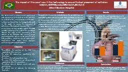
Theresa M Damiani NOAA National Geodetic Survey Geosciences Research Division CGSIC 2013 Nashville 1b Surveying Mapping and Geosciences Session Aerial Surveying All types of aircraft helicopter fixed wing balloon UAS ID: 908589
Download Presentation The PPT/PDF document "Use of High-Rate CORS for Airborne Pos..." is the property of its rightful owner. Permission is granted to download and print the materials on this web site for personal, non-commercial use only, and to display it on your personal computer provided you do not modify the materials and that you retain all copyright notices contained in the materials. By downloading content from our website, you accept the terms of this agreement.


Slide1
Use of
High-Rate CORS for Airborne Positioning
Theresa M.
Damiani
NOAA- National Geodetic Survey,
Geosciences Research Division
CGSIC 2013, Nashville
1b. Surveying, Mapping, and Geosciences Session
Slide2Aerial SurveyingAll types of aircraft (helicopter, fixed wing, balloon, UAS)Many tools for surveying, mapping, and geosciences.
Photogrammetry, (Topo-Bathy) LIDAR, Gravity, Magnetics, Hyperspectral or Multispectral, Radiometric, etc.Advantages: Cover a lot of ground quickly and with consistent sampling
Positioning is crucial!
Slide3Critical to U.S. National Geodetic Survey’s (NGS’) mission to define, maintain, and provide access to the U.S. National Spatial Reference System
Gravity for the
R
edefinition of the
A
merican Vertical
Datum (GRAV-D)
2007 – 2022 (9 years remaining)
Airborne Gravity SnapshotTarget: 2 cm accuracy orthometric heightsCoastal Mapping ProgramPhotogrammetry and Topo-Bathy LIDAREmergency Response Imagery
NGS Airborne Programs
Slide4Positioning
High-altitude, high-speed, long duration flights for gravimetryLow-altitude, slow-speed, short duration for coastal mapping
Traditionally, Differential Single Baseline or Differential Network
Consecutive epochs at 1 Hz required
I
nertial measurements for aircraft orientations
IMU
GPS Antenna
Instrumentation
CORS
Slide5Differential Positioning and CORS
Two GRAV-D surveys completed in 2008/2009
Puerto Rico and Virgin Islands
Louisiana
Slide6Kinematic GPS Processing ChallengeLouisiana 2008Two daysAltitude: 35k ft. (~10 km)Longest Baseline: 400 km
Flight Time: 3.5 HoursNetwork and Single Baseline Differential positions are equivalent, no matter which station is used as the basePrecise Point Positioning (PPP) is equivalent
New Orleans
Post-Processing
Not Applicable to Low-Altitude
Slide7Immediate PositioningPPP cannot be used for immediate processing of airborne data, since it requires precise IGS ephemeris (Lag time: 12 days)For quality control during a survey, you must have one or more bases. How many? Where located?
For rapid response or easy logistics, can you use one?Single point of failure; high risk for long duration missions; Use CORS as a backup station
Slide8Causes of GPS Failures at AirportsJammingOcclusionsOther broadcastsHardware breaks
Batteries don’t last
Data card fails
Human error
Slide9UASUnmanned Aerial Systems (UAS) of great interest to surveying and mapping in U.S.Logistically desirable- less equipment, less personnel, less fuelFast, easy deployment
In-field quality control without setting up your own base stations would be advantageous- can CORS support that?
Slide10High-Rate CORS Available Now1 Hz data rate necessaryRestriction for use as a base station in airborne positioning: Located within ~15 km of the airportPros: Managed, permanent site; low effort
Cons: No control over quality and continuity~670 1s stations in networkConcentrated in eastern 1/3 of U.S. and West Coast
Slide11Map of Operational 1s CORS
Slide12Co-location with airports
Slide13ConclusionsAirborne positioning for geoscience applications benefits from the co-location of high-rate CORS with U.S. airportsWith potential increase in UAS surveying, low-effort and rapid aerial deployments are of continuing interest
Over most of the U.S., airborne operators currently have to run at least 1 of their own base stations. Some places (like Wichita, KS) are CORS-ready for rapid deployment.
NGS Programs
Information:
http://
www.ngs.noaa.gov/GRAV-D http://www.ngs.noaa.gov/RSD
Contact:Dr. Theresa Damiani
theresa.damiani@noaa.gov