04
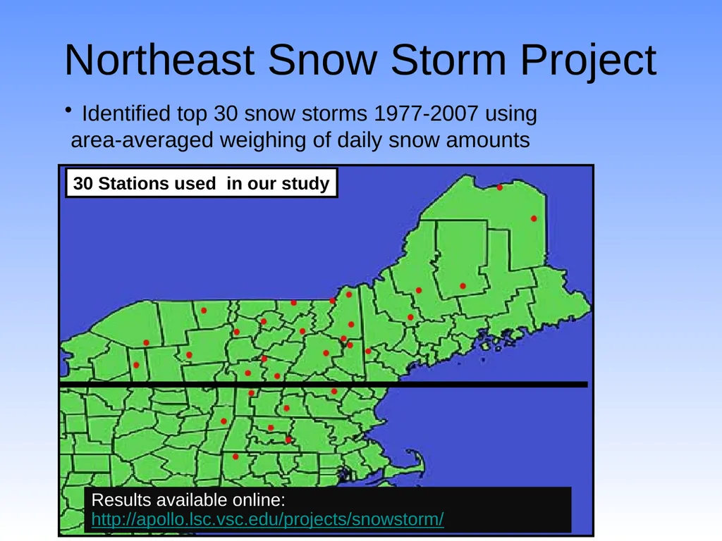
Northeast Snow Storm Project Identified top 30 snow storms 1977-2007 using
area-averaged weighing of daily snow amounts Results available online: http://apollo.lsc.vsc.edu/projects/snowstorm/<br>
05
Mar 13-14, 1993: Snow Totals<br>
06
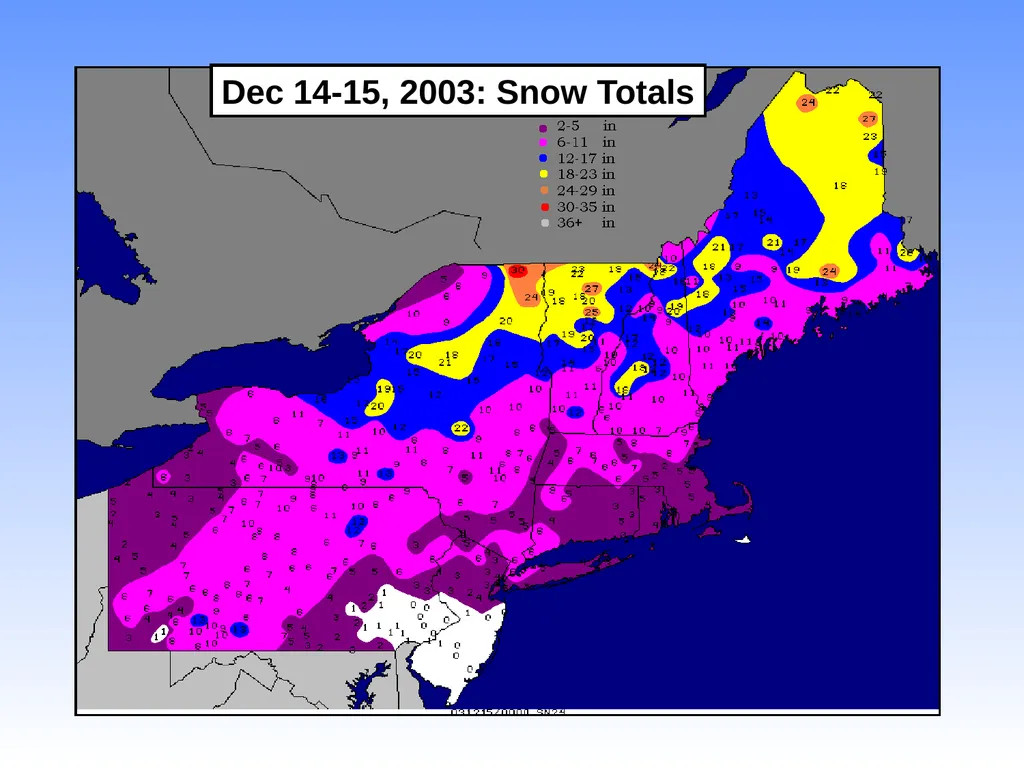
Dec 14-15, 2003: Snow Totals<br>
07
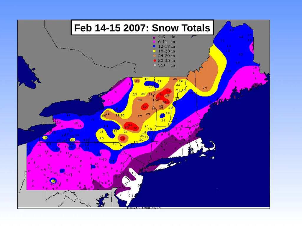
Feb 14-15 2007: Snow Totals<br>
08
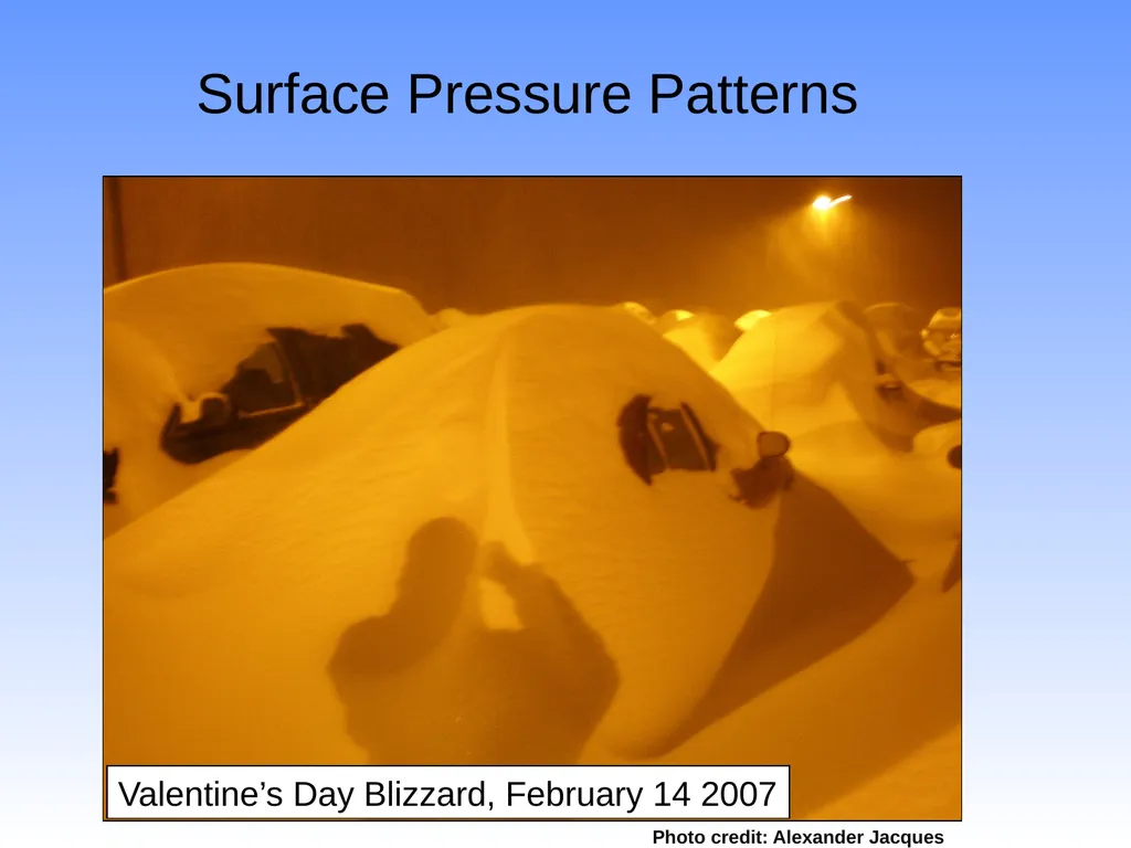
Surface Pressure Patterns Valentine’s Day Blizzard, February 14 2007 Photo credit: Alexander Jacques<br>
09
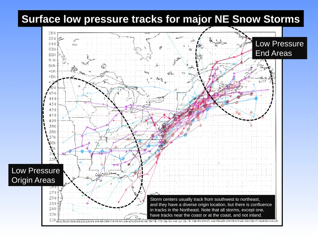
Surface low pressure tracks for major NE Snow Storms Low Pressure
Origin Areas Storm centers usually track from southwest to northeast,
and they have a diverse origin location, but there is confluence
in tracks in the Northeast. Note that all storms, except one,
have tracks near the coast or at the coast, and not inland. Low Pressure
End Areas<br>
10
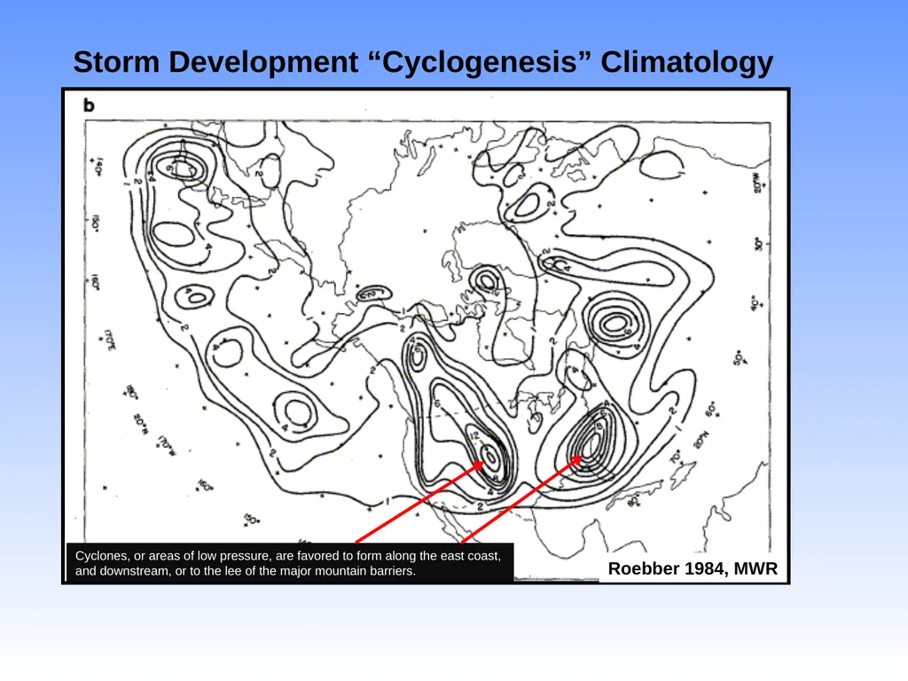
Roebber 1984, MWR Storm Development “Cyclogenesis” Climatology Cyclones, or areas of low pressure, are favored to form along the east coast,
and downstream, or to the lee of the major mountain barriers.<br>
11
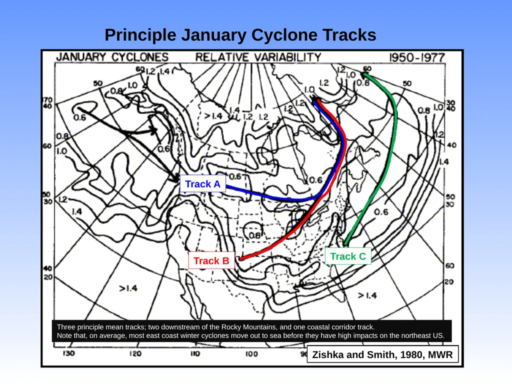
Principle January Cyclone Tracks Zishka and Smith, 1980, MWR Three principle mean tracks; two downstream of the Rocky Mountains, and one coastal corridor track.
Note that, on average, most east coast winter cyclones move out to sea before they have high impacts on the northeast US. Track A Track B Track C<br>
12
Why is the east coast favored �for cyclone or low pressure formation? Gulf Stream Current Cold Continental
Air Masses Juxtaposition of cold air masses
and warm temperatures related to
Ocean temperatures creates a strong
temperature gradient or “frontal zone” This creates baroclinic instability, which
is an instability resulting from a strong
temperature gradient; Mother Nature does
not like strong temperature gradients, so
a midlatitude cyclone develops to even out
this gradient and bring warm air north and
cold air south.<br>
13
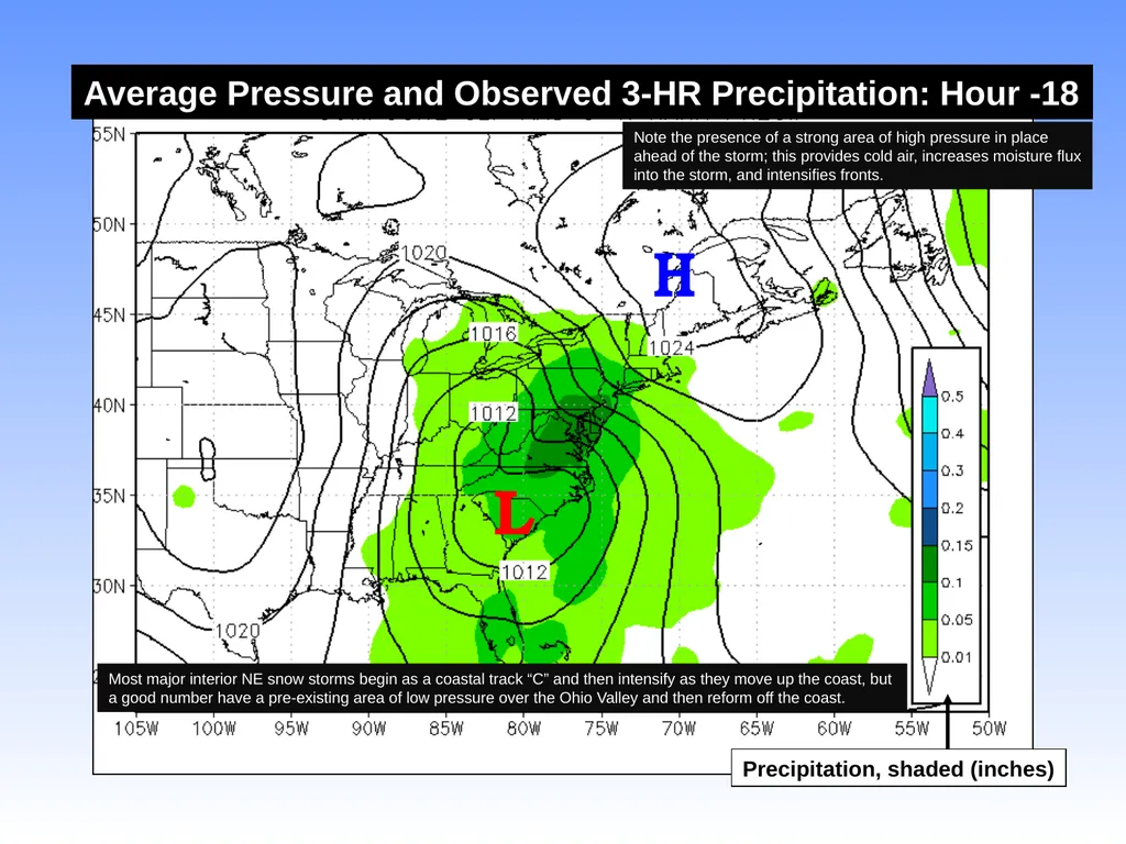
Average Pressure and Observed 3-HR Precipitation: Hour -18 Precipitation, shaded (inches) L H Most major interior NE snow storms begin as a coastal track “C” and then intensify as they move up the coast, but
a good number have a pre-existing area of low pressure over the Ohio Valley and then reform off the coast. Note the presence of a strong area of high pressure in place
ahead of the storm; this provides cold air, increases moisture flux
into the storm, and intensifies fronts.<br>
14
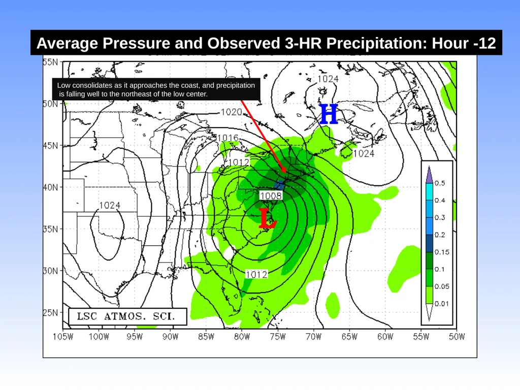
Average Pressure and Observed 3-HR Precipitation: Hour -12 L H Low consolidates as it approaches the coast, and precipitation
is falling well to the northeast of the low center.<br>
15
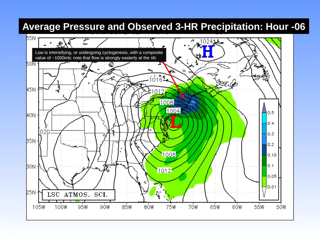
Average Pressure and Observed 3-HR Precipitation: Hour -06 L H Low is intensifying, or undergoing cyclogenesis, with a composite
value of ~1000mb; note that flow is strongly easterly at the sfc<br>
16
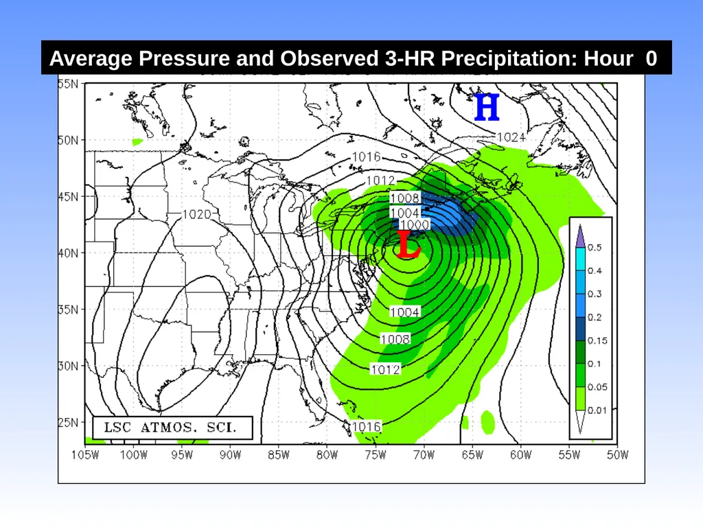
Average Pressure and Observed 3-HR Precipitation: Hour 0 L H<br>
17
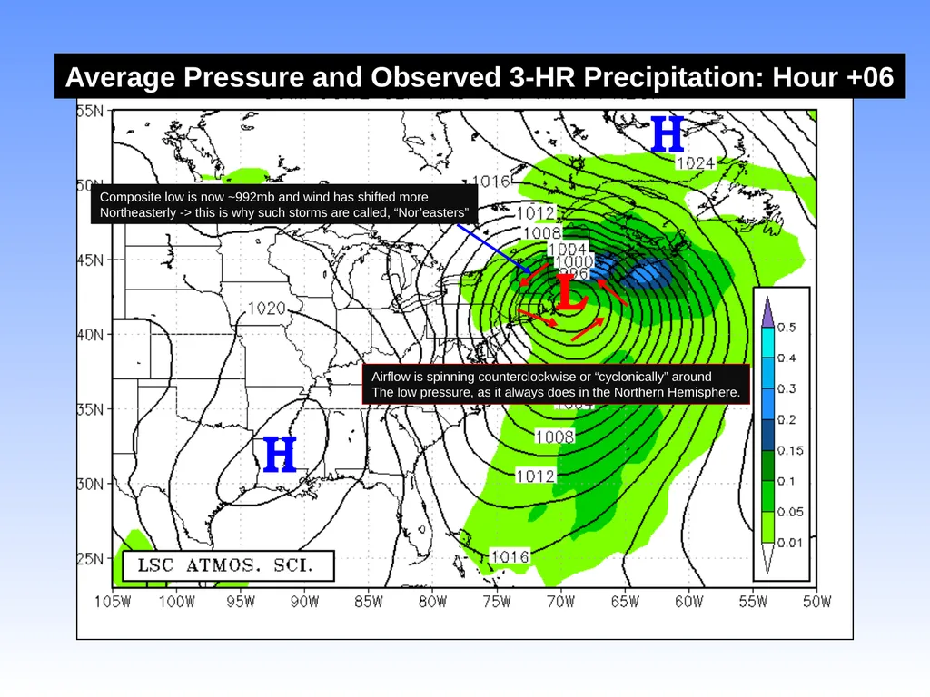
Average Pressure and Observed 3-HR Precipitation: Hour +06 L H H Composite low is now ~992mb and wind has shifted more
Northeasterly -> this is why such storms are called, “Nor’easters” Airflow is spinning counterclockwise or “cyclonically” around
The low pressure, as it always does in the Northern Hemisphere.<br>
18
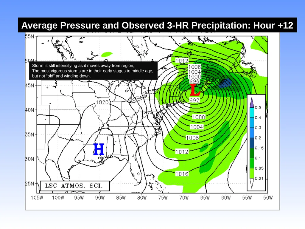
Average Pressure and Observed 3-HR Precipitation: Hour +12 L H Storm is still intensifying as it moves away from region;
The most vigorous storms are in their early stages to middle age,
but not “old” and winding down.<br>
19
Moisture Source and Evolution<br>
20
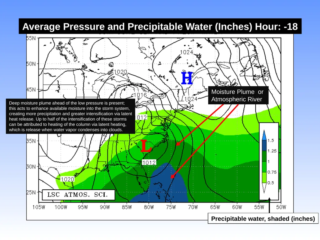
Average Pressure and Precipitable Water (Inches) Hour: -18 H L Precipitable water, shaded (inches) Deep moisture plume ahead of the low pressure is present;
this acts to enhance available moisture into the storm system,
creating more precipitation and greater intensification via latent
heat release. Up to half of the intensification of these storms
can be attributed to heating of the column via latent heating,
which is release when water vapor condenses into clouds. Moisture Plume or
Atmospheric River<br>
21
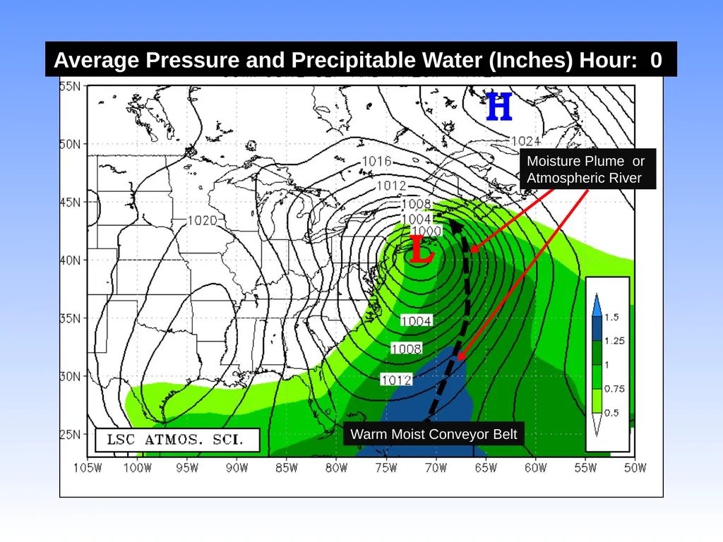
Average Pressure and Precipitable Water (Inches) Hour: 0 H L Moisture Plume or
Atmospheric River Warm Moist Conveyor Belt<br>
22
Temperature Pattern<br>
23
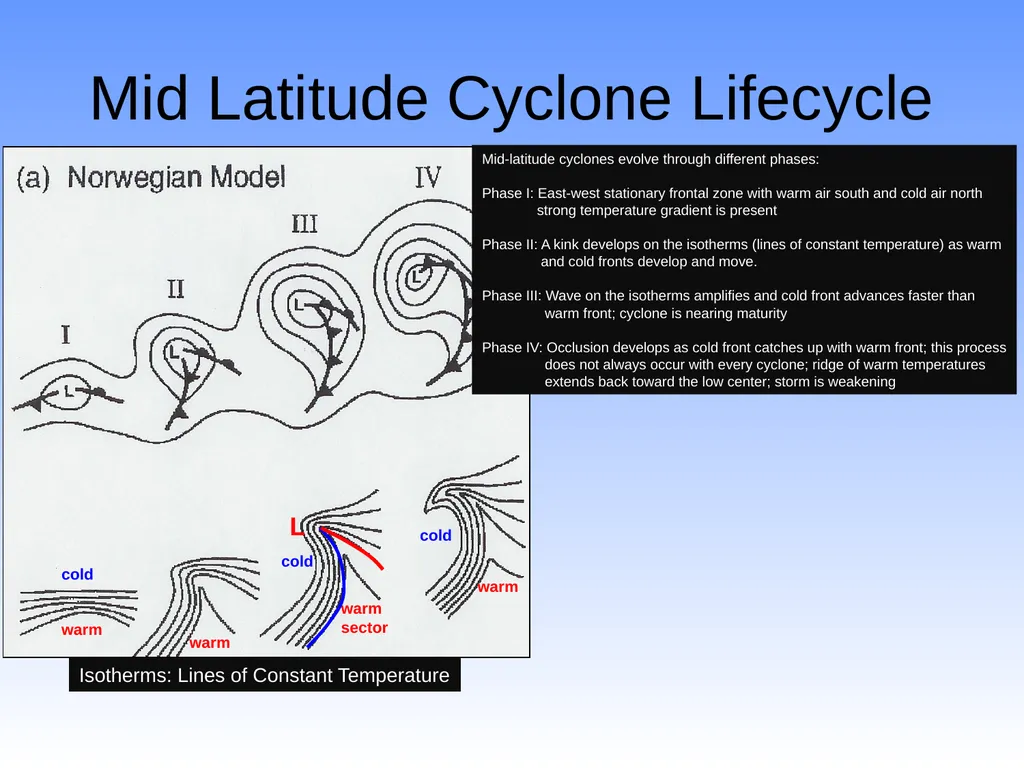
Mid Latitude Cyclone Lifecycle Mid-latitude cyclones evolve through different phases:
Phase I: East-west stationary frontal zone with warm air south and cold air north
strong temperature gradient is present
Phase II: A kink develops on the isotherms (lines of constant temperature) as warm
and cold fronts develop and move.
Phase III: Wave on the isotherms amplifies and cold front advances faster than
warm front; cyclone is nearing maturity
Phase IV: Occlusion develops as cold front catches up with warm front; this process
does not always occur with every cyclone; ridge of warm temperatures
extends back toward the low center; storm is weakening Isotherms: Lines of Constant Temperature warm warm warm
sector warm cold cold cold L<br>
24
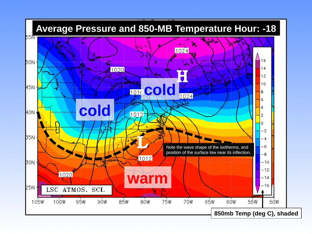
Average Pressure and 850-MB Temperature Hour: -18 H 850mb Temp (deg C), shaded L Note the wave shape of the isotherms, and
position of the surface low near its inflection. warm cold cold<br>
25
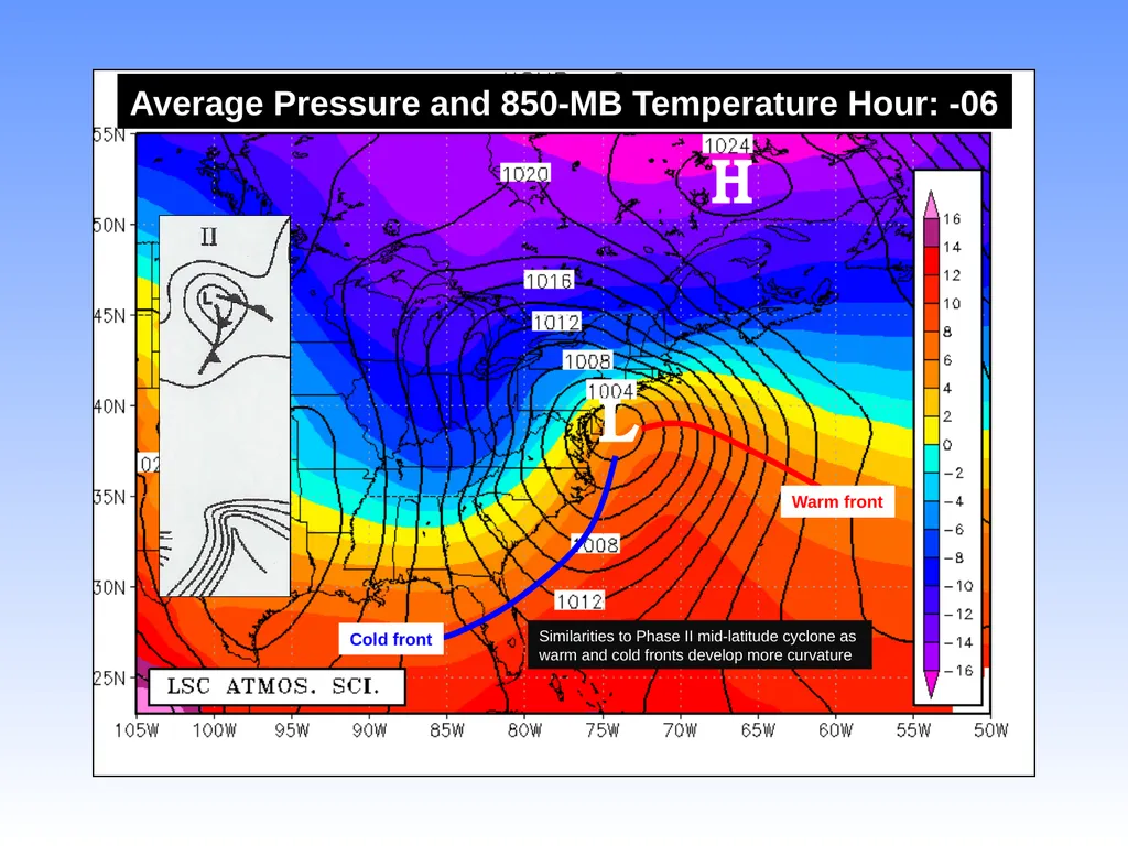
Average Pressure and 850-MB Temperature Hour: -06 H L Similarities to Phase II mid-latitude cyclone as
warm and cold fronts develop more curvature Warm front Cold front<br>
26
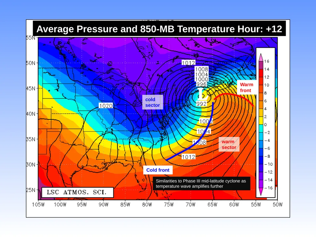
Average Pressure and 850-MB Temperature Hour: +12 Similarities to Phase III mid-latitude cyclone as
temperature wave amplifies further Warm
front Cold front L warm
sector cold
sector<br>
27
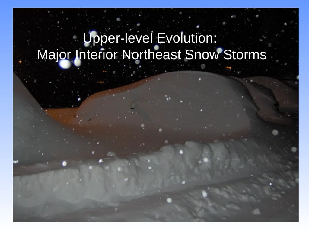
Upper-level Evolution: �Major Interior Northeast Snow Storms<br>
28
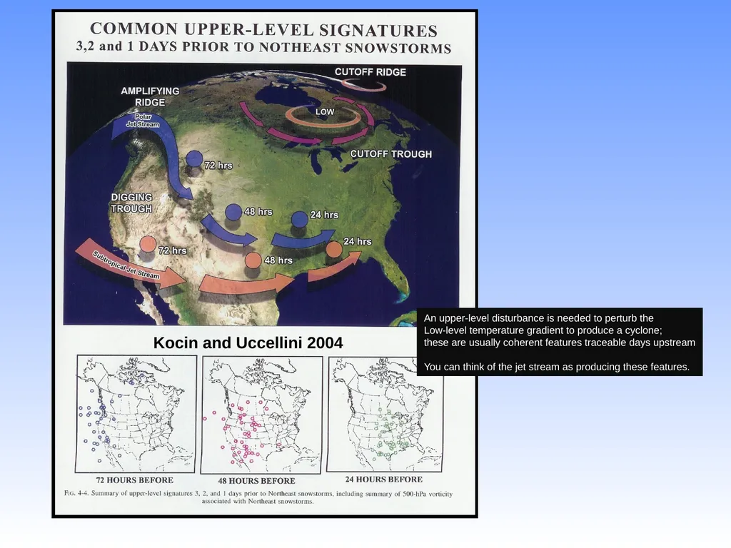
Kocin and Uccellini 2004 An upper-level disturbance is needed to perturb the
Low-level temperature gradient to produce a cyclone;
these are usually coherent features traceable days upstream
You can think of the jet stream as producing these features.<br>
29
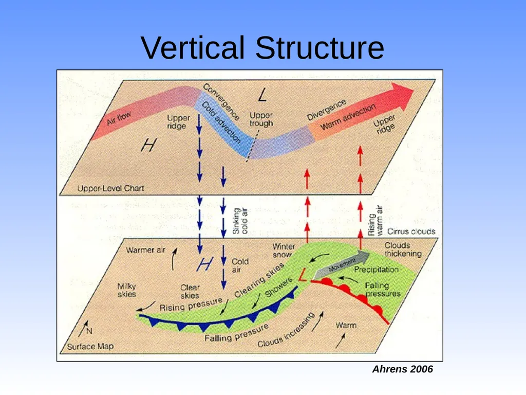
Vertical Structure Ahrens 2006<br>
30
Forecasting East Coast �Snow Storms<br>
31
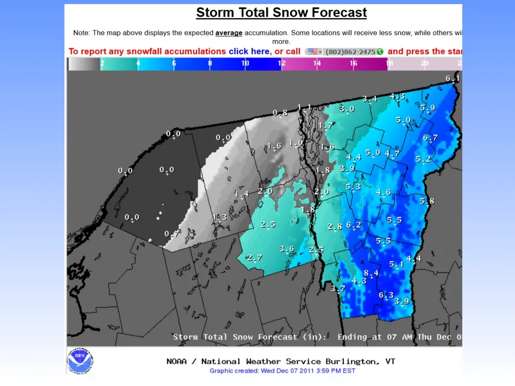
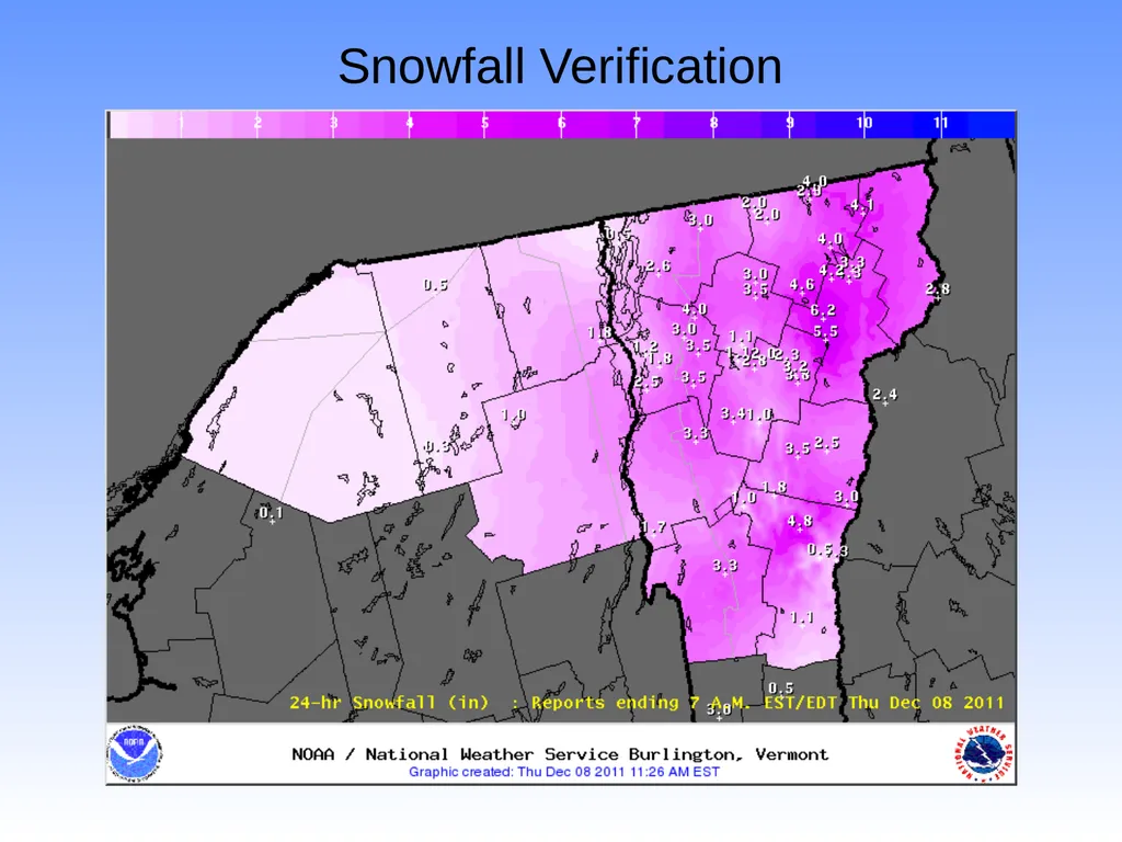
Snowfall Verification<br>
32
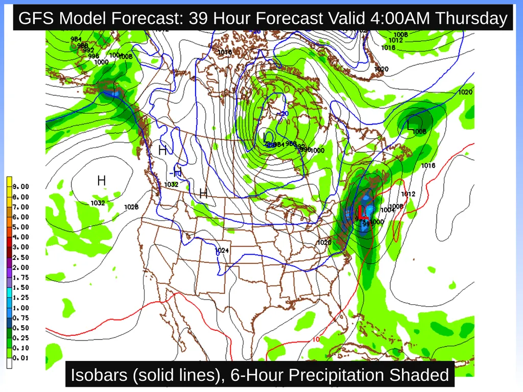
GFS Model Forecast: 39 Hour Forecast Valid 4:00AM Thursday Isobars (solid lines), 6-Hour Precipitation Shaded L<br>
33
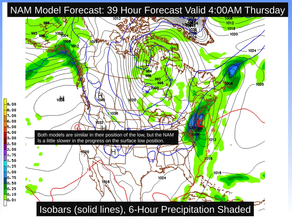
NAM Model Forecast: 39 Hour Forecast Valid 4:00AM Thursday Both models are similar in their position of the low, but the NAM
Is a little slower in the progress on the surface low position. Isobars (solid lines), 6-Hour Precipitation Shaded L<br>
34
Assessing Forecast Uncertainty<br>
35
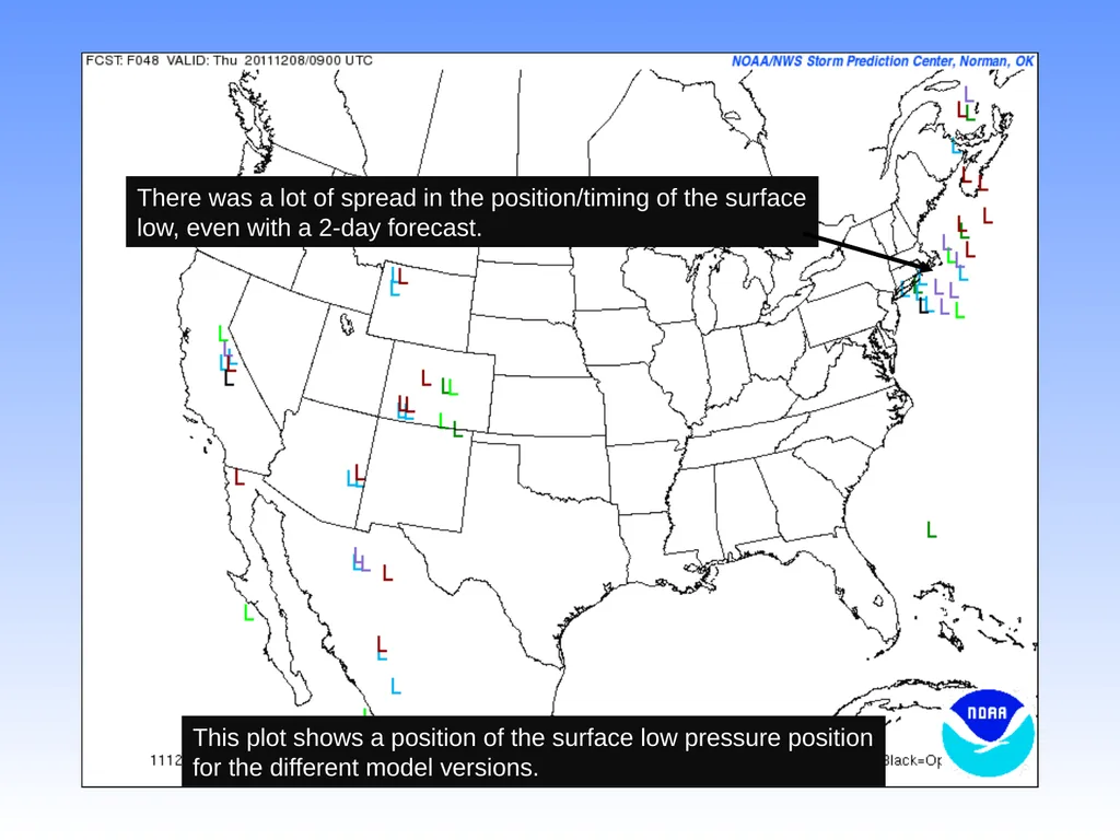
There was a lot of spread in the position/timing of the surface
low, even with a 2-day forecast. This plot shows a position of the surface low pressure position
for the different model versions.<br>
36
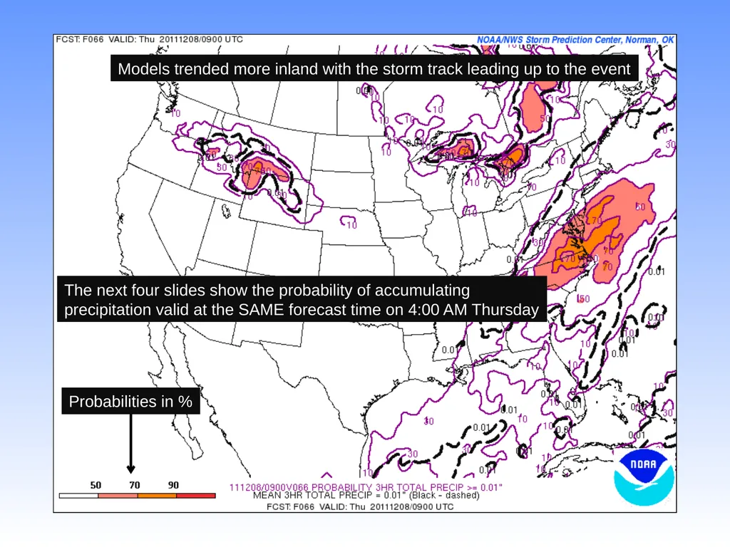
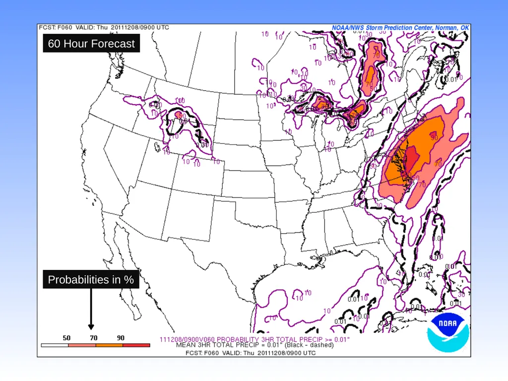
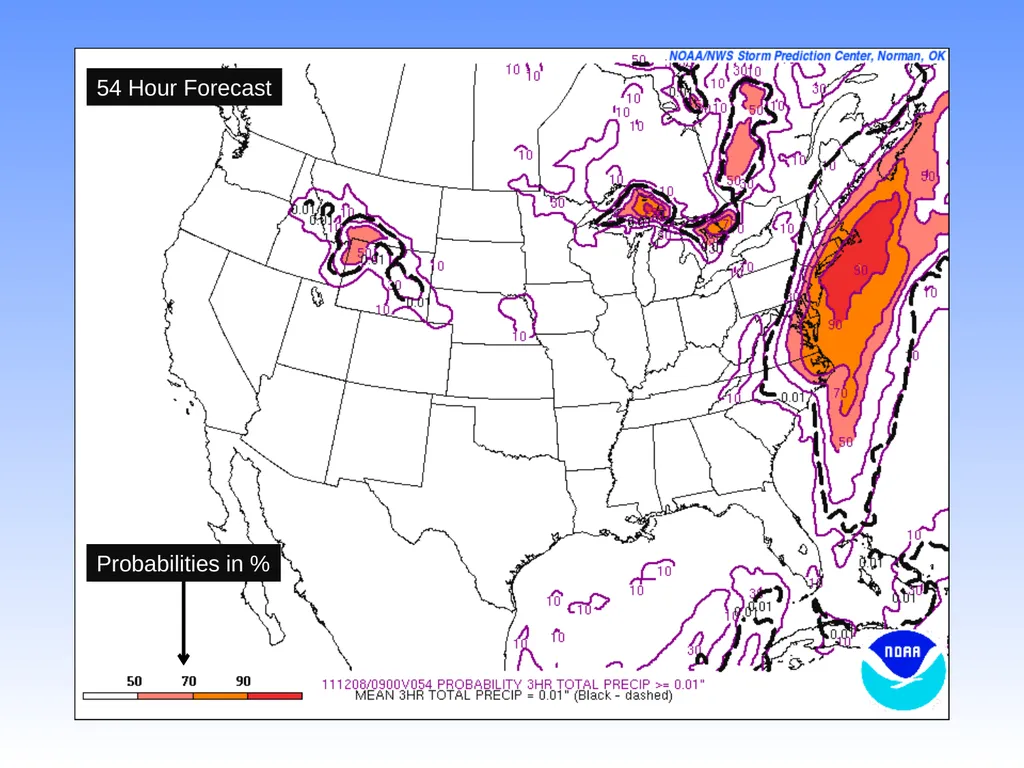
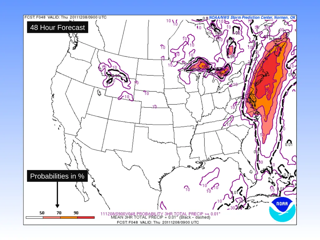
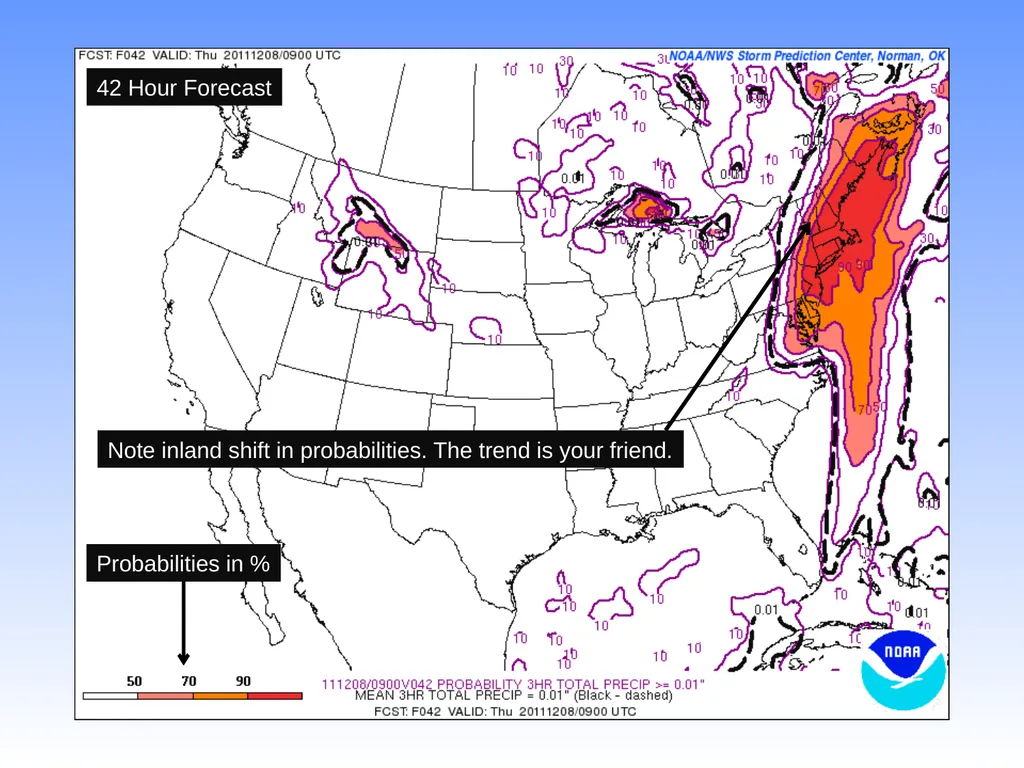
Models trended more inland with the storm track leading up to the event The next four slides show the probability of accumulating
precipitation valid at the SAME forecast time on 4:00 AM Thursday Probabilities in %<br>
37
Probabilities in % 60 Hour Forecast<br>
38
Probabilities in % 54 Hour Forecast<br>
39
Probabilities in % 48 Hour Forecast<br>
40
Note inland shift in probabilities. The trend is your friend. Probabilities in % 42 Hour Forecast<br>
41
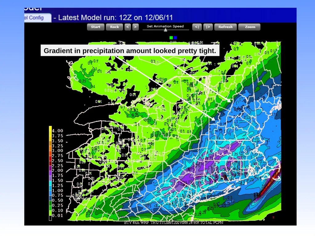
Gradient in precipitation amount looked pretty tight.<br>
42
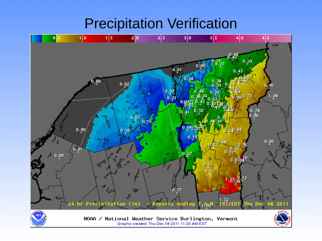
Precipitation Verification<br>
43
NAM Model Forecast Simulated Radar Imagery Valid 4:00AM Thursday<br>
44
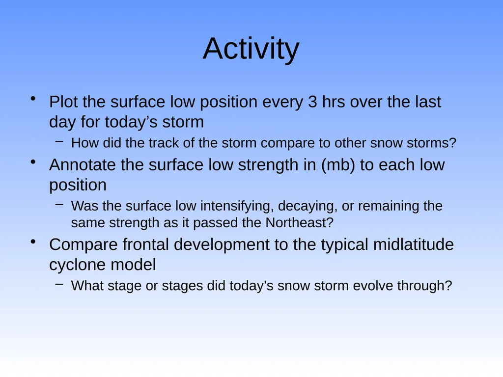
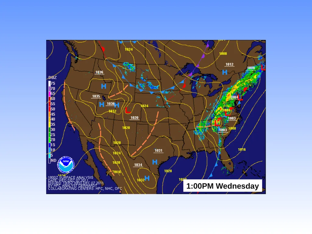
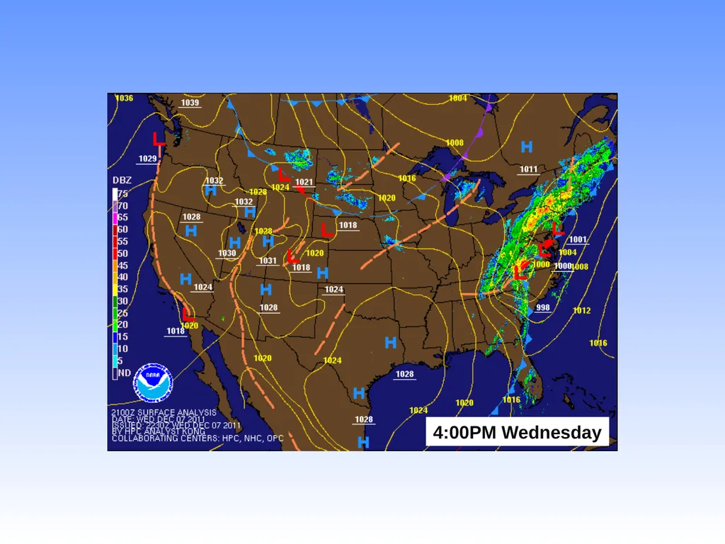
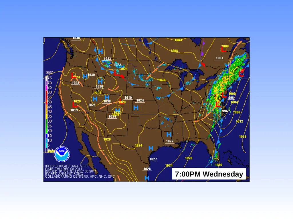
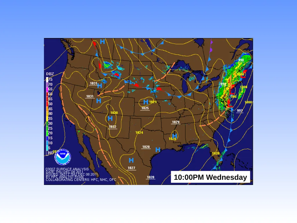
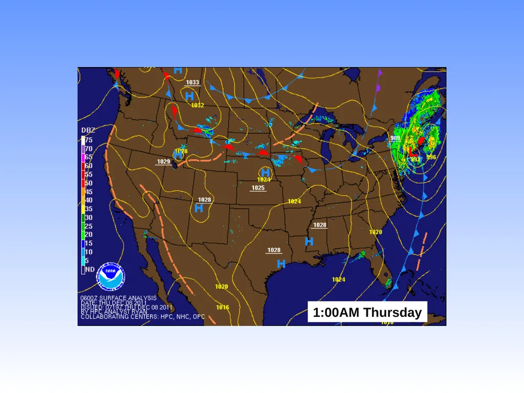
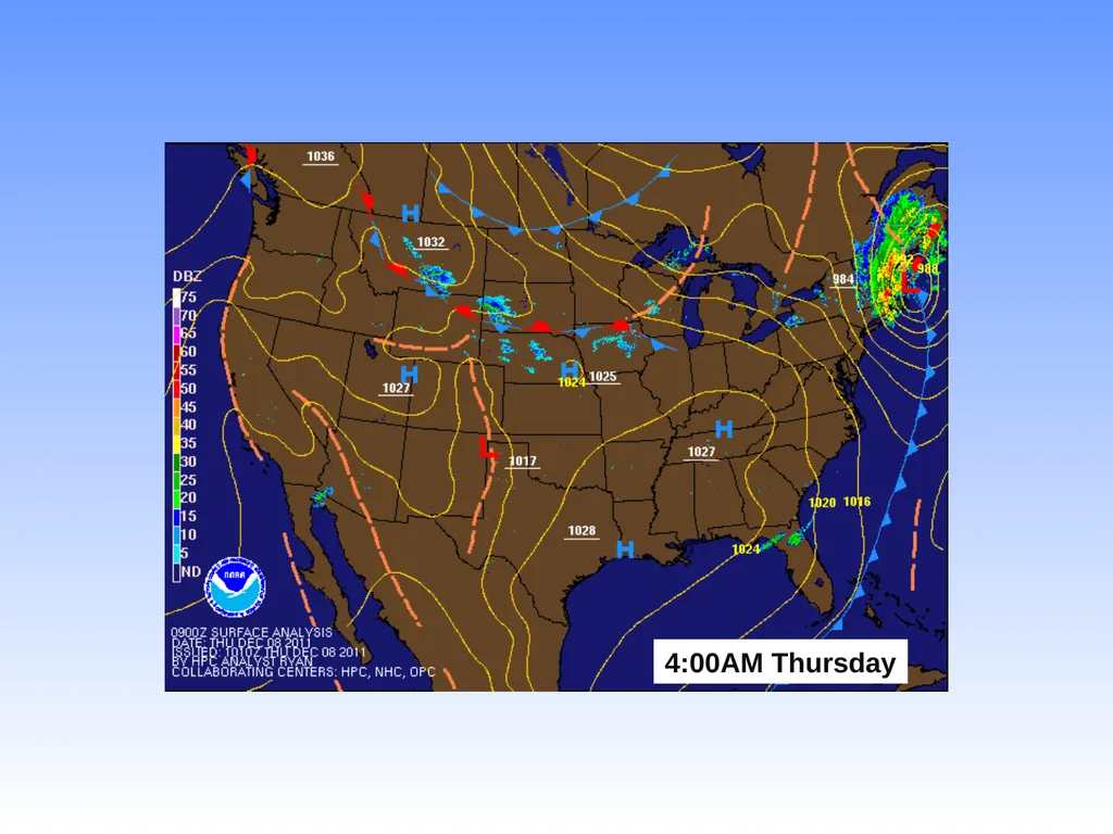
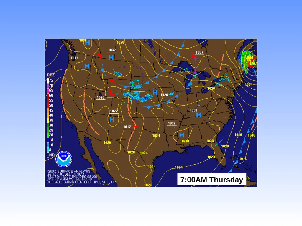
Activity Plot the surface low position every 3 hrs over the last day for today’s storm
How did the track of the storm compare to other snow storms?
Annotate the surface low strength in (mb) to each low position
Was the surface low intensifying, decaying, or remaining the same strength as it passed the Northeast?
Compare frontal development to the typical midlatitude cyclone model
What stage or stages did today’s snow storm evolve through?<br>
52
L 1003mb 998 996 992 989 984 980 L L L L L L<br>
54
Resources Lyndon Snow Storm Project: http://apollo.lsc.vsc.edu/projects/snowstorm/
NOAA Weather Forecast Models: http://mag.ncep.noaa.gov/NCOMAGWEB/appcontroller?prevpage=index&MainPage=index&cat=MODEL+GUIDANCE&page=MODEL+GUIDANCE
Burlington Weather.com: http://www.burlington-weather.com/models.php
NWS Burlington: http://www.erh.noaa.gov/er/btv/
Daily Observed Temperatures and Precipitation via NWS: http://www.erh.noaa.gov/btv/html/climatemaps/
Contact: jason.shafer@lyndonstate.edu<br>