
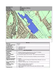
2 Site Location Information City or Town Hillsboro State or Province Oregon3 GNSS Receiver Information31 Receiver Type LEICA GR10 Satellite Syst ID: 836530
Download Pdf The PPT/PDF document "JIME Site Information Form WACOSU Co..." is the property of its rightful owner. Permission is granted to download and print the materials on this web site for personal, non-commercial use only, and to display it on your personal computer provided you do not modify the materials and that you retain all copyright notices contained in the materials. By downloading content from our website, you accept the terms of this agreement.


1 JIME Site Information Form WACOSU Co
JIME Site Information Form WACOSU Continuously Operating Reference Station0. Form Prepared by (full name) : cors-adm Date Prepared : 2013-08-061. Site Identification of the GNSS Monument Site Name : JIM ELAM Four Character ID : JIME 2. Site Location Information City or Town : Hillsboro State or Province : Oregon3. GNSS R
2 eceiver Information3.1 Receiver Type
eceiver Information3.1 Receiver Type : LEICA GR10 Satellite System : GPS+GLO3.x Receiver Type : (A20, from rcvr_ant.tab; see instructions)4. GNSS Antenna Information4.1 Antenna Type : LEIAS10 NONE Serial Number : 10461001 Antenna Reference Point : BPA� Marker-ARP Up Ecc. (m) : 0.00004.x Antenna Type : (A2
3 0, from rcvr_ant.tab; see instructions)55")
0, from rcvr_ant.tab; see instructions)5. Surveyed Local Ties5.x Tied Marker Name : Tied Marker Usage : (SLR/VLBI/LOCAL 6. Frequency Standard6.1 Standard Type : (INTERNAL or EXTERNAL H-MASER/CESIUM/etc)6.x Standard Type : (INTERNAL or EXTERNAL H-MASER/CESIUM/etc)7. Collocation Information7.1 Instrumentation Type : GPS Status : PERM
4 ANENT7.x Instrumentation Type : (GP
ANENT7.x Instrumentation Type : (GPS/GLONASS/DORIS/PRARE/SLR/VLBI/TIME/etc)8. Meteorological Instrumentation8.1.1 Humidity Sensor Model : Manufacturer :8.1.x Humidity Sensor Model : Manufacturer : Notes : (multiple lines)8.2.1 Pressure Sensor Model : Manufacturer :8.2.x Pressure Sensor Model : Manufacturer
5 :8.3.1 Temp. Sensor Model : M
:8.3.1 Temp. Sensor Model : Manufacturer :8.3.x Temp. Sensor Model : Manufacturer :8.4.1 Water Vapor Radiometer : Manufacturer : 8.4.x Water Vapor Radiometer : Manufacturer :8.5.1 Other Instrumentation : (multiple lines)9. Local Ongoing Conditions Possibly Affecting Computed Position9.1.1 Radio Interferences : (TV/CELL PHONE A
6 NTENNA/RADAR/etc) Observed Degrada Observed Degrada")
NTENNA/RADAR/etc) Observed Degradations : (SN RATIO/DATA GAPS/etc)9.1.x Radio Interferences : (TV/CELL PHONE ANTENNA/RADAR/etc) Observed Degradations : (SN RATIO/DATA GAPS/etc)9.2.1 Multipath Sources : (METAL ROOF/DOME/VLBI ANTENNA/etc)9.2.x Multipath Sources : (METAL ROOF/DOME/VLBI ANTENNA/etc)9.3.1 Signal Obstructions : (TREES/BUILDLINGS/etc) Effective Dates :
7 (CCYY-MM-DD/CCYY-MM-DD)9.3.x Signal Obs9.3.x Signal Obs")
(CCYY-MM-DD/CCYY-MM-DD)9.3.x Signal Obstructions : (TREES/BUILDLINGS/etc) Effective Dates : (CCYY-MM-DD/CCYY-MM-DD)10. Local Episodic Effects Possibly Affecting Data Quality10.1 Date : (CCYY-MM-DD/CCYY-MM-DD) Event : (TREE CLEARING/CONSTRUCTION/etc)10.x Date : (CCYY-MM-DD/CCYY-MM-DD) Event : (TREE CLEARI
8 NG/CONSTRUCTION/etc)11. On-Site, Point11. On-Site, Point")
NG/CONSTRUCTION/etc)11. On-Site, Point of Contact Agency Information Agency : Washington County Surveyor's Office12. Responsible Agency (if different from 11.) Agency : (multiple lines) Preferred Abbreviation : (A10)13. More Information Primary Data Center : Secondary Data Center : Hardcopy on File Site Map : (Y or