
SO 442 Tropical Meteorology Space and timescales of dynamical atmospheric processes SOURCE UCAR Climate PDO Years ENSO Seasons Monsoons MonthsWeeks MJO Atmospheric Scales of Motion ID: 776115
Download Presentation The PPT/PDF document " The Madden-Julian Oscillation" is the property of its rightful owner. Permission is granted to download and print the materials on this web site for personal, non-commercial use only, and to display it on your personal computer provided you do not modify the materials and that you retain all copyright notices contained in the materials. By downloading content from our website, you accept the terms of this agreement.


Slide1
The Madden-Julian Oscillation
SO 442
–
Tropical Meteorology
Slide2Space and time-scales of dynamical atmospheric processes. SOURCE: UCAR
Climate
: PDO
Years
: ENSO
Seasons:
Monsoons
Months/Weeks:
MJO
Atmospheric Scales of Motion
Slide3MJO- an intraseasonal event
Prior to 1971, it was thought that virtually all variability in the weather conditions within a given season in the Tropics was random.
There were indications of
interseasonal
(
eg
, June vs. December) and
interannual
(
eg
, 2006 vs 2007)
variations
, such as ENSO
But studies of tropical rainfall and pressure changes tended not to focus on oscillations on other time periods
Slide4What is the MJO?
Large-scale disturbance of deep convection and winds that controls up to half of the variance of tropical convection in some regionsNow known to be a major propagator of weather systems
Slide5The Madden-Julian Oscillation (MJO)
Important features:Discovered in the 1960s by Dr. Roland Madden and Dr. Paul Julian of NCARConvectively coupled disturbance that propagates eastward across the Tropics 5-10 m s-1 propagation speed in the Indian and west Pacific, where MJO convective variability is strongly coupled to the large-scale flow.Simple baroclinic wind structure, with 850 hPa and 200 hPa wind perturbations 180o out of phaseCharacteristic timescales of 30-90 days.
Madden and Julian 1972
Univ of Munich Physics Dept
Slide6Climate of the extratropics & oceans
Newman, M., M. Alexander, T. R. Ault, K. M. Cobb, C.
Deser, E. Di Lorenzo, and e. al. (2016), The Pacific decadal oscillation, revisited, J. Clim., in press.
ENSO teleconnections (red), ocean waves (blue), atmospheric extratropical variability (orange), and the reemergence of temperature anomaly from below the mixed layer (green). With the exception of the reemergence and of the coastal waves, most of these processes impact the PDO by influencing changes in the Aleutian Low, which is the main driver of the PDO (grey). (CLIVAR, 2016).
MJO
Modified from:
Slide7The MJO - A Description
A 30-60 day oscillation in the coupled Tropical ocean-atmosphere systemAn eastward progression of enhanced and suppressed convectionLow level and upper level wind patterns show distinct anomaliesStrong year to year variability in MJO that is related to ENSO cycle
Slide8climate.gov
MJO is a very large scale oscillation (approximately 15,000 km east-west distance)
Centered on the equatorFeatures: one region of upward motion (favoring convection) and one region of downward motion (favoring drier conditions)
Note: in this graphic, the MJO is
not
one thunderstorm that covers an entire ocean. Such a thing doesn’t exist! Rather, in the region represented by the cloud, MJO favors the development of more thunderstorms than normal
Slide9MJO Structure in Outgoing Longwave Radiation (OLR): Indian Ocean and Western Pacific, Phases 1-8
convective anomaly subsidence anomaly
convective
component
subsidencecomponent
1
2
3
4
5
8
7
6
Slide10MJO couplet (one region of upward motion and one region of downward motion) moves eastward along the equator
Why does it move along the equator, and not off the equator?
MJO really is an “
equatorally
trapped” Kelvin wave
Coriolis force acts to trap the MJO wave along the equator
Over a 3-5 week period, the MJO convective couplet can transit the tropical eastern hemisphere
Slide11Univ of Washington Atmos Sci dept
NOAA Pacific Northwest Laboratory (PNL)
US
Dept
of Energy
More views of the MJO convective couplet – not just thunderstorms but also specific humidity and wind anomalies, too!
The passage of the MJO across the tropical oceans also shows up in SST anomalies
Slide12Background: MJO and Global Circulation
MJO impacts global atmospheric weather patterns on intraseasonal timescales via upper tropospheric teleconnections (Hoskins and Karoly, 1981; Sardeshmukh and Hoskins, 1988).
Figure
.
a)
300
mb height field response in to a heat source (shaded region simulating MJO convection) in a
barotropic
global model (Hoskins and
Karoly
JAS
, 1981).
b)
Theoretical equivalent barotropic
streamfunction
at 300 mb resulting from heat source (red oval) similar to the MJO (adapted from
Sardeshmukh
and Hoskins 1988).
Slide13MJO Cluster Structure
Jon Gottschalck, NOAA Climate Prediction Center
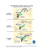
Slide14MJO Forecasting
Jon Gottschalck, NOAA Climate Prediction Center
Slide15MJO Forecasting
NOAA Climate Prediction Center
Slide16MJO teleconnections: linking the tropics to the high latitudes
One of the major elements of research in the Oceanography Department over the past 10 years has been to discover
subseasonal
variability of the atmosphere, ocean, and cryosphere
The Madden-Julian Oscillation is one of the most significant drivers of those teleconnections!
How does the MJO connect to the high latitudes?
Latent
heat
released
by
MJO
convection
excited
eastward
- and
poleward-propagating
Rossby
waves
Those
Rossby
waves
are
associated
with
high
and
low
pressure
,
which
controls
the
weather
(
wind
, temperatura,
precipitation
, and
cloud
)
patterns
all
around
the
world
!
Slide17MJO teleconnections
MJO convection over the Maritime Continent (MJO phases 4 & 5) drives a strong polar Jet stream and blocking high over the Gulf of AlaskaAs the MJO shifts east (phases 6-8), the Pacific Jet stream extends east, tooThat jet stream then advects copious amounts of water vapor and precipitation into the US west coastThe low can sometimes set up over the central Rocky Mountains and lead to severe weather (tornadoes and hail)