

Claudia Riedl ZAMG Austria Eumetrain Event Week on Droughts Floods and Land Slides 1 5 December 2014 Central Institute for Meteorology and Geodynamics Salzburg Austria Thats me and my cou ID: 837049
Download Pdf The PPT/PDF document "Landslides Structure of extreme rain fal..." is the property of its rightful owner. Permission is granted to download and print the materials on this web site for personal, non-commercial use only, and to display it on your personal computer provided you do not modify the materials and that you retain all copyright notices contained in the materials. By downloading content from our website, you accept the terms of this agreement.


1 Landslides: Structure of extreme rain fa
Landslides: Structure of extreme rain fall events and the developement of a meteorological early warning system Claudia Riedl, ZAMG, Austria Eumet
2 rain, Event Week on Droughts, Floods and
rain, Event Week on Droughts, Floods and Land Slides, 1 â 5 December 2014 Central Institute for Meteorology and Geodynamics, Salzburg, Austria
3 That's me and my country INCA â
That's me and my country INCA â I ntegrated N owcasting through c omprehensive A nalysis INCA RADAR SATELLITES T
4 OPOGRAPHY OBSERVATIONS ALARO5 limi
OPOGRAPHY OBSERVATIONS ALARO5 limited area model ECMWF, Reading ECMWF global model Météo France, Toulouse ARPEGE gl
5 obal model HYDROLOGY WARNINGS
obal model HYDROLOGY WARNINGS PRODUCTS â A nalyses â Nowcasts â Forecasts INCA - Precipitation 600 - 800
6 stations for analysis Station interpol
stations for analysis Station interpolation Radar Radar scaled INCA Analysis INCA Standard Domain Region Eastern Alps Domain siz
7 e 700 x 400 km Elevation range 1
e 700 x 400 km Elevation range 100 - 4000 m Resolution Horizontal: 1 km Vertical: 150 m Time: 5 min â 1h Domains, INCA -
8 CE INCA 2 - D Analyses und Forecast
CE INCA 2 - D Analyses und Forecasts ⢠Precipitation ⢠Precipitation type ⢠Cloudiness ⢠Global radiation 3 - D Analyses und
9 Forecasts ⢠Temperature ⢠Humidi
Forecasts ⢠Temperature ⢠Humidity ⢠Wind 2 - D Convective Analyses Fields ⢠CAPE ⢠CIN ⢠LCL ⢠LFC ⢠Instability In
10 dices (LI, Showalter, ..) ⢠Trigger
â¢
Trigger")
dices (LI, Showalter, ..) ⢠Trigger - Temperature - Deficit ⢠Equivalent Potential Temperature ⢠Moisture convergence ⢠Mass convergen
11 ce Other derived 2 - D Fields ⢠S
ce Other derived 2 - D Fields ⢠Surface temperature ⢠Snowfall line ⢠Icing potential ⢠Wind chill ⢠Visibility Horizontal
12 ⢠Lambert projection ⢠1x1 km â
⢠Lambert projection ⢠1x1 km ⢠4 domains (AU,SK,CZ,CH) Vertical ⢠True z - coordinate ⢠Shaved elements ⢠dz = 100 - 200 m
13 ⢠30 - 40 layers Variables Ari
⢠30 - 40 layers Variables Arial radar data lightning data satellite data POH field intensity field frequency map intens
14 ity fields combined - cells tracking
ity fields combined - cells tracking & nowcasting radar - cell tracking & nc lightning - cell tracking & nc satellite - cell tracking
15 & nc Arial CELL IDENTIFICATION RAD
& nc Arial CELL IDENTIFICATION RADAR DATA Identification of intensified precipitation cells on 2D Intensity maps: â Single Intensity Th
16 reshold* (38 dBZ) & Intensity Peak Se &
Intensity Peak Se")
reshold* (38 dBZ) & Intensity Peak Segmentation Algorithm â Area Threshold (6 km²) Calculation of 2D and 3D cell parameters LIGHTNING DATA
17 Identification of electrically active
Identification of electrically active regions Cell clustering: accumulation time* (9 min) maximum stroke distance* (8 km) Calculation of
18 lightning parameters * from sensitivi
lightning parameters * from sensitivity studies CELL PROGNOSES RADAR CELLS extrapolation of the previous movements (exponential weighted func
19 tion) or radar motion vector field whe
or radar motion vector field whe")
tion) or radar motion vector field when first detected LIGHTNING CELLS extrapolation of the previous movements (similar radar cells) or no ext
20 rapolation when first detected Cell Tr
rapolation when first detected Cell Tracking combined celltracks COMBINED TRACKING and NOWCASTING Definition Combined Cell : Radar and light
21 ning cells are assigned using spatially
ning cells are assigned using spatially overlapping regions of contemporaneous cells Tracking Combined Cell : âmost importantâ cell componen
22 t defines track (currently: radar - cell
t defines track (currently: radar - cell tracks are favored), other cells are also logged Combined Prognosis: currently: radar - cell prognosis
23 favored Cell Tracking radar cells
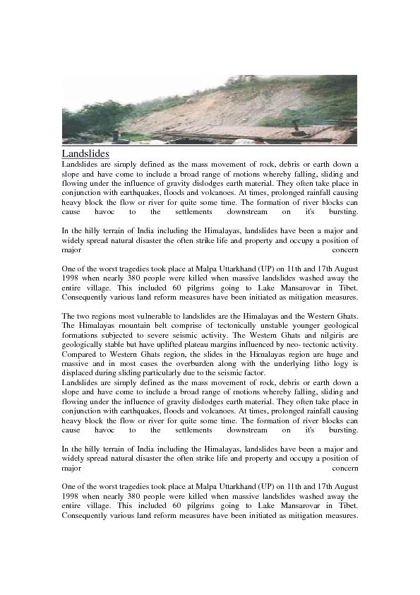
favored Cell Tracking radar cells lightning cells combined cells Landslides, Oberwölz, July 7th 2011 Landslides, Oberwölz, July 7th 2011
24 MUWA â meteorological early warnin
MUWA â meteorological early warning system of mudflows developed by Andreas Huber (BfW), Reinhard Fromm (BfW), Harald Schellander (ZAMG), Soph
25 ie Stuke (UIBK) ⢠Statistical relati
â¢
Statistical relati")
ie Stuke (UIBK) ⢠Statistical relationship between meteorological and topographic parameters Based on: ⢠Amount of rainfall at documen
26 ted mudflows (tresholds) ⢠Precipi
â¢
Precipi")
ted mudflows (tresholds) ⢠Precipitation forecast and previous rainfall impact for each INCA grid cell ⢠Topographic parameters for each I
27 NCA grid cell ⺠Propability of
NCA grid cell ⺠Propability of mudflow in an INCA grid cell MUWA â meteorological early warning system of mudflows MUWA â mete
28 orological early warning system of mudfl
orological early warning system of mudflows Data: Time, date, location and additional information for each documented mudflow (28 between 20
29 04 and 2012) Hydrological characteri
Hydrological characteri")
04 and 2012) Hydrological characteristics of the torrent catchments Precipitation data from meteorological/hydrological stations (15 min)
30 Topography: ALS - DHM (10 m resolution)")
Topography: ALS - DHM (10 m resolution) Land use maps Orthophotos MUWA â meteorological early warning system of mudflows Precipitatio
31 n Data: INCA 15 max sums of precip
n Data: INCA 15 max sums of precipitation Floating sums for different time intervalls Precipitaion data from weather stations MUWA â
32 meteorological early warning system
meteorological early warning system of mudflows MUWA â meteorological early warning system of mudflows Duration and intensity of mudflow
33 triggering rainfall MUWA â meteor
triggering rainfall MUWA â meteorological early warning system of mudflows Prediction function: Vectors for meteorological and topographi
34 c parameters (resolution 15 min) V
V")
c parameters (resolution 15 min) Vectors for mudflows (timestamp and duration) (resolution 15 min) Multiple linear regression for occurenc
35 e of mudflows MUWA â meteorologic
e of mudflows MUWA â meteorological early warning system of mudflows MUWA â meteorological early warning system of mudflows MUWA â
36 meteorological early warning system of
meteorological early warning system of mudflows MUWA â meteorological early warning system of mudflows MUWA â meteorological early war
37 ning system of mudflows MUWA â me
ning system of mudflows MUWA â meteorological early warning system of mudflows MUWA â meteorological early warning system of mudflows
38 MUWA â meteorological early warning
MUWA â meteorological early warning system of mudflows MUWA â meteorological early warning system of mudflows MUWA â meteorological