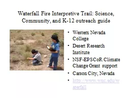
Community and K12 outreach guide Western Nevada College Desert Research Institute NSF EPSCoR Climate Change Grant support Carson City Nevada httpwwwwnceduwaterfall The 9000 acre wildfire the Waterfall Fire of 2004 ravaged homes and land in Carson City ID: 334894
Download Presentation The PPT/PDF document "Waterfall Fire Interpretive Trail: Scien..." is the property of its rightful owner. Permission is granted to download and print the materials on this web site for personal, non-commercial use only, and to display it on your personal computer provided you do not modify the materials and that you retain all copyright notices contained in the materials. By downloading content from our website, you accept the terms of this agreement.
Slide1
Waterfall Fire Interpretive Trail: Science,Community, and K-12 outreach guide
Western Nevada CollegeDesert Research InstituteNSF-EPSCoR Climate Change Grant supportCarson City, Nevada http://www.wnc.edu/waterfallSlide2
The 9000+ acre wildfire, the Waterfall Fire of 2004, ravaged homes and land in Carson City.Slide3Slide4
Study ObjectivesCompare lowland shrub and forest understory plant communities in burned and unburned areas
Evaluate the success of post-fire seedingListing of wildflower and grass speciesClimate change effects on re-vegetationSheep grazing impacts, if anySlide5
Plant Surveys took place at each
Study Site along the trail at intervals during the Spring and Summer. There are eight study sites that contain 3 plots each staked 2m x 2m square.Slide6
Appendix A lists the plant species observed or collected and identified at the Waterfall Fire Study sites during the Spring and Summer months of 2009.
Appendix ASlide7Slide8Slide9
Plot 1c: Drill seeded burned lowland shrub
This area has been successfully drill seeded with crested wheatgrass and is located along the bike path south of WNC.Slide10
Plot 1a: Unburned lowland shrub
This unburned area is primarily a sagebrush community with few grasses or forbs of any kind located at Vicee Canyon along the bike path.Slide11
Plot 2c: Aerial Seeded burned lowland shrubThis area is poorly seeded, and contains cheatgrass, erodium, and some native grasses and forbs along the bike path directly west of the WNC Aspen bldg
.Slide12
Plot 1b: Burned lowland shrub unseeded
This area is sorely infested with cheatgrass and erodium located to the south of the planetary walkway near the Observatory.Slide13
Plot 2a: Unburned lowland shrubThis area is an unburned sagebrush community that has been subjected to mechanical firebreak clearing with native wildflowers and shrubs to the north and east of the planetary walkway.Slide14
Plot 3c:Drill seeded burned lowland shrub, sheep grazed
This area has drill-seeded crested wheatgrass, mixed with cheatgrass, tumble mustard, Russian thistle, and native wildflowers located to the west of the Observatory.Slide15
Plot 1e: Unburned forest understory
This area is an unburned forest understory eastern Sierra Nevada Ponderosa (Jeffrey) pine community, with manzanita, rabbitbrush, bitterbrush, and native grasses and forbs, and no invasive weeds, located in Lakeview Park, Carson City.Slide16
Plot 1g: Burned forest understory, seeded and replanted
This area has been aerial seeded and replanted with pine trees. The tree planting success is minimal and the area is infested with cheatgrass, covered in dead debris (pine needles) mixed with native grasses, located in Lakeview Park, Carson CitySlide17
Unseeded
Seeded
Burned lowland sites
Green cover (May 2009, %)
30
20
10
0Slide18
Unseeded
Seeded
Burned lowland sites
Plant density (May 2009)
(per 2 x 2 m
2
)
80
60
40
0
20Slide19
Drill seeded
Aerial seeded
Burned lowland sites
Green cover (May 2009) (%)
40
30
20
0
10
n.s.Slide20
Study FindingsDesert Wheatgrass, not Siberian, predominated the drill seeded grass mixture
Native shrubs, forbs and grasses thrive 5 years post-fireUnseeded burned areas predominate in cheatgrass and other non-native speciesUnburned shrub and forest understory have little to no non-native plants (cheatgrass)Slide21
Community and K-12 OutreachThe Waterfall Fire Interpretive Trail as an outdoor classroom to study climate change and impacts on wildfire regimesSlide22
The trail begins at the Jack C. Davis Observatory parking lot. There might be a lecture or discussion within the observatory for groups when arranged with the college.Slide23
Star Party night at the
Observatory is each Saturday at dusk weather permitting. You can also access the weather station for current and historical data.Slide24
The trail descends along the WNC Observatory Planetary Walkway.Slide25
The trail follows down the bike path south and west of the college.Slide26
Measure height of plants on trail
Measure soil temperatureObserve what kinds of plants there are for each seasonSlide27
Measure soil temperature at different locations, shade and sunny, and times of the day
This simple thermometer has a built-in shovel as a baseSlide28
Counters keep track of how many plants are in a square plotSlide29
Magnifying glasses help to see up closeSlide30
Assistance from a teacher or grandparent makes for a fun learning environment
Kids tend to see more, and adults tend to focus on specific, plantsSlide31
Plants, cones, seeds, can be collected, but in limited supply for group study.
Plants that are pressed allow each participant to document their discovery on the trial.Slide32
AcknowledgementsDr. Jay Arnone, Research Professor, Desert Research Institute
Ann Bollinger, Naturalist, Open Space Division, Carson CityAlice SadyRobert Collier, Director WNC Jack C. Davis ObservatorySean Sady and Ashton Sady, featured in showMike Sady
, WNC Science Professor, presentation and photos
775-445-4400