PDF-NAPLES BAY WATER SHUTTLE ROUTE MAP
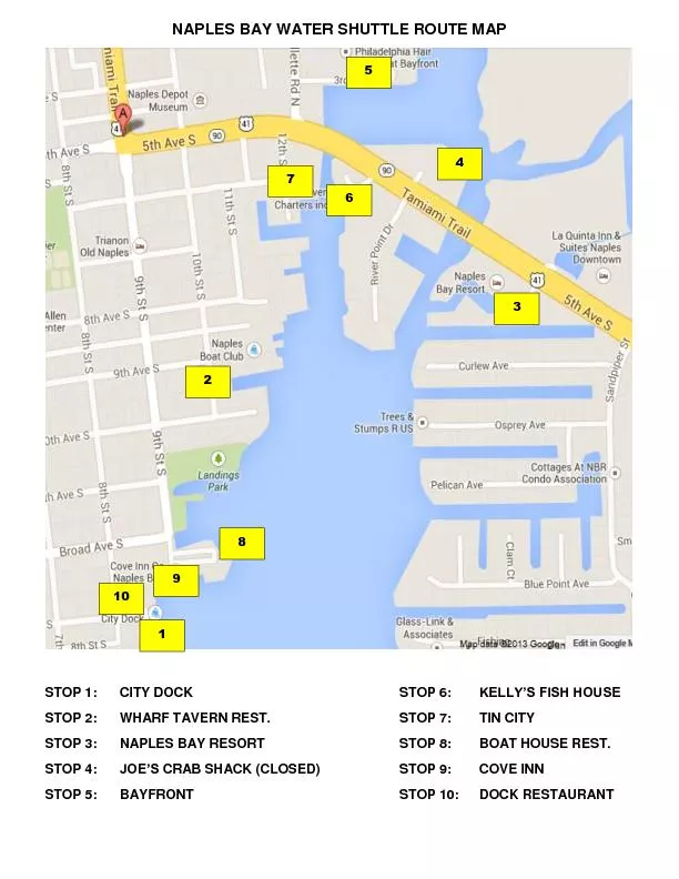
STOP 1 CITY DOCK
STOP 6
KELLYx2019S FISH HOUSE
STOP 2
WHARF TAVERN REST
STOP 7
TIN CITY
STOP 3
NAPLES BAY RESORT
STOP 8
BOAT HOUSE REST
STOP 4
JOEx2019S CRAB SHACK
Download Presentation
"NAPLES BAY WATER SHUTTLE ROUTE MAP" is the property of its rightful owner. Permission is granted to download and print materials on this website for personal, non-commercial use only, provided you retain all copyright notices. By downloading content from our website, you accept the terms of this agreement.
Presentation Transcript
Transcript not available.