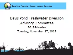
2015 Meeting Tuesday November 17 2015 David Pond Freshwater Diversion Advisory Committee Flood Control Act 1965 and WRDA 1974 Constructed by USACE operated by CPRA Four 14 ft 2 ID: 759428
Download Presentation The PPT/PDF document "Davis Pond Freshwater Diversion Advisory..." is the property of its rightful owner. Permission is granted to download and print the materials on this web site for personal, non-commercial use only, and to display it on your personal computer provided you do not modify the materials and that you retain all copyright notices contained in the materials. By downloading content from our website, you accept the terms of this agreement.
Slide1
Davis Pond Freshwater Diversion Advisory Committee2015 MeetingTuesday, November 17, 2015
David Pond Freshwater Diversion Advisory Committee
Slide2Flood Control Act 1965 and WRDA 1974Constructed by USACE, operated by CPRA* Four 14 ft2 gated culverts* Discharge = 10,650 cfs Operational oversight by TWG/DPACOnline in 2002 (2009 with drainage resolved)
Davis Pond Facts
David Pond Freshwater Diversion Advisory Committee
Slide3Slide4Davis Pond Goals
Enhancement of emergent marsh vegetation growthReduction of marsh lossIncrease significant commercial and recreational fisheries productivityIncrease significant commercial and recreational wildlife productivity
David Pond Freshwater Diversion Advisory Committee
Slide52014 Data Results2015 Operations and Maintenance2016 Proposed Operation Plan
David Pond Freshwater Diversion Advisory Committee2
Slide6Slide7Slide8Slide9Slide10Slide11Slide12Slide13Slide14Slide15Data Results 2014
Oysters continue to be of concernAll other fisheries/wildlife within range and consistent with historical variations
David Pond Freshwater Diversion Advisory Committee
Slide16Slide17Slide18Slide19Slide20Slide212010
2013
Davis Pond Freshwater Diversion Ponding Area
Slide22Slide23Slide24Slide25From December through May, the intent is to operate the diversion to maintain the seasonal average salinity at the 15 ppt line, based on data from the Barataria Bay N Grand Terre gauge. From June through November, operations will be based on the monthly salinity range at the 5 ppt line utilizing the Barataria Waterway S of Lafitte gauge as the primary gauge. Little Lake Bay Dos Gris will also be monitored. The structure will be operated when the 14-day moving average salinity is within or above the long term data range for the gauge(s) in use. When the moving average drops below the low trigger (the greater of the long term average minus1SD or 5ppt) the diversion operations will be maintained at the minimum of 1000cfs until the moving average re-enters the operational range. Operational settings are not to exceed 10,000 cfs.
David Pond Freshwater Diversion Advisory Committee
2015 Operational Plan
Slide26David Pond Freshwater Diversion Advisory Committee2014
Slide27Slide28Slide29Slide30* Discharges may deviate from operational plan as outlined below:
Emergency, maintenance and local parish situations will be evaluated on a case-by-case basis to determine operational needs. The DPAC shall be notified if operations outside of the plan are required.
Structure may be operated for public relations and/or educational purposes, though output is not to exceed 5000
cfs
for a duration of no longer than 2 hours.
Slide31Slide32Slide33Slide342015 Operations Activity
Gates 1 and 4 repaired2015 PULSE 10 day pulse, 2 day ramp downMarch 14- March 24: main pulse ~10,000cfsMarch 24 ~ noon-March 26 ~ 3pm: 5000 cfs ramp-down Back to minimum ~1000 cfs afternoon of March 26
David Pond Freshwater Diversion Advisory Committee2014
Slide35*
USGS gauge calibrations
Slide36Slide37Pulse Information
Slide38Slide39Slide40Temperature, degrees
Celcius
Slide41Slide42Slide43Proposed 2016 Operation Plan
TWG met 9/22/15 and 10/29/15LDWF input: coordinate during spring brown shrimp migration, continue to consider oyster development14-day moving average, 30-day and running annual monitoredBarataria Grand Terre(15ppt) and Barataria Waterway S of Lafitte (5ppt) Long-Term Averages utilizedOperations not to exceed 10,000 cfs
David Pond Freshwater Diversion Advisory Committee2014
Slide44December-May: 15ppt line
Barataria Grand Terre Gauge(USGS # 291929089562600) Hackberry Bay (public oyster grounds) utilized for supporting information and guidance
David Pond Freshwater Diversion Advisory Committee2014
Slide45Slide46June-November: 5ppt line
Barataria Waterway S Lafitte Gauge (USGS # 292859090004000)- operational range tailored to this gauge (previously combined)Bay Dos Gris and Hackberry Bay (public oyster grounds) utilized for supporting information and guidance
David Pond Freshwater Diversion Advisory Committee2014
Slide47Slide48Slide49*Discharges may deviate from operational plan as outlined below:Emergency, maintenance and local parish situations will be evaluated on a case-by-case basis to determine operational needs. The DPAC shall be notified if operations outside of the plan are required. Structure may be operated for public relations and/or educational purposes, though output is not to exceed 5000 cfs for a duration of no longer than 2 hours. Coordination with LDWF during post-larval brown shrimp migration period and oyster reproductive seasons to assist in operational decisions/adjustments to maximize benefit.
David Pond Freshwater Diversion Advisory Committee
Slide50David Pond Freshwater Diversion Advisory Committee
2015-2016
More transparency in operations
(
http://coastal.la.gov/diversion-operations
/
)
Forecast Model
Monitoring
Coastwide
monitoring program (SWAMP)
Coordination with LDWF
Slide51Slide522 months confidential, 10 months of data reported
Only thru June available: 3 months confidential, 3 months of data
Slide53Flow History