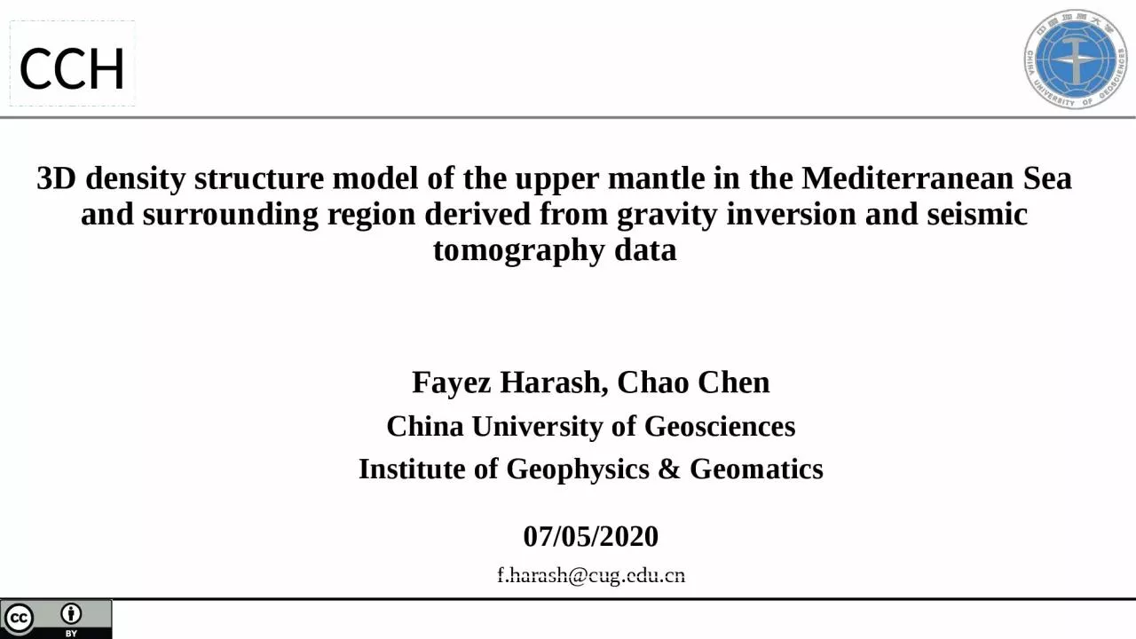
/
3D density structure model of the upper mantle in the Mediterranean Sea and surrounding 3D density structure model of the upper mantle in the Mediterranean Sea and surrounding

3D density structure model of the upper mantle in the Mediterranean Sea and surrounding - PowerPoint Presentation

blanko
blanko . @blanko
Follow
65 views
Uploaded On 2023-09-25

3D density structure model of the upper mantle in the Mediterranean Sea and surrounding - PPT Presentation

Fayez Harash Chao Chen China University of Geosciences Institute of Geophysics amp Geomatics 07 052020 fharashcugeducn CCH CCH Outline China University of Geosciences institute of Geophysics amp Geomatics ID: 1021224

amp density geophysics university density amp university geophysics institute geosciences crust mantle cchchina continental mediterranean eastern cyprus sea subduction

Share:

Link:

Embed:

Download Presentation from below link

Download Presentation The PPT/PDF document "3D density structure model of the upper ..." is the property of its rightful owner. Permission is granted to download and print the materials on this web site for personal, non-commercial use only, and to display it on your personal computer provided you do not modify the materials and that you retain all copyright notices contained in the materials. By downloading content from our website, you accept the terms of this agreement.


Presentation Transcript

1. 3D density structure model of the upper mantle in the Mediterranean Sea and surrounding region derived from gravity inversion and seismic tomography dataFayez Harash, Chao ChenChina University of GeosciencesInstitute of Geophysics & Geomatics07/05/2020f.harash@cug.edu.cnCCH

2. CCHOutlineChina University of Geosciences, institute of Geophysics & Geomatics2 Introduction Algorithm of the gravity inversion Initial density model S-wave velocity perturbations model Inverted density model Plate tectonic events Conversion Factor Conclusion

3. CCHOutline Is the crust beneath the Eratosthenes seamount continental or oceanic? What’s the mantle’s role that plays in the crust type determination? How do shear wave velocities vary in the lower crust and upper-mantle? Many authors suggest (Ben- Avraham et al. 2002) that the existence of continental- type crustal blocks in the Eastern Mediterranean basin is due, as the rifting from the African continental crust, with thickness varies in the range 22–26 km. In the first case the Levantine basin formed by the rifting of African continental crust fragments, whereas in the latter case, a sediment layer of 14–15 km overlies a thinned Precambrian continental crust (F. Di Luccio et al 2007).China University of Geosciences, institute of Geophysics & Geomatics3

4. CCHChina University of Geosciences, institute of Geophysics & Geomatics4The Eastern Mediterranean basin is tectonically complex and its evolution is strongly related to the active subduction along the Hellenic arc.The thickest sediments beneath most of the Eastern Mediterranean basin are in the Hellenic subduction zone and the Cyprus arc. The Ionian Sea is more characteristic of oceanic crust than the rest of the Eastern Mediterranean.The most significant crustal thinning in the Aegean Sea portion of the backarc, particularly towards the south.The present tectonics are driven by the collision of the African and Eurasian plates, the Arabian-Eurasian convergence and the displacement of the Anatolian-Aegean microplate. The boundary between the African and the Anatolian-Aegean microplates is delineated by the Hellenic arc and Cyprus in the west.Hellenic TrenchCyprus ArcESMAegean SeaD.S.FTurkeyBlack SeaN.A.FE.A.FN.A.F = North Anatolian Fault; E.A.F= East Anatolian Fault; D. S. F = Dead Sea Fault; MS = Marmara SeaSimplified tectonic and topographic map of the Eastern Mediterranean.18mm/yr6mm/yrM.S

5. CCHChina University of Geosciences, institute of Geophysics & Geomatics5Residual mantle gravity anomaly (Kaban et al. 2016) after removing the effects of topography/bathymetry, sediments, crustal density variation and the Moho relief from the free air gravity anomaly (EIGEN-6c4 model, F¨orste et al. 2014).Crustal thickness beneath the Eastern Mediterranean varies from oceanic to continental and the thickness of sediments plays an important role in determining the nature of the crust.the Arabian plate was formed by rifting of NE Africa from Arabia along the Red Sea and Gulf of Aden [Stern and Johnson, 2010].The collision between the Arabian plate and Eurasia in the north and northeast leads to an intracontinental subduction and formation of the Anatolian-Iranian plateau and Zagros Mountains [e.g., Stern and Johnson, 2010]

6. CCHChina University of Geosciences, institute of Geophysics & Geomatics6The Dead Sea fault system bounds the northwestern part of the Arabian plate and represents a north-south, left-lateral strike shear zone [Smit et al., 2010; Agrawal et al., 2015].Mantle density heterogeneities, in particularly in the upper mantle, are closely related to tectonic processes: density contrasts produce significant stresses, which directly affect style and amplitude of lithospheric deformations [e.g., Kaban et al., 2015a].Continuous plate interactions and mantle underplating processes lead to accumulation of various anomalies (compositional, structural, and thermal ) within the lithosphere. Seismic tomography does not always provide complete information about this heterogeneity. Therefore, knowledge of the mantle density structure is the key to understanding the tectonic processes and their surface expression. We construct an initial density model of the upper mantle based on a recent global seismic tomography model by Schaeffer and Lebedev [2013].

7. CCHChina University of Geosciences, institute of Geophysics & Geomatics7Topographic map of the Eastern MediterraneanThe distribution of seismicity is mainly concentrated along the Hellenic trench, Greece and Aegean region, along the NAF and EAF and the Cyprian arc, with deeper earthquakes occurring along the subduction zones and along the Hellenic arc. The seismicity of Cyprus is distributed differently along the arc; the Eastern segment is the locus of shallow and intermediate earthquakes whose magnitude can be larger than 6, whereas the western portion contains deep and low magnitude events. The seismicity of the Hellenic trench is in contrast distributed regularly along the arc with hypocentral depths. The difference in the seismicity trend along the two arcs confirms the dissimilar plate motion in the two regions. Subduction is active beneath the whole length of the Hellenic trench whereas the Cyprian arc is undergoing subduction along its north- western margin, collision in the southeastern part and transcurrence along its Eastern segment (Wdowinski et al. 2006).

8. CCHChina University of Geosciences, institute of Geophysics & Geomatics8Algorithm of the gravity inversionThe 3-D inversion algorithm of Liang et al. (2014) was used in this study.data misfitmodel objective functionRegularization parameter K is the kernel matrix or the integral operator for converting density into the gravity field.G is the mantle gravity anomaly initial density vectors. the pending density and weighting matrix

9. CCHChina University of Geosciences, institute of Geophysics & Geomatics9Relationship between velocity and density deviations(Levandowiski et al.2015)

10. CCHChina University of Geosciences, institute of Geophysics & GeomaticsS-wave velocity perturbations modelSlower S-wave velocities are found in the upper mantle, especially in the northern Red Sea and Dead Sea Rift, central Turkey, and along the subduction zone.From the Eratosthenes seamount towards southern parts a general increasing of the shear velocity is observed. Beneath Cyprus, mostly the northwestern part, the velocity has roughly the same value (∼3.5 km s−1) in the upper crust but becomes significantly higher in the lower crust.In the uppermost mantle the low velocities along and in back of the subduction zones in Cyprus might be an indication of serpentinized mantle, as suggested also in other subduction zones (Hyndman & Peacock 2003).These velocities decrease and become more localized from the upper crust down to the lower crust

11. CCHChina University of Geosciences, institute of Geophysics & Geomatics11This decrease probably relates to a hydrous or hydrothermal alteration as suggested in other subduction zones, where small percentage of serpentine in the crust would produce water in the mantle by the subducting crust (Hyndman & Peacock 2003).The physical properties of the forearc mantle are affected by the presence of hydrous minerals as serpentine, which, if present, can decrease the seismic velocity (Hyndman & Peacock 2003).The non-purely oceanic nature of the crust in this area suggest that the composition of the upper mantle is non-basaltic which would have implied higher seismic velocities if either peridotite or eclogite were predominant in the mineralogy (Kearey & Vine 2004).We speculate that the uppermost mantle should be composed of partially serpentinized peridotite, with a certain amount of serpentine due to the fact that in some regions the observed S-wave velocities are not high.Beneath the lithosphere roughly down to ∼150 km depth, when melt or partial melting occur there the asthenosphere is present and seismic velocities are lower with respect to the upper most mantle velocities. Partial melting in the upper mantle could explain the high heat flow observed in the Eastern Mediterranean, where sedimentation plays an important role (Ben-Avraham et al. 2002; Kearey&Vine 2004). Although different processes such as partial melting, water content, compositional or phase change, high temperature, can lower the seismic velocity (as in the Hellenic-Cyprian trench), either serpentinization or partial melting could be favourite candidates to explain the observed S-wave velocities.

12. CCHChina University of Geosciences, institute of Geophysics & Geomatics12Initial density modelThe relatively low dense mantle located below western Syria possibly originates from the asthenosphere. The thin high-density layer prove for strong oceanic lithosphere in the southeast Mediterranean sea. The high density at depth range from 65-95 km extend along the Red Sea from southern Mediterranean Sea to Gulf of Aden.

13. CCHChina University of Geosciences, institute of Geophysics & GeomaticsInverted density model13The inverted density model produces gravity anomalies.The inverted density model shows distinct differences of the upper mantle between Eastern Mediterranean Sea and surrounding regions.The low-density zone dominates a large region beneath western Syria along the Dead Sea Fault.In the Eastern Mediterranean basin the presence of partially molten material as well as the presence of serpentinite could explain the observation of low density.The Varity of density In the Eastern Mediterranean is due to variations of composition and temperature. In

14. CCHChina University of Geosciences, institute of Geophysics & Geomatics14

15. CCHChina University of Geosciences, institute of Geophysics & Geomatics15

16. CCHChina University of Geosciences, institute of Geophysics & Geomatics16The Eratosthenes Seamount (ESM), considered as a northward drifted continental fragment of the African plate (Ben-Avraham et al., 2002; Netzeband et al., 2006; Robertson, 1998b), entered the subduction trench along the Cyprus Arc during the Late Pliocene - early Pleistocene, triggering rapid uplift of Cyprus.The main terrane on Cyprus is the central Troodos ophiolite complex. The Troodos massif on Cyprus belongs to a group of ophiolites (including Kizildag in southern Turkey and the Baer-Bassit ophiolite of Syria, Dilek and Moores, 1990) which are well preserved and relatively undeformed, so that almost the complete sequence through the oceanic crust can be observed. The Troodos ophiolite was uplifted during late Pliocene- Pleistocene time. This can be largely explained by the collision of the Eratosthenes Seamount (ESM) with a subduction zone south of Cyprus (Robertson et al., 2013a).Robertson (1998b) interprets the ESM as a carbonate platform constructed on stretched continental crust rifted from the southern margin of Tethys in early Mesozoic time. Ben-Avraham et al. (2002) confirm that the crust under the ESM is continental, but note that it is thinner than normal continental crust. They suggest that this is caused by the extension that took place during the rifting of this fragment away from the African continent.The Eratosthenes Seamount was separated from the African margin in the Permian along with other continental fragments (Inati et al., 2016)Eratosthenes Seamount

17. CCHChina University of Geosciences, institute of Geophysics & Geomatics17Moho depth: increasing up to 32–35km depth beneath the ESM. North of the ESM the Moho depth is about 37 km and increasing beneath Cyprus.The minimum Moho depth in this region is 32 km. A crustal thickness of about 32–35 km, together with the observed low crustal velocities supports the interpretation that the crust in this block has a continental origin. A Moho depth of ~32 km and a continental origin of the crust beneath the ESM is consistent with several previous investigations (Robertson, 1998b; Ben-Avrahamet al., 2002; Koulakov and Sobolev, 2006; Welford et al., 2015a).The gravity data play an important role in determining the crustal structure. The most prominent feature of the gravity data is the gravity high above Cyprus (400–430 km offset). This is caused by the high densities (up to about 3.3 g/cm3) of the Troodos ophiolite complex beneath Cyprus, 12 km thick ophiolite sequence on Cyprus(Amit Segev et al.2006) .The northern boundary of the ESM is considered to represent a Mesozoic NNW–SSE oriented transform margin (Longacre et al., 2007; de Lamotte et al., 2011; Montadert et al., 2014).

18. CCHChina University of Geosciences, institute of Geophysics & Geomatics18It represents the relation between the S-wave velocity anomalies and computed density variations. It can be used to quantify thermal and compositional effects in the lithosphere (Root et al. 2017).Conversion FactorThe inverted density anomaly The reference density valueThe S-wave velocity perturbation from the global tomography model SL2013sv (Schaeffer & Lebedev 2013).Depth(Km)0-1515-4050100150200250300Density(g.cm-3)2.72.943.3573.3843.4193.4573.5103.5601-D reference density model of the crustal and upper mantle above 300 km(Q. Liang et al. 2019)

19. CCHChina University of Geosciences, institute of Geophysics & Geomatics19The inverted density variations in the study area are affected by both thermal and compositional anomalies. The positive conversion factor means the density anomaly is dominated by thermal effects, whereas the negative one indicates that the density anomaly is likely related to compositional variations.According to negative conversion factor of velocity model ((SL2013sv; Schaeffer & Lebedev 2013)) and density model estimation we think that the density variations anomaly is dominated to compositional variations under depth 75km beneath levant basin and along the Red sea.

20. CCHChina University of Geosciences, institute of Geophysics & Geomatics20Regional stratigraphic column of the Levant Basin based on the interpretation of seismic packages and their bounding surfaces and supported by correlations with adjacent exposed strata and the use of well data of the coastal northern Levant margin (Hawie et al., 2013).the Eratosthenes Seamount was separated from the African margin in the Permian along with other continental fragments (Inati et al., 2016).It has been postulated that the Eastern Mediterranean is Late Triassic in age and it is linked to the breakup of Pangea and the closure of theNeo Tethys Ocean (Cavazza et al., 2004; Stampflietal., 2001). On another hand, some authors believe that the Eastern Mediterranean results from the closure of the Tethys Ocean and was thus formed during the Cretaceous (Dercourt et al., 2000).(Inati et al., 2016)

21. CCHChina University of Geosciences, institute of Geophysics & Geomatics21Subduction of African oceanic lithosphere along the Hellenic and Cyprus arcs and extension in the Aegean and western Turkey.Subduction is ongoing below the Hellenic Arc but is no longer active below the Cyprus Arc, which may be in transition to continental collision (Ergün et al., 2005).As the ESM is considered as a continental fragment of the African plate (Ben-Avraham et al., 2002; Netzeband et al., 2006; Robertson, 1998b)

22. CCHChina University of Geosciences, institute of Geophysics & Geomatics22ConclusionIn the Eastern Mediterranean basin the presence of partially molten material as well as the presence of serpentinite could explain low seismic velocities.It’s a continental crust caused by a subduction between an Eurasian and African plates and it took place due to break off back arc happened within delamination process.It’s considered an incipient Seamount–Arc collision that triggered of the early-to-mid Pleistocene tectonic transition.

23. CCHChina University of Geosciences, institute of Geophysics & GeomaticsThanks for your attention!23