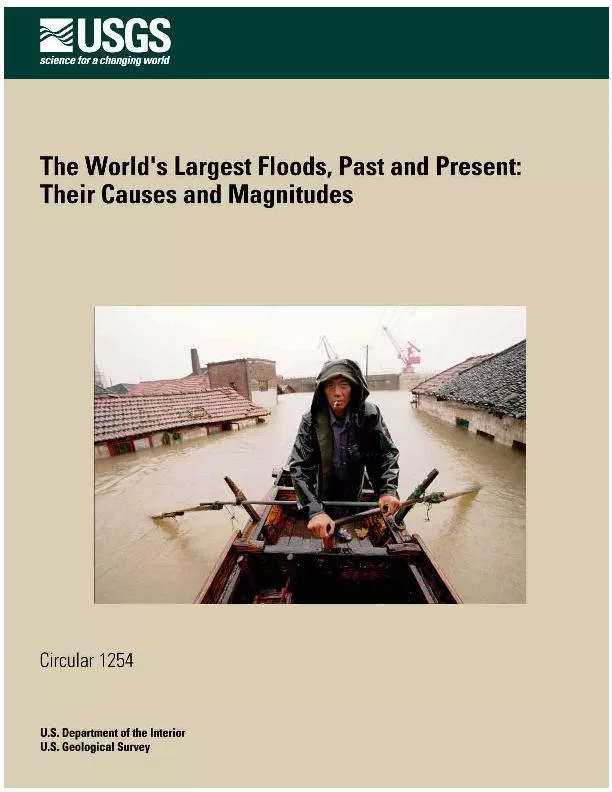
/
A man rows past houses flooded by the Yangtze River in Yueyang, Hunan A man rows past houses flooded by the Yangtze River in Yueyang, Hunan

A man rows past houses flooded by the Yangtze River in Yueyang, Hunan - PDF document

briana-ranney
briana-ranney . @briana-ranney
Follow
404 views
Uploaded On 2016-06-19

A man rows past houses flooded by the Yangtze River in Yueyang, Hunan - PPT Presentation

Cover The World146s Largest Floods Past and Present Their Causes and Magnitudes By Jim E O146Connor and John E Costa US Department of the InteriorUS Geological SurveyCircular 1254 iv ID: 369529

Cover: The World’s Largest Floods

Share:

Link:

Embed:

Download Presentation from below link

Download Pdf The PPT/PDF document "A man rows past houses flooded by the Ya..." is the property of its rightful owner. Permission is granted to download and print the materials on this web site for personal, non-commercial use only, and to display it on your personal computer provided you do not modify the materials and that you retain all copyright notices contained in the materials. By downloading content from our website, you accept the terms of this agreement.


Presentation Transcript

Cover: A man rows past houses flooded by the Yangtze River in Yueyang, Hunan Province, China, July 1998. The flood, one of the worst orecord, killed more than 4,000 people and drove millions from their homes. (AP/Wide World Photos) The World’s Largest Floods, Past and Present: Their Causes and Magnitudes By Jim E. O’Connor and John E. Costa U.S. Department of the InteriorU.S. Geological SurveyCircular 1254 iv Conversion Factors Multiply By To obtain Length meter (m) 3.281 foot (ft) kilometer (km) 0.6214 mile (mi) Area square kilometer (km 2 ) 0.3861 square mile (mi 2 ) Volume cubic meter per second (m 3 /s) 35.31 cubic foot per second (ft 3 /s) cubic kilometer (km 3 ) 0.2399 cubic mile (mi 3 ) Geologic Time Terms Quaternary eriod: About 1.8 million years ago to the present Pleistocene poch: A division of the Quaternary eriod extending from about 1.8 million years ago to about 10,000 years ago. Also known as "The Great Ice Age" poch: A division of the Quaternary eriod extending from about 10,000 years ago to the present The World's Largest Floods, Past and Present: Their Causes and Magnitudes By Jim E. O’Connor and John E. Costa Introduction Floods are among the most powerful forces on earth. Human societies worldwide have lived and died with floods from the very beginning, spawning a prominent role for floods within legends, religions, and history. Inspired by such accounts, geologists, hydrologists, and historians have studied the role of floods on humanity and its supporting ecosystems, resulting in new appreciation for the many-faceted role of floods in shaping our world. Part of this appreciation stems from ongoing analysis of long-term streamflow measurements, such as those eamflow gaging network. But - tant role of flooding in shaping our cultural and physical landscape also owes to increased understanding of the variety of mechanisms that cause floods and how the types and magnitudes of floods can vary with time and space. The USGS has contributed to this understanding through more than a century of diverse research activities on many aspects of floods, including their causes, effects, and hazards. This Circular summarizes a facet of this research by describing the causes and magnitudes of the world’s largest floods, including those measured and described by modern methods in historic times, as well as floods of prehistoric times, for which the only records are those left by the floods themselves. Residents of Dhaka, Bangladesh, carry drinking water as they wade through floodwaters caused by three weeks of rain in 1986. Three rivers—the Ganges, Brahmaputra, and Meghna—left their banks, killing more than 1,000 people and stranding millions. (AP/Wide World photos) Floods from Ice-Dammed Lakes 3 . Table 1. Quaternary floods with discharges greater than 100,000 cubic meters per second [Pleistocene, about 1.8 million to 10,000 years ago; Holocene, about 10,000 years ago to present. Peak discharge: 10 6 m 3 /s, million cubic meters per second] Flood/River Location Date Peak discharge 6 m 3 /s) Mechanism Reference Kuray Altai, Russia Late Pleistocene 18 Ice-dam failure Baker et al., 1993 Missoula Northwestern USA Late Pleistocene 17 Ice-dam failure O'Connor and Baker, 1992 Darkhat Lakes Mongolia Late Pleistocene 4 Ice-dam failure Rudoy, 1998 Jassater Lakes Altai, Russia Late Pleistocene 2 Ice-dam failure Rudoy, 1998 Yaloman Lakes Altai, Russia Late Pleistocene 2 Ice-dam failure Rudoy, 1998 Ulymon Lakes Altai, Russia Late Pleistocene 1.9 Ice-dam failure Rudoy, 1998 Lake Agassiz Alberta, Canada Early Holocene 1.2 Proglacial-lake overflow Smith and Fisher, 1993 Aniakchak Alaska, USA Late Holocene 1.0 Caldera-lake breach Waythomas et al., 1996 Lake Bonneville Northwestern USA Late Pleistocene 1.0 Lake-basin overflow O'Connor, 1993 Lake Regina Canada/USA Late Pleistocene .8 Ice-dam failure Lord and Kehew, 1987 Jökulsá á Fjöllum Iceland Early Holocene .7 Subglacial volc Waitt, 2002 Indus River Pakistan 1841 .54 Landslide-dam failure Shroder et al., 1991 Amazon River Obidos, Brazil 1953 .37 Rainfall Rodier and Roche, 1984 Katla Iceland 1918 .3 Subglacial volc Tomasson, 1996 Wabash River Indiana, USA Late Pleistocene .27 Ice-dam failure Vaughn and Ash, 1983 Toutle River Northwestern USA Late Holocene .26 Landslide-dam failure Scott, 1989 Amazon River Obidos, Brazil 1963 .25 Rainfall Rodier and Roche, 1984 Amazon River Obidos, Brazil 1976 .24 Rainfall Rodier and Roche, 1984 Columbia River Northwestern USA About 1450 .22 Landslide-dam failure O'Connor et al., 1996 Lake Agassiz Canada/USA Early Holocene .20 Proglacial-lake overflow Teller and Thorliefson, 1987 Lena River Kasur, Russia 1967 .19 Ice jam and snowmelt Rodier and Roche, 1984 Lena River Kasur, Russia 1962 .17 Ice jam and snowmelt Rodier and Roche, 1984 Lena River Kasur, Russia 1948 .17 Ice jam and snowmelt Rodier and Roche, 1984 Lake Agassiz Canada/USA Late Pleistocene .13 Ice-dam failure Matsch, 1983 Porcupine River Alaska, USA Late Pleistocene .13 Ice-dam failure Thorson, 1989 Yangtze River China 1870 .11 Rainfall Rodier and Roche, 1984 Russell Fiord Alaska, USA 1986 .10 Ice-dam failure Mayo, 1989 Figure 1. Most of the largest known floods of the Quaternary eriod resulted from breaching of dams formed by glaciers or landslides. See table 1 for details of each flood. Ice-Jam Floods 7 Landslide dams can form in a wide range of physio - ne debris avalanches to quick-clay failures in wide valley floors. The most com - dam-forming landslides are rainstorms, rapid snowmelt, and earthquakes. Landslide dams can be unstable and subject to failure because they have no controlled outlet. The vast majority of dam fail - ures and ensuing floods result from overtopping and inci - sion of the blockage, generally beginning soon after impounded water first reaches - age. Despite representing only a small percentage of the world's largest floods, breaches of landslide dams are a significant hazard. There have been at least six historic landslide dam floods with peak discharges greater than 3 /s. Most of these large floods were associated with tall blockages of large rivers, including cases where breach depths ranged up to 150 m through landslide dams that were as high as 250 m. Similar to the case of glacial dams, the potential peak discharge through a landslide dam increases exponentially with blockage height. Conse - quently, landscapes that generate large landslides that in turn form tall blockages in confined valleys have the greatest potential for extreme floods. Landslide dams can dwarf human-constructed dams and therefore produce mu - est landslide dam on Earth is the 550 m high Usoi land - slide dam in Tajikistan, which created Lake Sarez. The dam formed as a result of Usoi Dam in Tajikastan, formed by a landslide in 1911, created 16 cubic-kilometer Lake Sarez, the largest lake in the world resulting from a landslide. Five million people live in the valleys downstream of the dam. Even partial breaching of the dam could cause catastrophic flooding. Complete failure of the dam could result in the deadliest natural (Photograph courtesy of NASA) This dam is nearly twice the height of the largest constructed dam in the world today, the 300-m-high Nurek rockfill dam, also in Tajikistan. The largest flood documented from failure of a constructed dam is the Teton Dam, Idaho, which failed in 1976 by piping (erosion through the dam) and for which the peak discharge was about 70,000 m 3 /s, less than half the peak discharge of floods resulting from the landslide dam failures listed in table 1. Ice-Jam Floods Three of the world's largest 27 recorded flows were ice-jam floods on the Lena Rinot include the "unprecedented flooding" of May 1998 for which we have been unable - mation. Floods on large rivers from ice jams result from "breakup jams," in which dislodged river ice accumulates at constrictions or river bends, forcing ponding upstream and rapid release of water when the ice dams breach. Such was the case in April 1952 on the Missouri River, North Dakota, where an eroding ice dam resulted in flow increasing from about 2,100 m 3 /s to more than 14,000 3 /s in less than 24 hours. Ice jams, like this one on the Yukon River, Alaska, can cause severe flooding when impounded water overflows the stream channel upstream and when breakup of the jam suddenly releases water downstream. (Photograph courtesy of the Alaska Department of Military and Veterans Affairs) Extreme ice-jam floods are most common in high-latitude, north-flowing continental river systems like the Lena River and adjacent large river systems of northern Eurasia, and the MacKenzie River of North America. Large poleward-flowing rivers are especially susceptible to large breakup floods because headwater areas may melt before downstream areas, increasing the potential for large blockages. 8 The World’s Largest Floods—Past and Present Large Meteorological Floods In the tabulation of Quaternary floods with peak discharges greater than 100,000 m 3 /s, only four floods primarily due to rainfall or snowmelt make the list (table 1)—the floods of 1953, 1963, and 1976 on the Amazon River at Obidos, Brazil, and the 1870 flood of 110,000 3 /s on the Yangtze River, China. The Amazon River, draining by far the world's largest basin, with an area 7 2 (square kilometers), including a vast portion - ate tremendous floods by virtue of its immense size and tropical location. The Yangtze (Chang Jiang) River of China is also a large basin that receives substantial tropi - cal moisture. floods in this list of largest Quaternary floods does not indicate lesser signifi - cance of meteorologic floods. Indeed, meteorologic floods are by far the most common of the types of floods in the human experience, affecting parts of the globe every year. Such floods can bring good, such as the fer - tile soils formerly brought to the Nile Delta by annual flooding. However, large floods are mostly known for their catastrophic loss of life and property, such as the floods on the Mississippi River in 1927, when several hundred casualties resulted, the Columbia River in 1948, when the town of Vanport was destroyed, and the Yangtze River in 1931, when nearly 4 million people died from flooding and ensuing famine. The town of Vanport, Oregon, was destroyed in May 1948 when the Columbia River flooded due to rapid melting of large snowpacks in the Columbia and Snake River Basins. (Photograph from Oregon Historical Society [negative OrH: 68809], used by permission) Records of the largest historic floods from the Earth's largest drainage basins (figs. 5 and 6, table 2) show that, in general, larger basins produce larger floods. Variation within this general observation owes partly to a pronounced geographic pattern of larger unit discharges (defined as peak discharge per unit basin area) in the tropics, primarily between latitudes 10 o S and 30 o N (fig. 7). The largest floods in large basins within the tropics are primarily derived from rainfall within areas affected by tropical cyclones or strong monsoonal airflow, such as the Brahmaputra, Ganges, Yangtze, Mekong, Huangue River Basins, or eastward-draining continental basins, such as the Amazon and Orinoco River Basins, which intercept easterly flows of tropical moisture. The distribution of relatively large floods is skewed northward of the Equator by the preponderance of land in the northern hemisphere, promoting northward migration of monsoonal moisture flow driven by orographic lifting over large mountain belts, such as the Himalaya in Several large basins in the tropics do not produce relatively large peak discharges. These include the Congo, Niger, Chari, and Sao Francisco River Basins, which drain large areas of low relief or are isolated from zones of major precipitation. Likewise, many of the horse-latitude (20 o –40 o N) and midcontinental drain - age basins outside areas of seasonal tropical moisture influxes do not produce large flows compared with more tropical basins. Examples include the Murray and Dar - ling River Basins in Australia, the Nile River and Zam - bezi River Basins in Africa, and the Colorado and Mississippi River Basins of North America. Northward of 40 o N, snowmelt and ice jams are peak discharges from large basins, forming a group of rivers with flood discharges greater than the apparent latitudinal limits of flood flows ll (fig. 7). Exceptional dis - charges on the Lena, Yenisey, and Yukon Rivers were augmented by ice jams, but relatively large flows on riv - ers such as the Columbia and Dnieper Rivers indicate the importance of melting snow to peak flows, especially in present configuration of continents, there are no southern hemisphere river basins greater than 500,000 km 2 peak discharges substantially affected by snowmelt. Floods, Landscapes, and Hazards One observation evident from consideration of the world’s largest floods is that the incidence of floods caused by different processes changes through time. 12 The World’s Largest Floods—Past and Present Selected References Baker, V.R., Kochel, R.C., and Patton, P.C., eds, 1988, Flood Geomorphology: New York, Wiley, 503 p. Baker, V.R., Benito, G., and Rudoy, A.N., 1993. Paleo-hydrology of late Pleistocene superflooding, Altay Mountains, Siberia: Science, 259, p. 348–350. Costa, J.E., 1987, A comparison of the largest rainfall-runoff floods in the United States with those of the People’s Republic of China and the world: Journal of Hydrology, v. 96, p. 101–115. House, P.K., Webb, R.H., Baker, V.R., and Levish, D.R., eds., Ancient floods, modern application of paleoflood hydrology: American Geophysical Union Water Science and Application Series, no. 5, 385 p. Hoyt, W.G., and Langbein, W.B., 1955, Floods: Princeton, New Jersey, Princeton University Press, 469 p. Lord, M.L., and Kehew, A.E., 1987, Sedimentology and paleohydrology of glacial-lake outburst deposits in and northwestern North Dakota: Geological Society of America Bulletin v. 99, p. 663–673. Matsch, C.L., 1983 River Warren, the southern outlet of Teller, J.T., and Lee, Clayton, Glacial Lake Agassiz: Geological Association of Canada Special Paper 26, p. 231–244. Mayo, L.R., 1989, Advance of Hubbard Glacier and 1986 outburst of Russell Fiord, Alaska, U.S.A.: Annals of Glaciology, v. 13, p. 189–194. Miller, E.W., and Miller, R.M., 2000, Natural disasters— Floods, A reference handbook: Santa Barbara, California, ABC-CLIO, 286 p. O'Connor, J.E., 1993, Hydrology, hydraulics, and geomorphology of the Bonneville flood: Geological Society of America Special Paper 274, 83 p. O'Connor, J.E., and Baker, V.R., 1992, Magnitudes and implications of peak discharges from Glacial Lake Missoula: Geological Society of America Bulletin, v. 104, p. 267–279. O’Connor, J.E., Grant, G.E., and Costa, J.E., 2002, The geology and geography of floods, House, P.K., Webb, R.H., Baker, V.R., and Levish, D.R., eds., Ancient floods, modern hazards: principles and application of paleoflood hydrology: American Geophysical Union Water Science and Application Series, no. 5, p. 359–385. O'Connor, J.E., Pierson, T.C., Turner, D., Atwater, B.F., and Pringle, P.T., 1996, An exceptionally large Columbia River flood between 500 and 600 years ago—Breaching of the Bridge-of-the-Gods landslide?, Geological Society of America Program with Abstracts, v. 28, no. 7, p. 97. Rodier, J.A., and Roche, M., 1984, World catalogue of maximum observed floods: International Association of Hydrologic Sciences Publication No. 143, 354 p. Ryan, W., and Pitman, W., 1999, Noah’s flood—The new scientific discoveries about the event that changed history: New York, Simon and Schuster, 310 p. Rudoy, A., 1998, Mountain ice-dammed lakes of southern Siberia and their influence on the development and regime of the intracontinental runoff systems of North Asia in the late Pleistocene, Benito, G., Baker, V.R., and Gregory, K.J., eds., Paleohydrology and Environmental Change: John Wiley and Sons, p. 215–234. Scott, W.E., 1989, Volcanic and related hazards, in Volcanic hazards—Short course in geology—Volume 1: Washington, D.C., American Geophysical Union, p. 9–50. Shroder, J.F. Jr., Cornwell, K., and Khan, M.S., 1991, Catastrophic breakout floods in the western Himalaya, Pakistan: Geological Society of America Program with Abstracts, v. 23, no, 5, p. 87. Smith, D.G. and Fisher, T.G., 1993. Glacial Lake Agassiz— The northwest outlet and paleoflood: Geology v. 21, no. 1, p. 9–12. Teller J.T., and Thorliefson, L.H., 1987, Catastrophic flooding into the Great Lakes from Lake Agassiz, Majer, L. and Nash, D. eds.,. Catastrophic flooding: London, Allen & Unwin, p. 121–138. Thorson, R.M., 1989, Late Quaternary paleofloods along the Porcupine River, Alaska—Implication for regional correlation, Carter, L.D., Hamilton, T.D., and Galloway, J.P., eds., Late Cenozoic history of the interior basins of Alaska and the Yukon: U.S. Geological Survey Circular 1026, p. 51–54. Tomasson, H., 1996, The jokulhlaup from Katla in 1918: Annals of Glaciology, v. 22, p. 249–254. Vaughn, D., and Ash, D.W., 1983, Paleohydrology and geomorphology of selected reaches of the upper Wabash River, Indiana: Geological Society of America Program with Abstracts, v. 15, no. 6, p. 711. Vörösmarty, C.J., Fekete, B.M.R.B., 2000, Geomorphometric attributes of the global system of rivers at 30-minute spatial resolution: Journal of Hydrology v. 237, p. 17–39. Waitt, R.B., 2002, Great Holocene floods along Jökulsá á Fjöllum, North Iceland, Martini, I.P., Baker, V.R., and Garzón, G., eds., Flood and megaflood processes— amples: International Association of Sedimentologists, Special Publication 32, p. 37–52. Walder, J.S., and O’Connor, J.E., 1997, Methods for predicting peak discharge of floods caused by failure of natural and constructed earthen dams: Water Resources Research, v. 33, p. 2337–2348. Selected References 13 Waythomas, C.F., Walder, J.S., McGimsey, R.G., and Neal, C.A., 1996, A catastrophic flood caused by drainage of a caldera lake at Aniakchak Volcano, Alaska, and azards assessment: Geological Society of America Bulletin, v. 108, no. 7, p. 861–871. For More Information: USGS Flood Information http://water.usgs.gov/osw/programs/floods.html USGS Fact Sheet: Significant Floods in the United States During the 20th Century http://ks.water.usgs.gov/Kansas/pubs/fact-sheets/fs.024-00.html USGS Circular: Large Floods They Happen and Why http://pubs.water.usgs.gov/circ1245 USGS Water Watch http://water.usgs.gov/waterwatch/ Dartmouth University Flood Observatory http://www.dartmouth.edu/~floods/ EarthSat TM flood maps http://www.earthsat.com/wx/flooding/ National Weather Service: Significant River Flood Outlook http://www.hpc.ncep.noaa.gov/nationalfloodoutlook/ Federal Emergency Management Agency (FEMA) Flood http://www.fema.gov/mit/tsd/fq_genhm.htm Societal Aspects http://sciencepolicy.colorado.edu/socasp/floods.html