/
Shoreland Accessory Structures Shoreland Accessory Structures

Shoreland Accessory Structures - PDF document

cady
cady . @cady
Follow
343 views
Uploaded On 2021-09-28

Shoreland Accessory Structures - PPT Presentation

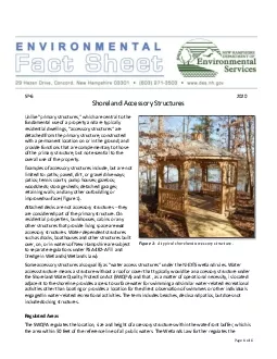
Page 1of 6SP62020Unlike primary structures which are central to the fundamental use of a property and are typically residential dwellings accessory structures are detached from the primary structurec ID: 888255

structures water access feet water structures feet access accessory buffer structure waterfront shoreland shoreline square wetlands line area figure

Share:

Link:

Embed:

Download Presentation from below link

Download Pdf The PPT/PDF document "Shoreland Accessory Structures" is the property of its rightful owner. Permission is granted to download and print the materials on this web site for personal, non-commercial use only, and to display it on your personal computer provided you do not modify the materials and that you retain all copyright notices contained in the materials. By downloading content from our website, you accept the terms of this agreement.


Presentation Transcript

1 Page 1 of 6 SP - 6 20 20 S
Page 1 of 6 SP - 6 20 20 Shoreland Accessory Structures Unlike “primary structures,” which are central to the fundamental use of a property and are typically residential dwellings, “accessory structures” are detached from the primary structure , constructed with a permanent location on or in the ground , and provide functions that are complementary to those of the primary structure, but not essential to the overall use of the property. Examples of accessory structures include, but are not limited to: paths ; paved , dirt, or gravel driveways ; patios ; tennis courts ; pump houses ; gazebos ; woodsheds ; storage sheds ; detached garages ; retaining walls ; and any other outbuilding or improved surface (Figure 1). Attached decks are not accessory structures – they are considered part of the primary structure . On residential properties, b unkhouses, cabins or any other structu re s that provide living space are not accessory structures. Water - dependent structures such as docks , boathouse s and other structures built over, on , or in waters of New Hampshire are subject to separate regulations under RSA 482 - A Fill and Dredge i n Wetlands ( Wetlands Law ). Some accessory structures also qualify as “water access structures” under the NHDES wetland rules . Water access structure means a structure without a roof or cover that typically would be an accessory structure under the Shoreland Water Quality Protection Act (SWQPA) and that , as a matter of operational necessity, is located adjacent to the shoreline provide s access to surface water for swimming and similar water - related recreational activities other than boating or provides a loca tion for the direct observation of swimmers or other individuals engaged in water - related recreational activities. The term includes beaches, decks and patios, but does not include docking structures . Regulated A reas The SWQPA regulates the location, size and height of accessory structures

2 within the waterfront buffer, which is
within the waterfront buffer, which is the area within 50 feet of the reference line of all public water s . The Wetlands Law further regulates the Figure 1 - A typical shoreland accessory structure . Page 2 of 6 loc ation, size , design and construction of water access structures wit hin any bank or other jurisd ic tional area that may also be in the waterfront buffer. Beyond the 50 - foot waterfront buffer, s tate regulations under the SWQPA apply to the total areas of excavation, fill, construction, native vegetation and impervious surfac e s associated with accessory structures on the property, when within the protected shoreland but outside wetlands jurisdiction . Summary of Accessory Structure Regulations Within the Waterfront Buffer Location: Accessory structures must be located in a manner that minimizes im pacts to natural ground cover within the waterfront buffer . If tree removal is necessary, upon completing the tree removal, each affected waterfront buffer grid segment must meet the minimum required tree and sapling point score. See the “ Vegetation Management for Water Quality ” f act s heet for details on scoring water front buffer grid segments. In addition, accessory structures cannot be constructed on slopes that exceed 25%. Accessory structures must be set back at least 20 feet from the reference line , with the exception of water access structures which may be located closer to the reference line ( Figure 2 ) . Accessory structures do not have setbacks from abutting property li nes . However , w ater access structures within the bank must be located at least 1 0 feet from abutting properties , unless written permission is obtained from the affected abutter(s). Water access s tructures must be placed in a location on the lake frontage that poses the least environmental impact. Their construction in a wetland or priority resource area is prohibited. Priority resource areas include areas with documented occurrences of protect

3 ed species or habit at, bogs, designated
ed species or habit at, bogs, designated prime wetlands , duly - established 100 - foot prime wetland buffer s , sand dunes, tidal wetlands, tidal waters, or undeveloped tidal buffer zones, and certain floodplain wetlands. Height: The maximum height of accessory structures within the waterfront buffer is 12 feet measured from the lowest adjacent ground level elevation . Size: The total area of accessory structures within the waterfront buffer cannot exceed 7 .5 square feet per linear foot of shoreland frontage . Shoreland front age is defined as the actual length of the shoreline along the waterfront measured at the reference line. Furthermore , water access structures can account for a maximum of 50% of the total area of accessory structure s allowed for a lot’s shoreland frontage . These limits apply to both pervious and impervious structures. Table 1 illustrates these limitations for different lengths of shoreland frontage. Please note that a direct pathway up to 6 feet wide to each accessory structure is not included when calcula ting accessory structures size limit ation s. Page 3 of 6 Table 1 - Accessory structure limitations within the waterfront buffer. In addition, new water access structures and/or combination s of existing and proposed water access structures cannot use more than 20 % of the applicant’s contiguous shoreline, up to a maximum of 50 feet. Shoreline is defined as the two distances – the average of the length of a straight line drawn betwe en the points where the side property lines intersect the reference line and the length of the shoreland frontage between the same points . Table 2 illustrates these limitations for different shoreline s . Contiguous shoreline (feet) Maximum combined length of all water access structure s along the shoreline 10 0 2 0 feet 200 40 feet 300 (and longer) 50 feet Shoreland frontage (feet) Maximum total area covered by water access structures Maximum total area covered by accesso

4 ry structures, including water access s
ry structures, including water access structures 10 0 375 square feet 750 square feet 200 750 square feet 1,500 square feet 300 1,125 square feet 2,250 square feet 500 1,875 square feet 3,750 square feet Figure 2 - Accessory structure slope, height and setback limitations within the waterfront buffer. Table 2 - Additional limitations for water access structures within the waterfront buffer. Page 4 of 6 Figure 3 illustrates some of the limitations for accessory structures that are described above . The shoreland frontage is 100 feet while the calculated shoreline is 95 feet ( i.e., the average between 90 feet ( length of a straight line drawn between the points where the side property lines intersect the reference line ) and 100 feet ( length of the natural fr ontage between the same points) . The beach is located more than 10 feet from abutting property lines and does not use more than 20 % of the applicant’s contiguous shoreline (maximum 19 feet along 95 feet of shoreline). Moreover, the area of the beach and patio wit hin the waterfront buffer do not exceed 7.5 square feet per linear foot of shoreland frontage (i.e., 750 square feet), while water access structures within 20 feet of the reference line do not exceed 50% (i.e., 375 square feet) of the total area of accesso ry structur es allowed within the waterfront buffer for a shoreland frontage of 100 feet. Figure 3 - Accessory structure s limitations within the waterfront buffer. The following accessory structures are found in the waterfront buffer of t his property : a beach , a patio, and six - feet - wide paths/stairs . Note that the maximum allowable area within the waterfront buffer for the beach and patio, combined, is 750 square feet, while the beach can only account for half of this area. Construction: All new paths, walkways and patios must be constructed using pervious surface s . A p ervious surface means any surface, whether natural, man - mad

5 e, or modified, that can effectively abs
e, or modified, that can effectively absorb or infiltrate water. Wherever a hardened shoreline exists, whether due to naturally - occurring rocks , installed rip - rap, or constructed retaining walls, any new water access structures must be located landward and above the hardened shoreline. This hardened shoreline must remai n intact with the exception of material that must be removed for the installation of steps to access the water. Where hardened shorelines do not exist, water access surfaces must be located at least 12 inches landward of the normal high water line or ordin ary high water mark, as applicable. Beaches must be flat while other water access structures must be sloped away from the adjacent surface water . All water access structures must incorporate methods for diverting surface runoff immediately upslope of the s tructures, such as swales and planted berms to protect water quality (Figure 4). Page 5 of 6 Figure 4 - Cross - section of a proposed water access structure. Note that the proposed beach has zero slope and will be located landward and above the existing hardened shoreline. This hardened shoreline will remain intact with the exception of material that must be removed for the installation of steps to access the water. In this example, a drainage swale will be installed to div ert surface runoff around the water access structure. Access to and from Water Access Structures : Stairs made of wood or wood - like materials that are constructed over the existing grade and are remov ed at the end of the season are the preferred design for access to and from the water, as they typically are the best option to avoid and minimize impacts to surface waters and resources (Figure 5). Stairs constructed to and from water access structures must not exceed 6 feet in width. If these stairs are installed or constructed to provide access to the water, they must be removed from the lakebed prior to ice - in and not be re - installed until ice - ou t. Figure 5 - Access stairs to and from w

6 ater access structures, viewed as a cros
ater access structures, viewed as a cross - section. Steps made from stone, concrete or similar materials leading to the water may be incorporated in the design of a water access structures , but mus t not exceed six feet in width. Page 6 of 6 Figure 6 - Access steps for a beach with a hardened shoreline, viewed as a cross - section. They should be constructed so that they are cut back into the bank, rather than extending into the la ke . Other Regulations: No accessory structure shall be modified or constructed so as to be serviced by piped water. Additional rules specific to beaches are explained in the “ Permitting Non - Tidal Beaches ” f act s heet . Is a Shoreland Permit Required? A s horeland p ermit is required for all excavation, fill and c onstruct ion, including any new structures within 250 feet of the reference line , unless impacts are already covered under a wetlands permit . Low impact projects that propose less than 900 square fee t of new, impervious area may qualify for the Shoreland Permit - by - Notification . Please note that p lacement of a single accessory structure more than 50 feet from the reference line that is less than 150 square feet , and is not within wetlands jurisdiction, and does not require a stone base or concrete pad may be placed without a shoreland permit. Is a Wetlands Permit Required? A w etlands p ermit is required for all fill and dredge associated with the construction of water access structures and/or other struc tures within wetlands jurisdiction . Are Other Permit s Required? Always check local requirements; many municipalities have ordinances that are more stringent than the SWQPA and the Wetlands law. Other state permit s or other approvals may also be required. F or M ore I nformation For more information , please visit www.des.nh.gov . You may also contact the Wetlands Bureau by phone at (603) 271 - 2147, via email at shoreland@des.nh.gov , or by mail at 29 Hazen Drive; P.O. Box 95 Concord, NH 03302 - 0