/
VEGA-GEOGLAM Web-based GIS for crop monitoring VEGA-GEOGLAM Web-based GIS for crop monitoring

VEGA-GEOGLAM Web-based GIS for crop monitoring - PowerPoint Presentation

caroline
caroline . @caroline
Follow
66 views
Uploaded On 2023-09-21

VEGA-GEOGLAM Web-based GIS for crop monitoring - PPT Presentation

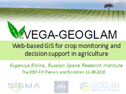
and decision support in agriculture Evgeniya Elkina Russian Space Research Institute The GEOXIII Plenary and Exhibition 11082016 VEGAGEOGLAM global agricultural monitoring websystem ID: 1019105

monitoring agricultural geoglamglobal web agricultural monitoring web geoglamglobal vega xiii plenary 2016slide systemgeo data land systemvega maps field crop

Share:

Link:

Embed:

Download Presentation from below link

Download Presentation The PPT/PDF document "VEGA-GEOGLAM Web-based GIS for crop moni..." is the property of its rightful owner. Permission is granted to download and print the materials on this web site for personal, non-commercial use only, and to display it on your personal computer provided you do not modify the materials and that you retain all copyright notices contained in the materials. By downloading content from our website, you accept the terms of this agreement.


Presentation Transcript

1. VEGA-GEOGLAMWeb-based GIS for crop monitoring and decision support in agricultureEvgeniya Elkina, Russian Space Research InstituteThe GEO-XIII Plenary and Exhibition 11-08-2016

2. VEGA-GEOGLAMglobal agricultural monitoring web-systemVEGA.GEOGLAM.RUis a web-based analytical system It provides accurate and up-to-date information about agricultural lands to users. It allows to improve efficiency of field management on local level and brings higher opportunity of food security threat recognition on global level. VEGA-GEOGLAM helps to understand how and where changes in cropland distribution affect other ecosystems all over the world.GEO-XIII Plenary 2016Slide 2 of 25

3. PurposesTo provide data and tools for global on-line crop monitoring VEGA-GEOGLAMglobal agricultural monitoring web-systemVEGA-GEOGLAMglobal agricultural monitoring web-systemGEO-XIII Plenary 2016Slide 3 of 25To serve as a platform for study and development remote sensing methods

4. TasksVEGA-GEOGLAMglobal agricultural monitoring web-systemVEGA-GEOGLAMglobal agricultural monitoring web-systemGEO-XIII Plenary 2016Slide 4 of 25 Real-time field monitoring and crop conditions assessmentCombination of Earth Observation and in-situ data analysis (over the JECAM test-sites Access to SIGMA/JECAM sites data)Land inventory and land use mappingChange detection and environmental changes studyImpact identification, assessment and adverse factors predictionDevelopment of new Earth monitoring methods

5. UsersVEGA-GEOGLAMglobal agricultural monitoring web-systemVEGA-GEOGLAMglobal agricultural monitoring web-systemGEO-XIII Plenary 2016Slide 5 of 25Government organizationsAgricultural producersScientists and students

6. NeedsVEGA-GEOGLAMglobal agricultural monitoring web-systemVEGA-GEOGLAMglobal agricultural monitoring web-systemGEO-XIII Plenary 2016Slide 6 of 25Crop condition indicators for the decision supportDATATOOLSANALYTICS

7. VEGA-GEOGLAMglobal agricultural monitoring web-systemVEGA.GEOGLAM.RUcore componentsVEGA-GEOGLAMglobal agricultural monitoring web-systemGEO-XIII Plenary 2016Slide 7 of 25DATATOOLSANALYTICS

8. VEGA-GEOGLAMglobal agricultural monitoring web-systemDataVEGA-GEOGLAMglobal agricultural monitoring web-systemGEO-XIII Plenary 2016Slide 8 of 25Satellite Imagery and cloud-free compositesProducts (maps and masks)Field dataMeteorological dataFires on agricultural/non-agricultural landsNDVI data for user defined objects (fields)

9. VEGA-GEOGLAMglobal agricultural monitoring web-systemDataCanopus-VResurs-P Meteor-MDeimosSentinel-1A,2AEO-1 (Hyperion)Landsat 4, 5, 7, 8Terra, Aqua MODISSuomi-NPPNOAAEnvisatERS-1DEIMOS, 22 mMETEOR-M, 60 mRESURS-P, 25 mSentinel-2A, 10 mCANOPUS-V, 10 mLANDSAT-8, 30 mVEGA-GEOGLAMglobal agricultural monitoring web-systemGEO-XIII Plenary 2016Slide 9 of 25

10. VEGA-GEOGLAMglobal agricultural monitoring web-systemData coverageVEGA-GEOGLAMglobal agricultural monitoring web-systemGEO-XIII Plenary 2016Slide 10 of 25MODIS derived NDVI map

11. VEGA-GEOGLAMglobal agricultural monitoring web-systemDataVEGA-GEOGLAMglobal agricultural monitoring web-systemGEO-XIII Plenary 2016Slide 11 of 25Satellite Imagery and cloud-free compositesProducts (maps and masks)Field dataMeteorological dataFires on agricultural/non-agricultural landsNDVI data for user defined objects (fields)

12. VEGA-GEOGLAMglobal agricultural monitoring web-systemMaps VEGA-GEOGLAMglobal agricultural monitoring web-systemGEO-XIII Plenary 2016Slide 12 of 25IIASA arable land mapWinter crops map,updated seasonallyThematic maps (Russia)Fallows map,updated annually

13. VEGA-GEOGLAMglobal agricultural monitoring web-systemDataVEGA-GEOGLAMglobal agricultural monitoring web-systemGEO-XIII Plenary 2016Slide 13 of 25Satellite Imagery and cloud-free compositesProducts (maps and masks)Field dataMeteorological dataFires on agricultural/non-agricultural landsNDVI data for user defined objects (fields)

14. VEGA-GEOGLAMglobal agricultural monitoring web-systemIn-situ data VEGA-GEOGLAMglobal agricultural monitoring web-systemGEO-XIII Plenary 2016Slide 14 of 25Field borders, type of land (arable/non-arable), crop type, yield, phenological stages.BrazilChinaUkraineRussiaArgentinaSIGMA-JECAM test-sites

15. VEGA-GEOGLAMglobal agricultural monitoring web-systemDataVEGA-GEOGLAMglobal agricultural monitoring web-systemGEO-XIII Plenary 2016Slide 15 of 25Satellite Imagery and cloud-free compositesProducts (maps and masks)Field dataMeteorological dataFires on agricultural/non-agricultural landsNDVI data for user defined objects (fields)

16. VEGA-GEOGLAMglobal agricultural monitoring web-systemMeteo- and Fires Data VEGA-GEOGLAMglobal agricultural monitoring web-systemGEO-XIII Plenary 2016Slide 16 of 25MODIS detected active fires and KMSS Meteor image of burnt area acquired on Nov 12, 2015 NCEP meteo data (Temperature)for the 4th of November 2016

17. VEGA-GEOGLAMglobal agricultural monitoring web-systemDataVEGA-GEOGLAMglobal agricultural monitoring web-systemGEO-XIII Plenary 2016Slide 17 of 25Satellite Imagery and cloud-free compositesProducts (maps and masks)Field dataMeteorological dataFires on agricultural/non-agricultural landsNDVI data for user defined objects (fields)

18. VEGA-GEOGLAMglobal agricultural monitoring web-systemVEGA-GEOGLAMglobal agricultural monitoring web-systemGEO-XIII Plenary 2016Slide 18 of 252015-05-26 Landsat 8Russia, Kursk regionPROBA-V cloud-free NDVI mapNDVI profiles forthe selected objectsCrop status assessment by comparison with the NDVI normMultiyear mean NDVI valueField2NDVIField101

19. VEGA-GEOGLAMglobal agricultural monitoring web-systemToolsMap interfaceUser data input toolsField PassportImage enhancement toolsImage classification toolsMap algebra Import/Export dataCurrent to standard NDVI comparison chartsTemporal and spectral profiles analysis toolsGEO-XIII Plenary 2016Slide 19 of 25

20. VEGA-GEOGLAMglobal agricultural monitoring web-systemAnalyticsNDVI trendsSpectral profiles VEGA-GEOGLAMglobal agricultural monitoring web-systemLANDSAT-7, 2015-09-23GEO-XIII Plenary 2016Slide 20 of 25

21. VEGA-GEOGLAMglobal agricultural monitoring web-systemGEO-XIII Plenary 2016Slide 21 of 25ArchitectureAll you need is…Internet!

22. VEGA-GEOGLAMglobal agricultural monitoring web-systemGEO-XIII Plenary 2016Slide 22 of 251.Visual crop condition assessment2. NDVI time-series analysis3.Meteorological data analysis4.Agricultural land-usage evaluation, abandoned land detection5.Сrop condition maps creationNDVImapDeviationfromMean NDVIfor thedistrictDynamicsofvegetation evolutionHeterogeneitymapUse cases – local level

23. VEGA-GEOGLAMglobal agricultural monitoring web-systemGEO-XIII Plenary 2016Slide 23 of 21GEO-XIII Plenary 2016Slide 23 of 251. Сrop condition maps  Crop Yield Estimates2. Risk assessment  Response3. Change detection and environmental changes study4.Land inventory and land use mapping5.SIGMA/JECAM test-sites data processing: new algorithms testing, mapping results validationUse cases – global level

24. VEGA-GEOGLAMglobal agricultural monitoring web-systemVEGA.GEOGLAM.RUbenefitsAll-in-oneFreewareOn-lineTutorialMulti-userFast accessVEGA-GEOGLAMglobal agricultural monitoring web-systemGEO-XIII Plenary 2016Slide 24 of 25

25. Thank you!VEGA.GEOGLAM.RUGEO-XIII Plenary 2016Slide 25 of 25 vega@smis.iki.rssi.ru

26. “Development of automated methods and information technologies for global satellite-based agricultural monitoring in support of GEOGLAM initiative” funded by the Ministry of Education and Science of the Russian Federation in support of the SIGMA project,Contract № 14.616.21.0063, Unique project ID - RFMEFI61615X0063