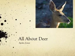
Edward Jackson 11182014 RENR 405 599 Texas AampM University Florida Key Deer Odocoileus virginianus clavium Lives only in the Florida Keys Subspecies of the whitetailed deer ID: 543256
Download Presentation The PPT/PDF document "Florida Key Deer Land Acquisition" is the property of its rightful owner. Permission is granted to download and print the materials on this web site for personal, non-commercial use only, and to display it on your personal computer provided you do not modify the materials and that you retain all copyright notices contained in the materials. By downloading content from our website, you accept the terms of this agreement.
Slide1
Florida Key Deer Land Acquisition
Edward Jackson
11/18/2014
RENR – 405 – 599
Texas A&M UniversitySlide2
Florida Key Deer
(
Odocoileus virginianus clavium)
Lives only in the Florida KeysSub-species of the white-tailed deerMigrated over a land bridge during the Wisconsin glaciationEarliest documented migration in the 1550sListed as an endangered speciesHunted for food supplyBanned in 1939Population has risen since 1955Slide3
Our Goal
Determine potential, private, undeveloped land for acquisition using a GIS
To find a suitable habitat for the Key Deer populationBased on popular vegetation for the species
Away from major roadsThis is where most deaths occurProjection RequestedContiguous Albers Equal Area ConicCentral Meridian: -84.01st Standard Parallel: 24.02nd Standard Parallel: 31.5Reference Latitude: 24.0
False Easting: 400015
False Northing: 50.0Slide4
Mapping the Area
Add data provided
VegetationMortalityOwnership
Ensure that all layer are correctly projectedUse the Contiguous Albers Equal Area Conic Slide5
Initial MapSlide6
Vegetation MapSlide7
Adding the Telemetry Points
Convert Telemetry locations .dbf to .
shpAdd data –> add XY data -> editProject to NAD_83
Export data as a shapefileA cluster of points will appear off of the map as shown belowSlide8
Define and Project the Telemetry Points
Use the Define Projection tool
Use Contiguous Albers Equal Area ConicProject toolUse this tool to project the telemetry points to align with the other layers
Set output to North_America_1983Slide9
Mapped Deer Telemetry PointsSlide10
Joining Relevant Points
Use the Spatial Join tool to join the telemetry data with the types of vegetation
This allows you to select telemetry points according to where they were found in each type of vegetationFill in the table provided
Calculate the expected amount of observed deerRatios are calculated and show preferred vegetationPick two forms of preferred vegetation Hammocks and Pinelands were used in this projectSlide11
Vegetation/Deer Frequency TableSlide12
Create a Preferred Vegetation Layer
Select Pinelands and Hammocks in the vegetation layer
Export this data to create a layer that shows only the preferred vegetationDissolve toolUse this to dissolve unnecessary data
Multipart toolUse this tool to keep data for each polygon in the preferred vegetationSlide13
Pinelands and HammocksSlide14
Add Road Data
Convert e00 file to
shapefile using the Conversion tools -> to CoverageSelect the major roadsHighway 1 and Key Deer Boulevard have the highest mortality rates
Create a BufferCreating a buffer will keep these areas out of your selection30 meter buffer for highway 150 meter buffer for Key Deer BoulevardMerge the buffers into a single bufferSlide15
RoadsSlide16
Map with Road BufferSlide17
Selecting an Area for the Habitat
Selecting an area
Away from human activityClose to federal landOutside of the buffer zone
Close together if multiple parcelsSelected multiple parcels Total acreage: 4.11 acresSlide18
Determining the Cost
Determination Factors
Total acres of undeveloped land: 1217Total cost of undeveloped land: $28,924,293Cost per acreTotal cost/Total Acres
$28,924,293/1217Cost per acre = $23,766.88Slide19
Selecting this location
Selected on these factors
Total cost: $97,173Total acreage: 4.11Proximity to federal landGives a better chance for expansion
Protects land from future developmentSlide20
Final Map