PPT-Surnames and Land Acquisition
Author : cheryl-pisano | Published Date : 2016-07-24
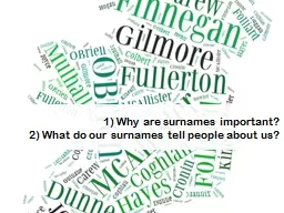
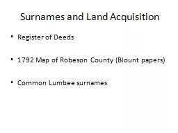
Register of Deeds 1792 Map of Robeson County Blount papers Common Lumbee surnames Map Surname Legend 1 Ten Mile Swamp Wilkins 2 Back Swamp Chavis Lowery
Presentation Embed Code
Download Presentation
Download Presentation The PPT/PDF document "Surnames and Land Acquisition" is the property of its rightful owner. Permission is granted to download and print the materials on this website for personal, non-commercial use only, and to display it on your personal computer provided you do not modify the materials and that you retain all copyright notices contained in the materials. By downloading content from our website, you accept the terms of this agreement.
Surnames and Land Acquisition: Transcript
Download Rules Of Document
"Surnames and Land Acquisition"The content belongs to its owner. You may download and print it for personal use, without modification, and keep all copyright notices. By downloading, you agree to these terms.
Related Documents