PPT-Ocean Data Interoperability Platform
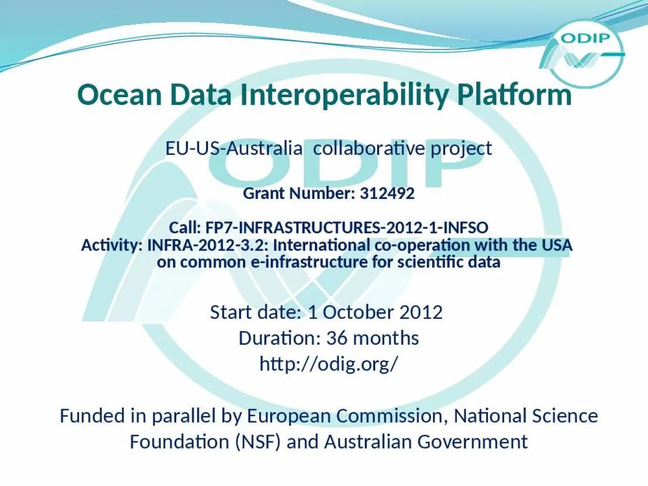
EUUSAustralia collaborative project Grant Number 312492 Call FP7INFRASTRUCTURES20121INFSO Activity INFRA201232 International cooperation with the USA on common einfrastructure
Download Presentation
"Ocean Data Interoperability Platform" is the property of its rightful owner. Permission is granted to download and print materials on this website for personal, non-commercial use only, provided you retain all copyright notices. By downloading content from our website, you accept the terms of this agreement.
Presentation Transcript
Transcript not available.