PDF-Trail History
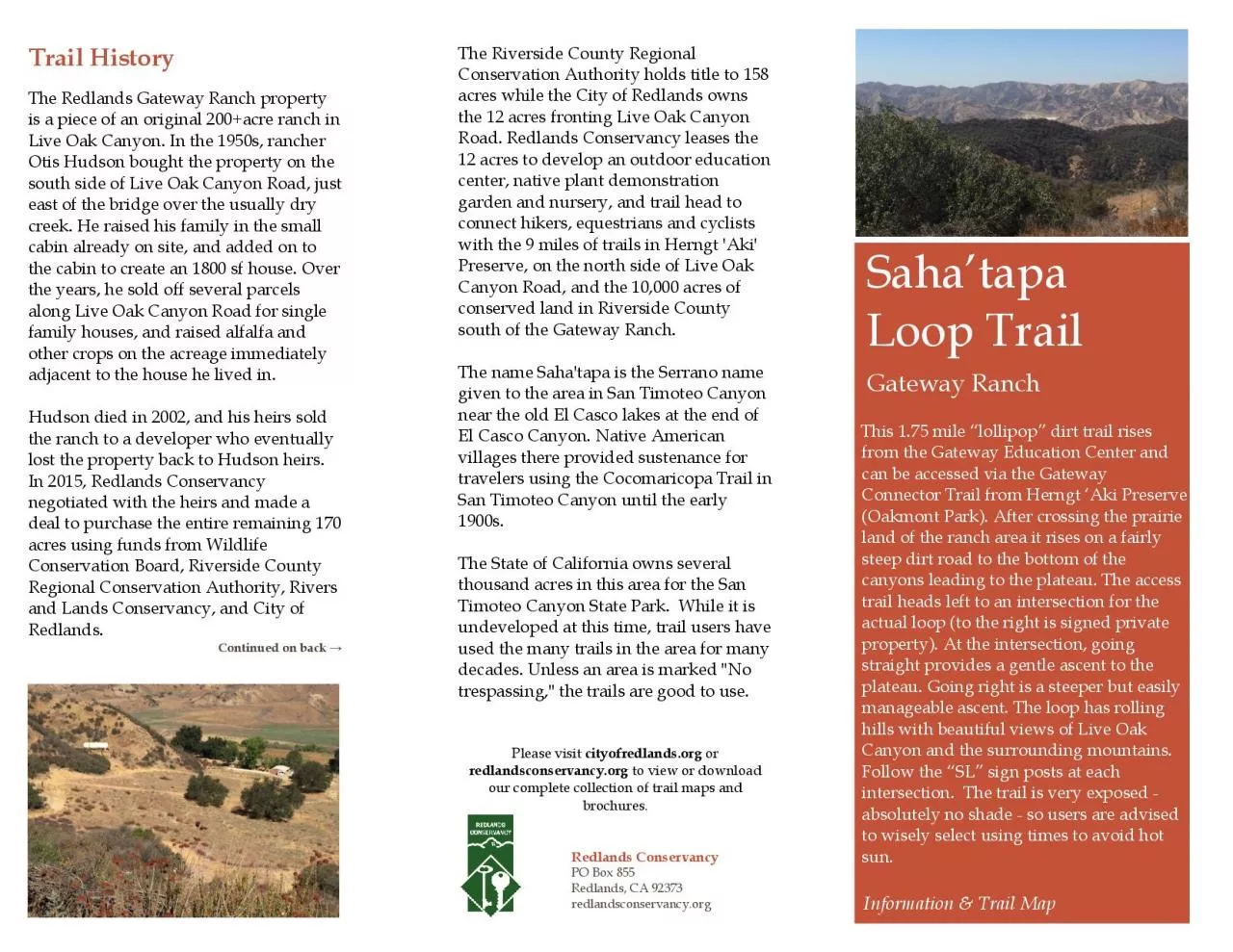
The Redlands Gateway Ranch property is a piece of an original 200acre ranch in Live Oak Canyon In the 1950s rancher Otis Hudson bought the property on the south
Download Presentation
"Trail History" is the property of its rightful owner. Permission is granted to download and print materials on this website for personal, non-commercial use only, provided you retain all copyright notices. By downloading content from our website, you accept the terms of this agreement.
Presentation Transcript
Transcript not available.