/
BookletChart BookletChart

BookletChart - PDF document

fanny
fanny . @fanny
Follow
346 views
Uploaded On 2021-06-20

BookletChart - PPT Presentation

153 
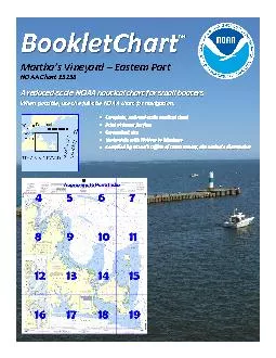
Martha146s Vineyard Eastern PartNOAA Chart 13238 A reducedscale NOAA nautical chart for small boaters When possible use the fullsize NOAA chart for navigation Included Area 2 ublished by t ID: 846352

noaa x00740069 chart gov x00740069 noaa gov chart x00740074 www coast harbor cape channel poge weather shoal buoy vessels

Share:

Link:

Embed:

Download Presentation from below link

Download Pdf The PPT/PDF document "BookletChart" is the property of its rightful owner. Permission is granted to download and print the materials on this web site for personal, non-commercial use only, and to display it on your personal computer provided you do not modify the materials and that you retain all copyright notices contained in the materials. By downloading content from our website, you accept the terms of this agreement.


Presentation Transcript

1 BookletChart ™ Martha’s Vine
BookletChart ™ Martha’s Vineyard Eastern PartNOAA Chart 13238 A reducedscale NOAA nautical chart for small boaters When possible, use the fullsize NOAA chart for navigation. Included Area 2 ublished by theNational Oceanic and Atmospheric AdministrationNational Ocean ServiceOffice of Coast Surveywww.NauticalCharts.NOAA.gov NOAAWhat are Nautical Charts?Nautical charts are a fundamental tool of marine navigation. They show water depths, obstructions, buoys, other aidsto navigation, and much more. The in

2 formation is shown in a way that promote
formation is shown in a way that promotes safe and efficient navigation. Chart carriage is mandatory on the commercial ships hat carry America’s commerce. They are also used on every Navy and Coast Guard ship, fishing and passenger vessels, and are widely carried by recreational boaters.What is a BookletChartThis BookletChart is made to help recreational boaters locate themselves on the water.It has been reduced in scale for convenience, but otherwise contains all the information of the fullscale nautical chart. The bar scales ha

3 ve also been reduced, and are accurate w
ve also been reduced, and are accurate when used to measure distances in this BookletChart. ee the Note at the bottom of page 5 for the reduction in scale applied to this chart.Whenever possible, use the official, full scale NOAA nautical chart for navigation. Nautical chart sales agents are listed on the Internet at http://www.NauticalCharts.NOAA.gov . This BookletChartdoes NOT fulfill chart carriage requirements for regulated commercial vessels under Titles 33 and 44 of the Code of Federal Regulations.Notice to Mariners Correctio

4 n StatusThis BookletChart has been updat
n StatusThis BookletChart has been updated for chart corrections published in the U.S. Coast Guard Local Notice to Mariners, the National Geospatial Intelligence Agency Weekly Notice to Mariners, and, where applicable, the Canadian Coast Guard Notice to Mariners. Additional chart corrections have been made by NOAA in advance of their publication in a Notice to Mariners.The last Notices to Mariners applied to this chart are listed in the Note at the bottom of page 7.Coast Pilot excerpts are not being correctedFor latest Coast Pilot exce

5 rpt visit the Office of Coast Survey web
rpt visit the Office of Coast Survey website at http://www.nauticalcharts.noaa.gov/nsd/searchbychart.php?chart=132 38 . Selected Excerpts from Coast PilotMuskeget Channelis an opening 6 miles wide on the south side of Nantucket Sound between Muskeget and Chappaquiddick Islands. The opening is full of shifting shoals. The best water is found close to the eastward of Wasque Shoal and about 1.5miles eastward of the eastern shore of Chappaquiddick Island. Although this channel is partly buoyed, strangers should never attempt it as tidal

6 currents with velocities of 2 to 5 knots
currents with velocities of 2 to 5 knots make navigation dangerous. The currents through the channel are strong, having a velocity of 3.8 knots on the flood and 3.3 knots on the ebb about 1.5 miles east of Wasque Point. The flood sets northnortheastward and ebbs southsouthwestward.Wasque Shoalextends southward ofWasque Point, the southeastern extremity of Chappaquiddick Island. The shoal, which dries about 2 miles south of Wasque Point, rises abruptly from deep Muskeget Channel.Martha’s VineyardandChappaquiddick Islandhave a combi

7 ned length of 18 miles; the two islands
ned length of 18 miles; the two islands are separated by Edgartown Harbor, Katama Bay, and the narrow slough connecting them. The northern extremity of Martha’s Vineyard is about 3 miles southeastward of the western end of Cape Cod. Martha’s Vineyard is well settled, especially along its northern shore, and is popular as a summer resort. Along the northern shore the island presents a generally rugged appearance. The southern shore is low and fringed with ponds, none of which has navigable outlets to the sea. Approaching from

8 the south, the principal landmarks are a
the south, the principal landmarks are a standpipe at Edgartown, an aerolight near the center of the island, a church spire nearChilmarkin the western part, a tall radar tower north of Chilmark, and Gay Head on the west side.Cape Poge, the northeastern point of Chappaquiddick Island, is a bare, bluff, precipitous head, which may appear from a distance to be a small island.Cape Poge Light(41°25'10"N., 70°27'08"W.), 65 feet above the water, is shown from a white conical tower on the cape.Cape Poge Flats, extending about 1.5 miles north

9 eastward from Cape Poge,are marked at th
eastward from Cape Poge,are marked at the northeast end by a bell buoy. The southerly edge of the white sector of West Chop Light is about 0.9 mile north of the buoy. Shoal water extends about 0.4 mile offshore westward and northwestward of Cape Poge. A buoy, 1 mile westnorthwestward of Cape Poge Light, marks the western side of the shoal water.Cape Poge Bay, a lagoon of considerable size in the northern part of Chappaquiddick Island, is entered from Edgartown Harbor. The unmarked entrance is used mostly by local pleasure and fishing c

10 raft. In 1981, it was reported that 4 fe
raft. In 1981, it was reported that 4 feet could be carried through the entrance channel with local knowledge.AnchoragesAnchorage with good shelter from easterly gales is found westward of Cape Poge on the eastern side of the outer harbor. In sterly and southerly gales vessels find shelter in the southern end of the outer harbor about 0.4 mile eastward or eastsoutheastward from Edgartown Harbor Light. In northerly or northeasterly gales vessels usually go to Woods Hole or Tarpaulin Cove for sheltered anchorage. Vessels should not ancho

11 r in the channel abreast the town where
r in the channel abreast the town where the bottom is hard sand, the channel narrow, and tidal currents strong. Southeast of the town, anchorage may be found south of Middle Ground in depths of 24 to 30 feet, sticky bottom.Small craft usually anchor in thespecial anchoragein the vicinity of Middle Ground. (Seeand, chapter 2, for limits and regulations.)DangersOn the western side of the outer harbor is a shoal area extending 2.8 miles northward of Edgartown Harbor Light. A bell buoy marks the northern edge of the shoal; vessels entering

12 or leaving the harbor pass eastward of
or leaving the harbor pass eastward of this buoy. The depths over the remainder of the shoal are irregular, and there are a rock awash and several rocks covered 3 to 5 feet. Strangers should never attempt to pass across this shoal. The channel into Edgartown Harbor is marked by a lighted buoy and unlighted buoys.Sturgeon Flats, covered 2 to 18 feet, extend about 600 yards off the southeastern shore of the outer harbor between the narrow entrance to Cape Poge Bay and the entrance to the inner harbor. In 2004, an obstruction covered 19

13 feet was reported in about 41°23'31"N.,
feet was reported in about 41°23'31"N., 70°29'27"W.U.S. Coast Guard Rescue Coordination Center24 hour Regional Contact for EmergenciesRCC Boston Commander1stCG District(617) 223Boston, MA G LateralSystemSeenEnteringFromSeawardon navigablewatersexcept WesternRiversPORTSIDEODDNUMBEREDAIDSGREENLIGHTONLYFLASHING(2)PREFERREDCHANNELNUMBERS LETTEREDPREFERREDCHANNELSTARBOARDTOPMOSTBANDGREENPREFERREDCHANNELNUMBERS LETTEREDPREFERREDCHANNELPORTTOPMOSTBANDREDSTARBOARDSIDENUMBEREDAIDSREDLIGHTONLYFLASHING(2)FLASHINGFLASHINGOCCULTINGGREENLIGH

14 TONLYREDLIGHTONLYOCCULTINGQUICKFLASHINGQ
TONLYREDLIGHTONLYOCCULTINGQUICKFLASHINGQUICKFLASHINGISOCOMPOSITEGROUPFLASHING(2+1)COMPOSITEGROUPFLASHING(2+1)ISO"1"G 6s"9"G 4s "A"(2+1)G 6s"B"(2+1)"2"R "8"LIGHTC "1"LIGHTEDBUOY"5"GR "U"GR "S"RG N "C"RG "G"LIGHTN "6"LIGHTEDBUOYCANDAYBEACONCANDAYBEACONFormoreinformationaids navigation,includingthoseon WesternRivers,pleaseconsultthelatestUSCGLight Listforyourarea.Thesevolumesareavailable onlineat http://www.navcen.uscg.gov 2 2 C U 5 1 VHF Marine Radio channels for use on the waterways: – Inter-ship safety communica񴀆

15 9;ons.Channel 9– Communica�
9;ons.Channel 9– Communica�ons between boats andship-to-coast.– Naviga�on purposes at bridges, locks, and harbors. – Emergency, distress and safety calls to Coast Guard and others, and to ini�ate calls to other vessels. Contact the other vessel, agree to another channel, and then switch.– Calls between the Coast Guard and the public. Severe weather warnings, hazards to naviga�on and safety warnings are broadcast here.– Recrea�onal boat channels.Ge�ng and Gi

16 ving Help — Signal other boaters using
ving Help — Signal other boaters using visual distress signals (�ares, orange �ag, lights, arm signals); whistles; horns; and on your VHF radio. You are required by law to help boaters in trouble. Respond to distress signals, but do not endanger yourself. EMERGENCY INFORMATION Distress Call Procedures•Make sure radio is on.•Select Channel 16.•Press/Hold the transmit bu�on.•Clearly say: “MAYDAY, MAYDAY, MAYDAY.”•Also give: Vessel Name and/or Descrip�on;Posi�on and/or

17 Loca�on; Nature of Emergency
Loca�on; Nature of Emergency; Number of People on Board.•Release transmit bu�on.•Wait for 10 seconds — If no responseRepeat MAYDAY call.HAVE ALL PERSONS PUT ON LIFE JACKETS! This Booklet chart has been designed for duplex prin�ng (printed on front and back of one sheet). If a duplex op�on is not available on your printer, you may print each sheet and arrange them back-to-back to allow for the proper layout when viewing.Quick ReferencesNau�cal chart related products and infor

18 ma�onh�p://www.nau
ma�onh�p://www.nau�calcharts.noaa.gov  Report a chart discrepancyh�p://ocsdata.ncd.noaa.gov/idrs/discrepancy.aspxChart and chart related inquiries and commentsh�p://ocsdata.ncd.noaa.gov/idrs/inquiry.aspx?frompage=ContactUsChart updates (LNM and NM correc�ons)h�p://www.nau�calcharts.noaa.gov/mcd/updates/LNM_NM.htmlCoast Pilot onlineh�p://www.nau�calcharts.noaa.gov/nsd/cpdownload.htmTides and Currentsh�p://t

19 0069;desandcurrents.noaa.govMarine Forec
0069;desandcurrents.noaa.govMarine Forecastsh�p://www.nws.noaa.gov/om/marine/home.htmNa�onal Data Buoy Centerh�p://www.ndbc.noaa.gov/NowCoast web portal for coastal condi�onsh�p://www.nowcoast.noaa.gov/Na�onal Weather Serviceh�p://www.weather.gov/Na�onal Hurrican Centerh�p://www.nhc.noaa.gov/Paci�c Tsunami Warning Centerh�p://ptwc.weather.gov/Contact Ush�p://www.nau�calcharts.noaa.gov/staf

20 0066;/contact.htm NOAA’s O�
0066;/contact.htm NOAA’s O�ce of Coast Survey The Na�on’s Chartmaker NOAA Weather Radio All Hazards (NWR) is a na�onwide network of radio sta�ons broadcas�ng con�nuous weather informa�on directly from the nearest Na�onal Weather Service o�ce. NWR broadcasts o�cial Weather Service warnings, watches, forecasts and other hazard informa�on 24 hours a day, 7 days a week.h�p://www.nws.

Related Contents


Next Show more