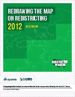
/
REDRAWING THE MAP ON REDISTRICTING REDRAWING THE MAP ON REDISTRICTING

REDRAWING THE MAP ON REDISTRICTING - PDF document

giovanna-bartolotta
giovanna-bartolotta . @giovanna-bartolotta
Follow
410 views
Uploaded On 2015-10-06

REDRAWING THE MAP ON REDISTRICTING - PPT Presentation

2012 DDENDUM Using geographical analysis to measure electoral district compactness following the 2010 US CensusAn Azavea White Paper Azavea x2022 340 North 12th StreetPhiladelphia Pennsylvania ID: 152127

2012 DDENDUM Using geographical analysis measure

Share:

Link:

Embed:

Download Presentation from below link

Download Pdf The PPT/PDF document "REDRAWING THE MAP ON REDISTRICTING" is the property of its rightful owner. Permission is granted to download and print the materials on this web site for personal, non-commercial use only, and to display it on your personal computer provided you do not modify the materials and that you retain all copyright notices contained in the materials. By downloading content from our website, you accept the terms of this agreement.


Presentation Transcript

REDRAWING THE MAP ON REDISTRICTING 2012 DDENDUM Using geographical analysis to measure electoral district compactness following the 2010 U.S. CensusAn Azavea White Paper Azavea • 340 North 12th StreetPhiladelphia, Pennsylvania • 19107(215) 925-2600www.azavea.comCopyright © 2012 AzaveaAll rights reserved.Printed in the United States of America.The information contained in this document is the exclusive property of Azavea. This work is protected under United States copyright law and other international copyright treaties and conventions. No part of this work may be reproduced or transmitted in any form or by any means, electronic or mechanical, including photocopying and recording, or by any information storage or retrieval system, except as expressly permitted in writing by Azavea. All requests should be sent to Attention: Contracts Manager, Azavea Incorporated, 340 N 12th St, Suite 402, Philadelphia, PA 19107, USA.The information contained in this document is subject to change without notice.U.S. GOVERNMENT RESTRICTED/LIMITED RIGHTSAny software, documentation, and/or data delivered hereunder is subject to the terms of the License Agreement. In no event shall the U.S. Government acquire greater than RESTRICTED/LIMITED RIGHTS. At a minimum, use, duplication, or disclosure by the U.S. Government is subject to restrictionsas set forth in FAR §52.227-14 Alternates I, II, and III (JUN 1987); FAR §52.227-19 (JUN 1987) and/or FAR §12.211/12.212 (Commercial Technical Data/Computer Software); and DFARS §252.227-7015 (NOV 1995) (Technical Data) and/or DFARS §227.7202 (Computer Software), as applicable.Contractor/Manufacturer is Azavea, 340 N 12th St, Suite 402, Philadelphia, PA 19107, USA.Azavea, the Azavea logo, Cicero, DecisionTree, Esphero, GeoTrellis, HunchLab, OpenTreeMap, REX, Kaleidocade, Sajara, www.azavea.com, and @azavea.com are trademarks, registered trademarks, or service marks of Azavea in the United States, and certain other jurisdictions. Other companies and products mentioned herein are trademarks or registered trademarks of their respective trademark owners. INTRODUCTIONIn 2006, Azavea released its �rst white paper related to redistricting and gerrymandering in the United States. In anticipation of the Census release and subsequent redistricting, we released a completely revised white paper in September 2010 as well as an Addendum that focused on the Philadelphia region. With the Congressional redistricting now complete we thought it might be useful to deliver another revision that would examine how the most recent round of redistricting has affected the geometry and geography of legislative districts in the United States.Similar to previous versions of Azavea’s redistricting drives our Cicero product, a web API that supports data queries and mapping related to legislative districts in sevThis second addendum to our 2010 white paper is not a standalone document. It is a much shorter document focused on what has changed since 2010, and we are not providing much of the background documentation that is http://www.azavea.com/redistricting-white-papersbackgroundAccording to the U.S. Census, the population of the United States grew by 9.7% to 308.7 million in 2010. As it does every ten years, this resulted in a reapportionment of all 435 seats in the House of Representatives based on new population numbers for each state. Eighteen states lost or gained seats. Texas gained the most, with four more seats, while Florida gained two more seats. Six other states gained one seat. The biggest losers were New York and Ohio, which lost two seats each. Other states that lost seats include Illinois, Iowa, Louisiana, Massachusetts, Michigan, Missouri, Pennsylvania and New Jersey.Once the population gures are released and states’ seats reapportioned, the Census Bureau makes available detailed demographic data to each state’s legislature. This demographic data contains information on race and voting age population aggregated to the Census block level. The data that is released is aimed primarily at supporting the redistricting and reapportionment process and is delivered in stages beginning in January 2011 with all states delivered on or before April 1, 2011. This full count of the enables each state as well as many local legislatures to begin the process of redrawing the congressional and legislative districts. Prior to 1962, many states had vastly unequal districts. The landmark Supreme Court decision of Baker v. Carr (1962) was the rst step of the Supreme Court’s role in redistricting. The Court’s decision demands that congressional districts be “as equal as possible” in population while state legislative districts may have up to a 10% deviation if just cause exists. In addition, federal courts also enforce Section 2 of the Voting Rights Act to protect the voting rights of minorities. To comply with the Voting Rights Act, states This is done through a "majority-minority” district, in which racial or ethnic minorities constitute a majority (50% plus 1 or more) of the population. Alternatively, if enough minority population exists but not enough to make a majority of the population, an “opportunity” district may be created. An opportunity district contains enough population to provide minority voters with an equal opportunity to elect a candidate of their choice. In addition to complying with Section 2 of the Voting Rights Act, some states must also receive pre-clearance from the U.S. Department of Justice. To obtain pre-clearance, the state must demonstrate their redistricting plan does not discriminate against receive approval from the D.O.J. are mostly in the South and have a history of discriminatory voting practices. tricts, there is no legal standard for compactness. In fact, some districts that have a low measure of compactness can be justied on the grounds of the Voting Rights Act. Therefore, we do not offer any denitive judgment of what is considered “gerrymandering”. Rather the purpose of the public of the quantitative methods commonly used to METHODSThe nature of the spatial data received from various state redistricting authorities required a way to provide a fair comparison to current districts. One issue that we have faced in all of our previous studies continues. When asdetailed and “generalized” versions of new congressioproduced a “generalized” version of districts that was not clipped to the Chesapeake Bay shoreline and therefore did not have all of the fractal details of the Chesapeake edge. In contrast, Wisconsin’s boundary data was neatly trimmed around Lake Michigan, resulting in a very fine-grained boundary. In order to resolve these differences in ized shoreline of the United States for use in both the 2000 and 2010 districts prior to beginning the analysis in order THE LEAST COMPACT CONGRESSIONAL DISTRICTSto support a more even-handed comparison between the As noted in the 2010 white paper, the Polsby-Popper and Schwartzberg ratios place high importance on district perimeter. Thus, they are highly susceptible to bias due to shoreline complexity. Therefore, districts that are trimmed score through no fault of the district's authors and may not necessarily be a true indicator of gerrymandering. This is precisely why it's important to use multiple compactness scores (in this case the Polsby-Popper, Schwartzberg, Reock and Convex Hull measures) and let the reader judge which one is a better fit based on the geography of the district and method of calculation each score uses. A higher score means more compact, but the scores using different measures cannot be directly compared to each other.For consistency purposes, measures for this study have vious study in 2010, though with a slightly different workflow for Schwartzberg. Also, z-scores were calculated for each compactness measure and averaged for each district and state. In addition, it is important to note that we used a single district) were excluded. Finally, like in our previous white paper, all compactness scores were multiplied by 100. DistrictPolsby-PopperSchwartzbergConvex HullReockFL-5LA-2FL-22NY-10Table 1: Top 10 least compact districts DISTRICT STORIESThe top offender on our revised 2010 list of least compact districts is North Carolina’s 12th District. At 120 miles long but only 20 miles wide at its widest part, the district has the lowest z-score of any district in our analysis. It includes chunks of Charlotte and Greensboro connected by a thin along Interstate 85 between the two cities (traveling on 85 between Charlotte and Greensboro would take you in and out of the district 4 times). An appendage extends northwest from just south of Greensboro, offering Winston-Salem part of the district. The 12th district was created after the 1990 census and meant to be a majority-minority district. However, in the Supreme Court case Shaw v. Reno, 517 U.S. 899 (1995) the district was found unconstitutional as a racial gerrymander. After the state redrew the district slightly, it was justified as political gerrymandering and thus legal. Using 2010 census data, this district is still a majority-minority district, with 51% of the population . Despite the 12th district, the U.S. Department of Justice gave preclearance to North Carolina’s congressional redistricting plan in 2011 Florida’s new 5th District is the second least compact of all congressional districts, containing pieces of Jacksonville and Orlando, without keeping either city intact. Similar to NC-12, this district connects two majority African-American neighborhoods with a thin strip stretching across the state, occasionally stopping to pick up more minority voters in Gainesville and Palatka. The district appears to be constructed out of the remnants of FL-3, currently represented by Connie Mack, yet it is narrower and less compact. This is also a majority-minority district, with an . While Florida’s redistricting plan has been pre-cleared by the U.S. Department of Justice, there is currently a complaint in state court filed against the plan. The complaint argues Florida’s redistricting plan violates state constitutional requirements regarding partisan and racial gerrymandering. The case specifically refers to the 5th congressional district as an example of racial packing. Moreover, the case cites the districts’ lack of compactness.Another offender on our list of least compact districts is Maryland’s 3rd District. The district, which straddles the western shore of the Chesapeake Bay and includes Annapolis, then, diverts inland to include northern Washington, DC suburbs such as Olney and Sandy Springs, before reversing course all the way to the City of Baltimore. The district includes a chunk of East Baltimore, before narrowing to less than 600 feet across as it snakes through a small neighborhood near Clifton Park in Baltimore. The northern part of the district contains two lopsided chunks in the northeastern and northwestern suburbs of Baltimore connected by a thin strip barely a half-mile wide. There is no doubt that part of the district is affected by the shoreline of the Chesapeake Bay, however there is seemingly no other reason for the district to snake through various communities in three different metropolitan areas the way it doesFL-5 If you have never seen a Lake Erie water snake, look no further than Ohio’s 9th District. At 100 miles long but never more than several miles wide, this elongated district stretches across Ohio’s northern border with Lake Erie from west of Toledo to Cleveland. At one point, it is only as wide as a beach. The district resulted from a combination of the former 9th and 10th district, represented by Marcy Kaptur and Dennis Kucinich, respectively. Democrats charge that Republicans in control of the state’s redistrictsame narrow district to result in a member versus member primary, which Kucinich eventually lost.Due to very strong population growth, Texas gained four U.S. House seats. One of those new seats now makes our list as the fifth least compact in the nation. Texas’ 35th District contains portions of Austin and San Antonio, connected by a thin strip along Interstate 35 through the south central part of the state. Texas had one of the most complicated redistricting stories in the country. When the state a federal court redrew the districts in a way considered much more favorable to the Democrats than the GOP-led legislature preferred. After a successful appeal to the Supreme Court, the lower court had to redraw the congrespreferred. Thus the 35th district was created out of pieces of six other districts, picking up Democratic voters in both Austin and San Antonio, while not making up a majority of voters in either city. This district is the third majority-minority district in the top 5, with a 58% Hispanic voting Polsby-PopperSchwartzbergConvex HullReockNC-12NC-12NC-12FL-5NC-12FL-5FL-5FL-5NY-10PA-7PA-7FL-22WA-2WA-2TX-15MI-14PA-1Table 2: Top 10 least compact districts by compactness score Polsby-PopperSchwartzbergConvex HullReock46.1237.29Standard Deviation11.7712.4312.3611.27(MD-3) 16.38(NC-12) 24.99(NV-2) 58.97(NV-2) 76.79(TX-16) 94.25 (FL-17) 67.96 Top 10 statesIn addition to measuring the compactness of individual pactness scores for all congressional districts in a given state. Similar to our previous paper, we compiled a top 10 list by converting each compactness measure into a z-score than averaging the state’s z-scores across the four Five states are in the Top 10 least compact states for each compactness score; Maryland, North Carolina, Louisiana, West Virginia and Illinois. Of all states in the Top 10, Maryevery measure, except for Reock. Many of the states in the top 10 have notable geography issues which may create lower compactness scores, such as Hawaii and Rhode Island. However, states where geography can not necessarily be demonstrably explained as resulting in such low compactness scores include Illinois and Pennsylvania. Even considering their shorelines, Maryland and North Carolina also seem to indicate the potential for gerryman Polsby-PopperShwartzbergConvex HullReockdering. Louisiana, West Virginia, Virginia and New Hampshire also have geographical issues which may be reducing their compactness score but other factors may be at play here. Table 5 is a list of all states with their average compactness score for all measures ranked by the state’s Table 3: Summary statistics for compactness scores Table 4: Top 10 states whose districts have the lowestaverage compactness Mean Score,Polsby-PopperMean Score,SchwartzbergMean Score,Convex Hull Mean Score,Reock# of Districts27.6711.5132.1711.1032.1432.1413.6554.7614.4237.2867.5827.8929.1067.5816.4567.5316.6461.0331.0717.1434.1520.1417.2263.7418.4541.7463.1914.0437.0419.1767.3536.1218.9618.4337.7019.2137.1621.1944.7471.3934.0019.8937.4248.1836.0035.1048.0039.1227.6569.1734.1847.5876.8421.8547.5825.0177.4137.6971.8542.1927.0851.4931.8131.1574.8276.8035.1744.1341.1041.0381.7348.12Table 5: Average compactness scores for all states with more than one congressional district Moving beyond the work in the 2010 white paper, we performed an additional analysis focusing on the conditions under which redistricting processes occurred, including types of redistricting authority and the party controlling the process.Redistricting by Type of AuthorityFor the purpose of this analysis, we will dene two types of legislative and two types of non-partisan redistricting authorities. Since all Congressional districts have now been redrawn, we now know which type of authority was actually responsible for drawing a state’s congressional districts. We evaluated the type of authority that ultimately drew the districts, rather than the type of authority that was to draw the lines. So, for example, the category for court-drawn districts to redraw the state’s districts. Types of redistricting authorities are found in Table 6.compactness by redistricting authority and party control Type of AuthorityDescriptionLegislatureLegislative CommissionA state legislature appoints a commission to redraw the congressional districts. The commission is often made up of appointees by the majority and minority parties in the state legislature, and sometimes another by other state executivesor Non-partisanAn independent commission made up of citizens redraws districts or non-partisan Court-drawnAs a result of litigation, legislative gridlock or inaction, congressional districts were drawn up or enacted by a Court Table 6: Average compactness by redistricting authority Conventional wisdom might suggest that Republicans had overwhelming control of redrawing the nation’s congressional districts. After the 2010 midterm election the GOP control of only 16. In addition, many states where the swing states that contained many Republicans who won by a slim majority in 2010. However, a nal analysis shows that the GOP only had total control over redrawing of 159 districts. We are not arguing that the GOP (or Democratic Party, for that matter) may have had other methods of inuencing the process, simply that the structure of the control 159 districts. For example, one could claim that the Texas court-approved redistricting maps were in fact originally drawn by the GOP. Nevertheless, of districts where the process was controlled by one political party, the GOP did control the outcome of many more than the DemoLegislative Commissions, Non-partisan processes or the Court system, we nd that 235 districts remain, about 54% of the House of Representatives. Of those 235, more than cratic Party. Twenty-seven districts were drawn in states with either split control of the legislature (such as in the case of Kentucky) or a Governor of a different party than Redistricting under partisan control Redistricting AuthorityPolsby-PopperSchwartzbergConvex HullReock# of Districts# of StatesLegislature20.5443.6467.3135.73235Legislative Commission19.4543.0668.3736.77or non-partisan25.2949.3173.7240.03Court-enacted27.4450.6472.4839.22Nationwide Mean22.8246.1269.5937.2942843 Table 7: Average compactness by redistricting authority Compiling districts by redistricting authority (Table 7), we nd that the most compact districts are a result of a court action or independent commissions. For Polsby-Popper, Court-enacted districts have a score of 0.2744; these districts were even more compact than those drawn by independent or non-partisan processes. The same holds true for the Schwartzberg measure. For Convex Hull and Reock, independent commissions and non-partisan processes produced districts more compact than those enacted by a Court. Furthermore, those independent commissions and non-partisan processes also produced districts that were more compact than the national average. It is perhaps most notable that districts produced by legislatures or legislative commissions produced districts less compact than the national average by all measures. While districts drawn by Republicans in this decennial redistricting process may be somewhat more compact than those drawn by Democrats, it is also clear that both parties appeared to take advantage of their situation and draw districts more favorable to their party’s election. For example, Democrats took advantage in Maryland and Illinois while Republicans took advantage in Ohio and Pennsylvania. Republicans just had many more states, which may have buffered their Partisan ControlPolsby-PopperSchwartzbergConvex HullReock# of Districts# of StatesGOP or Democratic PartyNon-partisan (incl. court-drawn)167Total The mean Polsby-Popper, Schwartzberg and Reock scores split control fall in the middle. Nevertheless, districts with a political party in control remain less compact than the Partisan ControlPolsby-PopperSchwartzbergConvex HullReock# of Districts# of States21.7344.8868.6436.90159Democratic Party17.2839.9861.4432.5919.3942.9670.1234.6027Total235where a party has control are signicantly less compact than districts drawn by a non-partisan process (see Table 9). Using the convex hull measure shows a different story. Districts drawn by a split in control come out with a higher far behind. Districts drawn by the Democratic Party are much less compact than either.Table 8: Average compactness by partisan control Table 9: Average compactness by partisan or non-partisan control 109th Congress113th CongressPolsby-Popper11.59Schwartzberg27.67Convex Hull60.13Reock27.00Since the national scores show little change, it might be most useful to look at the degree to which individual states’ scores changed. Most notably, we nd that Maryany state. As a matter of fact, for every score calculated Table 11, the average compactness of Maryland’s 113th 2002 Maryland Districts2012 Maryland Districts 109th Congress113th CongressPolsby-Popper21.77Schwartzberg46.12Convex HullReock37.29As noted previously, we compiled average compactness scores across all four measures for each congressional district and also aggregated to an average of each state’s congressional districts. The districts are also clipped to the Census. Consequently, we can now make useful comparisons between districts drawn up for the 109th Congress and districts drawn up for the 113th Congress.In Table 10, one can see that average compactness scores increased, very slightly, overall for all congressional districts. Polsby-Popper noted a 4.8% increase in compactness. Compactness measured using the Schwartzberg raComparison to 109th congressional districtsConvex Hull increased by 1.5% and Reock scores increased Our Gerrymandering Index white paper released in 2006the 109th Congress compared to the 104th. However, the slight increase in the 113th Congress’ scores is still lower than those of the 104th Congress.Table 10: Average compactness for all 2002 and 2012 districtsTable 11: Average compactness for Maryland's 2002 and2012 districts 109th Congress113th CongressPolsby-Popper18.47Schwartzberg42.01Convex HullReock31.53California was another state that signicantly changed its redistricting process, implementing a Citizen Commission approach. This appears to have results in signicantly more compact districts, as outlined in Table 13.ness include New Jersey, and Tennessee, which fell out of our Top 10 least compact this year. 2002 California Districts2012 California Districts 109th Congress113th CongressPolsby-Popper16.87Schwartzberg39.1348.18Convex Hull61.50ReockOn the opposite end of the spectrum, Florida’s congresously. This is despite two of Florida’s districts showing up in the top 10 least compact. What could be the reason for the overall improvement in Florida’s districts? In 2010, voters approved the Florida Congressional District Boundaries Amendment. The amendment orders that all redisfeasible, and where feasible must make use of existing . This appears to have resulted were drawn by legislators. While the state previously had six districts with a Polsby-Popper score of less than 0.1, the 2002 Florida Districts2012 Florida DistrictsTable 12: Average compactness for Florida's 2002 and2012 districtsTable 13: Average compactness for California's 2002 and2012 districts With any study of legislative district compactness, one must look at the score in context of several factors. One of those factors is the state’s geography. For example, Washington State contains a rugged shoreline around the Puget Sound. This affects three of the states 10 districts and drags down the state’s overall compactness score for the Polsby-Popper and Schwartzberg measures. West Virginia is a similar example. West Virginia’s 2nd District contains most of the state’s eastern panhandle, an appendage that seems to reduce some measures of compactness, despite being the state’s legal border. The unique geographic features within a state can be an additional factor. This rings true in the case of Louisiana, with the Mississippi river Additionally, one must consider other more subjective factors, such as the need for minority representation. The district outlines of LA-2, NC-12, FL-5 may at rst appear majority-minority districts meant to ensure that minorities have an equal opportunity to elect a representative of their choice. While ostensibly for a social justice purpose, this can also be seen as “packing”, which is characterized by voters of a party are drawn out of surrounding districts and lumped together in the often awkwardly-shaped remnants. So where do we draw the proverbial line between a valid majority-minority district and packing of minorities into a single district? Ultimately, this is when lawsuits are led to challenge the districts in court. As in previous white papers, we do not argue that compactness is the metric for identifying gerrymandering. Rather, it is a means of identifying potential gerrymandering and should always be considered in context of the district’s geographical surWhat we can say with some degree of certainty is that compact, regardless of requirements under the Voting Rights Act (VRA). Maybe this means that even when majority-minority districts must be drawn, they need not be drawn in such a way that dees common sense. California CONCLUSIONpopulation as well as the need for majority-minority districts. However, California ranks right in the middle (25th) of all states for average compactness. Arizona, another state with an independent commission and VRA requirecompact). Iowa with its non-partisan process is ranked 39th, though the state has no need for majority-minority districts. Furthermore, Florida’s dramatic increase in comenforced through stricter requirements on the legislature for drawing districts in a fair, impartial manner. As we have noted in previous papers on this topic, the advent of GIS technologies have created an opportunity to improve the quality of our legislative districts as well as powerful tools to use for gerrymandering. We are encouraged by the inmore widespread requirements for public input. We hope Using Esri ArcGIS software, the “clip” tool trimmed the new districts shapele at the shorelines of the current districtsIn our previous white paper, Schwartzberg scores were calculated on a more generalized shapele in an attempt to remove bias that results from states with detailed coastlines. For this study, all scores were calculated on the same somewhat generalized coastline shapele. Readers will notice that this results in the same ranking for Polsby-Popper and Schwartzberg, whereas our previous study had different rankings.Hunt vs. Cromartie, 526 U.S. 541 (1999) 2011 North Carolina General Assembly. District Statistics Plan CST1A Rucho Lewis Congress 3 – District 12. http://www.ncga.state.nc.us/GIS/Download/District_Plans/DB_2011/Congress/Rucho-Lewis_Congress_3/Reports/DistrictStats/SingleDistAdobe/rptDistrictStats-12.pdfPerez, Thomas E. letter to Alexander McC. Peters. 1 November 2011.Florida Senate. District 5 Demographic Prole (H000C9047). http://www.senate.gov/PublishedContent/Session/Redistricting/Plans/H000C9047/H000C9047_district_details.Romo, Weaver et al. v. Detzner No. 37-2012-CA-00412 (Florida Circuit Court, Leon County)It is worth noting that excluding the Chesapeake Bay shoreline, MD-3 ranks with the second lowest Polsby-Popper and Schwartzberg score, only slightly more compact than NC-12.Texas Legislative Council. Hispanic Population Prole Using Census, American Community Survey, and Voter Registration Data Congressional Districts – Plan C235. ftp://ftpgis1.tlc.state.tx.us/PlanC235/Reports/PDF/PlanC235_RED119_Hispanic_Population_Prole%202006-2010.pdfKeep in mind that districts approved by a Court may have been inuenced by partisans, such as the case in Texas or Colorado. Legislative commissions, while non-partisan in theory, not included in this calculation.Florida Department of State Division of Elections. Standards for Legislature to Follow in Congressional Redistricting. http://election.dos.state..us/initiatives/initdetail.ENDNOTES Azavea White Paper Azavea White Paper