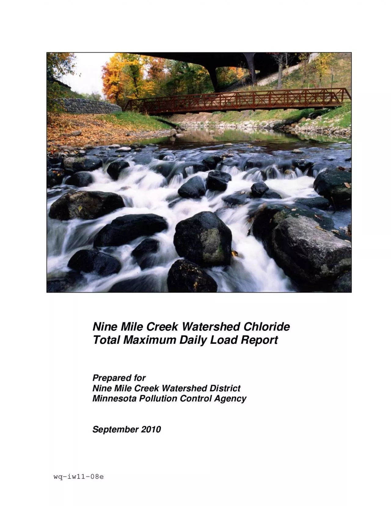
/
Nine Mile Creek Watershed Chloride  Nine Mile Creek Watershed District Nine Mile Creek Watershed Chloride  Nine Mile Creek Watershed District

Nine Mile Creek Watershed Chloride Nine Mile Creek Watershed District - PDF document

helene
helene . @helene
Follow
349 views
Uploaded On 2021-06-28

Nine Mile Creek Watershed Chloride Nine Mile Creek Watershed District - PPT Presentation

Nine Mile Creek Watershed District Minnesota Pollution Control Agency 4700 West 77 th Street Minneapolis MN 554354803Phone 952 8322600 Fax 952 8322601 Nine Mile Creek Watershed Chlori ID: 848391

creek chloride watershed mile chloride creek mile watershed tmdl water load salt road report sources lake monitoring quality existing

Share:

Link:

Embed:

Download Presentation from below link

Download Pdf The PPT/PDF document "Nine Mile Creek Watershed Chloride Nine..." is the property of its rightful owner. Permission is granted to download and print the materials on this web site for personal, non-commercial use only, and to display it on your personal computer provided you do not modify the materials and that you retain all copyright notices contained in the materials. By downloading content from our website, you accept the terms of this agreement.


Presentation Transcript

1 Nine Mile Creek Watershed Chloride Nine
Nine Mile Creek Watershed Chloride Nine Mile Creek Watershed District Minnesota Pollution Control Agency Nine Mile Creek Watershed District Minnesota Pollution Control Agency 4700 West 77 th Street Minneapolis, MN 55435-4803Phone: (952) 832-2600 Fax: ( 952 832-2601 Nine Mile Creek Watershed Chloride TMDL Report--Final Nine Mile Creek Watershed Chloride Total Maximum Daily Load Report September 2010 Table of Contents Executive Summary .............................................................................................................1.0 Introduction .............................................................................................................2.0 Background Information ...................................................................................................Applicable Water Quality Standards ........................................................................................... General Stream Characteristics ................................................................................................3.0 Nine Mile Creek Chloride Impairment ......................................................................................Surface Water Quality Conditions for Chloride.......................................................................... 8Comparison of Existing Chloride Concentrations to the Water Quality Stand

2 ards ....... 9Existing Chloride Concentr
ards ....... 9Existing Chloride Concentration and Snowfall Relationships ..................................... 14Chloride Sources and Current Contributions ............................................................................ 15Methodology for Load Allocations, Wasteload Allocations and Margin of Safety .................. 20Wasteload Allocations ................................................................................................. 20Load Allocations to Nonpoint Sources ........................................................................ 21Margin of Safety .......................................................................................................... 21Reserve Capacity ......................................................................................................... 22Chloride TMDL Allocations for Nine Mile Creek ................................................................... 23Critical Conditions and Seasonal Variation .............................................................................. 244.0 Monitoring Plan to Track TMDL Effectiveness ..............................................................................5.0 TMDL Implementation Strategies ...........................................................................................Annual Load Reductions ...................................................

3 ........................................
.....................................................Responsible Parties ...........................................................................................................Implementation Cost ...........................................................................................................6.0 Reasonable Assurances ....................................................................................................7.0 Public Participation .....................................................................................................References .................................................................................................................... Nine Mile Creek Watershed Chloride TMDL Report--FinalList of Tables EPA TMDL Summary Table ........................................................................................................Table ES-1Nine Mile Creek Chloride Budget and Wasteload and Load Allocations ..................... viiTable 1Minnesota Pollution Control Agency Chloride Water Quality Standard and Basis for Determining Impairment ................................................................................................ 5Table 2Nine Mile Creek Watershed and Seven-County Twin City Metropolitan Area (TCMA) Landuse ..................................................................................................

4 .....................Table 3Estimated Ch
.....................Table 3Estimated Chloride Concentrations for Nine Mile Creek @ 106 Street WOMP Site and Days with Snowfall ............................................................................................... 14Table 4Nine Mile Creek Watershed MS4 Lane Mileage .......................................................... 16Table 5Existing MS4 Road Salt Application Rates .................................................................. 18Table 6Nine Mile Creek Watershed Existing Road Salt Chloride Sources and Annual Loads . 19Table 7Nine Mile Creek Chloride Budget and Wasteload and Load Allocations ..................... 24List of Figures Nine Mile Creek Watershed Map ................................................................................... 2Nine Mile Creek Watershed WOMP Site Chloride Concentrations ............................. 11Nine Mile Creek @ 106 Street WOMP Site—Chloride-Specific Conductance Relationship ................................................................................................................. Nine Mile Creek @ 106 2007 Chloride from Specific Conductance ................................................................................................................ 13Nine Mile Creek @ 106 Street WOMP Site—Estimated Chloride Concentrations and Days with Snowfall Regressions ........................................

5 ........................................
.......................................... 15List of Appendices Appendix A Watershed Monitoring Data Appendix B Salt Application and Storage Information for Municipal Separate Storm Sewer Systems (MS4s) Nine Mile Creek Watershed Chloride TMDL Report--Final EPA TMDL Summary Table EPA/MPCA Required Elements Summary Page # Location Southwest Hennepin County 1 303(d) Listing Information Waterbody: Nine Mile Creek AUID 07020012-518 Impaired Beneficial Use: Aquatic Life Impairment/TMDL Pollutant of Concern: Chloride Priority Ranking: 2005 Target Start, 2009 Target Completion Original Listing Year: 2004 Applicable Water Standards/Numeric MPCA Toxicity-Based Water Quality Standards for Protection of Aquatic Life: 230 mg/L Chloride 4-Day Mean Chronic Standard 860 mg/L Chloride Maximum Standard Source: Minnesota Rule 7050.0222 Subp. 4. Class 2B Loading Capacity Chloride Loading Capacity for critical condition Critical condition summary: MPCA chloride standard is compared to the higher of the estimated 4-day average and maximum stream concentrations. Daily loading capacity for critical condition is based on the relationship between the total annual load and peak streamflow concentrations during the critical snowmelt and spring Nine Mile Creek (tons/day) 6.967 Margin of Safety The margin of safety for this TMDL is provided implicitly through the use of conservativ

6 e assumptions about the existing water q
e assumptions about the existing water quality for critical conditions combined with a high number of deicing events to derive the loading reductions in the development of allocations. Seasonal Variation Chloride concentrations in the streams vary significantly throughout the year, typically peaking between January and March. The TMDL guidelines for chloride listings are defined by the 4-day mean and maximum concentrations (MPCA, 2007). Accordingly, water quality management scenarios were evaluated in terms of the higher of the estimated 4-day average and maximum stream concentrations relative to the respective standards. Nine Mile Creek Watershed Chloride TMDL Report--Final EPA TMDL Summary Table EPA/MPCA Required Elements Summary Page # Wasteload Allocation Source Nine Mile Creek Permitted MS4 Activities—Minnesota Department of Transportation 0.797 Permitted MS4 Activities—Hennepin 0.463 Permitted Categorical MS4 Activities—Cities of Bloomington, Edina, Minnetonka, Hopkins, Eden Prairie and Richfield; Normandale 5.164 Load Allocation (LA) Source Nine Mile Creek LA (tons/day) The estimated background chloride concentration of 18.7 mg/L is approximately eight percent of the chronic standard for chloride, so the LA was set to eight percent of the calculated TMDL. 0.542 Monitoring The monitoring plan to track TMDL effectiveness is described in Secti

7 on 4.0 of this TMDL report. Implementat
on 4.0 of this TMDL report. Implementation The implementation strategy to achieve the load reductions described in this TMDL is summarized in Section 5.0 of this TMDL report. Reasonable Assurance The overall implementation plan (Section 5.0) is multifaceted, with various projects put into place over the course of many years, allowing for monitoring and reflection on project successes and the chance to change course if progress is exceeding expectations or is unsatisfactory. Also the bulk of the sources are NPDES-permitted, which provides a mechanism for determining compliance with wasteload allocations. Public Participation Several TMDL technical advisory committee meetings were conducted between Watershed staff, representatives from the various entities that are responsible for loads within the watershed and the MPCA. Nine Mile Creek Watershed Chloride TMDL Report--Final Executive Summary Nine Mile Creek is currently listed on the Minnesota Pollution Control Agency’s (MPCA) 2008 303(d) Impaired Waters List because of chloride levels, as well as impaired biota due to low fish Index of Biotic Integrity (IBI) scores, and requires a Total Maximum Daily Load (TMDL) report. The creek was first listed on the MPCA’s 303(d) list in 2004 after data indicated that Nine Mile Creek had chloride levels in excess of the MPCA’s state water quality chronic standard of 2

8 30 milligrams per liter. Nine Mile Cree
30 milligrams per liter. Nine Mile Creek (AUID 07020012-518) is located in southwest Hennepin County in the lower portion of the Minnesota River Basin and the watershed covers an area of 44.5 square miles. The watershed is fully developed with various urban land uses, several large open space areas and numerous lakes and large wetland complexes. The TMDL report for the creek had a target start date of 2005 and a target completion date of 2009. The MPCA’s projected schedule for TMDL completions, as indicated on Minnesota’s 303(d) impaired waters list, implicitly reflects Minnesota’s priority ranking of this TMDL. Ranking criteria for scheduling TMDL projects include, but are not limited to: impairment impacts on public health and aquatic life; public value of the impaired water resource; likelihood of completing the TMDL in an expedient manner, including a strong base of existing data and restorability of the waterbody; technical capability and willingness locally to assist with the TMDL; andappropriate sequencing of TMDLs within a watershed The recent results of the monitoring program suggest that chloride levels in the creek are generally highest in the winter and likely only exceed the standard during “critical conditions” following snow melt runoff. In the winter the amount of water in Nine Mile Creek is at a much lower level; therefore, chlorides become mor

9 e concentrated, leading to higher concen
e concentrated, leading to higher concentrations. Chlorides are present in road salts, which most road authorities and commercial and private applicators in the metropolitan area use extensively in the winter. A network of freeways, highways, and local roads, all of which eventually drain to the creek, oughout the watershed along with significant areas of high density development. The commercial and private applications of salt represent the single largest source of chloride, with more than a third of the estimated load to Nine Mile Creek. The cities of Nine Mile Creek Watershed Chloride TMDL Report--Final Edina, Bloomington and Hennepin County combine for another 40 percent of the total load. It is estimated that the background or irreducible load currently represents 3 percent of the total chloride load. The TMDL equation is defined as follows: TMDL = Wasteload Allocation (WLA) + Load Allocation (LA) + Margin of Safety (MOS) + Reserve Capacity (RC). For Nine Mile Creek, the Load Capacity is 2,543 tons of chloride per year to meet the water quality standards during the snowmelt/spring runoff season (see Table ES-1). The TMDL equation used to derive this Load Capacity for Nine Mile Creek is: Expressed as annual totals: = 2,345 tons chloride (WLA) + 198 tons chloride (LA) + 0 (Implicit MOS) + 0 tons (RC) = 2,543 tons chloride per year Expressed in daily

10 terms (based on annual totals) = 6.425
terms (based on annual totals) = 6.425 tons/day chloride (WLA) + 0.542 tons/day (LA) + 0 (Implicit MOS) + 0 (RC) = 6.967 tons chloride per day, average annual basis For Nine Mile Creek, the critical condition with respect to the current watershed loadings and the observations at the 106 Street WOMP station requires a minimum load reduction of 60 percent. Table ES-1 provides the existing chloride budget and the wasteload and load allocations required to meet the TMDL. The Wasteload Allocation represents a 62% reduction in the existing watershed load estimated for Nine Mile Creek. The Load Allocation represents the background chloride loading without anthropogenic inputs. The TMDL will be achieved through a 62% reduction of chloride load in Nine Mile Creek through management of road salt inputs from both road authorities and commercial and private applicators. There is no Reserve Capacity because the watershed is fully developed and ultimate land use conditions were used in estimating watershed loads. Nine Mile Creek Watershed Chloride TMDL Report--Final Table ES-1 Nine Mile Creek Chloride Budget and Wasteload and Load Allocations Sources Existing (tons/year) Allocation Daily TMDL Wasteload Allocation Reduction of Existing (WLA) (tons/year) (WLA) (tons/day) Hennepin County MS4 761 169 0.463 78 Categorical MS4s 4,985 1,885 5.164 62 MNDOT MS4 413 291 0.79

11 7 30 Total WLA Sources 6,159 2,345 6.42
7 30 Total WLA Sources 6,159 2,345 6.424 62 Natural and Background Sources Existing (tons/year)TMDL Load Allocation Daily TMDL Load Allocation Reduction of Existing (LA) (tons/year) (LA) (tons/day) Natural and Background Sources 198 198 0.542 0 Total LA Sources 198 198 0.542 0 Overall Source Total 6,357 2,543 6.967 60 ________________________ Note: Wasteload and load allocations are based on the loads estimated by a long-term relationship between maximum chloride concentration and a mass balance of chloride applied. During the critical winter and spring snowmelt runoff season, the watershed chloride load and the background loads of chloride combine to produce higher concentrations than the rest of the year. Both types of allocations were summed on an annual basis due to the high amount of year-to-year variability that occurs from variable snowfall, temperatures, deicing, spring rainfall and antecedent conditions. The margin of safety is implicitly included in the way that the monitoring data was compared to the standard and the way that the mass balance was conducted for Nine Mile Creek. It is expected that a Pilot-Scale Chloride Loading Study will be included in the TMDL Implementation Plan to determine the sources and potential improvement measures for chloride load reductions from representative chloride sources in a smaller portion of the Nine Mile C

12 reek watershed. In addition, the stakeh
reek watershed. In addition, the stakeholders will partner on public education and training/information exchange for MS4 staff and private/commercial salt applicators. It is expected that a cost-sharing initiative for retrofitting and upgrading equipment will also be developed. Nine Mile Creek Watershed Chloride TMDL Report--Final 1.0 Introduction Nine Mile Creek (AUID 07020012-518) is located in southwest Hennepin County in the lower portion of the Minnesota River Basin and the watershed covers an area of 44.5 square miles (Figure 1). The watershed is fully developed with various urban land uses, several large open space areas and numerous lakes and large wetland complexes. Nine Mile Creek is currently listed on the Minnesota Pollution Control Agency’s (MPCA) 2008 303(d) Impaired Waters List because of chloride levels, as well as impaired biota due to low fish Index of Biotic Integrity (IBI) scores, and requires a Total Maximum Daily Load (TMDL) report. The creek was first listed on the MPCA’s 303(d) list in 2004 after data indicated that Nine Mile Creek had chloride levels in excess of the MPCA’s state water quality chronic standard of 230 milligrams per liter. In 2003, the Ninek Watershed District (NMCWD) began a more intensive water quality and electrofishing monitoring program to supplement the Metropolitan Council Environmental ServiOutlet Monitoring

13 Program (WOMP) monitoring and further a
Program (WOMP) monitoring and further assess the impairments throughout the watershed. The TMDL report for the creek had a target start date of 2005 and a target completion date of 2009. The MPCA’s projected schedule for TMDL completions, as indicated on Minnesota’s 303(d) impaired waters list, implicitly reflects Minnesota’s priority ranking of this TMDL. Ranking criteria for scheduling TMDL projects include, but are not limited to: impairment impacts on public health and aquatic life; public value of the impaired water resource; likelihood of completing the TMDL in an expedient manner, including a strong base of existing data and restorability of the waterbody; technical capability and willingness locally to assist with the TMDL; andappropriate sequencing of TMDLs within a watershed or basin. ! . ! . ! . ! . Edina Edina Bloomington Bloomington Eden Prairie Eden Prairie Minnetonka Minnetonka Minneapolis Minneapolis Richfield Richfield Hopkins Hopkins Minneapolis- Minneapolis- Saint Paul Saint Paul International International Airport Airport Bush Lake Bryant Lake North Anderson Lake Glen Lake Normandale Lake Shady Oak Lake Southwest Anderson Lake Smetana Lake Penn Lake Southeast Anderson Lake Rose Lake Lake Edina Mirror Lake Birch Island Lake Lone Lake Oxboro Lake Arrowhead Lake Girard Lake Wing Lake Minnetoga Lake Indianhead Lake Highlands Lake Holiday Lak

14 e Marsh Lake Hawkes Lake Barthels Pond L
e Marsh Lake Hawkes Lake Barthels Pond Lake Cornelia North Fork at Metro Blvd., Edina Main Stem at West 98th St., Bloomington Main Stem at West 106th St., Bloomington South Fork at West 78th St., Bloomington § ¨ ¦ 494 § ¨ ¦ 494 § ¨ ¦ 494 § ¨ ¦ 35W 4 5 6 7 62 4 5 6 7 28 4 5 6 7 61 4 5 6 7 60 4 5 6 7 17 4 5 6 7 31 4 5 6 7 3 4 5 6 7 53 4 5 6 7 34 4 5 6 7 39 4 5 6 7 158 4 5 6 7 1 4 5 6 7 32 4 5 6 7 4 4 5 6 7 35 4 5 6 7 52 4 5 6 7 73 4 5 6 7 52 4 5 6 7 3 4 5 6 7 28 62 62 7 7 100 100 100 100 62 62 £ ¤ 212 £ ¤ 169 £ ¤ 169 £ ¤ 212 Bryant Lake Hopkins Marsh Lake Lake Edina Mtka Oxboro Lake Penn Drain Dist 494 Nine Mile_S_of_62 Smetana Lake Nine Mile South Branch Lower Valley above 106th Nine Mile _N_of_62 Nord Myr Skri Drain Dist Nine Mile_S_of_70th Upper Anderson Lake Minnetoga Lake SW Ponds Mt Normandale Lake Holiday/Rose Lake Kingsley Pond Lower Valley below 106th Lower Anderson Lake Coffman Pond Dewitt Pond Bush Lake *Pumped Outlet Glen Lake *High outlet - rarely flows Birch Island Lake *Landlocked Shady Oak Lake *Landlocked Hawkes Lake *Pumped Outlet Mirror Lake *Pumped Outlet Adams Hill Pond *Pumped Outlet Highlands Lake *Pumped Outlet Lone Lake *Landlocked Not to Nine Mile Creek *Flows out of NMCWS Arrowhead Lake *Landlocked Indian Head Lake *Landlocked Not to Nine Mile Creek *Flows out of NMCWS Not to Nine Mile Creek *Flows out of NMCWS North Br

15 anch Nine Mile Creek South Branch Nine M
anch Nine Mile Creek South Branch Nine Mile Creek Main Stem Nine Mile Creek Barr Footer: Date: 4/16/2010 11:51:19 AM File: I:\Client\MPCA\Work_Orders\TMDL_Studies\Nine_Mile_Creek_2327H89\Maps\Users\tja\Figure 1 Chloride TMDL Study.mxd User: TJA Nine Mile Creek Watershed Twin Cities Metropolitan Area ! ; N FIGURE 1 NINE MILE CREEK WATERSHED MAP Chloride TMDL Study Nine Mile Creek Watershed District Minnesota Pollution Control Agency Hennepin County, Minnesota Municipalities ! . WOMP Stations District Hydrologic Boundary Major Watershed Boundary Non Contributing Major Watersheds Streets and Highways Interstate Highway Other MnDOT Highways County State-Aid Highways and County Roads Other Roads Nine Mile Creek Industrial and Utility Institutional Mixed Use Industrial Multifamily Office Retail and Other Commercial 0 1,000 2,000 500 Meters 0 2,400 4,800 1,200 Feet Nine Mile Creek Watershed Chloride TMDL Report--Final 2.0 Background Information Section 303(d) of the Clean Water Act provides authority for completing Total Maximum Daily Loads (TMDLs) to achieve state water quality standards and/or designated uses. A TMDL is a calculation of the maximum amount of pollutant that a waterbody can receive and still meet water quality standards and/or designated uses. It is the sum of the loads of a single pollutant from all contributing point and nonpoint sources. TMDLs

16 are approved by the U.S. Environmental P
are approved by the U.S. Environmental Protection Agency (EPA) based on the following elements: They are designed to implement applicable water quality criteria; Include a total allowable load as well as individual waste load allocations; Consider the impacts of background pollutant contributions; Consider critical environmental conditions; Consider seasonal environmental variations; Include a margin of safety; Provide opportunity for public participation; and Have a reasonable assurance that the TMDL can be met. In general, the TMDL is developed according to the following relationship: TMDL = WLA + LA + MOS + RC Where: WLA = wasteload allocation; the portion of the TMDL allocated to existing and future point sources of the relevant pollutant; LA = load allocation, or the portion of the TMDL allocated to existing and future nonpoint sources of the relevant pollutant. The load allocation may also encompass “natural background” contributions; MOS = margin of safety, or an accounting of uncertainty about the relationship between pollutant loads and receiving water quality. The margin of safety can be provided implicitly through analytical assumptions or explicitly by reserving a portion of loading capacity (USEPA, 1999); and RC = reserve capacity, an allocation for future growth. This is an MPCA-required element, if applicable, for TMDLs. Nine Mile Creek Waters

17 hed Chloride TMDL Report--Final 2.1 App
hed Chloride TMDL Report--Final 2.1 Applicable Water Quality Standards A discussion of water classes in Minnesota and the standards for those classes is provided below in order to define the regulatory context and environmental endpoint of the TMDL addressed in this report. All waters of Minnesota are assigned classes based on their suitability for the following beneficial uses: Domestic consumption Aquatic life and recreation Industrial consumption Agriculture and wildlife Aesthetic enjoyment and navigation Other uses Limited resource value According to Minn. Rules Ch. 7050.0470, the impaired waters covered in this TMDL are classified as Class 2B or 2C, 3B, 3C, 4A, 4B, 5 and 6. Relative to aquatic life and recreation the designated beneficial uses for 2B waters are as follows: Class 2B waters . The quality of Class 2B surface waters shall be such as to permit the propagation and maintenance of a healthy community of cool or warm water sport or commercial fish and associated aquatic life, and their habitats. These waters shall be suitable for aquatic recreation of all kinds, including bathing, for which the waters may be usable. Impaired waters are listed and reported to the citizens of Minnesota and to the EPA in the 305(b) report and the 303(d) list, named after relevant sections of the Clean Water Act. Assessment of waters for the 305(b) report identifie

18 s candidates for listing on the 303(d) l
s candidates for listing on the 303(d) list of impaired waters. The purpose of the 303(d) list is to identify impaired water bodies for which a plan will be developed to remedy the pollution problem(s) (the TMDL—this document). The basis for assessing Minnesota streams for impairment due to chloride includes the numeric water quality standard and assessment factors in Minnesota Rules 7050.0222. To be listed as impaired by the MPCA, the monitoring data must show that two or more of the analytical data results are greater than the 230 mg/L chronic standard for chloride in Nine Mile Creek Watershed Chloride TMDL Report--Final consecutive three year periods during the most recent ten year period (MPCA, 2007), or one exceedance of the maximum standard of 860 mg/L in three years indicates impairment. The chronic standard is based on a four-day average. Table 1 shows the basis for applying the m standards to determine whether chloride impairment exists in each case. Table 1 Minnesota Pollution Control Agency Chloride Water Quality Standard and Basis for Determining Impairment Standard Description Standard Limit (mg / L)Based on Violation Resulting in Impairment Chronic Standard 230 average 2 or more exceedances in a 3 year sampling period Maximum Standard 860 1 exceedance in a 3 year sampling period 2.2 General Stream Characteristics Nine Mile Creek (AUID 0702001

19 2-518) is located in southwest Hennepin
2-518) is located in southwest Hennepin County in the lower portion of the Minnesota River Basin and the watershed covers an area of 44.5 square miles. Nine Mile Creek is divided into three reaches, North Branch, South Branch, and Main Stem (see Figure 1). The north branch of the creek begins in Hopkins and flows through Edina before joining the main stem in Bloomington. The south branch originates in Minnetonka and flows through Eden Prairie before joining the main stem of the creek in Bloomington. Most of the direct drainage to the main stem of Nine Mile Creek originates in Bloomington with a small portion of the watershed in the city of Richfield. Nine Mile Creek typically experiences low flow levels during the winter with flow rates below 5 cfs at the lower valley main stem watershed outlet monitoring station (WOMP) at Street (see Figure 1). The upper valley, north branch and south branch stream reaches typically undergo significant frozen conditions during the middle of the winter, with little or no flow indicated at the respective WOMP sites. Figure 1 shows that there are portions of the watershed that are landlocked or do not contribute surface water to the creek during normal flow conditions. As a result, these non-contributing watershed areas are not expected to deliver chloride to Nine Mile Creek during spring runoff, or the “critical condition”

20 for impairment (as defined in Section 3
for impairment (as defined in Section 3.5). Nine Mile Creek Watershed Chloride TMDL Report--Final 2.3 General Watershed Characteristics Table 2 shows that land use in the Nine Mile Creek watershed is fully urbanized with a mix of residential, commercial/office/industrial, institutional, parkland and open water or wetlands. The land uses in the contributing portion of the watershed are compared to the entire seven-county Twin City Metropolitan Area (TCMA) in Table 2, based on the 2005 land use coverage provided by the Metropolitan Council. For the Nine Mile Creek watershed, rights-of-way (including major highway areas) were extracted from the surrounding land uses provided by the 2005 Metropolitan Council land use coverage. The summary in Table 2 shows that residential and higher density land uses cover a greater proportion of the Nine Mile Creek watershed than the seven-county TCMA, which has significantly higher percentages of agricultural and undeveloped land uses. The Nine Mile Creek watershed percentage of single-family land area is 1.7 times higher than the TCMA, while the overall percentage of developed land (excluding the golf courses) in the Nine Mile Creek watershed is 2.73 times higher than the percentage of developed land in the TCMA. When the single-family and golf course land uses are subtracted from the developed land areas in the respective are

21 as, the overall percentage of higher-den
as, the overall percentage of higher-density land uses in the Nine Mile Creek watershed is 4.98 times higher than the percentage in the TCMA. These land uses, along with the rights-of-way, represent most of the area that is subject to applications from bulk sources of road salt. Figure 1 shows the existing higher-density land uses in the Nine Mile Creek watershed. Nine Mile Creek Watershed Chloride TMDL Report--Final Table 2 Nine Mile Creek Watershed and Seven-County Twin City Metropolitan Area – Included in Right of Way percentage. – Integrated into adjacent or surrounding land uses. Land Use Percentage of Nine Mile Creek Contributing Watershed Percentage of Twin City Metropolitan Area Agricultural/Farmstead 0% 32% Golf Course 2% 1% Industrial 9% 2% Institutional 4% 2% Major Highway -- 1 2% Multifamily 4% 1% Office 4% 0% Park, Recreational, Preserve 13% 8% Retail and Other Commercial 4% 2% Single Family 32% 19% Undeveloped 5% 24% Water 5% 7% Right of Way 19% -- 2 Developed Land (excluding golf course) 75% 28% Developed Land (excluding golf course and single family residential) 43% 9% Nine Mile Creek Watershed Chloride TMDL Report--Final 3.0 Nine Mile Creek Chloride Impairment The approach used for this TMDL involves a comparison of the existing chloride levels in Nine Mile Creek with the standards to determine the loading reduction pe

22 rcentage required to meet the TMDL, deve
rcentage required to meet the TMDL, developing an existing mass-balance for watershed sources of chloride and then applying the necessary loading reductions to the wasteload allocations for a conservatively high number of deicing events. This methodology is appropriate for this TMDL for the following reasons: A strong relationship exists between the instantaneous and 4-day average maximum chloride concentrations (the basis of the standards) observed at the downstream Nine Mile Creek (long-term) monitoring station and the number of days with snowfall (further described in Section 3.1.2) While long-term receiving water chloride monitoring data was available, there was no watershed runoff monitoring data that could be tied directly to the individual sources of runoff in the watershed Besides road salt applications, there are no other significant natural or background sources of chloride in the watershed; and existing groundwater contributions to the stream are constant with no discernable annual and seasonal trends that would affect compliance with the water quality standard The total load of applied road salt could be reliably estimated, but the delivery of chloride to the receiving water could not be reliably estimated due to the complexity and timing of the deicing events, source locations and magnitudes, and the inability of constant concentration or buildup/was

23 hoff routines in the available watershed
hoff routines in the available watershed runoff models to consistently simulate the inter- and intra-annual chloride concentrations in the stream. 3.1 Surface Water Quality Conditions for Chloride In 2003, NMCWD began a more intensive water quality monitoring program to supplement the MCES WOMP and further assess the impairments throughout the watershed. These Nine Mile Creek Watershed Chloride TMDL Report--Final programs have combined to provide continuous water quantity and quality monitoring at the following four stations on Nine Mile Creek (shown in Figure 1): North Fork at Metro Blvd., Edina South Fork at West 78 St., Bloomington Main Stem at West 98 St., Bloomington Main Stem at West 106 St., Bloomington The existing WOMP stations, and the corresponding historical monitoring data, were used for this study, along with data collected from a new monitoring site that was established to monitor a storm sewer inflow to the creek between the West 98 and 106 Street WOMP stations. Specialized water quality monitoring of specific source areaduring critical conditions was also conducted as part of this study. The TMDL study monitoring was conducted in accordance with a QAPP completed by the MPCA. Appendix A contains the summarized watershed monitoring data that is pertinent to this TMDL study. 3.1.1 Comparison of Existing Chloride ConcentrationsQuality Standards Th

24 e recent results of the monitoring progr
e recent results of the monitoring program suggest that chloride levels in the creek are generally highest in the winter and likely only exceed the standard during “critical conditions” following snowmelt or early spring runoff. In the winter the amount of water in Nine Mile Creek is at a much lower level; therefore, chlorides become more concentrated, leading to less dilution from stormwater runoff and higher stream concentrations. The monitoring data used to list Nine Mile Creek for the chloride impairment was based upon grab samples and flow-weighted composite samples analyzed at the MCES laboratory. Figure 2 shows some of the past monitoring data for individual chloride samples taken from the four WOMP stations in the watershed. The results show that exceedances of the chronic chloride standard (4-day average concentration) of 230 mg/L occurred at all four stations. Rainfall measurements were not available for the 106 St. site. Nine Mile Creek Watershed Chloride TMDL Report--Final Average continuous conductivity probe measurements taken at 15-minute intervals (based on the average of all of the 10-second scans measured by the probe and recorded during the 15-minute time periods) were compiled during the time when samples were collected at each monitoring station. Figure 3 shows the relationship developed for the lab sample chloride concentrations and

25 specific conductance taken from the cont
specific conductance taken from the continuous conductivity probe at the Street WOMP station. The results of these analyses show that there is a strong relationship between the conductivity measurements and chloride concentration at all four WOMP stations. The continuous measurements for specific conductance were used to estimate the chloride concentrations at 15-minute intervals for each WOMP station. The 15-minute chloride concentration estimates were compared to the 860 mg/L maximum standard and used to develop four-day average chloride concentrations at each WOMP station for each year with available data. Figure 4 shows a comparison of the estimated four-day average chloride concentrations at the 106 Street WOMP station for 2007 to the 230 mg/L chronic standard. After comparing the estimated chloride concentrations based on the continuous specific conductance measurements it was determined that the load reduction required to attain the chronic standard is greater than the reduction needed to meet the maximum chloride standard and the 106 Street WOMP station data should be used as the basis for development of the TMDL for Nine Mile Creek because this station: Is located at the downstream end of the watershed, integrates all of the upstream sources of chloride and is most representative of the entire assessed reach Has the longest period of recorded wate

26 r quality data Maintains open water thro
r quality data Maintains open water throughout the winter, while the three upstream stations typically undergo some level of frozen conditions Exhibits the highest sustained (4-day average) levels of chloride relative to the chronic standard and maximum concentrations that are comparable to, or exceed, the highest instantaneous chloride measurements at the other upstream monitoring stations. Nine Mile Creek Watershed Chloride TMDL Report--Final Figure 2 Nine Mile Creek Watershed WOMP Site Chloride Concentrations Nine Mile Creek Watershed Chloride TMDL Report--Final Figure 3 Nine Mile Creek @ 106 Street WOMP Site—Chloride-Specific Conductance Relationship Nine Mile Creek Watershed Chloride TMDL Report--Final Figure 4 Nine Mile Creek @ 106 Street WOMP Site—Estimated 2007 Chloride from Specific Conductance Nine Mile Creek Watershed Chloride TMDL Report--Final 3.1.2 Existing Chloride Concentration and Snowfall Relationships As shown in Figure 4, the estimated four-day average chloride concentrations at the 106Street WOMP station were compared to the 230 mg/L chronic standard. The estimated 15-minute maximum chloride concentrations were also determined for each year and compared to the 860 mg/L maximum standard for the 106 Street WOMP station. The estimated four-day and 15-minute maximum chloride concentrations for each year are shown in Table 3, along with

27 the number of days of snowfall that occu
the number of days of snowfall that occurred during the respective years. Figure 5 shows a plot of the data from Table 3, along with regressions that were used to estimate the maximum 4-day average and 15-minute chloride concentrations based on the number of days of snowfall. The regression used to estimate the maximum 4-day average chloride concentration from the number of days of snowfall explains a significant portion (approximately 70 percent) of the variance in the data (see Figure 5). Table 3 Estimated Chloride Concentrations for Nine Mile Creek @ 106 Street WOMP Site and Days with Snowfall Days with Snowfall Estimated Chloride Concentrations (mg/L) from Conductance Maximum 4-day Avg. 15-Minute Maximum 1999 10 290 571 2000 2 174 427 2001 10 321 364 2002 13 393 1475 2003 12 572 1291 2004 25 700 2021 2005 25 433 1891 2006 28 431 912 2007 13 451 1398 MSP airport is the closest (approximately 3 miles east of the Nine Mile Creek watershed), most reliable source of snowfall data. An examination of the long-term climate data from the Minneapolis/St. Paul (MSP) airport station indicates that there are 31 days with snowfall 0.01” precipitation) from the median of the annual water-year records between 1950 and 2008. Using 31 days of snowfall in the regressions shown in Figure 5 results in maximum 4-day average and 15-minute chloride concentrations of 57

28 2 and 1625 mg/L, respectively. As a res
2 and 1625 mg/L, respectively. As a result, the estimated load reductions necessary to meet the 4-day average and maximum standards for chloride in Nine Mile Creek would be 60% and 47%, respectively. Nine Mile Creek Watershed Chloride TMDL Report--Final Figure 5 Nine Mile Creek @ 106 Street WOMP Site—Estimated Chloride Concentrations and Days with Snowfall Regressions 3.2 Chloride Sources anPotential sources of chloride in the TCMA include effluents from wastewater treatment plants containing water softening salt, snowmelt runoff containing road salt, industrial effluents, fertilizer applications and natural deposition (Novotny et al., 2008). The Nine Mile Creek watershed does not have wastewater treatment plant or septic system effluent, industrial process-water effluents and fertilizer applications would be expected to contribute a small amount of chloride outside of the critical winter runoff conditions. As a result, road salt would be expected to contribute almost all of the anthropogenic chloride in Nine Mile Creek.Chloride comprises approximately three-fifths of the chemical composition (or mass) in sodium chloride based road salts, which most road authorities and commercial and private applicators in the metropolitan area use extensively in the winter. A network of freeways, highways, and local roads, all of which eventually drain to the creek, are

29 distributed throughout the watershed alo
distributed throughout the watershed along with significant areas of high density development (as discussed in Section 2.3). Paved impervious surfaces (roads, parking lots, etc.) can Nine Mile Creek Watershed Chloride TMDL Report--Final contribute to excess chloride levels directly via snowmelt and rainfall runoff delivery as well as increased runoff of water to Nine Mile Creek. In 1987 the federal Clean Water Act was amended to include provisions for a two-phase program to address stormwater runoff. The cities, Normandale College (Permit #MS400255), Hennepin County, and Minnesota Department of Transportation (MnDOT) are the Municipal Separate Storm Sewer Systems (MS4s) or permitted sources of urban stormwater in the watershed. Appendix B contains the and storage information for the MS4s in the watershed. Currently, all of the municipal salt storage areas in the watershed are covered and assumed to contribute a negligible chloride loading to the creek. Table 4 shows that approximately 80% of the lane mileage exists within Bloomington, Edina, Hennepin County and MNDOT rights-of-way. Table 4 Nine Mile Creek Watershed MS4 Lane Mileage MS4 Permit # Lane Miles Percent Bloomington MS400005 384 33% Eden Prairie MS400015 86 7% Edina MS400016 256 22% Hopkins MS400024 55 5% Minnetonka MS400035 78 7% Richfield MS400045 11 1% Hennepin County MS400138 110 9% MNDO

30 T Metro District MS400170 189 16% Regar
T Metro District MS400170 189 16% Regarding construction, the MPCA issues construction permits for any construction activities disturbing: one acre or more of soil; less than one acre of soil if that activity is part of a “larger common plan of development or sale” that is greater than one acre; or less than one acre of soil, but the MPCA determines that the activity poses a risk to water resources. Although stormwater runoff at construction sites that do not have adequate runoff controls can be significant on a per acre basis (MPCA Stormwater web page, 2006), MPCA records show that the number of projects per year in this fully developed watershed is relatively small. In addition, most of the construction activity is likely occurring during times of the year where salt applications are not needed. Therefore, this source appears to be a very minor source of chloride. Nine Mile Creek Watershed Chloride TMDL Report--Final Permitted industrial stormwater sources do not appear to represent a chloride loading concern in this watershed because of the relatively small drainage areas that they represent. For the purpose of the TMDL allocations industrial stormwater, along with construction activities and Normandale Community College stormwater, have been combined with a categorical WLA for the cities in the watershed. A categorical WLA for these sources of runoff is

31 justified because all of the cities incl
justified because all of the cities include a similar mix of land use and municipal road salt operations, the water quality at the monitoring station used to set the TMDL allocations represents an integration of all of the upstream municipalities, and the cities include private/commercial salt applications that the other road authorities do not include in their jurisdictions. As previously discussed, the 60 percent load reduction required to attain the chronic (4-day) chloride standard is greater than the 47 percent reduction needed to meet the maximum chloride standard at the 106 Street WOMP station. As a result, the data contained in Appendix B were compiled along with literature information to develop estimates of the current chloride contributions in the Nine Mile Creek watershed and to form the basis for determining the load reductions necessary from each source to meet an overall reduction of 60 percent. Table 5 shows the total road miles, total road salt typically applied by each MS4, and the resulting application rate per road mile per year (note: data is for the entirety of each MS4, not just the portions falling within the watershed). These road salt application rates were applied to the respective road miles within the Nine Mile Creek watershed (based on the lane mileage in Table 4) to determine the existing road salt loadings for the portions of t

32 he MS4s that fall within the watershed.
he MS4s that fall within the watershed. The road salt application amounts in Table 5 do not include the salt applied by commercial and private applicators within each MS4 area. The salt load for the commercial and private applications in the watershed were estimated based on the methodology described in Sander et al. (2007) and the resulting 2,215 ton loading estimate presented in Novotny et al. (2008) for the Nine Mile Creek watershed. Sander et al. (2007) estimated that the bulk deicing salt applied by commercial snow and ice control companies accounts for 19% of the total salt used in the seven-county TCMA, while packaged deicer for home and commercial use is estimated to account for 5% of the total in the seven-county TCMA. Nine Mile Creek Watershed Chloride TMDL Report--Final Table 5 Existing MS4 Road Salt Application Rates MS4 Total MS4 Road Miles Road Salt Application Rates (tons/year) (tons/mile/year) Bloomington 377 2240 5.9 Eden Prairie 245 1200 4.9 Edina 206 2875 13.9 Hopkins 48 1200 25.1 Minnetonka 257 3000 11.7 Richfield 127 1590 12.5 Hennepin County 60 1250* 20.9* MNDOT 95 680 7.2 Composite Rate10.8 * - Estimated based on the existing Shingle Creek watershed loadiNovotny et al. (2008) assumed that the commercial (19%) and packaged (5%) deicer combined to represent 24% of the total amount of salt applied within the Nine Mile Creek w

33 atershed, with the remaining salt load o
atershed, with the remaining salt load originating from the road authorities. For development of the existing chloride mass-balance in this TMDL study, it was thought that the 24% assumption would apply as long as the relative proportion of the land uses that use commercial or packaged deicer in the watershed are comparable to the respective land uses in the seven-county TCMA, and are thus, relatively proportional to the salt applied by the road authorities. But, as discussed in Section 2.3, the contributing portion of the Nine Mile Creek watershed is more highly developed than the seven-county TCMA, with a considerably higher percentage (4.98 ÷ 2.73 = 82% higher) of high-density land uses and slightly lower percentage (1.7 ÷ 2.73 = 38% lower) of single-family residential land use relative to the proportion of developed land. As a result, it is expected that there is an 82% higher contribution of commercial applications from bulk sources of salt relative to road salt in the Nine Mile Creek watershed, while there is a 38% lower contribution from packaged (private) sources of salt relative to road salt. As a result, this study weighs the 19% commercial and 5% packaged percentages from Sander et al. (2007) based on the relative percentages of high-density and single-family land uses in the Nine Mile Creek watershed and the seven-county TCMA, respectively. Based

34 on the relative proportions (1.82 * 19%
on the relative proportions (1.82 * 19% plus 0.62 * 5%), the Nine Mile Creek Watershed Chloride TMDL Report--Final relative contribution for commercial and packaged deicer in the Nine Nile Creek watershed is estimated to be 38 percent of the total amount of road salt that is applied. The existing road salt application rates, from Table 5, were multiplied by the respective lane mileage, from Table 4, and the mass fraction of chloride in road salt to estimate the existing chloride load for each MS4, as shown in the following example for the City of Bloomington: Chloride Load (tons/year) = 5.94 tons/two-lane road mile/year * 384 lane miles * 0.607 chloride mass fraction of road salt ÷ 2 lane miles/road mile = 692 tons/year Table 6 shows the relative annual contributions of chloride to Nine Mile Creek from various sources based on the mass-balance estimates. The commercial and private applications of salt represent the single largest source of chloride, with more than a third of the estimated load to Nine Mile Creek. Contributions from Normandale Community College are incorporated into the “Commercial/Private Applications” in Table 6. The cities of Edina, Bloomington and Hennepin County combine for another 40 percent of the total load. It is estimated that the background or irreducible load currently represents 3 percent of the total chloride load. Table 6 Nine

35 Mile Creek Watershed Existing Road Salt
Mile Creek Watershed Existing Road Salt Chloride Sources and Annual Estimated Existing Chloride Load (tons/year) Percentage Bloomington 692 11% Eden Prairie 128 2% Edina 1,085 17% Hopkins 421 7% Minnetonka 278 4% Richfield 42 1% Hennepin County 761* 12% MNDOT 413 6% Commercial/Private Applications 2,339* 37% 198 3% Total 6,357 100% * - Estimated. Nine Mile Creek Watershed Chloride TMDL Report--Final 3.3 Methodology for and Margin of Safety This section will define how each of the terms in this equation have been developed for the Nine Mile Creek chloride TMDL. A TMDL is defined as follows (EPA 1991): TMDL = WLA + LA + MOS + Reserve Capacity Where: WLA = Wasteload Allocation to Point (Permitted) Sources LA = Load Allocation to NonPoint or Background Sources MOS = Margin of Safety Reserve Capacity = Load set aside for future allocations from growth or changes The TMDL developed for the stream in this report consist of three main components: WLA, LA, and MOS as defined in Section 2.0. The WLA includes an MS4 permitted stormwater source category that is combined with the construction and industrial activities permitted stormwater category. The LA, reported as a single category, includes the nonpoint sources which represent the background loading for the creek. The third component, MOS, is the part of the allocation that accounts for uncertainty tha

36 t the allocations will result in attainm
t the allocations will result in attainment of water quality standards. Two of the four components (WLA and LA) were calculated as total annual and daily loads of chloride. The total loading capacity or “TMDL” was divided into its component WLA and LA, and the MOS was accounted for implicitly through conservative assumptions. 3.3.1 Wasteload Allocations To ensure that the 60 percent overall chloride load reduction would be attained, the total MS4 WLA required a 62 percent total load reduction to the previous estimates described for two sources of salt: the road salt used by each municipal operator and the salt applied by commercial and private applicators within each MS4 area. The existing average annual MS4 road salt application rates from Table 5 were compared with the available application rate guidance and MS4 estimates of attainable reduction percentages to deterates that would be applicable for setting the WLAs for each type of MS4. Nine Mile Creek Watershed Chloride TMDL Report--Final Based on consultation with MNDOT staff regarding the current technical feasibility of further road salt application reductions, it was estimated that the average annual road salt feasibly be reduced by 30 percent from the existing levels to set the WLA for MNDOT. It was then assumed that the resulting average annual road salt application rate for MNDOT would be used to

37 set the WLA for Hennepin County, result
set the WLA for Hennepin County, resulting in a 78 percent reduction. The WLAs for Hennepin County and MNDOT individual allocations and do not include any load associated with commercial or private applications of salt within their respective rights-of-way. The remainder of the available loading capacity was assigned to the categorical WLA for the cities in the watershed and the resulting road salt application rate was checked against the assumption that road salt will be applied according to the Minnesota Local Road Research Board (LRRB, 2005) deicing application rate guidelines (250 lbs/two-lane mile) for 31 deicing events with the remaining allowable load for the commercial and private salt applications that would occur within the cities of the watershed. As previously discussed, Normandale Community College, construction stormwater and industrial stormwater are combined with the categorical WLA for the cities. 3.3.2 Load Allocations to Nonpoint Sources The load allocation for Nine Mile Creek is attributable to the background loading of chloride that corresponds to the baseline chloride concentration in the creek or the observed concentration during the portion of the year that is not significantly influenced by road salt applications. Novotny et al. (2008) estimated that the background chloride concentration in the Minneapolis/St. Paul Twin City Metropolita

38 n Area (TCMA) was 18.7 mg/L, which close
n Area (TCMA) was 18.7 mg/L, which closely matched concentrations observed in the Mississippi River before it enters the TCMA. This background chloride concentration is approximately eight percent of the chronic standard for chloride of 230 mg/L. As a result, the load allocation for this study was set to eight percent of the TMDL once the WLA had been determined for the creek. 3.3.3 Margin of Safety The purpose of the MOS is to account for lack of knowledge or uncertainty that the allocations will result in attainment of water quality standards. The MOS can be applied to Nine Mile Creek Watershed Chloride TMDL Report--Final the calculation of a TMDL implicitly, through the use of conservative assumptions or explicitly, by setting aside a percentage of the total load to address the uncertainty. The margin of safety for this TMDL is provided implicitly through the use of a conservatively high number of deicing events (31) to derive the loading reductions in the development of allocations, relative to the number of deicing events observed in any of the years that have been monitored (as shown in Figure 5), which were used to develop the relationship between the 4-day chloride concentration and the number of days with snowfall. In addition, the existing water quality at the downstream monitoring station used in the development of the TMDL is most representative

39 of the critical conditions and minimizes
of the critical conditions and minimizes uncertainty in the calculations because this station: Is located at the downstream end of the watershed, integrates all of the upstream sources of chloride and is most representative of the entire assessed reach Has the longest (ten years) period of recorded water quality data Maintains open water throughout the winter, while the three upstream stations typically undergo some level of frozen conditions Exhibits the highest sustained (4-day average) levels of chloride relative to the chronic standard and maximum concentrations that are comparable to, or exceed, the highest instantaneous chloride measurements at the other upstream monitoring stations. This TMDL involves meeting the chloride standard entirely through source control of deicing salt applications. However, future development/redevelopment projects in the Nine Mile Creek watershed will incorporate Best Management Practices (BMPs) that will infiltrate runoff from the site. It is expected that broad scale implementation of these practices will also limit the timing and total load of chloride that reaches Nine Mile Creek under the critical conditions. 3.3.4 Reserve Capacity Because significant development is not expected in the watershed study areas, existing conditions can be considered ultimate land use conditions for the TMDL allocations for Nine Nine Mile Cre

40 ek Watershed Chloride TMDL Report--Final
ek Watershed Chloride TMDL Report--Final Mile Creek. The allocations for point and nonpoint sources are for all current future sources, including any expectations by the public for a higher level of service with road deicers (which are assumed to be offset by better public education). This means that any expansion of point and nonpoint sources will need to comply with the respective WLAs and LA provided in this report. 3.4 Chloride TMDL AllocatAllocations were set so that Nine Mile Creek would meet the more stringent 4-day average, chronic chloride standard based on the regressions described in Section 3.1.2. For Nine Mile Creek, the critical condition with respect to the current watershed loadings and the observations at the 106 Street WOMP station requires a minimum load reduction of 60 percent. As a result, the total chloride loading capacity was determined to be 60 percent lower than the existing condition loading: Total loading capacity = (6,357 – (0.60 * 6,357)) tons = 2,543 tons As discussed in Section 3.3.1, the MNDOT and Hennepin County MS4 WLAs for chloride were determined based on the difference between the existing road salt application rates for each MS4 and the feasible reduction percentage determined for MNDOT: MNDOT MS4 WLA = (413 – (0.30 * 413)) tons = 291 tons Hennepin County MS4 WLA = (761 – (0.78 * 761)) tons = 169 tons The remaining c

41 ategorical MS4 WLA was determined by sub
ategorical MS4 WLA was determined by subtracting the other allocations and the natural/background loading from the total loading capacity: Categorical MS4 WLA = (2,543 – 291 – 169 – 198) tons = 1,885 tons Table 7 provides the existing chloride budget and the wasteload and load allocations required to meet the TMDL. Nine Mile Creek Watershed Chloride TMDL Report--Final Table 7 Nine Mile Creek Chloride Budget and Wasteload and Load Allocations Sources Existing (tons/year) Allocation Daily TMDL Wasteload Allocation Reduction of Existing (WLA) (tons/year) (WLA) (tons/day) Hennepin County MS4 761 169 0.463 78 Categorical MS4s 4,985 1,885 5.164 62 MNDOT MS4 413 291 0.797 30 Total WLA Sources 6,159 2,345 6.425 62 Natural and Background Sources Existing (tons/year)TMDL Load Allocation Daily TMDL Load Allocation Reduction of Existing (LA) (tons/year) (LA) (tons/day) Natural and Background Sources 198 198 0.542 0 Total LA Sources 198 198 0.542 0 Overall Source Total 6,357 2,543 6.967 60 ________________________ Note: Wasteload and load allocations are based on the loads estimated by a long-term relationship between maximum chloride concentration and a mass balance of chloride applied. During the critical winter and spring snowmelt runoff season, the watershed chloride load and the background loads of chloride combine to produce higher concentrations than th

42 e rest of the year. Both types of alloc
e rest of the year. Both types of allocations were summed on an annual basis due to the high amount of year-to-year variability that occurs from variable snowfall, temperatures, deicing, spring rainfall and antecedent conditions. The margin of safety is implicitly included in the way that the monitoring data was compared to the standard and the way that the mass balance was conducted for Nine Mile Creek. 3.5 Critical Conditions and Seasonal Variation EPA states that the critical condition “…can be thought of as the “worst case” scenario of environmental conditions in the waterbody in which the loading expressed in the TMDL for the pollutant of concern will continue to meet water quality standards. Critical conditions are the combination of environmental factors (e.g., flow, temperature, etc.) that results in attaining and maintaining the water quality criterion and has an acceptably low frequency of occurrence” (USEPA, 1991). Chloride concentrations in the streams vary significantly throughout the year, typically peaking and exceeding the chloride water quality standards between January and March, as described in Section 3.1. Daily loading capacity for critical condition is based on the relationship between the total load and peak streamflow concentrations during the critical snowmelt and spring runoff conditions. Accordingly, water quality management scenarios

43 were evaluated in terms of the Nine Mil
were evaluated in terms of the Nine Mile Creek Watershed Chloride TMDL Report--Final higher of the estimated 4-day average and maximum stream concentrations relative to the respective standards. Nine Mile Creek Watershed Chloride TMDL Report--Final Track TMDL Effectiveness NMCWD and MCES will continue the water quality monitoring at the three WOMP-type stations on Nine Mile Creek and the NMCWD will continue the annual electrofishing and habitat surveys on the creek. The primary elements of the approach for collecting additional monitoring and specialized study data include the following: Conduct additional flow and water-quality monitoring, including continuous flow gaging and sampling for storm events and baseflow under critical conditions at the primary discharge location of the remaining drainage area of storm water runoff that enters the creek between the West 98 Street WOMP stations (shown in Analysis of surface- and bottom-water lake sample chloride levels to facilitate future evaluation of the effect that the lakes in the contributing watershed area have on the stream chloride Conduct specialized water quality monitoring of specific sourcechloride during critical conditions. Documentation of the weather/road conditions and amount of salt that is being applied by each road authority for each deicing event. The monitoring will be conducted in accorda

44 nce with an approved Quality Assurance P
nce with an approved Quality Assurance Project Plan (QAPP). It will also be important to monitor the long-term effectiveness of any water quality improvement initiatives in the Nine Mile Creek watershed. As discussed in Section 5.0, pilot projects are being proposed for smaller areas of the watershed where more detailed monitoring and documentation of salt application rates will be required to evaluate the effectiveness of the BMPs that are implemented. Nine Mile Creek Watershed Chloride TMDL Report--Final 5.0 TMDL Implementation Strategies 5.1 Annual Load Reductions gies focus on reducing watershed road salt, packaged and other sources of chloride-based deicers. Annual reductions of 3,802 tons (60%) from road salt and bulk/packaged loading sources are required to achieve the required TMDL threshold of 230 mg/L for Nine Mile Creek. Projects will be implemented in a stepwise manner, with some implementation of improvements and practices already having occurred prior to this report. It is anticipated that it will take 10-20 years to implement all of the projects required to achieve these annual load reductions. The 62 percent load reduction associated with meeting the categorical MS4 WLA from Table 7 would likely result from a 61 percent reduction in road salt applied to the city rights-of-way and a 63 percent reduction in commercial and private applications

45 of salt. The reduction of the various
of salt. The reduction of the various sources of chloride will require an approach with multiple tasks to address all of the significant contributions from the various sectors in the watershed. It is expected that watershed monitoring and documentation by the stakeholders will continue in future years to determine whether adjustments should be made to the implementation strategies. It is expected that, at a minimum, the following tasks will be included in the TMDL Implementation Plan: Pilot-Scale Chloride Loading Study—Determine the sources and potential improvement measures for chloride load reductions from representative sources in a smaller portion of the Nine Mile Creek watershed and implement measures, monitor progress and apply what was learned to implementation practices in other parts of the watershed. Education and Training—Partner on public education and training/information exchange for MS4 staff and private/commercial salt applicators Cost-Sharing Initiative—Develop cost-sharing program for retrofitting and upgrading equipment Nine Mile Creek Watershed Chloride TMDL Report--Final 5.2 Responsible Parties The Nine Mile Creek Watershed District will initially take a role in providing guidance for implementing projects to achieve the WLA defined in this TMDL. However, other MS4s are expected to fulfill their existing responsibilities in storm water m

46 anagement to help meet the goals of this
anagement to help meet the goals of this TMDL. Specifically, work in the Nine Mile Creek watershed will: Look for opportunities to implement voluntary projects to reduce chloride loading wherever possible, taking advantage of cost-share or grant programs for training and other improvements. Continue to implement Storm Water Pollution Prevention Plans (SWPPPs) and to improve public works maintenance practices and training wherever possible. Continue to implement volume reduction BMPs on all watershed projects to comply with NMCWD standards. 5.3 Implementation Cost The Clean Water Legacy Act requires that a TMDL include an overall approximation (“…a range of estimates”) of the cost to implement a TMDL [Minn. Statutes 2007, section 114D.25]. The initial estimate for implementing this TMDL ranges from approximately $1 to $10 million. This estimate will be refined when the detailed implementation plan is developed, following approval of the TMDL study. Nine Mile Creek Watershed Chloride TMDL Report--Final 6.0 Reasonable Assurances The following should be considered as reasonable assurance that implementation will occur and result in chloride load reductions in Nine Mile Creek toward meeting its designated uses. The BMPs and other actions outlined in Section 5.0 have all been demonstrated to be effective in reducing transport of pollutants to surface water. Als

47 o, many of these actions are currently b
o, many of these actions are currently being promoted by local resource managers with some local efforts showing significant levels of adoption of these BMPs and actions by landowners. The technical advisory committee convened to provide feedback and input into the project had broad representation from government, commercial interests, and technical experts. Monitoring will be conducted to track progress and suggest adjustment in the implementation approach. The MPCA’s MS4, Construction and Industrial Activities NPDES Permits require permittees to provide reasonable assurances that if an EPA-approved TMDL has been developed, they must review the adequacy of their Storm Water Pollution Prevention Program to meet the TMDL's WLA set for stormwater sources. If the Storm Water Pollution Prevention Program is not meeting the applicable requirements, schedules and objectives of the TMDL, they must modify their Storm Water Pollution Prevention Program, as appropriate, within 18 months after the TMDL is approved. Nine Mile Creek Watershed Chloride TMDL Report--Final 7.0 Public Participation Over the course of this project a variety of public participation and outreach efforts have been conducted: An advisory group was assembled, and four advisory group meetings were held, that included members representing the following commercial interests, local, regional and sta

48 te government: Cities: Bloomington, Ede
te government: Cities: Bloomington, Eden Prairie, Edina, Hopkins, Minnetonka, Richfield Counties: Hennepin County State: MNDOT, DNR, MPCA Private: Opus & Southdale Shopping Center Contractors: Barr Engineering Company, Fortin Consulting Citizens: Nine Mile Creek Watershed District Managers and Citizen Advisory Committee were frequently presented with information and status updates on the chloride TMDL Staff made presentations at the 2010 Road Salt Symposium and to the City of Edina Public Work staff NMCWD sponsored a Winter Road Maintenance Workshop on January 12, 2010 for municipal public works staff in the watershed. NMCWD is partnering with Fortin Consulting on a Section 319 grant to provide winter and summer maintenance workshops over the next three years, including winter maintenance workshops for public and private planned for next fall. An opportunity for further public comment will be provided once the TMDL draft is finalized. A public notice regarding that comment period will be published in the State Register. Nine Mile Creek Watershed Chloride TMDL Report--Final Minnesota Local Road Research Board (LRRB). 2005. Minnesota Snow and Ice Control Field Handbook for Snowplow Operators. Manual Number 2005-01. Minnesota Pollution Control Agency (MPCA). 2007. Guidance Manual for Assessing the Quality of Minnesota Surface Waters For The Determination

49 of Impairment 305(b) Report and 303(d)
of Impairment 305(b) Report and 303(d) List.http://www.pca.state.mn.us/publications/wq-iw1-04.pdf Minnesota Pollution Control Agency (MPCA). 2008. Winter Parking Lot and Sidewalk Maintenance Manual. Reducing Environmental Impacts of Chloride. Novotny, E., Sander, A., O. Mohseni, H. Stefan. 2008. A Salt (Chloride) Balance for the Minneapolis/St. Paul Metropolitan Area Environment. University of Minnesota, St. Anthony Falls Laboratory Report No. 513, 29 pp. Sander, A., E. Novotny, O. Mohseni, H. Stefan. 2007. Inventory of Road Salt Uses in the Minneapolis/St. Paul Metropolitan Area. University of Minnesota, St. Anthony Falls Laboratory Report No. 503, 46 pp.US Environmental Protection Agency. 1991. Guidance for Water Quality-Based Decisions: The TMDL Process EPA 440/4-91-001. Washington, D.C. Wenck and Associates. 2006. Shingle Creek Chloride TMDL Report. Watershed Monitoring Data Chloride monitoring dataChloride monitoring data Chloride Chloride --continuous conductivity continuous conductivity relationshipsrelationships Chloride Chloride --continuous conductivity continuous conductivity relationshipsrelationships Chloride monitoring dataChloride monitoring data Chloride Chloride --continuous conductivity continuous conductivity relationshipsrelationships Salt Application and Storage Information for Municipal Separate Storm Sewer Systems (MS4s) MS4Loc