/
Missouri Department of Natural Resources Missouri Department of Natural Resources

Missouri Department of Natural Resources - PDF document

julia
julia . @julia
Follow
356 views
Uploaded On 2021-06-27

Missouri Department of Natural Resources - PPT Presentation

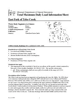
Henry Nearby Cities Windsor Length of impairment 1 mile Pollutants pH Abandoned mine lands Beneficial usesLivestock and Wildlife Watering Protection of ID: 847404

creek tebo east fork tebo creek fork east water protection missouri triple mile department aml resources 150 natural tmdl

Share:

Link:

Embed:

Download Presentation from below link

Download Pdf The PPT/PDF document "Missouri Department of Natural Resources" is the property of its rightful owner. Permission is granted to download and print the materials on this web site for personal, non-commercial use only, and to display it on your personal computer provided you do not modify the materials and that you retain all copyright notices contained in the materials. By downloading content from our website, you accept the terms of this agreement.


Presentation Transcript

1 Missouri Department of Natural Resources
Missouri Department of Natural Resources Henry Nearby Cities: Windsor Length of impairment: 1 mile Pollutants: pH Abandoned mine lands Beneficial usesLivestock and Wildlife Watering Protection of Warm Water Aquatic Life Human Health Protection (Fish Consumption) Protection of Warm Water Aquatic Life The impairment of this waterbody is based on exceedence of the specific criteria contained in R 20-7.031. The specific criteria state: pH. Water contaminants shall not cause pH10 CSR 20-7.031(4)(E). Description of the ProblemThe Tebo Creek area has been an important cowere numerous underground mines along the MKT raCalhoun and Windsor. this area were strip-mined. Large amounts near the Johnson-Henry County line. A smaller Creek about 1.5 miles northwest of downtown Windsor. When sulfide to water and oxygen, they oxidize and form highly ese minerals make up a large amount of th

2 e coal wastes in the Tebo Creek area. A
e coal wastes in the Tebo Creek area. Acid mine drainage affected Revised 7/2006 to the large volumes of coal ng into the stream and the seepagcoal waste deposits along thThe Missouri Department of Natural Resources reclaimed these coal waste arsite, a wetland was constructed for treatment of acistabilization structures ilize the stream channel. Cost projects was $4.6 million. The table of recent water que reclamation projects In East Fork Tebo Creek there is approximately one mile of slightly acid water. The U.S. Environmental Protection Agency approved Total Maximum Daily Loads (TMDLs) for West Fork, Tebo Creek on February 12, 2004. This document may be accessed at http://www.dnr.mo.gov/env/wpp/tmdl/tebo-ck-final-tmdl.pdf Even though East Fork Tebo Creek is now meeting water quality standards, the US Environmental Protection Agency (EPA) established a TMDL for Missouri could meet the requirements of a lawsuit thmb

3 er of TMDLs to be completed each calenda
er of TMDLs to be completed each calendar year. Range of pH values on the East Fork of Tebo Creek, 1987-2000 02468 Min Max Sources: Missouri Department of Natural Resources and U.S. Geological Survey. Revised 7/2006 Map of Impaired Portion of East, Middle and West Forks of Tebo Creek Showing Location of Sampling Sites Revised 7/2006 M1 M3 M4 M5 M7 E1 E2 E3 E4 W1 W2 W3 W4W. Fork Tebo Cr M2 M6Middle Fork Tebo CrE. Fork Tebo Cr WindsorCalhounJohnson County N 1012MilesImpaired segments Direction of Flow E1 – East Fork Tebo Creek 0.5 mile above Triple AML E2 – East Fork Tebo Creek 0.5 mile below Triple AML E3 – East Fork Tebo Creek 2 miles below Triple AML E4 – East Fork Tebo Creek 3 miles below Triple AML Creek, see the Tebo Creeks Information Sheet For more information call or write: Missouri Department of Natural Resources Program Home Page: www.dnr.mo.gov/env/wpp/index.html