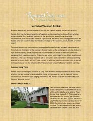
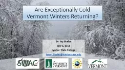
Dr Jay Shafer July 1 2015 Lyndon State College JasonShaferlyndonstateedu 1 Description The winters of 201314 and 201415 featured exceptionally cold temperatures in the Northeastern United States some of the coldest in the last 50 years This workshop will use these winters as a ID: 277360
Download Presentation The PPT/PDF document "Are Exceptionally Cold Vermont Winters R..." is the property of its rightful owner. Permission is granted to download and print the materials on this web site for personal, non-commercial use only, and to display it on your personal computer provided you do not modify the materials and that you retain all copyright notices contained in the materials. By downloading content from our website, you accept the terms of this agreement.
Slide1
Are Exceptionally Cold Vermont Winters Returning?
Dr. Jay Shafer
July 1, 2015Lyndon State CollegeJason.Shafer@lyndonstate.edu
1Slide2
Description
The winters of 2013-14 and 2014-15 featured exceptionally cold temperatures in the Northeastern United States - some of the coldest in the last 50 years. This workshop will use these winters as a case study to understand major weather and climatic controls affecting regional weather patterns. Major contributing factors to the prolonged cold and regional climatic trends will be discussed. The activity will include a simple statistical method to predict seasonal temperatures. Several Vermont climatic data sets will be provided with suggestions as to how one could incorporate them into classroom activities. 2Slide3
Outline
What the cold forecast well?How cold was it?Arctic air characteristicsRegional climate controlsClimate trendsActivity – statistical method to predict seasonal weather3Slide4
Dynamical Model Forecasts and Verification
4
Verification: 2013-14Forecasthttp://iri.columbia.edu/our-expertise/climate/forecasts/seasonal-climate-forecasts/
http://www.esrl.noaa.gov/psd/data/usclimdivs/ Slide5
Dynamical Model Forecasts and Verification
5
http://iri.columbia.edu/our-expertise/climate/forecasts/seasonal-climate-forecasts/ http://www.esrl.noaa.gov/psd/data/usclimdivs/ Forecast
Verification:
2014-15Slide6
Seasonal Snowfall 2014-15
Above average snowfall
in fact, winters are getting wetter, and the climate is cold enoughto sustain snow, so wintershave gotten snowier
6Slide7
Heating Degree Days
HDD = 65 deg F - (daily avg temperature)For example, high = 40, low = 20, daily avg temperature = 3065-30 = 35 HDDs HDDs correlate well with energy use
7Slide8
Energy Use vs HDDs
8Slide9
Heating Degree Day Trends
Over the last century, heating demand has declined
5-10 % due to winter warming.
9Slide10
Why were these last two winters so cold?
10Slide11
North American Circulation Pattern
11Slide12
Arctic Air Mass Example – January 23, 2104
12
Arctic High PressureSlide13
Where did the arctic air originate?
13
Arctic air masses typically have a long residence
time over high latitude continental regions with
snow cover associated with high pressure systemsSlide14
14
Sampling arctic air at Lyndon StateSlide15
15Slide16
Arctic
Air Mass CharacteristicsDry (typically sunny)
Very cold (less than -30 deg C)Stable (difficult to get precipitation/clouds to form)Isothermal low-level air mass (coldest air mass at the surface)16Slide17
17
Very cold, stable airSlide18
18Slide19
Seasonal Controls of Winter Weather Variability
19Slide20
El Ni
ño/La Niña (Nino3.4) vs. Burlington Winter Temperatures
El NiñoWarmN=6El NiñoColdN=4
La NiñaWarm
N=7La Niña
ColdN=3
20Slide21
El Niñ
o/La Niña (ENSO) ConclusionsENSO does not explain the variability Other factors are at play, complex interactions of tropics and high latitudes
Other areas of the US have significant winter ENSO relationships, but not the Northeast USENSO has little to no effect on winter conditions in the Northeast US21Slide22
Snow Cover – Land Surface Feedbacks
22Slide23
23
http://climate.rutgers.edu/snowcover/
Snowy Octobers last two yearsTheory: snowier fall conditions produce an increased risk for cold air mass development
and eventual movement into middle latitudes – In other words, if there’s more snow in the fall,
then somewhere in the Northern Hemisphere,there is bound to be an enhanced risk of arctic airmasses moving southward away from the arctic.
This is an example of a positive feedback loop, annegative correlation. Slide24
24
Winters following high October Eurasian Snow Cover
Arctic air pathway is open more oftenSlide25
25
Winters following low October Eurasian Snow Cover
Cold air is shy and remains furthernorth – Alaska and northern CanadaSlide26
26
Fall Sea-Surface Temperature Anomalies Preceding Cold Winters
North and Central Atlantic Oceanis average to cold.
Oceans play a significant role
in forcing the atmosphereover longer time periods.Slide27
27
Fall Sea-Surface Temperature Anomalies Preceding Cold Winters
North and Central Atlantic Oceanis warm to average.
Strong dipole of SSTs in north and central PacificSlide28Arctic Oscillation
28Slide29
29Slide30
Vermont Climatic Changes
30Slide31
Heating Degree Day Trend – Temperature Trend
Over the last century, heating demand has declined
5-10 % due to winter warming.
31Slide32
http://journals.ametsoc.org/doi/full/10.1175/2011WCAS1096.1?prevSearch=[Contrib%3A+alan+betts]&searchHistoryKey
=
Betts 201132
Winters are getting shorter and the growing season is increasing. Slide33
Betts 2011
33
Winters are getting shorter through other proxies. Slide34
Seasonal Forecasting
34Slide35
Statistical Prediction Methods
Relate numerical index values of oceanic temperature patterns (or whatever variable you choose) to the following winter’s temperature and precipitationFor example, you could look at the ENSO state, which represents El Niño/La Niña, the largest oceanic oscillation on monthly to yearly time scalesWe will relate the Arctic Oscillation to show how this is related to winter temperatures
35Slide36
Statistical Methods: Fall Snow Cover
Siberian snowfall during October has an effect on winter temperature patterns over the Northern Hemisphere.There is well documented literature on the topic physically connecting the two – as mentioned earlierEnhanced fall snow cover enhances the Hemispheric cold air reservoir and creates a greater potential for winter cold in the mid and high latitudes
Complex interaction involving stratosphere and troposphere, but it has been physically described – still need “weather” events to move cold air south36Slide37
Climate Prediction Center Forecasts
37
July, August, September Outlook
Precipitation forecasting is much more difficult
than temperature forecasting. Slide38
http://iri.columbia.edu/our-expertise/climate/forecasts/seasonal-climate-forecasts
/
http://www.cpc.ncep.noaa.gov/products/predictions/long_range/seasonal.php?lead=3
38
Fall (Sept – Nov)
OutlookSlide39
39
Winter (Dec– Feb)
OutlookSlide40
Conclusions
Are cold winters returning? No, not for the long haulHowever, natural variability will continue to produce cold spells and occasional prolonged cold weather like the last two wintersClimate models struggle with seasonal forecasting and processes as snow cover-land surface feedbacksVermont winters are getting shorter (especially with their late arrival), but they can have intense stretches as they have in the pastThe next ten winters will probably be like the last ten winters
40Slide41
Activity
Correlate Arctic Oscillation state with season cumulative HDDsHypothesis: Arctic Oscillation phase during winter has an effect on Vermont seasonal temperaturesExcel sheet is available at: https://drive.google.com/file/d/0B3NtxLJnOImFRUxHQU9qMnNJazg/view?usp=sharing
41Slide42
42