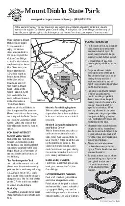
/
Macedo Ranch Staging Area This excellent staging area for equestrians bicyclists and hikers Macedo Ranch Staging Area This excellent staging area for equestrians bicyclists and hikers

Macedo Ranch Staging Area This excellent staging area for equestrians bicyclists and hikers - PDF document

liane-varnes
liane-varnes . @liane-varnes
Follow
482 views
Uploaded On 2014-10-19

Macedo Ranch Staging Area This excellent staging area for equestrians bicyclists and hikers - PPT Presentation

Mitchell Canyon Staging Area and Visitor Center This is the main access point to trails on the mountains north side From here you can hike to Deer Flat 37 miles or all the way to the summit 68 miles The visitor center is open on week ends from 8 am ID: 6152

Mitchell Canyon Staging Area

Share:

Link:

Embed:

Download Presentation from below link

Download Pdf The PPT/PDF document "Macedo Ranch Staging Area This excellent..." is the property of its rightful owner. Permission is granted to download and print the materials on this web site for personal, non-commercial use only, and to display it on your personal computer provided you do not modify the materials and that you retain all copyright notices contained in the materials. By downloading content from our website, you accept the terms of this agreement.


Presentation Transcript

Macedo Ranch Staging Area This excellent staging area for equestrians, bicyclists and hikers is located on the western side of the park. Mitchell Canyon Staging Area and Visitor Center This is the main access point to trails on the mountain’s north side. From here you can hike to Deer Flat (3.7 miles) or all the way to the summit (6.8 miles). The visitor center is open on week-ends from 8 a.m to 4 p.m. during the summer months, 9 a.m. to 3 p.m. during winter months. Diablo Valley Overlook From here, 2,900 feet above sea level, you can see the Golden Gate Bridge. INTERPRETIVE PROGRAMS Park staff conduct guided hikes and other interpretive events. Publications of the park’s cultural and natural history and a detailed topographic hiking map are for stations and at the visitor centers. CANYON RD. 24680 680 Many visitors to Mount Diablo head straight for the summit to enjoy the famous view. You can look to the west, beyond the Golden Gate Bridge, to the Farallon Islands;southeast to the JameLick Observatory on Mount Hamilton at 4,213 feet; south to Mount Loma Prieta in the Santa Cruz Mountains at 3,791 feet; north to Mount Saint Helena in the Coast Range at 4,344 feet; and still farther north to Mount Lassenin the Cascades at 10,466 feet. North and east of Mount Diablo the San Joaquin and Sacramento Rivers meet to form the twisting waterways of the Delta. To the east beyond California’s great Central Valley, the crest of the Sierra Nevada seems to oat in space. s Summit Visitor Center Built in the late 1930s by the Civilian Conservation Corps, this building was constructed of sandstone quarried from Fossil Ridge, Rock City. Remnants of ancient fossils can be found on this building. The Fire Interpretive Trail Just below the summit, this trail showcases the natural recovery process that is underway following a 6,000-acre re in 1977. Some spectacular vistas can be enjoyed along the way. The rst half of this gentle 0.7-mile trail is accessible to visitors in wheelchairs. Rock City You will nd unusually large sand-here. PLEASE REMEMBER • Park hours are 8 a.m. to sunset daily. Gates close at sunset and are locked at night. To exiting the park before sunset. • beverages is prohibited in the • Dogs are allowed only in developed areas of the park. night. Dogs are NOT permitted on trails or re roads. • Fires are a continuing hazard; restrict smoking or prohibit res or even close the park during periods of extreme re danger. See park staff for specic information. Fires are only allowed in the park’s fuel. Collection of rewood is prohibited in the park. • Mountain bikes may be ridden on paved roads, maintained re roads and authorized trails. Cyclists should see park staff for other rules and regulations concerning trail use. • rattlesnakes—are protected by law. This is their home, and you are the visitor. • To avoid rattlers, watch where you are hiking, and if you see one, give it a wide berth. It is no more anxious for an encounter than you are. Mount Diablo State Park At the eastern fringe of the San Francisco Bay region, Mount Diablo, elevation 3,849 feet, stands alone on the edge of California’s great Central Valley. At this point, the Coast Range consists only of low hills, none high enough to block the spectacular views from the upper slopes of the mountain. Welcome! www.parks.ca.gov • www.mdia.org • (925) 837-2525 © 2006 California State Parks Scenic Blvd.To ConcordVisitor Visitor CenterLivermore Valley Operated by East Bay Regional Park DistrictNorth Gate Rd. Mitchell Canyon Rd.Summit Rd.South Gate RdLEGEND Picnic AreaTelephoneViewpointJuniperBarbecueTerraceBuckeyeGreen Valley Rd.South Gate Entrance StationMacedo RanchStaging AreaWildcatBoundaryStagecoachJunctionDiablo Valley Overlook Marsh Creek Rd. Mount Diablo State Park NOTE: Mt. Diablo State Park has many trails, features, and re roads that are not shown on this map. For a more complete map of the park, see the “Trail Map of Mt. Diablo State Park” or the Mount Diablo State Park brochure, both of which are available at the park business ofce, entrance stations, and visitor centers.Most land adjacent to the park is private property. Do not enter without the owner’s permission. TicksTicks are found on children frequently. leaves—they grow in groups of three TicksTicks are found on children frequently. leaves—they grow in groups of three For emergencies call 911 . Maps not to scale .