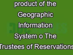
PDF-This map is a product of the Geographic Information System o The Trustees of Reservations
Author : liane-varnes | Published Date : 2015-03-12
Source data obtained from 125000 scale USGS topomaps field surveys G PS and MassGIS Boundary lines and trail locations are approximate March 2012 CRANE ESTATE Castle
Presentation Embed Code
Download Presentation
Download Presentation The PPT/PDF document "This map is a product of the Geographic ..." is the property of its rightful owner. Permission is granted to download and print the materials on this website for personal, non-commercial use only, and to display it on your personal computer provided you do not modify the materials and that you retain all copyright notices contained in the materials. By downloading content from our website, you accept the terms of this agreement.
This map is a product of the Geographic Information System o The Trustees of Reservations: Transcript
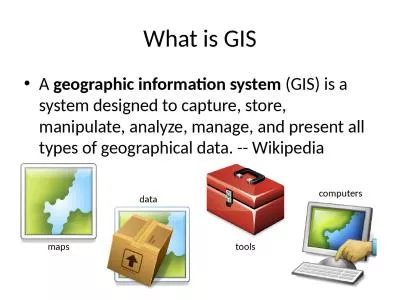
Source data obtained from 125000 scale USGS topomaps field surveys G PS and MassGIS Boundary lines and trail locations are approximate March 2012 CRANE ESTATE Castle Hill Crane Beach Crane Wildlife Refuge Argilla Road Ipswich Massachusetts 781784. To make online reservations visit our website at wwwparkscagov ALTERNATE FORMAT This publication can be made available in alternate formats Contact interpparkscagov or call 916 6542249 Pismo State Beach MMJWUJTI PARK FEES are due and payable upon Reservations may be charged to VISA Discover or Mastercard To make online reservations visit our website at wwwparkscagov Refugio State Beach 10 Refugio Beach Rd Goleta CA 93117 805 9681033 PARK FEES are due and payable upon entry into the park Us To make online reservations visit our website at wwwparkscagov ALTERNATE FORMAT This publication can be made available in alternate formats Contact interpparkscagov or call 916 6542249 PARK FEES are due and payable upon entry into the park The camps Week 8. : . R. aster Data Model. Geographic Extent and Unit of Analysis. Data Sources. Geographic Information Systems I | Department of Geography, DePaul University. Nandhini Gulasingam . Subhay. . manandhar. Geographic Information Systems (GIS). - . System. designed to capture, store, manipulate, analyze, manage, and present all types of spatial or . geographical. data. .. - GIS consists of 3 components . The four concepts of geographic thinking – . Spatial significance. , . Patterns . and . Trends. , . Interrelationships. , . Geographic Perspective . These underpin . thinking and learning . when doing an investigation in geography.. Presented by Morag Fleming, . MInstF. (. Cert). Trustees, Fundraising Regulation. and Recent Changes. Presented by Morag Fleming, . MInstF. (. Cert). Trustees Responsibilities. “Trustees are responsible for taking control of how their charity fundraises.”. Biennial Conference 12 April 2013. An update from the Regulator. Tom Dunphy. Head of Enforcement. The Pensions Board. Agenda. The Pensions Board. Regulatory approach and intent. The Registered Administrator regime. Are you planning a trip to Atlanta? If Your answer is yes, then you feel happy to know that we share some amazing deals to our customers. To know more than you can contact +1-844-231-5895 three main types: . . Global Positioning Systems. Remote Sensing. Geographic Information Systems. One of a Set. Defining GIS. Different definitions of a GIS have evolved in different areas and disciplines . Week 3. :. Cartographic Principles: Classifications. Coordinate Systems . Map Projections. Call Delta Airlines Reservations Phone Number and make your travel comfortable, we believe in making travel easy for you. So, call now +1 844 459 3409, we will get you amazing services on your mobile phone. Read more at https://delta.airlines-reservationsnumber.com/ GEO 241: Geographic Information Systems I Week 3 : Cartographic Principles: Classifications Coordinate Systems Map Projections (GIS) is a system designed to capture, store, manipulate, analyze, manage, and present all types of geographical data. -- Wikipedia. maps. data. tools. computers. Geography is visualized in maps. www.arcgis.com.
Download Document
Here is the link to download the presentation.
"This map is a product of the Geographic Information System o The Trustees of Reservations"The content belongs to its owner. You may download and print it for personal use, without modification, and keep all copyright notices. By downloading, you agree to these terms.
Related Documents